



Maps and Mapping
How do I find, download, or order topographic maps?
What types of elevation datasets are available, what formats do they come in, and where can I download them?
What is a Digital Orthophoto Quadrangle (DOQ) or an orthoimage?
Where can I find land cover data for the U.S.?
The USGS provides the mapping and digital geospatial foundation for the Nation.

What Aerial Imagery Data Set Should I Use in EarthExplorer? What Aerial Imagery Data Set Should I Use in EarthExplorer?
Your choice depends on your location, the time period you need, and the image scale. Use EarthExplorer to search for these recommended aerial datasets: 1937–2014: Aerial Photo Single Frames 1980–1989: National High Altitude Aerial Photography (NHAP) 1987–2007: National Aerial Photography Program (NAPP) 1987–2006: Digital Orthophoto Quadrangle (DOQs) 2000–2016: High Resolution Orthoimagery (HRO)...

What is an OnDemand Topo? What is an OnDemand Topo?
OnDemand Topos are USGS topographic maps generated on demand (at no cost) using the topoBuilder application and the best available data from The National Map. The ability to customize your map and center it wherever you choose is exclusive to topoBuilder. OnDemand Topo map extents do not need to align with the traditional grids utilized by US Topos and other USGS topographic maps. Once a map has...

Why are USGS topographic maps called “quadrangles”? Why are USGS topographic maps called “quadrangles”?
In the making of topographic maps, the USGS subdivides the United States by using Latitude and Longitude lines to form the boundaries of four-sided figures called “quadrangles”. The maps are often referred to as quadrangle maps (or quad maps). Different sizes of quadrangles have been used over time, for example the 30-minute quadrangle (30 minutes of latitude or longitude on each side) and the 15...

Does the Board on Geographic Names (BGN) decide what is derogatory or offensive? Does the Board on Geographic Names (BGN) decide what is derogatory or offensive?
The BGN’s Principles, Policies, and Procedures document includes a Policy on Derogatory and Offensive Names. As of 2023, three words are declared derogatory in all occurrences: In 1963, the BGN, at the request of the Secretary of the Interior, mandated that the pejorative form of the word “Negro” be eliminated from all federal maps and publications. The word was replaced with “Negro” for all...

Why is the orthoimage (air photo) layer not available for some US Topo maps and OnDemand Topo maps? Why is the orthoimage (air photo) layer not available for some US Topo maps and OnDemand Topo maps?
In the lower 48 States, orthoimages (rectified air photographs) for US Topo maps and OnDemand Topo maps comes from the National Agriculture Imagery Program (NAIP). There are areas over some military installations where NAIP imagery is not available. In these locations, the OnDemand Topo maps will either not include imagery or contain partial imagery. US Topo maps are only produced for areas that...
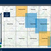
How do USGS OnDemand Topo maps differ from US Topo maps? How do USGS OnDemand Topo maps differ from US Topo maps?
USGS OnDemand Topo maps and USGS US Topo maps are built using similar datasets but can look different depending on what areas or options the user selects. OnDemand Topos--created using the topoBuilder application--offer customizations such as custom extents, a variety of scales, contour smoothing, and user-selected data layers. They include U.S. Territory coverage that is not available on US...

What is The National Map Structures Tint? What is The National Map Structures Tint?
The National Map’s Structures Tint dataset represents manmade structures using broad-area tints rather than defining the exact shape of individual buildings. The Structures Tint data was provided by Oak Ridge National Labs and the Federal Emergency Management Agency. This dataset was introduced in 2021 and is designed for use at the 1:24,000 scale (the standard scale for USGS topographic maps) or...

Where can I find a topographic map symbol sheet? Where can I find a topographic map symbol sheet?
Like topographic maps, topographic map symbols have evolved over time. There is no single document that describes all of the symbols used on all USGS topographic maps since they were first created. Maps published 2013-present: US Topo maps have a symbol sheet attached to the map file (PDF format only). Open the PDF file in Adobe Acrobat and click on the paperclip icon. Maps published 1947-2009...

Does the USGS have 1:50,000-scale maps, like the military uses, for the United States? Does the USGS have 1:50,000-scale maps, like the military uses, for the United States?
The USGS has a limited number of 1:50,000-scale maps available for the United States. Some of these are maps that the National Geospatial-Intelligence Agency (NGA) has released for sale to the public. To see which maps are available for sale (or free digital download), go to the online USGS Store: In the top navigation menu, select Products > Other Maps. In the "Filter by Country" box, select USA...

What are Cloud Optimized GeoTIFFs (COGs)? What are Cloud Optimized GeoTIFFs (COGs)?
A Cloud Optimized GeoTIFF (COG) is a GeoTIFF file with an internal organization that enables more efficient workflows in the cloud environment. It does this by leveraging the ability of clients issuing HTTP GET range requests to ask for just the parts of a file they need. Learn more: Landsat COG Data Format Control Book USGS Digital Elevation Models (DEM) Switching to New Distribution Format

Where can I get global elevation data? Where can I get global elevation data?
Download free global elevation data products using AppEEARS or EarthExplorer. Free registration is required. In AppEEARS: Download Aster Global Digital Elevation Model (GDEM version 3) 1-arc-second (30m) resolution GeoTIFF format Acquired 2000-2013 In EarthExplorer, select “Digital Elevation” under the "Data Sets" tab and choose an option: Shuttle Radar Topography Mission (SRTM) 1-arc-second...

Where can I get Global Land Cover Data (GLCC)? Where can I get Global Land Cover Data (GLCC)?
In EarthExplorer, select "GLCC" under "Land Cover" in the "Data Sets" tab. Derived from 1-km Advanced Very High Resolution Radiometer ( AVHRR) data collected April 1992 to March 1993. Learn more: USGS EROS Archive - Land Cover Products - Global Land Cover Characterization (GLCC) Global Ecosystems Global Climate Data (NOAA) NOAAView Global Data (NOAA) Map of Worldwide Croplands (USGS news release)...