



Maps and Mapping
How do I find, download, or order topographic maps?
What types of elevation datasets are available, what formats do they come in, and where can I download them?
What is a Digital Orthophoto Quadrangle (DOQ) or an orthoimage?
Where can I find land cover data for the U.S.?
The USGS provides the mapping and digital geospatial foundation for the Nation.

Are the Public Land Survey System (PLSS) section lines on US Topo maps a legal record? Are the Public Land Survey System (PLSS) section lines on US Topo maps a legal record?
US Topo maps are not legal documents and the Public Land Survey System (PLSS) representation is not legally authoritative. The sections, townships, and ranges of the PLSS that are shown on US Topo maps are derived from GIS data from the Bureau of Land Management (BLM) in cooperation with the Federal Geographic Data Committee (FGDC). Learn More: FGDC Cadastral Subcommittee (information and links)

Your map has road/address errors and people can't find my house Your map has road/address errors and people can't find my house
This issue is usually about maps on GPS devices, smart phone applications, or commercial online maps. The USGS does not provide road or address information for those products, almost all of which use road data from commercial sources. The USGS has no relationship with those companies. The USGS mission does not include the collection and maintenance of road data or addresses. Roads and other...

I found an error on a map. How can I report it and when will you fix it? I found an error on a map. How can I report it and when will you fix it?
There are different answers to this question for different products. In all cases, we must know what product you're addressing. Please read the following guidelines and email error reports to tnm_help@usgs.gov : US Topo Maps (topographic maps published 2009-present) Please include the following information: The map title, state, and date (from the title block in the lower right corner)...

Why are there no power lines, pipelines, libraries, trails, etc. on US Topo maps? Why are there no power lines, pipelines, libraries, trails, etc. on US Topo maps?
The original USGS 7.5-minute (1:24,000 scale) Historical Topographic Maps (produced 1945-1992) included feature classes that are not yet shown on US Topo maps (produced 2009-present). Examples include pipelines, power lines, survey markers, many types of boundaries, and many types of buildings. The USGS no longer does field verification or other primary data collection for these feature classes...

Can I still get the older topographic maps? Can I still get the older topographic maps?
Yes. Topographic maps originally published as paper documents between 1884-2006 have been scanned and published as the USGS Historical Topographic Map Collection. Download our historical topographic maps and our more current US Topo maps (published 2009-present) free of charge using TopoView (GeoPDF, GeoTIFF, JPEG, and KMZ formats) or using the USGS Store’s Map Locator (GeoPDF format). Order paper...

How do US Topo maps differ from historical USGS topographic maps? How do US Topo maps differ from historical USGS topographic maps?
Historically, USGS topographic maps were made using data from primary sources including direct field observations. Those maps were compiled, drawn, and edited by hand. By today's standards, those traditional methods are very expensive and time-consuming, and the USGS no longer has funding to make maps that way. A new USGS topographic map series was launched in 2009 and branded " US Topo." Though...

How often is orthoimagery in The National Map updated and what are the acquisition dates? How often is orthoimagery in The National Map updated and what are the acquisition dates?
Orthoimagery (georectified aerial photography) available through The National Map Downloader and The National Map Services is from the USDA Farm Service Agency's National Agricultural Imagery Program (NAIP), which is 1-meter resolution. Generally, NAIP imagery is refreshed on a 3-year cycle with approximately one third of the continental U.S. flown each year. The month and year of imagery...

What are the URLs for imagery services in The National Map, and are they cached or dynamic? What are the URLs for imagery services in The National Map, and are they cached or dynamic?
There are several imagery services for The National Map. Some imagery services are cached and some are dynamic: USGSImageryOnly (under Base Maps), for example, is a tile cache base map service of orthoimagery. It has different imagery data sources depending on view scale. The USGSImageryOnly service uses cache tiles of 256x256 pixels in size and 96 dots per inch (dpi) resolution with 75%...

How can I bulk download USGS Earth Resources Observation and Science (EROS) products? How can I bulk download USGS Earth Resources Observation and Science (EROS) products?
The Bulk Download Web Application (BDWA ) lets users download large amounts of satellite, aerial imagery and other geospatial data. A video " Using the EarthExplorer BDWA," explains how to add scenes through EarthExplorer and retrieve them with minimal user interaction. An April 2023 webinar, " The New and Improved Bulk Download Web Application," also provides an overview of the tool. To receive...
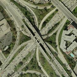
How do I download orthoimagery products and what are the available formats? How do I download orthoimagery products and what are the available formats?
Download orthoimagery (georectified aerial photographs) using EarthExplorer, which has the full catalog of USGS orthoimagery and aerial photography. EarthExplorer: Products Overview Format varies by type of orthoimagery: Native format, Georeferenced Tagged Image File Format (GeoTIFF), or compressed 10:1 JPEG2000 A NAIP orthoimage is included as an optional layer in the PDF format of digital...

How do I download The National Map data products? How do I download The National Map data products?
Download or access The National Map data products via several applications and websites: The National Map Download Client – The primary site for data downloads. See the training videos (lessons 4a-4d) or click the Help link at the top of the Downloader for detailed instructions. LidarExplorer – Lidar Point Cloud data only. See where lidar is available, get a list of downloadable products, and...

What sources were used to create the Boundaries, Structures and Transportation layers in The National Map? What sources were used to create the Boundaries, Structures and Transportation layers in The National Map?
Boundaries: Primary sources include the U.S. Census Bureau, Bureau of Land Management (BLM), International Boundary Commission (IBC) for the Canadian boundary, and the International Boundary and Water Commission (IBWC) for the Mexican boundary. Boundaries include city, county, State, Federal lands, provinces, and territories; as well as cadastral data (where applicable), associated with Public...