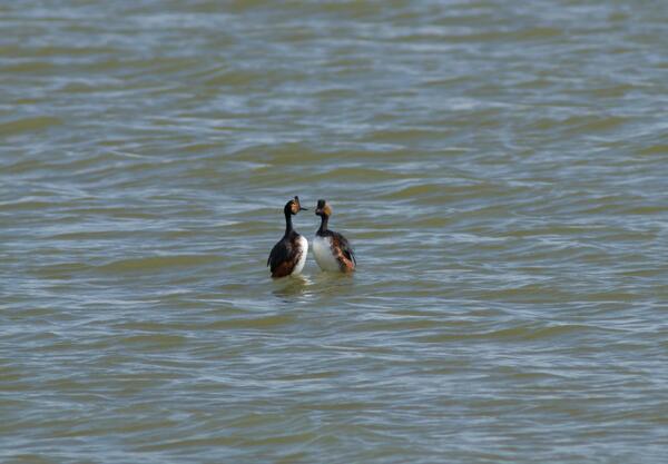
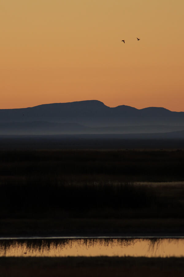
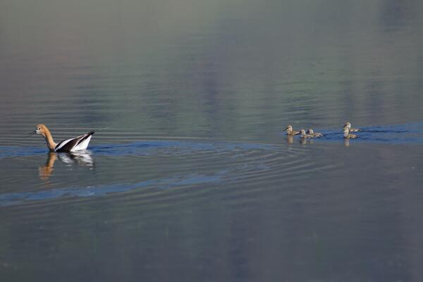
U.S. flag

An official website of the United States government

Images

If you are not able to access a product, contact salinelakesiwaas@usgs.gov

Filter Total Items: 81
Blue skies with white cloud streaks reflect on Walker Lakes blue waters
Walker Lake
Walker Lake
Walker Lake

Walker Lake is part of the Great Basin in western Nevada. Walker lake is a rest stop for many migratory birds including Common Loon, Snow Geese, White Pelicans, several types of Grebe, Brants and Harlequin ducks. 

Walker Lake is part of the Great Basin in western Nevada. Walker lake is a rest stop for many migratory birds including Common Loon, Snow Geese, White Pelicans, several types of Grebe, Brants and Harlequin ducks. 

Words of different text sizes and colors arranged into a cloud-like shape
Word Cloud: Key Mechanisms that Interconnect the Great Basin Landscape

This word cloud displays answers to the question: what are the key mechanisms that interconnect the Great Basin landscape? The exercise was conducted at a stakeholder workshop in 2022. Answers that were selected by many participants have the largest text size and are more central in the cloud. The most popular answers were: climate, water, birds, fire and drought.

This word cloud displays answers to the question: what are the key mechanisms that interconnect the Great Basin landscape? The exercise was conducted at a stakeholder workshop in 2022. Answers that were selected by many participants have the largest text size and are more central in the cloud. The most popular answers were: climate, water, birds, fire and drought.

Five rectangles in different colors contain text stating the five primary thematic questions
Saline Lakes Project Primary Thematic Questions

The Saline Lakes Team identified five primary thematic questions around environmental data collection activities or management needs: 1) How much water is there and how is it used throughout the watershed? 2) What are the hydrologic vulnerabilities of each saline lake? 3) What are the primary resources being utilized by representative taxa at each lake?

The Saline Lakes Team identified five primary thematic questions around environmental data collection activities or management needs: 1) How much water is there and how is it used throughout the watershed? 2) What are the hydrologic vulnerabilities of each saline lake? 3) What are the primary resources being utilized by representative taxa at each lake?

A map of the Great Basin with saline lakes labeled
Study Saline Lakes of the Great Basin Desert Area
a silhouette of a goose standing on the shore of a lake at sunrise
Lone goose at sunrise at Summer Lake Wildlife Area
Close up image of small waterbird that has brown body with white flecks and a yellow triangle beak dips in the marsh
Sora at Summer Lake
Sora at Summer Lake
Sora at Summer Lake

This Sora is likely looking to munch on some seeds from the wetland plants or a small aquatic critter. Sora's have huge migratory ranges and rely on terminal lakes of the Great Basin as they go between breeding and wintering habitats. 

This Sora is likely looking to munch on some seeds from the wetland plants or a small aquatic critter. Sora's have huge migratory ranges and rely on terminal lakes of the Great Basin as they go between breeding and wintering habitats. 

Diagram showing the connection between water availability, water quality, saline lakes habitats, and bird usage
Saline Lakes Ecosystems Project Integrated Science Themes

A diagram showing the connection between water availability, water quality, saline lake habitats, and bird usage. Water availability drives water quality, which affects saline lake habitats that birds use. Water budget, water use, timing, vulnerability, and water depth are factors in water availability.

A diagram showing the connection between water availability, water quality, saline lake habitats, and bird usage. Water availability drives water quality, which affects saline lake habitats that birds use. Water budget, water use, timing, vulnerability, and water depth are factors in water availability.

Map from the Great Salt Lake Water Dashboard from July 27th, 2022 showing the extent of the Great Salt Lake watershed.
Great Salt Lake Water Dashboard

Map from the Great Salt Lake Water Dashboard from July 27th, 2022 showing the extent of the Great Salt Lake watershed. Markers are stream flow gages colored by flow status with warmer colors indicating below normal flow status, green as normal, and blue to black as above normal.

Map from the Great Salt Lake Water Dashboard from July 27th, 2022 showing the extent of the Great Salt Lake watershed. Markers are stream flow gages colored by flow status with warmer colors indicating below normal flow status, green as normal, and blue to black as above normal.

Four scientist looking out over the Great Salt Lake from Antelope Island. There are mountains behind them and clouds
Scientist looking out onto the GSL from Antelope Island

These scientists are working on The Great Salt Lake to determine the amount of water and qualities of it. This will help them in developing better management techniques that will work to support the migratory birds that frequent the area. 

Scientist gently holds captured bird against her while measuring. Headlamp lights the night time field work.
Field research on White Faced Ibis

Andrea a USGS researcher measures the birds bill or "culmen". The culmen is measured from the tip of the upper mandible to the end where the culmen meets the forehead.

Andrea a USGS researcher measures the birds bill or "culmen". The culmen is measured from the tip of the upper mandible to the end where the culmen meets the forehead.

Map of Water a table contour map (2018) for Harney Basin, Oregon
Water table contour map (2018), Harney Basin, Oregon.

Water table contour map (2018) of the Harney Basin, Oregon. Image is from a new groundwater basin study study by the Oregon Water Resources Department and U.S. Geological Survey for Harney Basin in southeast Oregon.

Water table contour map (2018) of the Harney Basin, Oregon. Image is from a new groundwater basin study study by the Oregon Water Resources Department and U.S. Geological Survey for Harney Basin in southeast Oregon.

Medium size bird held by the wings. Bird has brown body feathers and a white face, red eye and long grey beak.
White-faced Ibis temporarily captured for research

White-faced Ibis breed in colonies that shift locations from year to year with changes in water levels. The birds usually nest in dense marsh growth such as bulrush or cattails. 

White-faced Ibis breed in colonies that shift locations from year to year with changes in water levels. The birds usually nest in dense marsh growth such as bulrush or cattails. 

a lake photographed from the back of a boat
Malheur Lake, Oregon

Malheur Lake, a saline lake in eastern Oregon, photographed from a USGS airboat. USGS has been monitoring water quality parameters including temperature, turbidity, and pH in the lake since 2017.

Malheur Lake, a saline lake in eastern Oregon, photographed from a USGS airboat. USGS has been monitoring water quality parameters including temperature, turbidity, and pH in the lake since 2017.

a white dry lake bed with hills and blue sky in the background
Lake Abert, Oregon
Lake Abert, Oregon
Lake Abert, Oregon

The eastern shore of Lake Abert, a saline lake in Oregon, photographer during a field trip USGS researchers led with multiple local groups. A drought in 2022 resulted in low water levels.

The eastern shore of Lake Abert, a saline lake in Oregon, photographer during a field trip USGS researchers led with multiple local groups. A drought in 2022 resulted in low water levels.

a dry lake bed at sunset with mountains in the background
Warner Lakes, Oregon

Warner Lakes in Oregon photographed from the eastern ridge looking west. In 2022 the lakes were dry due to an extended drought in the western U.S.

Warner Lakes in Oregon photographed from the eastern ridge looking west. In 2022 the lakes were dry due to an extended drought in the western U.S.

Shadowy figure of birds flying through golden dusk lit cloudy sky
Snowy Egrets
Snowy Egrets
Snowy Egrets

The medium sized Snowy Egret is a regal looking heron. Mature Snowy Egrets are all white with black bill, black legs and yellow feet.

The medium sized Snowy Egret is a regal looking heron. Mature Snowy Egrets are all white with black bill, black legs and yellow feet.

Several birds flying low over a wetland. Mountains in the background.
Ruby Lake National Wildlife Reserve
Two tall gray bodied crimson headed cranes walking at Summer Lake.
Summer Lake Sandhill Crane

These large birds live in open habitats like wetlands, fields, and prairies across North America. Looking closely you can see the crane on the left is banded with a GPS tracker on its right side leg.

These large birds live in open habitats like wetlands, fields, and prairies across North America. Looking closely you can see the crane on the left is banded with a GPS tracker on its right side leg.

Was this page helpful?