Intro
John H. Williams has a BA in Geology from Colgate University, and a MS in Geosciences from Pennsylvania State University. John currently is the Groundwater Specialist for the U. S. Geological Survey Water Science Center in New York, and is responsible for technical oversight of the Survey’s groundwater program in the State.
John has provided technical assistance to the U. S. Environmental Protection Agency, Army Corp of Engineers, and U.S. Nuclear Regulatory Commission on investigations of contaminated fractured-bedrock aquifers. He has worked with the Geological Survey of Canada in the investigation of transboundary aquifers in New York and Quebec.
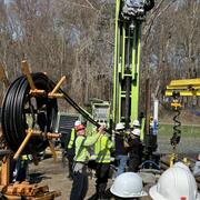
In addition, John is an integral part of the geophysical training and technology transfer program of the Hydrogeophysics Branch of the Earth System Processes Division. He has provided support in borehole geophysics to Survey offices throughout the U. S. and in the United Arab Emirates. He recently co-taught a borehole geophysics workshop in northern Iraq for the Iraqi Central and Kurdish Regional Governments that was supported by the U. S. Department of Defense.
Over the past several years, John has made presentations on water-resource issues related to shale-gas development to the U. S. Department of Energy, U. S. Environmental Protection Agency, National Ground Water Association, North American Energy Marketers Association, Empire State Water Well Drillers Association, New York State Department of Environmental Conservation, Pennsylvania Department of Environmental Protection, professional associations of geologists, geophysicists, and engineers, universities, and environmental groups. He also has provided testimony to the New York State Assembly and New York City Council on these issues.
Science and Products
Geophysical Methods Capabilities
Fractured-Rock Test Holes in Areas of Marcellus Shale Gas Development, Pennsylvania
Borehole Geophysics
Understanding Spectral Gamma: Fundamentals of Nuclear Geophysics
Simulation of Contributing Areas to Selected Public Water-Supply Wellfields in the Valley-Fill Aquifers of New York State
Water Issues and Marcellus Shale Gas Development in New York
Groundwater Information and Data
Groundwater-level Monitoring for Characterization of Hydraulic Connections in the Basal Sand & Gravel Aquifer, Hoosic River Valley, Hoosick Falls, New York
Appalachian Plateau Groundwater Availablity Study
Surface-Geophysical Surveys and Well Network for Monitoring Aquifer Salinity in the Genesee River Valley, Livingston County, New York
Geohydrology of the Valley-Fill Aquifer in Upper Buttermilk Creek/Danby Creek Valleys, Town of Danby, Tompkins County, New York
Geohydrology of the Upper Sixmile Creek/West Branch Owego Creek Valleys and Lower Sixmile Creek/Willseyville Creek Valleys, Town of Caroline, Tompkins County, New York
Interpolated hydrogeologic framework and digitized datasets for upstate New York study areas
Horizontal-to-Vertical Spectral Ratio and Depth-to-Bedrock Data for Saline-Groundwater Investigation in the Genesee Valley, New York, October-November 2016 and 2017
Passive seismic depth to bedrock data collected along headwater stream corridors in the Neversink River watershed, NY, USA
Transient Electromagnetic Surveys Collected for Delineation of Saline Groundwater in the Genesee Valley New York: October-November 2016
Incorporating snowmelt into daily estimates of recharge using a state-space model of infiltration
Areas contributing recharge to priority wells in valley-fill aquifers in the Neversink River and Rondout Creek drainage basins, New York
Data sources and methods for digital mapping of eight valley-fill aquifer systems in upstate New York
Areas contributing recharge to selected production wells in unconfined and confined glacial valley-fill aquifers in Chenango River Basin, New York
Geohydrologic and water-quality characterization of a fractured-bedrock test hole in an area of Marcellus Shale gas development, Sullivan County, Pennsylvania
The stratigraphy, water-bearing zones, and quality of groundwater were characterized in a 1,400-ft-deep test hole drilled during 2013 in fractured bedrock in Sullivan County, Pa., by collection and analysis of measurements made during drilling, geophysical logs, and depth-specific hydraulic tests and water samples. The multidisciplinary characterization of the test hole was a cooperative effort be
Time-domain electromagnetic soundings and passive-seismic measurements for delineation of saline groundwater in the Genesee Valley-fill aquifer system, western New York, 2016–17
Aquifer transmissivity in Nassau, Queens, and Kings Counties, New York, estimated from specific-capacity tests at production wells
Time-domain electromagnetic soundings for the delineation of saline groundwater in the Genesee River Valley, Western New York, 2016-2017
Bioremediation in fractured rock: 1. Modeling to inform design, monitoring, and expectations
Groundwater-level analysis of selected wells in the Hoosic River Valley near Hoosick Falls, New York, for aquifer framework and properties
Hydrogeology of the Owego-Apalachin Elementary School geothermal fields, Tioga County, New York
Geophysical log analysis of selected test and residential wells at the Shenandoah Road National Superfund Site, East Fishkill, Dutchess County, New York
Fractured Rock Geophysical Toolbox Method Selection Tool (FRGT-MST)
The Fractured Rock Geophysical Toolbox Method Selection Tool (FRGT-MST) is an Excel-based tool for identification of geophysical methods most likely to be appropriate for project goals and site conditions.
Science and Products
- Science
Filter Total Items: 18
Geophysical Methods Capabilities
Geophysics Geophysics GEOPHYSICAL METHODS CAPABILITIES The New York Water Science Center (NY WSC) makes extensive use of geophysical methods in its hydrologic investigations and research in cooperation with local, State, and Federal partners. The NY WSC staff has many years of experience in collecting and interpreting surface and borehole geophysical data, and applying the results to provide aFractured-Rock Test Holes in Areas of Marcellus Shale Gas Development, Pennsylvania
USGS and Pennsylvania Geological Survey analyzed rock cuttings, geophysical logs, water quality, water-bearing zones, gas-isotope, and other data from deep test holes drilled in fractured bedrock in north-central Pennsylvania. The results of this study helped to quantify the depth and character of fresh and saline groundwater in areas of shale-gas exploration and development.Borehole Geophysics
Borehole geophysics is the science of recording and analyzing measurements of physical properties made in wells or test holes. Probes that measure different properties are lowered into the borehole to collect continuous or point data that is graphically displayed as a geophysical log. Multiple logs typically are collected to take advantage of their synergistic nature--much more can be learned by...Understanding Spectral Gamma: Fundamentals of Nuclear Geophysics
The principles essential to the interpretation of gamma, gamma-spectrometry, gamma-gamma, and various types of neutron logs include the nature of subatomic particles and the particles and photons emitted by unstable isotopes.Simulation of Contributing Areas to Selected Public Water-Supply Wellfields in the Valley-Fill Aquifers of New York State
Background For effective wellhead protection, the area where water carrying potential contaminants can enter the groundwater system and flow to the supply well must first be defined, and then best management practices need to be implemented to minimize the opportunity for contamination to occur in areas defined as sources of water to the well. Determination of the sources of water and contributiWater Issues and Marcellus Shale Gas Development in New York
The Marcellus Shale of the Appalachian Basin is one of the largest unconventional gas plays in the United States.Groundwater Information and Data
The U.S. Geological Survey collects groundwater level data at about 20,000 wells nationwide, hundreds here in New York. The USGS provides long-term, accurate, and unbiased information that meets the needs of many diverse users. The USGS collects groundwater data needed by Federal, State, and local agencies for planning and operating water-resources projects and regulatory programs.Groundwater-level Monitoring for Characterization of Hydraulic Connections in the Basal Sand & Gravel Aquifer, Hoosic River Valley, Hoosick Falls, New York
Hydrogeologic characterization of the basal sand and gravel aquifer in the Hoosic River valley in Hoosick Falls, New York is important for determination of sources, extent, and future migration of PFOA groundwater contamination; evaluation of potential remedial actions; and appraisal of alternative groundwater supplies. Variations in the current pumping stresses and a planned 72-hour aquifer tAppalachian Plateau Groundwater Availablity Study
Pennsylvanian- and Mississippian-age aquifers occupy approximately 86,000 square-miles in the Appalachian Plateaus Physiographic Province of Pennsylvania, Ohio, Maryland, Virginia, West Virginia, Kentucky, Tennessee, and Alabama. As one of several USGS Regional Groundwater Studies, the primary goal of this study is to provide a regional understanding of groundwater flow and availability in the...Surface-Geophysical Surveys and Well Network for Monitoring Aquifer Salinity in the Genesee River Valley, Livingston County, New York
Background and Problem The Retsof salt mine in the Genesee River valley, Livingston County, New York flooded after roof collapses in 1994 created two rubble chimneys in overlying bedrock that intersected a confined aquifer in the basal glacial-drift deposits (figs. 1 and 2). Groundwater flowed downward through the rubble chimneys causing widespread drawdown in the lower confined aquifer until theGeohydrology of the Valley-Fill Aquifer in Upper Buttermilk Creek/Danby Creek Valleys, Town of Danby, Tompkins County, New York
Problem - The valley-fill deposits in Upper Buttermilk Creek/Danby Creek valleys are sources of water for many homeowners, farms, and small businesses that are in this valley. The aquifer was mapped by Miller (2000) and identified as one of the 17 aquifers in Tompkins County that needs to be studied in more detail. However, there is little geohydrologic data in the valley. A cluster of wells in UpGeohydrology of the Upper Sixmile Creek/West Branch Owego Creek Valleys and Lower Sixmile Creek/Willseyville Creek Valleys, Town of Caroline, Tompkins County, New York
Problem - The Town of Caroline needs geohydrologic data in two major valley-fill aquifers within the town in order for planners to develop a strategy to manage and protect their water resources. Interest in the interaction between ground water and surface water has increased in recent years as a result of widespread concerns related to water supply. The need to better understand how the developmen - Data
Interpolated hydrogeologic framework and digitized datasets for upstate New York study areas
This data release contains digital hydrogeologic datasets compiled for eight valley-fill aquifer systems in upstate New York. The data sets include input data necessary to create and interpolate the hydrogeologic framework of the aquifers and surrounding till-covered uplands. Input data is provided as point feature classes and georeferenced files of previously published reports along with the digiHorizontal-to-Vertical Spectral Ratio and Depth-to-Bedrock Data for Saline-Groundwater Investigation in the Genesee Valley, New York, October-November 2016 and 2017
In October and November of 2016 and 2017, the U.S. Geological Survey collected horizontal-to-vertical spectral ratio (HVSR) data at 104 sites in the Genesee Valley, Livingston County, New York as part of a saline-groundwater investigation in cooperation with the New York State Department of Environmental Resources. The HVSR technique, commonly referred to as the passive-seismic method, is used toPassive seismic depth to bedrock data collected along headwater stream corridors in the Neversink River watershed, NY, USA
The Neversink River watershed (above the Neversink Reservoir) has been a focus of U.S. Geological Survey (USGS) research regarding stream geochemistry, acidification, and ecology dynamics for decades. In 2019, the Water Mission Area Next Generation Water Observing Systems Program augmented the existing stream gage network there, including instrumentation to specifically characterize various aspectTransient Electromagnetic Surveys Collected for Delineation of Saline Groundwater in the Genesee Valley New York: October-November 2016
In late October and early November 2016, transient electromagnetic (TEM) data were acquired at two locations in Livingston County, in western New York, in order to characterize the subsurface resistivity structure in support of a U.S. Geological Survey groundwater investigation. The TEM data were collected as part of a pilot project to evaluate geophysical methods to characterize the valley-fill s - Publications
Filter Total Items: 53
Incorporating snowmelt into daily estimates of recharge using a state-space model of infiltration
A state-space model (SSM) of infiltration estimates daily groundwater recharge using time-series of groundwater-level altitude and meteorological inputs (liquid precipitation, snowmelt, and evapotranspiration). The model includes diffuse and preferential flow through the unsaturated zone, where preferential flow is a function of liquid precipitation and snowmelt rates and a threshold rate, above wAuthorsAllen M. Shapiro, Frederick Day-Lewis, William M. Kappel, John H. WilliamsAreas contributing recharge to priority wells in valley-fill aquifers in the Neversink River and Rondout Creek drainage basins, New York
In southeastern New York, the villages of Ellenville, Wurtsboro, Woodridge, the hamlet of Mountain Dale, and surrounding communities in the Neversink River and Rondout Creek drainage basins rely on wells that pump groundwater from valley-fill glacial aquifers for public water supply. Glacial aquifers are vulnerable to contamination because they are highly permeable and have a shallow depth to wateAuthorsNicholas Corson-Dosch, Michael N. Fienen, Jason S. Finkelstein, Andrew T. Leaf, Jeremy T. White, Joshua C. Woda, John H. WilliamsData sources and methods for digital mapping of eight valley-fill aquifer systems in upstate New York
Digital hydrogeologic maps were developed in eight study areas in upstate New York by the U.S. Geological Survey in cooperation with the New York State Department of Environmental Conservation. The digital maps define the hydrogeologic framework of the valley-fill aquifers and surrounding till-covered uplands in the vicinity of the villages of Ellenville and Wurtsboro and hamlets of Woodbourne andAuthorsJason S. Finkelstein, Joshua C. Woda, John H. WilliamsAreas contributing recharge to selected production wells in unconfined and confined glacial valley-fill aquifers in Chenango River Basin, New York
In the Chenango River Basin of central New York, unconfined and confined glacial valley-fill aquifers are an important source of drinking-water supplies. The risk of contaminating water withdrawn by wells that tap these aquifers might be reduced if the areas contributing recharge to the wells are delineated and these areas protected from land uses that might affect the water quality. The U.S. GeolAuthorsPaul J. Friesz, John H. Williams, Jason S. Finkelstein, Joshua C. WodaGeohydrologic and water-quality characterization of a fractured-bedrock test hole in an area of Marcellus Shale gas development, Sullivan County, Pennsylvania
The stratigraphy, water-bearing zones, and quality of groundwater were characterized in a 1,400-ft-deep test hole drilled during 2013 in fractured bedrock in Sullivan County, Pa., by collection and analysis of measurements made during drilling, geophysical logs, and depth-specific hydraulic tests and water samples. The multidisciplinary characterization of the test hole was a cooperative effort be
AuthorsDennis W. Risser, John H. Williams, Aaron D. BierlyTime-domain electromagnetic soundings and passive-seismic measurements for delineation of saline groundwater in the Genesee Valley-fill aquifer system, western New York, 2016–17
The U.S. Geological Survey, in cooperation with the New York State Department of Environmental Conservation, used noninvasive surface geophysics in the investigation of the distribution of saline groundwater in the valley-fill aquifer system of the Genesee River Valley near the former Retsof salt mine in western New York. In 1994, the Retsof salt mine, the largest of its kind in the western hemispAuthorsJohn H. Williams, William M. Kappel, Carole D. Johnson, Eric A. White, Paul M. Heisig, John W. LaneAquifer transmissivity in Nassau, Queens, and Kings Counties, New York, estimated from specific-capacity tests at production wells
As part of a cooperative effort between the U.S. Geological Survey and the New York State Department of Environmental Conservation to evaluate the sustainability of Long Island’s sole-source aquifer system, the transmissivities of four aquifers were estimated from specific-capacity tests at 447 production wells in Nassau, Queens, and Kings Counties on Long Island, New York. The specific-capacity tAuthorsJohn H. Williams, Madison Woodley, Jason S. FinkelsteinTime-domain electromagnetic soundings for the delineation of saline groundwater in the Genesee River Valley, Western New York, 2016-2017
The U.S. Geological Survey, in cooperation with the New York State Department of Environmental Conservation, is investigating the distribution of saline groundwater in the Genesee River Valley near the former Retsof salt mine (fig. 1). As part of this study, paired time-domain electromagnetic (TEM) soundings and horizontal-to-vertical spectral ratio (HVSR) seismic soundings were made at 39 locatioAuthorsJohn H. Williams, William M. Kappel, Carole D. Johnson, Eric A. White, Paul M. Heisig, J. W. LaneBioremediation in fractured rock: 1. Modeling to inform design, monitoring, and expectations
Field characterization of a trichloroethene (TCE) source area in fractured mudstones produced a detailed understanding of the geology, contaminant distribution in fractures and the rock matrix, and hydraulic and transport properties. Groundwater flow and chemical transport modeling that synthesized the field characterization information proved critical for designing bioremediation of the source arAuthorsClaire R. Tiedeman, Allen M. Shapiro, Paul A. Hsieh, Thomas E. Imbrigiotta, Daniel J. Goode, Pierre Lacombe, Mary F. DeFlaun, Scott R. Drew, Carole D. Johnson, John H. Williams, Gary P. CurtisGroundwater-level analysis of selected wells in the Hoosic River Valley near Hoosick Falls, New York, for aquifer framework and properties
The U.S. Geological Survey, in cooperation with the New York State Department of Environmental Conservation, analyzed groundwater levels, drilling record logs, and field water-quality data from selected wells, and the surficial geology in the Hoosic River valley south of the village of Hoosick Falls, New York, to provide information about the framework and properties of a confined aquifer. The aquAuthorsJohn H. Williams, Paul M. HeisigHydrogeology of the Owego-Apalachin Elementary School geothermal fields, Tioga County, New York
The hydrogeology of the Owego-Apalachin Elementary School geothermal fields, which penetrate saline water and methane in fractured upper Devonian age bedrock in the Owego Creek valley, south-central New York, was characterized through the analysis of drilling and geophysical logs, water-level monitoring data, and specific-depth water samples. Hydrogeologic insights gained during the study proved bAuthorsJohn H. Williams, William M. KappelGeophysical log analysis of selected test and residential wells at the Shenandoah Road National Superfund Site, East Fishkill, Dutchess County, New York
The U.S. Geological Survey collected and analyzed geophysical logs from 20 test wells and 23 residential wells at the Shenandoah Road National Superfund Site in East Fishkill, New York, from 2006 through 2010 as part of an Interagency Agreement to provide hydrogeologic technical support to the U.S. Environmental Protection Agency, Region 2. The geophysical logs collected include caliper, gamma, acAuthorsRichard J. Reynolds, J. Alton Anderson, John H. Williams - Software
Fractured Rock Geophysical Toolbox Method Selection Tool (FRGT-MST)
The Fractured Rock Geophysical Toolbox Method Selection Tool (FRGT-MST) is an Excel-based tool for identification of geophysical methods most likely to be appropriate for project goals and site conditions.
- News
- Multimedia