
The SQUID-5, or Structure-from-motion (SfM) Quantitative Underwater Imaging Device with 5 cameras, shown being staged for a test run at the St. Petersburg Coastal and Marine Science Center. In the background, Andy Farmer (SPCMSC) and Gerry Hatcher (PCMSC) prep the R/V Sallenger, the vessel being used to tow the device.
Meaghan Emory (Former Employee)
Science and Products

Coastal Change Hazards - Stakeholder Engagement and Communications
An important role of the Coastal Change Hazards (CCH) program focus is to foster communication and information exchange, promote collaboration, build partnerships, and connect people with CCH knowledge, data, and tools. Coastal communities and practitioners need scientific information to support decisions regarding development, economics, environmental health, and public safety along the coast...
View photos and videos by Meaghan Emory.

Puerto Rico Coastal Hazards
The island of Puerto Rico is subject to numerous natural hazards including hurricanes and coastal erosion. Information on how the island’s coastal environments respond to these events is critical for bolstering coastal resilience. Dr. Legna Torres-Garcia, who was born in raised in Puerto Rico, is leading an effort to study coastal hazards and make this information more accessible to communities on...
Filter Total Items: 72

SQUID-5 being prepped for a test run
The SQUID-5, or Structure-from-motion (SfM) Quantitative Underwater Imaging Device with 5 cameras, shown being staged for a test run at the St. Petersburg Coastal and Marine Science Center. In the background, Andy Farmer (SPCMSC) and Gerry Hatcher (PCMSC) prep the R/V Sallenger, the vessel being used to tow the device.

Secrets of the Sediment on Barrier Islands
Join the USGS St. Petersburg Coastal and Marine Science Center as they uncover the secrets of the sediment on barrier islands in Pinellas County, Florida. This video was originally created for use at the 2021 virtual St. Petersburg Science Festival.
Join the USGS St. Petersburg Coastal and Marine Science Center as they uncover the secrets of the sediment on barrier islands in Pinellas County, Florida. This video was originally created for use at the 2021 virtual St. Petersburg Science Festival.

What is Bathymetry?
Bathymetry is the science of measuring the depth of water in ocean, river and lake environments. Learn how USGS measures bathymetry in this video by the St. Petersburg Coastal and Marine Science Center, originally created for the 2021 virtual St. Petersburg Science Festival.
Bathymetry is the science of measuring the depth of water in ocean, river and lake environments. Learn how USGS measures bathymetry in this video by the St. Petersburg Coastal and Marine Science Center, originally created for the 2021 virtual St. Petersburg Science Festival.

Virtual Tour of USGS St. Pete
Take a virtual tour of the USGS St. Petersburg Coastal and Marine Science Center to learn about the science we do and how we do it!
Take a virtual tour of the USGS St. Petersburg Coastal and Marine Science Center to learn about the science we do and how we do it!

USGS Coastal Change Hazards
The USGS Coastal Change Hazards team works to identify and address the Nation’s coastal change hazards problems. By integrating research, technical capabilities and applications, and stakeholder engagement and communications, the Coastal Change Hazards team develops robust and accessible coastal change assessments, forecasts, and tools that help improve the lives,
The USGS Coastal Change Hazards team works to identify and address the Nation’s coastal change hazards problems. By integrating research, technical capabilities and applications, and stakeholder engagement and communications, the Coastal Change Hazards team develops robust and accessible coastal change assessments, forecasts, and tools that help improve the lives,

We are the Coastal and Marine Hazards and Resources Program
We are the Coastal and Marine Hazards and Resources ProgramWe are the USGS Coastal and Marine Hazards and Resources Program. Our mission is to provide science for sustainable stewardship of Earth’s precious resources.
We are the Coastal and Marine Hazards and Resources Program
We are the Coastal and Marine Hazards and Resources ProgramWe are the USGS Coastal and Marine Hazards and Resources Program. Our mission is to provide science for sustainable stewardship of Earth’s precious resources.

Aerial view of northern Pinellas County barrier islands
Aerial view of northern Pinellas County barrier islandsBarrier islands off the coast of northern Pinellas County, Florida including Anclote Key, Three Rooker Island, and the northern tip of Honeymoon Island. These barriers protect a highly populated coastline.

Dr. Mark Buckley holds a buoy used to collect oceanographic data
Dr. Mark Buckley holds a buoy used to collect oceanographic dataDr. Mark Buckley of the USGS St. Petersburg Coastal and Marine Science Center holds a new Sofar Smart Mooring and Spotter Buoy that will be used to deliver high-fidelity, real-time wave, water level, and wind data.

Sediment coring at Mullet Key, Florida along the Gulf of Mexico
Sediment coring at Mullet Key, Florida along the Gulf of MexicoMendenhall postdoctoral fellow Daniel Ciarletta and geologists Julie Bernier and Nancy DeWitt of the St.
Sediment coring at Mullet Key, Florida along the Gulf of Mexico
Sediment coring at Mullet Key, Florida along the Gulf of MexicoMendenhall postdoctoral fellow Daniel Ciarletta and geologists Julie Bernier and Nancy DeWitt of the St.

Sediment Sample from Barrier Island Core
Daniel Ciarletta, Ph.D. holds a chunk of sand from the bottom of a core collected at Fort de Soto Park in Pinellas County, Florida. Learn more about what barrier island cores tell us: https://www.usgs.gov/media/videos/secrets-sediment-barrier-islands.
Daniel Ciarletta, Ph.D. holds a chunk of sand from the bottom of a core collected at Fort de Soto Park in Pinellas County, Florida. Learn more about what barrier island cores tell us: https://www.usgs.gov/media/videos/secrets-sediment-barrier-islands.

Collecting sediment core with vibracore equipment at Mullet Key, FL
Collecting sediment core with vibracore equipment at Mullet Key, FLDan Ciarletta (right) working alongside Julie Bernier (left) to collect a sediment core on Mullet Key, an island within Fort de Soto Park in Pinellas County, Florida. The core will be used to reconstruct the geologic history of the island.

Mendenhall Postdoctoral Fellow Daniel Ciarletta labels a sediment core
Mendenhall Postdoctoral Fellow Daniel Ciarletta labels a sediment coreMendenhall postdoctoral fellow Daniel Ciarletta of the St.
Mendenhall Postdoctoral Fellow Daniel Ciarletta labels a sediment core
Mendenhall Postdoctoral Fellow Daniel Ciarletta labels a sediment coreMendenhall postdoctoral fellow Daniel Ciarletta of the St.
")
Bathymetry: Mapping the depth of Tampa Bay with USGS (Teaser)
Bathymetry: Mapping the depth of Tampa Bay with USGS (Teaser)Join the USGS St. Petersburg Coastal and Marine Science Center on an adventure in the field! Our team of scientists will take you on board a personal watercraft near downtown St. Pete to show you how they collect bathymetry data – which is the depth of the ocean floor (in this case, Tampa Bay). This video was created as part of the 2020 St.

Studying How the Beach Changes at Madeira Beach, Florida
Studying How the Beach Changes at Madeira Beach, FloridaThe importance of our Nation’s coasts is indisputable. They provide homes for people and animals alike, and support the Nation’s economy. The USGS Coastal Change Hazards team studies how our shorelines change over time, especially following extreme events such as storms and hurricanes.

Sea Turtle Nest on Madeira Beach
The USGS Coastal Change Hazards team collects data to monitor coastal change – including how storms and waves shape and reshape our beaches. It’s important to keep track of how beaches change over time because they provide habitat for many creatures including birds and sea turtles, and they are beautiful locations where people love to live and vacation.
The USGS Coastal Change Hazards team collects data to monitor coastal change – including how storms and waves shape and reshape our beaches. It’s important to keep track of how beaches change over time because they provide habitat for many creatures including birds and sea turtles, and they are beautiful locations where people love to live and vacation.

Vegetated dunes on Cocoa Beach, Florida
A view looking north on Cocoa beach towards Kennedy Space Station. Coastal infrastructure and natural resources such as sediment and beach vegetation can all be affected by coastal change processes.
A view looking north on Cocoa beach towards Kennedy Space Station. Coastal infrastructure and natural resources such as sediment and beach vegetation can all be affected by coastal change processes.
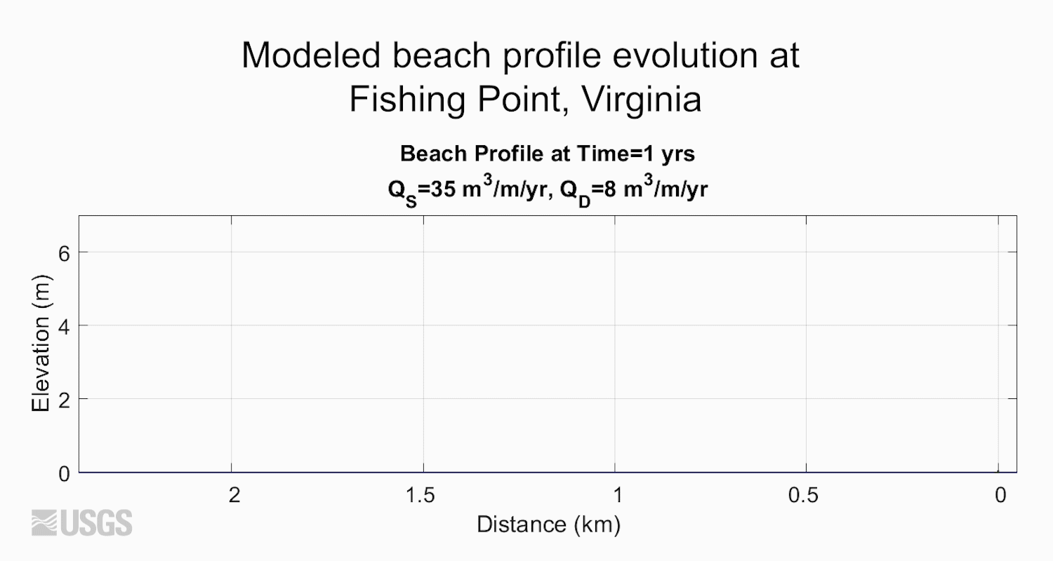
Modeled beach profile evolution at Fishing Point, Virginia
Modeled beach profile evolution at Fishing Point, VirginiaAnimation displays modeled beach profile elevation as it has evolved at Fishing Point, Virginia. These data are based on historical charts and images and measure distance (in kilometers) of cross-shore accretion. QS is the flux of sand to the beach, and QD is the flux of sand from the beach to the active dune.

SPCMSC Library
Rows of scientific journal articles housed within the library at the USGS St. Petersburg Coastal and Marine Science Center.
Rows of scientific journal articles housed within the library at the USGS St. Petersburg Coastal and Marine Science Center.

Davina Passeri presents poster about coastal change research
Davina Passeri presents poster about coastal change researchDavina Passeri of the St. Petersburg Coastal and Marine Science Center presents a poster about coastal change research in Dauphin Island, Alabama at the USGS Southeast Regional Meeting in February 2020.

Ilsa Kuffner presents a poster on coral research
Ilsa Kuffner speaks to a group at the USGS Southeast Regional Meeting in February 2020 about coral research conducted by the St. Petersburg Coastal and Marine Science Center
Ilsa Kuffner speaks to a group at the USGS Southeast Regional Meeting in February 2020 about coral research conducted by the St. Petersburg Coastal and Marine Science Center
Science and Products
Coastal Change Hazards - Stakeholder Engagement and Communications
An important role of the Coastal Change Hazards (CCH) program focus is to foster communication and information exchange, promote collaboration, build partnerships, and connect people with CCH knowledge, data, and tools. Coastal communities and practitioners need scientific information to support decisions regarding development, economics, environmental health, and public safety along the coast...
View photos and videos by Meaghan Emory.
Puerto Rico Coastal Hazards
The island of Puerto Rico is subject to numerous natural hazards including hurricanes and coastal erosion. Information on how the island’s coastal environments respond to these events is critical for bolstering coastal resilience. Dr. Legna Torres-Garcia, who was born in raised in Puerto Rico, is leading an effort to study coastal hazards and make this information more accessible to communities on...
Filter Total Items: 72
SQUID-5 being prepped for a test run
The SQUID-5, or Structure-from-motion (SfM) Quantitative Underwater Imaging Device with 5 cameras, shown being staged for a test run at the St. Petersburg Coastal and Marine Science Center. In the background, Andy Farmer (SPCMSC) and Gerry Hatcher (PCMSC) prep the R/V Sallenger, the vessel being used to tow the device.
The SQUID-5, or Structure-from-motion (SfM) Quantitative Underwater Imaging Device with 5 cameras, shown being staged for a test run at the St. Petersburg Coastal and Marine Science Center. In the background, Andy Farmer (SPCMSC) and Gerry Hatcher (PCMSC) prep the R/V Sallenger, the vessel being used to tow the device.
Secrets of the Sediment on Barrier Islands
Join the USGS St. Petersburg Coastal and Marine Science Center as they uncover the secrets of the sediment on barrier islands in Pinellas County, Florida. This video was originally created for use at the 2021 virtual St. Petersburg Science Festival.
Join the USGS St. Petersburg Coastal and Marine Science Center as they uncover the secrets of the sediment on barrier islands in Pinellas County, Florida. This video was originally created for use at the 2021 virtual St. Petersburg Science Festival.
What is Bathymetry?
Bathymetry is the science of measuring the depth of water in ocean, river and lake environments. Learn how USGS measures bathymetry in this video by the St. Petersburg Coastal and Marine Science Center, originally created for the 2021 virtual St. Petersburg Science Festival.
Bathymetry is the science of measuring the depth of water in ocean, river and lake environments. Learn how USGS measures bathymetry in this video by the St. Petersburg Coastal and Marine Science Center, originally created for the 2021 virtual St. Petersburg Science Festival.
Virtual Tour of USGS St. Pete
Take a virtual tour of the USGS St. Petersburg Coastal and Marine Science Center to learn about the science we do and how we do it!
Take a virtual tour of the USGS St. Petersburg Coastal and Marine Science Center to learn about the science we do and how we do it!
USGS Coastal Change Hazards
The USGS Coastal Change Hazards team works to identify and address the Nation’s coastal change hazards problems. By integrating research, technical capabilities and applications, and stakeholder engagement and communications, the Coastal Change Hazards team develops robust and accessible coastal change assessments, forecasts, and tools that help improve the lives,
The USGS Coastal Change Hazards team works to identify and address the Nation’s coastal change hazards problems. By integrating research, technical capabilities and applications, and stakeholder engagement and communications, the Coastal Change Hazards team develops robust and accessible coastal change assessments, forecasts, and tools that help improve the lives,
We are the Coastal and Marine Hazards and Resources Program
We are the Coastal and Marine Hazards and Resources ProgramWe are the USGS Coastal and Marine Hazards and Resources Program. Our mission is to provide science for sustainable stewardship of Earth’s precious resources.
We are the Coastal and Marine Hazards and Resources Program
We are the Coastal and Marine Hazards and Resources ProgramWe are the USGS Coastal and Marine Hazards and Resources Program. Our mission is to provide science for sustainable stewardship of Earth’s precious resources.
Aerial view of northern Pinellas County barrier islands
Aerial view of northern Pinellas County barrier islandsBarrier islands off the coast of northern Pinellas County, Florida including Anclote Key, Three Rooker Island, and the northern tip of Honeymoon Island. These barriers protect a highly populated coastline.
Dr. Mark Buckley holds a buoy used to collect oceanographic data
Dr. Mark Buckley holds a buoy used to collect oceanographic dataDr. Mark Buckley of the USGS St. Petersburg Coastal and Marine Science Center holds a new Sofar Smart Mooring and Spotter Buoy that will be used to deliver high-fidelity, real-time wave, water level, and wind data.
Sediment coring at Mullet Key, Florida along the Gulf of Mexico
Sediment coring at Mullet Key, Florida along the Gulf of MexicoMendenhall postdoctoral fellow Daniel Ciarletta and geologists Julie Bernier and Nancy DeWitt of the St.
Sediment coring at Mullet Key, Florida along the Gulf of Mexico
Sediment coring at Mullet Key, Florida along the Gulf of MexicoMendenhall postdoctoral fellow Daniel Ciarletta and geologists Julie Bernier and Nancy DeWitt of the St.
Sediment Sample from Barrier Island Core
Daniel Ciarletta, Ph.D. holds a chunk of sand from the bottom of a core collected at Fort de Soto Park in Pinellas County, Florida. Learn more about what barrier island cores tell us: https://www.usgs.gov/media/videos/secrets-sediment-barrier-islands.
Daniel Ciarletta, Ph.D. holds a chunk of sand from the bottom of a core collected at Fort de Soto Park in Pinellas County, Florida. Learn more about what barrier island cores tell us: https://www.usgs.gov/media/videos/secrets-sediment-barrier-islands.
Collecting sediment core with vibracore equipment at Mullet Key, FL
Collecting sediment core with vibracore equipment at Mullet Key, FLDan Ciarletta (right) working alongside Julie Bernier (left) to collect a sediment core on Mullet Key, an island within Fort de Soto Park in Pinellas County, Florida. The core will be used to reconstruct the geologic history of the island.
Mendenhall Postdoctoral Fellow Daniel Ciarletta labels a sediment core
Mendenhall Postdoctoral Fellow Daniel Ciarletta labels a sediment coreMendenhall postdoctoral fellow Daniel Ciarletta of the St.
Mendenhall Postdoctoral Fellow Daniel Ciarletta labels a sediment core
Mendenhall Postdoctoral Fellow Daniel Ciarletta labels a sediment coreMendenhall postdoctoral fellow Daniel Ciarletta of the St.
Bathymetry: Mapping the depth of Tampa Bay with USGS (Teaser)
Bathymetry: Mapping the depth of Tampa Bay with USGS (Teaser)Join the USGS St. Petersburg Coastal and Marine Science Center on an adventure in the field! Our team of scientists will take you on board a personal watercraft near downtown St. Pete to show you how they collect bathymetry data – which is the depth of the ocean floor (in this case, Tampa Bay). This video was created as part of the 2020 St.
Studying How the Beach Changes at Madeira Beach, Florida
Studying How the Beach Changes at Madeira Beach, FloridaThe importance of our Nation’s coasts is indisputable. They provide homes for people and animals alike, and support the Nation’s economy. The USGS Coastal Change Hazards team studies how our shorelines change over time, especially following extreme events such as storms and hurricanes.
Sea Turtle Nest on Madeira Beach
The USGS Coastal Change Hazards team collects data to monitor coastal change – including how storms and waves shape and reshape our beaches. It’s important to keep track of how beaches change over time because they provide habitat for many creatures including birds and sea turtles, and they are beautiful locations where people love to live and vacation.
The USGS Coastal Change Hazards team collects data to monitor coastal change – including how storms and waves shape and reshape our beaches. It’s important to keep track of how beaches change over time because they provide habitat for many creatures including birds and sea turtles, and they are beautiful locations where people love to live and vacation.
Vegetated dunes on Cocoa Beach, Florida
A view looking north on Cocoa beach towards Kennedy Space Station. Coastal infrastructure and natural resources such as sediment and beach vegetation can all be affected by coastal change processes.
A view looking north on Cocoa beach towards Kennedy Space Station. Coastal infrastructure and natural resources such as sediment and beach vegetation can all be affected by coastal change processes.
Modeled beach profile evolution at Fishing Point, Virginia
Modeled beach profile evolution at Fishing Point, VirginiaAnimation displays modeled beach profile elevation as it has evolved at Fishing Point, Virginia. These data are based on historical charts and images and measure distance (in kilometers) of cross-shore accretion. QS is the flux of sand to the beach, and QD is the flux of sand from the beach to the active dune.
SPCMSC Library
Rows of scientific journal articles housed within the library at the USGS St. Petersburg Coastal and Marine Science Center.
Rows of scientific journal articles housed within the library at the USGS St. Petersburg Coastal and Marine Science Center.
Davina Passeri presents poster about coastal change research
Davina Passeri presents poster about coastal change researchDavina Passeri of the St. Petersburg Coastal and Marine Science Center presents a poster about coastal change research in Dauphin Island, Alabama at the USGS Southeast Regional Meeting in February 2020.
Ilsa Kuffner presents a poster on coral research
Ilsa Kuffner speaks to a group at the USGS Southeast Regional Meeting in February 2020 about coral research conducted by the St. Petersburg Coastal and Marine Science Center
Ilsa Kuffner speaks to a group at the USGS Southeast Regional Meeting in February 2020 about coral research conducted by the St. Petersburg Coastal and Marine Science Center