
Pete Steeves
Pete Steeves is a Physical Scientist in the New England Water Science Center.
Pete Steeves has a long history with hydrography mapping in USGS, having been the original water program geospatial liaison to the National Geospatial Program (NGP). Pete has been involved in national and international hydrography mapping for decades and served as the USGS hydrography lead on the highly successful efforts to 'harmonize' hydrography and watershed boundaries with Canada along the international border. Pete attended a vast majority of the annual National Hydrography Dataset (NHD) Management meetings from the earliest years (late 90s) and provided many insights from the water program perspective. Pete started what would become StreamStats with Kernell Ries in the early 90s and has been a member of the National StreamStats Team since its inception in the early 2000s. One of Pete's primary roles in StreamStats early on was to co-develop tools to preprocess raster (elevation) and vector (hydrography, watershed boundaries) data, and to train others on the use of those tools. This process was adopted by national products over the ensuing decades.
Science and Products
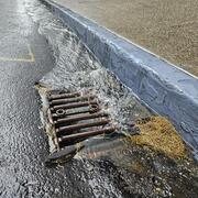
Integrating Stormwater Drainage into USGS StreamStats Application for the Duwamish and Lower Green River

Outlining High-Resolution Urban Drainage Systems for Stormwater Management in the Neponset River Watershed

Delineating High-Resolution Urban Drainage Systems for Stormwater Management in the Mystic River Watershed
Science and Products
Integrating Stormwater Drainage into USGS StreamStats Application for the Duwamish and Lower Green River
Outlining High-Resolution Urban Drainage Systems for Stormwater Management in the Neponset River Watershed