
In July of 2016, a team from the Climate and Land Use Research and Development Program took a trip to South Carolina to study outcrops of the “Canepatch” and “Socastee” formations along the Intra-Coastal Waterway, near Myrtle Beach. The age of these fossiliferous marine units has been controversial for several decades.
Images
Images intro.
Filter Total Items: 308

ICW Section Outcrops, S.C., Summer 2016
In July of 2016, a team from the Climate and Land Use Research and Development Program took a trip to South Carolina to study outcrops of the “Canepatch” and “Socastee” formations along the Intra-Coastal Waterway, near Myrtle Beach. The age of these fossiliferous marine units has been controversial for several decades.
In July of 2016, a team from the Climate and Land Use Research and Development Program took a trip to South Carolina to study outcrops of the “Canepatch” and “Socastee” formations along the Intra-Coastal Waterway, near Myrtle Beach. The age of these fossiliferous marine units has been controversial for several decades.

Coarse Diabase
Diabase is a mafic (meaning high in magnesium and iron), igneous rock that usually forms below the Earth’s surface. This particular one has large amounts of augite and labradorite minerals, and comes from the Lucke Quarry, which is southeast of Leesburg, VA.
Diabase is a mafic (meaning high in magnesium and iron), igneous rock that usually forms below the Earth’s surface. This particular one has large amounts of augite and labradorite minerals, and comes from the Lucke Quarry, which is southeast of Leesburg, VA.

USGS National Center North Entrance and Volcanic Crystal Columns
USGS National Center North Entrance and Volcanic Crystal ColumnsGranite is an igneous rock that we’ve used for building materials for thousands of years. It’s name comes from the Latin word “granum,” meaning “grain,” which refers to the grains of quartz and feldspar that define granite. This one is from the Barre formation in Vermont.

Leesburg Conglomerate
Conglomerates are sedimentary rocks that are made up of various fragments of rock interspersed with finer grained material. This particular conglomerate was deposited as a fan on the northwest side of the Culpeper Basin.
Conglomerates are sedimentary rocks that are made up of various fragments of rock interspersed with finer grained material. This particular conglomerate was deposited as a fan on the northwest side of the Culpeper Basin.

Cockeysville Marble
Marble is a famous metamorphic rock known for its use in sculpture and architecture. This particular marble came from the Campbell Quarry in Texas, Maryland.
Marble is a famous metamorphic rock known for its use in sculpture and architecture. This particular marble came from the Campbell Quarry in Texas, Maryland.

Diopside Crystals
Diopside crystals are made up of Magnesium, Calcium, Silicon and Oxygen, and are usually found in metamorphic rocks. These crystals have developed in some Cockeysville Marble from Texas, Maryland.
Diopside crystals are made up of Magnesium, Calcium, Silicon and Oxygen, and are usually found in metamorphic rocks. These crystals have developed in some Cockeysville Marble from Texas, Maryland.

USGS National Center Benchmark
A USGS benchmark at the USGS National Center.
A USGS benchmark at the USGS National Center.

Barre Granite
Granite is an igneous rock that we’ve used for building materials for thousands of years. It’s name comes from the Latin word “granum,” meaning “grain,” which refers to the grains of quartz and feldspar that define granite. This one is from the Barre formation in Vermont.
Granite is an igneous rock that we’ve used for building materials for thousands of years. It’s name comes from the Latin word “granum,” meaning “grain,” which refers to the grains of quartz and feldspar that define granite. This one is from the Barre formation in Vermont.

Cannel Coal
Cannel coal is a type of bituminous coal, which is the second-highest rank of coal (just behind anthracite). This particular sample has a high carbon content with high pollen and spore content as well. Unlike most bituminous coal, Cannel coal can be carved into ornaments. This sample came from the Eastern Interior Coalfield in Kentucky.
Cannel coal is a type of bituminous coal, which is the second-highest rank of coal (just behind anthracite). This particular sample has a high carbon content with high pollen and spore content as well. Unlike most bituminous coal, Cannel coal can be carved into ornaments. This sample came from the Eastern Interior Coalfield in Kentucky.

USGS ecologist Jaimie Gillespie measuring a Sediment Elevation Table
USGS ecologist Jaimie Gillespie measuring a Sediment Elevation TableUSGS ecologist Jaimie Gillespie measuring a Sediment Elevation Table (SET) on the Pamunkey River, VA. This SET is part of a larger project which consists of two SETs at each of five research sites, on both the Mattaponi and Pamunkey Rivers spanning Oligahaline to non-tidal conditions.

Sampling for Impacts of UOG Waists
Sampling for Impacts of UOG Wastes
USGS scientist collecting water-quality samples on a wastewater disposal facility in West Virginia to assess potential environmental impacts due to activities at the site.
Sampling for Impacts of UOG Wastes
USGS scientist collecting water-quality samples on a wastewater disposal facility in West Virginia to assess potential environmental impacts due to activities at the site.

Pollen Lab Field Gear
This gear, known as a Russian corer, is commonly used to extract sediment cores from field sites.
This gear, known as a Russian corer, is commonly used to extract sediment cores from field sites.

Sieving a Sample to Extract Pollen, Pollen Laboratory
Sieving a Sample to Extract Pollen, Pollen LaboratoryIn this photo, a lab technician sieves a sample to get rid of fine minerals (such as clay).
Sieving a Sample to Extract Pollen, Pollen Laboratory
Sieving a Sample to Extract Pollen, Pollen LaboratoryIn this photo, a lab technician sieves a sample to get rid of fine minerals (such as clay).

Swirling a Sample to Separate Pollen from Minerals, Pollen Laboratory
Swirling a Sample to Separate Pollen from Minerals, Pollen LaboratoryIn a watch glass, a lab technician swirls out pollen from heavier mineral material and then pipets it out.
Swirling a Sample to Separate Pollen from Minerals, Pollen Laboratory
Swirling a Sample to Separate Pollen from Minerals, Pollen LaboratoryIn a watch glass, a lab technician swirls out pollen from heavier mineral material and then pipets it out.

Set-up to Sieve Samples for Pollen, Pollen Laboratory
Set-up to Sieve Samples for Pollen, Pollen LaboratorySeen in this image is the sieving setup of the pollen lab.
Set-up to Sieve Samples for Pollen, Pollen Laboratory
Set-up to Sieve Samples for Pollen, Pollen LaboratorySeen in this image is the sieving setup of the pollen lab.

Methane Seeps along Offshore Virginia
Numerous distinct methane streams emanating from the seafloor at an upper slope (< 500 m water depth) cold seep site offshore Virginia. Image courtesy of NOAA Okeanos Explorer Program, 2013 Northeast U.S. Canyons Expedition.
Numerous distinct methane streams emanating from the seafloor at an upper slope (< 500 m water depth) cold seep site offshore Virginia. Image courtesy of NOAA Okeanos Explorer Program, 2013 Northeast U.S. Canyons Expedition.
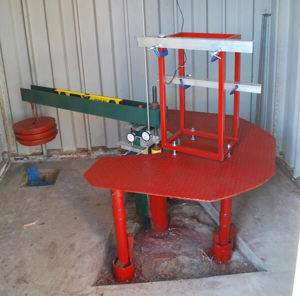
The USGS Franklin pipe extensometer with a total depth of 860 feet.
The USGS Franklin pipe extensometer with a total depth of 860 feet.The USGS Franklin pipe extensometer with a total depth of 860 feet.
Period of record: 1979-1995; 2016-present
The USGS Franklin pipe extensometer with a total depth of 860 feet.
The USGS Franklin pipe extensometer with a total depth of 860 feet.The USGS Franklin pipe extensometer with a total depth of 860 feet.
Period of record: 1979-1995; 2016-present

Building housing the USGS Suffolk extensometer
This photograph shows the building housing the USGS Suffolk extensometer. Inside, the extensometer extends to a depth of 1,599 feet below groundlevel.
Period of record: 1982-1995; 2016-present
This photograph shows the building housing the USGS Suffolk extensometer. Inside, the extensometer extends to a depth of 1,599 feet below groundlevel.
Period of record: 1982-1995; 2016-present

The USGS Suffolk pipe extensometer with a total depth of 1,620 feet.
The USGS Suffolk pipe extensometer with a total depth of 1,620 feet.The USGS Suffolk pipe extensometer with a total depth of 1,620 feet.
Period of record: 1982-1995; 2016-present
The USGS Suffolk pipe extensometer with a total depth of 1,620 feet.
The USGS Suffolk pipe extensometer with a total depth of 1,620 feet.The USGS Suffolk pipe extensometer with a total depth of 1,620 feet.
Period of record: 1982-1995; 2016-present