Pivot block where the USGS Nansemond extensometer connects to the fulcrum arm.
This extensometer is a part of the The Virginia Extensometer Network.

Official websites use .gov
A .gov website belongs to an official government organization in the United States.
Secure .gov websites use HTTPS
A lock () or https:// means you’ve safely connected to the .gov website. Share sensitive information only on official, secure websites.

Pivot block where the USGS Nansemond extensometer connects to the fulcrum arm.
This extensometer is a part of the The Virginia Extensometer Network.
Pivot block where the USGS Nansemond extensometer connects to the fulcrum arm.
This extensometer is a part of the The Virginia Extensometer Network.

Installing the linear potentiometer on the USGS Nansemond extensometer. The linear potentiometer is used to measure land-surface movement in response to aquifer system deformation at the USGS Nansemond extensometer.
Installing the linear potentiometer on the USGS Nansemond extensometer. The linear potentiometer is used to measure land-surface movement in response to aquifer system deformation at the USGS Nansemond extensometer.

Functional and Molecular Bioassay Laboratory — Kearneysville, West Virginia. Multiwell cell culture array
Functional and Molecular Bioassay Laboratory — Kearneysville, West Virginia. Multiwell cell culture array

Roanoke VA Precipitation Station Garden City Elementary School.
Roanoke VA Precipitation Station Garden City Elementary School.

Roanoke VA Precipitation Station at Mill Mountain Park
Roanoke VA Precipitation Station at Mill Mountain Park

Roanoke VA Precipitation Station at Shrine Hill Park
Roanoke VA Precipitation Station at Shrine Hill Park

Roanoke VA Precipitation Station at Roanoke Center for Industry and Technology at Blue Hills Drive
Roanoke VA Precipitation Station at Roanoke Center for Industry and Technology at Blue Hills Drive

Occupying a surveying benchmark, part of the Hampton Roads Benchmark Monitoring Network.
Occupying a surveying benchmark, part of the Hampton Roads Benchmark Monitoring Network.

Monitoring Roanoke River along Route 626 at Lafayette, VA
Monitoring Roanoke River along Route 626 at Lafayette, VA

Occupying a surveying benchmark in Hampton Roads. Part of the Hampton Roads Benchmark Monitoring Network.
Occupying a surveying benchmark in Hampton Roads. Part of the Hampton Roads Benchmark Monitoring Network.

Looking downstream along the cowpasture river.
Looking downstream along the cowpasture river.
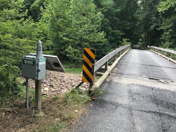
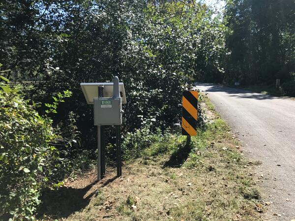
Monitoring Ramseys Draft at Route 716 near West Augusta
Monitoring Ramseys Draft at Route 716 near West Augusta

An R10-bipod occupying a GNSS survey benchmark as a part of the Hampton Roads Benchmark Monitoring Network program.
An R10-bipod occupying a GNSS survey benchmark as a part of the Hampton Roads Benchmark Monitoring Network program.

Occupying a surveying benchmark, part of the Hampton Roads Benchmark Monitoring Network.
Occupying a surveying benchmark, part of the Hampton Roads Benchmark Monitoring Network.

Cowpasture river monitoring at Route 627 near Williamsville, VA
Cowpasture river monitoring at Route 627 near Williamsville, VA

A photo of the Roanoke River Valley at Sunset.
A photo of the Roanoke River Valley at Sunset.

Water monitoring at Little Stony Creek above Archer Trail near Pembroke, VA
Water monitoring at Little Stony Creek above Archer Trail near Pembroke, VA
Monitoring Spruce Creek at Route 627 near Nellysford, VA
Monitoring Spruce Creek at Route 627 near Nellysford, VA

Virginia and West Virginia Water Science Center: Virginia Science Office, Richmond.
Virginia and West Virginia Water Science Center: Virginia Science Office, Richmond.

A photo of the edge of a dock with pier and surrounding water and reflected sunshine. Photo taken by Hayley Austin.
A photo of the edge of a dock with pier and surrounding water and reflected sunshine. Photo taken by Hayley Austin.

A View of the York River and Bridge, York County Virginia, July, 2017.
A View of the York River and Bridge, York County Virginia, July, 2017.