Surveying Contracted-Opening Indirect Measurements
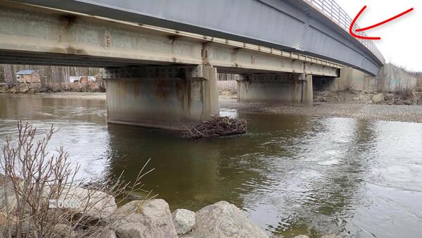
Surveying Contracted-Opening Indirect MeasurementsThis video goes into detail about surveying high-water marks, various aspects of bridges, and cross sections for the contracted-opening method.

An official website of the United States government
Here's how you know
Official websites use .gov
A .gov website belongs to an official government organization in the United States.
Secure .gov websites use HTTPS
A lock () or https:// means you’ve safely connected to the .gov website. Share sensitive information only on official, secure websites.
Videos from Region 6.
 Surveying Contracted-Opening Indirect Measurements
This video goes into detail about surveying high-water marks, various aspects of bridges, and cross sections for the contracted-opening method.
This video goes into detail about surveying high-water marks, various aspects of bridges, and cross sections for the contracted-opening method.
This video discusses the general requirements that will be needed to accomplish a contracted-opening indirect discharge measurement. Approach section, contracted section, and necessary high-water mark locations are described along with scenarios where the method will not be successful.
This video discusses the general requirements that will be needed to accomplish a contracted-opening indirect discharge measurement. Approach section, contracted section, and necessary high-water mark locations are described along with scenarios where the method will not be successful.
 Climate Projections as a Way to Illustrate Future Possibilities
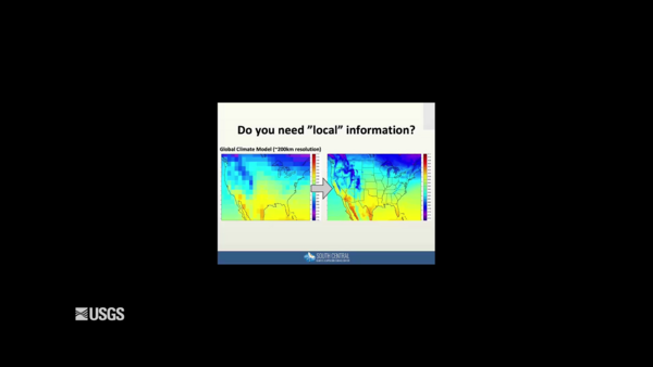
This video is a recording of the webinar “Climate Projections as a Way to Illustrate Future Possibilities" that is part of the USGS National Climate Adaptation Science Center (NCASC), in partnership with the National Conservation Training Center (NCTC), 2019 webinar series.
This video is a recording of the webinar “Climate Projections as a Way to Illustrate Future Possibilities" that is part of the USGS National Climate Adaptation Science Center (NCASC), in partnership with the National Conservation Training Center (NCTC), 2019 webinar series.
Lake Meredith National Recreation Area takes its name from the water body it surrounds in the Texas Panhandle. The Amarillo-area lake sees more than a million visitors a year.
Lake Meredith National Recreation Area takes its name from the water body it surrounds in the Texas Panhandle. The Amarillo-area lake sees more than a million visitors a year.
 Habitat Connectivity: Assessing Threats and IDing Conservation Actions
An important conservation strategy for climate change is to enhance and maintain regional habitat connectivity for the long-term viability of wildlife populations. Modeling habitat connectivity for wildlife species often results in a mapped network of linkages between habitat patches.
An important conservation strategy for climate change is to enhance and maintain regional habitat connectivity for the long-term viability of wildlife populations. Modeling habitat connectivity for wildlife species often results in a mapped network of linkages between habitat patches.
Waterfowl populations in the northern Gulf of Mexico (NGOM) rely extensively on plants that grow under the surface in shallow waters, know as submerged aquatic vegetation (SAV), as a critical food resource in the winter season.
Waterfowl populations in the northern Gulf of Mexico (NGOM) rely extensively on plants that grow under the surface in shallow waters, know as submerged aquatic vegetation (SAV), as a critical food resource in the winter season.
 Groundwater use from the Ozark Plateaus aquifer system, 1900 to 2010
Groundwater use from the Ozark Plateaus aquifer system, 1900 to 2010” is a short video showing modeled groundwater withdrawal rates from the Ozark Plateaus aquifer system (Ozark system) in the central United States.
Groundwater use from the Ozark Plateaus aquifer system, 1900 to 2010” is a short video showing modeled groundwater withdrawal rates from the Ozark Plateaus aquifer system (Ozark system) in the central United States.
Before a hurricane, USGS Scientists undertake a data collection effort of a grand scale. They install a temporary mobile network of sensors along the coasts to collect additional data on the intensity of storm surge, one of the most dangerous elements of a hurricane.
Before a hurricane, USGS Scientists undertake a data collection effort of a grand scale. They install a temporary mobile network of sensors along the coasts to collect additional data on the intensity of storm surge, one of the most dangerous elements of a hurricane.
Hurricane Harvey dumped over 50 inches of rain near Houston, leaving extensive flooding throughout the area.
At the USGS EROS Center, we study land change, operate the Landsat satellites, and maintain the longest, continuously acquired collection of images of the Earth's land surface.
Hurricane Harvey dumped over 50 inches of rain near Houston, leaving extensive flooding throughout the area.
At the USGS EROS Center, we study land change, operate the Landsat satellites, and maintain the longest, continuously acquired collection of images of the Earth's land surface.
 Image of the Week: Hurricane Harvey Inundates Gulf Coast
Hurricane Harvey made landfall on August 25th. Over the next few days, record rain totals had devastated the area.
At the USGS EROS Center, we study land change, operate the Landsat satellites, and maintain the longest, continuously acquired collection of images of the Earth's land surface.
Hurricane Harvey made landfall on August 25th. Over the next few days, record rain totals had devastated the area.
At the USGS EROS Center, we study land change, operate the Landsat satellites, and maintain the longest, continuously acquired collection of images of the Earth's land surface.
 Developing Effective Drought Monitoring Tools for Farmers and Ranchers
This webinar was conducted on August 7, 2017 as part of the USGS National Climate Change and Wildlife Science Center’s Climate Change Science and Management Webinar Series, held in partnership with the USFWS National Conservation Training Center.
This webinar was conducted on August 7, 2017 as part of the USGS National Climate Change and Wildlife Science Center’s Climate Change Science and Management Webinar Series, held in partnership with the USFWS National Conservation Training Center.
 Awareness: USGS "Water-on-the-Go" Mobile App (Texas)
The USGS Texas Water Science Center has developed a new mobile application called “Water On-the-Go” that gives people easy access to current conditions in streams across Texas. The information reflects what is happening in streams near you at that very moment.
The USGS Texas Water Science Center has developed a new mobile application called “Water On-the-Go” that gives people easy access to current conditions in streams across Texas. The information reflects what is happening in streams near you at that very moment.
USGS scientists drill a research well near Waco, Texas, as part of the assessment of oil and gas resources in the Eagle Ford Group. Cores like these provide information on the various rock layers, such as their make-up, their age, etc.
USGS scientists drill a research well near Waco, Texas, as part of the assessment of oil and gas resources in the Eagle Ford Group. Cores like these provide information on the various rock layers, such as their make-up, their age, etc.
 Be Water Aware: USGS "Water-on-the-Go" Mobile Application
The USGS Texas Water Science Center has developed a new mobile application called “Water On-the-Go” that gives people easy access to current conditions in streams across Texas. The information reflects what is happening in streams near you at that very moment.
The USGS Texas Water Science Center has developed a new mobile application called “Water On-the-Go” that gives people easy access to current conditions in streams across Texas. The information reflects what is happening in streams near you at that very moment.
Golden eagles can be killed by colliding with a number of human-made objects, including wind turbines. USGS research wildlife biologist Todd Katzner describes his studies of golden eagle flight. This research is being done to model flight behavior which might help managers understand how placement of wind turbines might pose significant risks to golden eagles.
Golden eagles can be killed by colliding with a number of human-made objects, including wind turbines. USGS research wildlife biologist Todd Katzner describes his studies of golden eagle flight. This research is being done to model flight behavior which might help managers understand how placement of wind turbines might pose significant risks to golden eagles.
A USGS field crew takes flood measurements on the Sabine River on March 12 near Bon Weir, Texas. USGS scientists on the boat included Jeff East, Jimmy Hopkins, and Jody Avant.
A USGS field crew takes flood measurements on the Sabine River on March 12 near Bon Weir, Texas. USGS scientists on the boat included Jeff East, Jimmy Hopkins, and Jody Avant.
Hydrologists from Arizona aid the Texas Water Science Center in gathering measurements and other information after the catastrophic Blanco River flooding event that swept Austin, Texas.
Hydrologists from Arizona aid the Texas Water Science Center in gathering measurements and other information after the catastrophic Blanco River flooding event that swept Austin, Texas.
 Water-level Change in the High Plains Aquifer System
In 1986, Congress directed the USGS to regularly report groundwater-level changes in the High Plains aquifer system. To comply with this directive, the USGS compares water levels measured every two years. By measuring water levels across the entire aquifer in one year, measurements made two years later enable calculation of changes over time.
In 1986, Congress directed the USGS to regularly report groundwater-level changes in the High Plains aquifer system. To comply with this directive, the USGS compares water levels measured every two years. By measuring water levels across the entire aquifer in one year, measurements made two years later enable calculation of changes over time.
This webinar, Climate, Water Quality, Toxic Blooms of Golden Alga in Texas, was presented by Reynaldo Patino from the USGS Texas Cooperative Fish and Wildlife Research Unit.
This webinar, Climate, Water Quality, Toxic Blooms of Golden Alga in Texas, was presented by Reynaldo Patino from the USGS Texas Cooperative Fish and Wildlife Research Unit.
