
This image from the European Space Agency's Sentinel-2A satellite offers a breathtaking view of Crater Lake National Park in southern Oregon. It offers something equally important to park managers, scientists, and anyone else interested in land cover change—a view that is highly similar and complementary to Landsat acquisitions.
Multimedia
Images

Crater Lake Image Shows Potential of Sentinel-2A
This image from the European Space Agency's Sentinel-2A satellite offers a breathtaking view of Crater Lake National Park in southern Oregon. It offers something equally important to park managers, scientists, and anyone else interested in land cover change—a view that is highly similar and complementary to Landsat acquisitions.

Photo of Crater Lake with oblique bathymetric image of the caldera ...
Photo of Crater Lake with oblique bathymetric image of the caldera ...Photo of Crater Lake with oblique bathymetric image of the caldera floor beneath the lake's surface. Oregon
Photo of Crater Lake with oblique bathymetric image of the caldera ...
Photo of Crater Lake with oblique bathymetric image of the caldera ...Photo of Crater Lake with oblique bathymetric image of the caldera floor beneath the lake's surface. Oregon

Map showing one-year probability of accumulation of 1 centimeter
Map showing one-year probability of accumulation of 1 centimeterMap showing one-year probability of accumulation of 1 centimeter (0.4 inch) or more of tephra from eruptions of volcanoes in the Cascade Range.
By
Natural Hazards Mission Area, Volcano Hazards Program, California Volcano Observatory, Cascades Volcano Observatory, Crater Lake, Glacier Peak, Lassen Volcanic Center, Medicine Lake, Mount Adams, Mount Baker, Mount Hood, Mount Jefferson, Mount Rainier, Mount Shasta, Mount St. Helens, Newberry, Three Sisters

Mount Scott fire lookout tower near Crater Lake, OR
Mount Scott fire lookout tower near Crater Lake, ORMount Scott fire lookout tower near Crater Lake, Oregon. Tower houses seismic and deformation monitoring instruments.
Mount Scott fire lookout tower near Crater Lake, OR
Mount Scott fire lookout tower near Crater Lake, ORMount Scott fire lookout tower near Crater Lake, Oregon. Tower houses seismic and deformation monitoring instruments.

Crater Lake combined digital elevation and bathymetric map showing ...
Crater Lake combined digital elevation and bathymetric map showing ...Crater Lake partially fills the caldera that formed approximately 7,700 years ago during the eruption of a 12,000-ft-high volcano known as Mount Mazama.
Crater Lake combined digital elevation and bathymetric map showing ...
Crater Lake combined digital elevation and bathymetric map showing ...Crater Lake partially fills the caldera that formed approximately 7,700 years ago during the eruption of a 12,000-ft-high volcano known as Mount Mazama.

Crater Lake caldera rim view to north. Pumice Castle, orange spire ...
Crater Lake caldera rim view to north. Pumice Castle, orange spire ...Crater Lake caldera rim view to north. Pumice Castle, orange spire in center right, a near-vent deposit formed by 71ka Plinian tephra-fall deposit; cliff to left is Redcloud Cliff lava flow.
Videos

PubTalk 9/2003 — Beneath Crater Lake
An underwater volcanic landscape tells a complex tale
by Charles R. Bacon, Geologist
Visualizations presented by David W. Ramsey, Geologist
An underwater volcanic landscape tells a complex tale
by Charles R. Bacon, Geologist
Visualizations presented by David W. Ramsey, Geologist

Crater Lake, Oregon, Fly-by Animation
Fly-by of shaded-relief bathymetry and surrounding mountains of Crater Lake Oregon. The colored region is the lake floor whereas the gray region shows the surrounding mountains. The lake is approximately 9-km wide east to west.
Fly-by of shaded-relief bathymetry and surrounding mountains of Crater Lake Oregon. The colored region is the lake floor whereas the gray region shows the surrounding mountains. The lake is approximately 9-km wide east to west.
Webcams
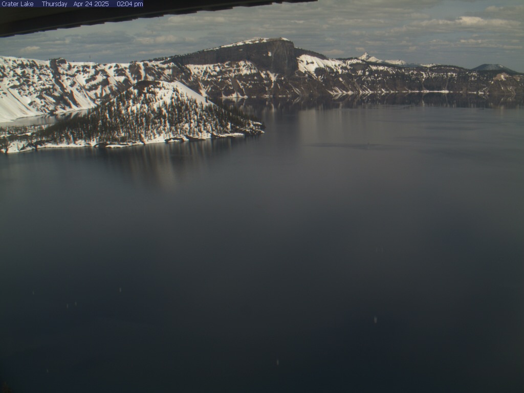
Crater Lake National Park
From the Sinnott Memorial Overlook webcam, 7,100 feet above sea level, you can view Wizard Island, Llao Rock, and at times you can see Mount Thielsen outside the park. Note: Up to 50% of the time in the winter the webcam is obscured by snow and clouds. The webcam updates every 10 minutes.
By
From the Sinnott Memorial Overlook webcam, 7,100 feet above sea level, you can view Wizard Island, Llao Rock, and at times you can see Mount Thielsen outside the park. Note: Up to 50% of the time in the winter the webcam is obscured by snow and clouds. The webcam updates every 10 minutes.
By
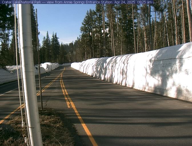
Annie Springs Entrance
Open year-round, Highway 62 provides access to Crater Lake's rim via Munson Valley Road. 7 miles long, Munson Valley Road takes visitors from Annie Spring entrance station (elevation 6000 ft) and climbs nearly 1100 feet to Rim Village. Image updates every 10 minutes.
By
Open year-round, Highway 62 provides access to Crater Lake's rim via Munson Valley Road. 7 miles long, Munson Valley Road takes visitors from Annie Spring entrance station (elevation 6000 ft) and climbs nearly 1100 feet to Rim Village. Image updates every 10 minutes.
By
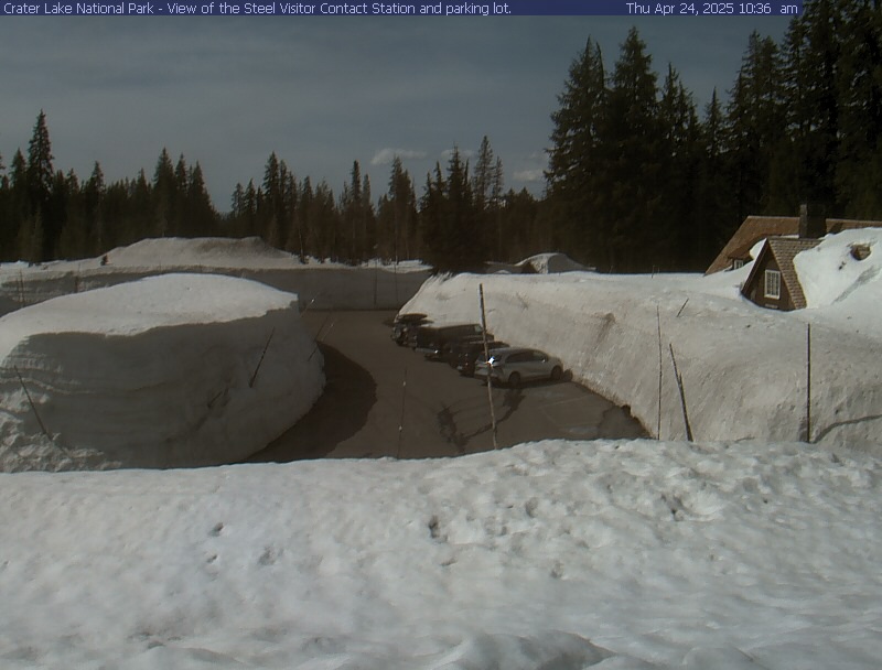
Steel Visitor Center
View of Steel Visitor Center at Crater Lake National Park headquarters, a few miles from Rim Village and the Crater Lake Lodge. The Steel Visitor Center is 6450 feet above sea level. Image updates every 10 minutes.
By
View of Steel Visitor Center at Crater Lake National Park headquarters, a few miles from Rim Village and the Crater Lake Lodge. The Steel Visitor Center is 6450 feet above sea level. Image updates every 10 minutes.
By