U.S. flag

An official website of the United States government

Images

Kīlauea images of eruptive activity, field work, and more.

Filter Total Items: 3249
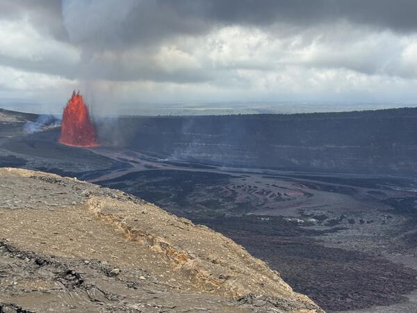
Color photograph of lava fountain
June 14, 2026 — Kīlauea summit eruption episode 49

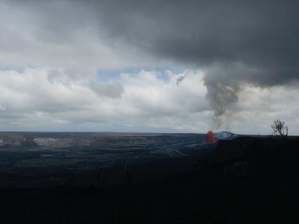
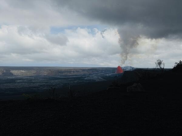
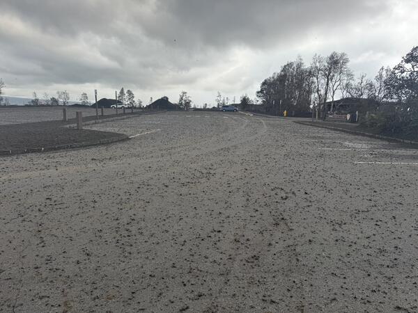
An overview of episode 49 of lava fountaining during the ongoing Kīlauea summit eruption in Halema‘uma‘u, taken from Kīlauea overlook in Hawai‘i Volcanoes National Park. Fountains reached a maximum height of approximately 210 m (688 ft), but because of wind patterns, little to no tephra was deposited in the public viewing areas of the national park.

An overview of episode 49 of lava fountaining during the ongoing Kīlauea summit eruption in Halema‘uma‘u, taken from Kīlauea overlook in Hawai‘i Volcanoes National Park. Fountains reached a maximum height of approximately 210 m (688 ft), but because of wind patterns, little to no tephra was deposited in the public viewing areas of the national park.

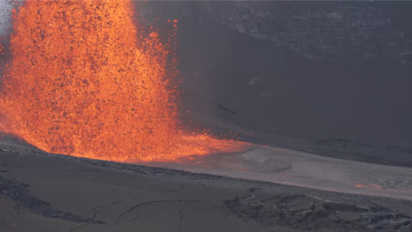
Color photograph of lava fountain erupting during the day
June 14, 2026 — Kīlauea episode 49 lava fountain from the north vent

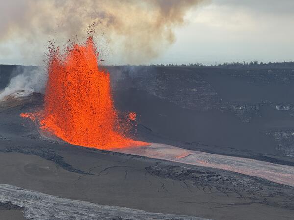
Episode 49 of the Kīlauea summit eruption in Halema‘uma‘u started at 9:36 a.m. HST on June 14, 2026, and lasted approximately 7.5 hours. Only north vent erupted a lava fountain, which reached a maximum height of about 210 m (688 ft). USGS photo by T. Paladino.

Episode 49 of the Kīlauea summit eruption in Halema‘uma‘u started at 9:36 a.m. HST on June 14, 2026, and lasted approximately 7.5 hours. Only north vent erupted a lava fountain, which reached a maximum height of about 210 m (688 ft). USGS photo by T. Paladino.

Color photograph of scientists with top of lava fountain in distance
June 14, 2026 — Monitoring Kīlauea eruption episode 49

USGS scientists traverse the tephra deposit from the ongoing Kīlauea summit eruption in Halema‘uma‘u on June 14, 2026, to collect real-time measurements of lava fountain heights, tephra dispersal, and crater floor coverage during episode 49.

USGS scientists traverse the tephra deposit from the ongoing Kīlauea summit eruption in Halema‘uma‘u on June 14, 2026, to collect real-time measurements of lava fountain heights, tephra dispersal, and crater floor coverage during episode 49.

Color photograph of lava fountain with scientists in the foreground
June 14, 2026 — Monitoring Kīlauea episode 49

During lava fountaining episodes at the summit of Kīlauea, USGS Hawaiian Volcano Observatory scientists use laser rangefinders to estimate high how the lava fountains are reaching above the vents and how far the lava flows have traveled from the vents. Additionally, they document eruption dynamics and record eruptive activity using high-resolution cameras.

During lava fountaining episodes at the summit of Kīlauea, USGS Hawaiian Volcano Observatory scientists use laser rangefinders to estimate high how the lava fountains are reaching above the vents and how far the lava flows have traveled from the vents. Additionally, they document eruption dynamics and record eruptive activity using high-resolution cameras.

Color photograph of lava fountain at night
June 14, 2026 — Episode 49 at the summit of Kīlauea as it was ending

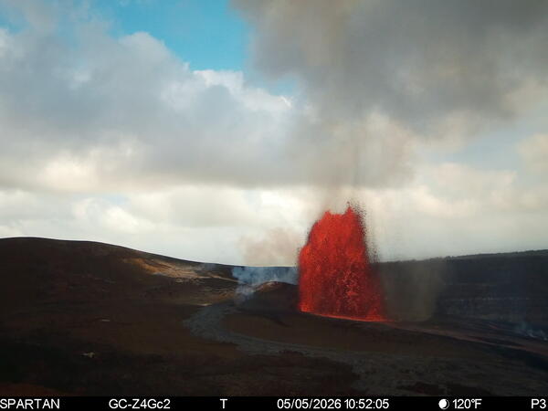
Episode 49 of the Kīlauea summit eruption in Halema‘uma‘u ended abruptly by 5:05 p.m. HST on June 14, after 7.5 hours of lava fountaining activity from the north vent. The final waning stage of fountaining activity lasted less than 5 minutes, during which the lava fountain dropped below 60-80 meters (200-260 ft) in height.

Episode 49 of the Kīlauea summit eruption in Halema‘uma‘u ended abruptly by 5:05 p.m. HST on June 14, after 7.5 hours of lava fountaining activity from the north vent. The final waning stage of fountaining activity lasted less than 5 minutes, during which the lava fountain dropped below 60-80 meters (200-260 ft) in height.

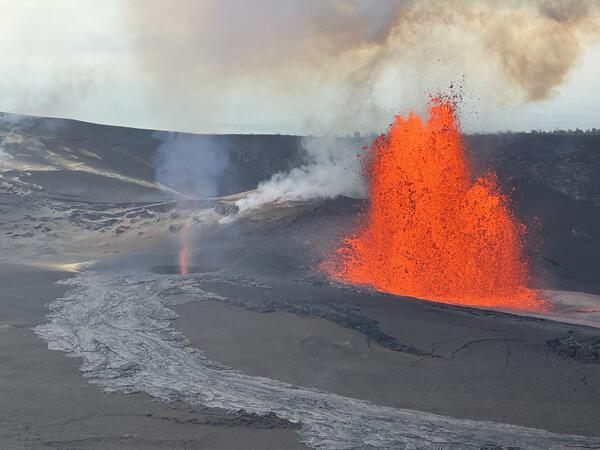
Color photograph of lava fountain
June 14, 2026 — Kīlauea episode 49 fountain and dust devil visible from V3cam

This photograph, taken just after 2 p.m. HST on June 14, 2026, shows a dust devil, or puahiohio, forming within Halemaʻumaʻu crater at the summit of Kīlauea during lava fountaining episode 49. USGS photo. 

Color photograph of active degassing volcanic vents
June 9, 2026 — Aerial view into the eruptive vents in Halemaʻumaʻu at the summit of Kīlauea

USGS scientists conduct Kīlauea summit monitoring overflight on June 9, 2026, to document changes to the eruptive vents and crater floor after episode 48 that took place on June 1.

Color photograph of degassing volcanic vents
June 9, 2026 — Aerial overview of the eruptive vents at the summit of Kīlauea

Aerial photograph showing the eruptive vents in Halema‘uma‘u crater at the summit of Kīlauea during a USGS Hawaiian Volcano Observatory monitoring overflight on June 9, 2026. Erupted material (lava flows and tephra) continues to build up the base of the vents, and sulfur precipitation is present on the vent walls (yellow patches). USGS photo by H. Winslow.

Aerial photograph showing the eruptive vents in Halema‘uma‘u crater at the summit of Kīlauea during a USGS Hawaiian Volcano Observatory monitoring overflight on June 9, 2026. Erupted material (lava flows and tephra) continues to build up the base of the vents, and sulfur precipitation is present on the vent walls (yellow patches). USGS photo by H. Winslow.

Color photograph of helicopter on crater floor with crater wall in background
June 9, 2026 — South sulphur bank at the summit of Kīlauea

On June 9, 2026, USGS-Hawaiian Volcano Observatory scientists landed on the floor of Halema'uma'u crater in the vicinity of the south sulphur bank, visible in the background of this photo. The south sulphur bank was prominently visible in the mid-19th century but was covered as lava flows filled the caldera and wasn't visible in the twentieth century.

On June 9, 2026, USGS-Hawaiian Volcano Observatory scientists landed on the floor of Halema'uma'u crater in the vicinity of the south sulphur bank, visible in the background of this photo. The south sulphur bank was prominently visible in the mid-19th century but was covered as lava flows filled the caldera and wasn't visible in the twentieth century.

Color photograph of volcanic landscape with volcanic plume and clouds
June 5, 2026 — View of cone forming behind north and south vents at Kīlauea summit

This view is of the cone (pu‘u) that has formed in the predominant downwind direction (southwest) of the north and south vents during the ongoing eruption at Halema‘uma‘u at the summit of Kīlauea. This photo is south of the southwest corner of Halema‘uma‘u and is looking to the north-northwest.

This view is of the cone (pu‘u) that has formed in the predominant downwind direction (southwest) of the north and south vents during the ongoing eruption at Halema‘uma‘u at the summit of Kīlauea. This photo is south of the southwest corner of Halema‘uma‘u and is looking to the north-northwest.

Color photographs of vegetation changes near a brown wooden sign
Changes in vegetation near the Hawaiian Volcano Observatory sign

Before and after photos of vegetation defoliation outside the new USGS Hawaiian Volcano Observatory Field Station building located near the Kilauea Military Camp inside Hawaiʻi Volcanoes National Park. Left photo was taken on February 11, 2026. Right photo was taken on April 21, 2026. USGS photos by K. Mulliken.

Before and after photos of vegetation defoliation outside the new USGS Hawaiian Volcano Observatory Field Station building located near the Kilauea Military Camp inside Hawaiʻi Volcanoes National Park. Left photo was taken on February 11, 2026. Right photo was taken on April 21, 2026. USGS photos by K. Mulliken.

Color photographs of vegetation regrowth
Renewed vegetation growth at Kīlauea summit

Signs of renewed growth on vegetation in areas hit hard by recent storm and volcanic impacts in the Kīlauea Summit region. Photos courtesy of Pete Lockhart and Jill Briggs. 

Signs of renewed growth on vegetation in areas hit hard by recent storm and volcanic impacts in the Kīlauea Summit region. Photos courtesy of Pete Lockhart and Jill Briggs. 

Color graphic map showing volcanic eruption deposit at the summit of a volcano
June 2, 2026 — Kīlauea lava flow and tephra fall map following episode 48

This map shows lava flow and tephra accumulation at the summit of Kīlauea volcano associated with episode 48 of the ongoing eruption in Halemaʻumaʻu that started on December 23, 2024, using data recorded by the Italian Space Agency's (ASI) COSMO-SkyMed Second Generation satellite constellation.

This map shows lava flow and tephra accumulation at the summit of Kīlauea volcano associated with episode 48 of the ongoing eruption in Halemaʻumaʻu that started on December 23, 2024, using data recorded by the Italian Space Agency's (ASI) COSMO-SkyMed Second Generation satellite constellation.

Color photograph of volcanic plume
June 1, 2026 — View of episode 48 lava fountain and plume from near the Ka‘ū Desert trailhead

This photo was taken from near the Ka‘ū Desert trailhead within Hawai‘i Volcanoes National Park on June 1, 2026, during episode 48 of lava fountaining at Kīlauea summit. It shows the top of the north vent lava fountain on the skyline to the right and the volcanic plume rising above it.

This photo was taken from near the Ka‘ū Desert trailhead within Hawai‘i Volcanoes National Park on June 1, 2026, during episode 48 of lava fountaining at Kīlauea summit. It shows the top of the north vent lava fountain on the skyline to the right and the volcanic plume rising above it.

Color photograph of lava fountain during the daytime
June 1, 2026 — Episode 48 lava fountain at dawn

This photo of the Halema‘uma‘u north vent lava fountain was captured shortly after sunrise on June 1, 2026, around the time that activity was peaking during Kīlauea summit eruption fountaining episode 48. Preliminary estimates indicate that the lava fountain reached at least 500 feet (150 meters) in height during the episode.

This photo of the Halema‘uma‘u north vent lava fountain was captured shortly after sunrise on June 1, 2026, around the time that activity was peaking during Kīlauea summit eruption fountaining episode 48. Preliminary estimates indicate that the lava fountain reached at least 500 feet (150 meters) in height during the episode.

Color photograph of lava fountain
June 1, 2026 — Episode 48 north vent fountain

During episode 48 of lava fountaining at the summit of Kīlauea on June 1, 2026, the lava fountain from the north vent reached a maximum height of almost 650 ft (200 m) at its peak around 6:30 a.m. HST. This photo was taken at 8:00 a.m. HST, nearly an hour and a half later, and shows a fountain of around 500 ft (152.5 m). USGS photo by L. Gallant.

During episode 48 of lava fountaining at the summit of Kīlauea on June 1, 2026, the lava fountain from the north vent reached a maximum height of almost 650 ft (200 m) at its peak around 6:30 a.m. HST. This photo was taken at 8:00 a.m. HST, nearly an hour and a half later, and shows a fountain of around 500 ft (152.5 m). USGS photo by L. Gallant.

Color photograph of lava fountain in crater, visitors and rainbow on the rim
June 1, 2026 — Episode 48 lava fountain and rainbow

Visitors at Uēkahuna overlook in Hawaiʻi Volcanoes National Park at approximately 6:30 a.m. HST on June 1, 2026, viewed lava fountaining from the north vent during episode 48 of the ongoing Kīlauea summit eruption, framed by a rainbow. USGS photo by L. Gallant. 

Visitors at Uēkahuna overlook in Hawaiʻi Volcanoes National Park at approximately 6:30 a.m. HST on June 1, 2026, viewed lava fountaining from the north vent during episode 48 of the ongoing Kīlauea summit eruption, framed by a rainbow. USGS photo by L. Gallant. 

Color photograph of lava fountain within crater
June 1, 2026 — Episode 48 lava fountain within Halemaʻumaʻu at Kīlauea summit

Episode 48 lava fountain from the north vent in Halemaʻumaʻu crater, at the summit of Kīlauea volcano, as viewed from near Uēkahuna overlook in Hawaiʻi Volcanoes National Park. USGS photo by M. Decker. 

Color photograph of a whirlwind near a steamy volcanic vent in a crater
June 1, 2026 — Whirlwind after episode 48 of lava fountaining at Kīlauea summit

Rain at Kīlauea summit following nine hours of lava fountaining during episode 48 on June 1, 2026, created steamy conditions within Halemaʻumaʻu, the crater floor of which was 40% covered with new lava flows during the episode. In the V1cam, a prominent whirlwind (puahiohio in ʻŌlelo Hawaiʻi, or the Hawaiian language) was visible forming at 4:47 p.m.

Rain at Kīlauea summit following nine hours of lava fountaining during episode 48 on June 1, 2026, created steamy conditions within Halemaʻumaʻu, the crater floor of which was 40% covered with new lava flows during the episode. In the V1cam, a prominent whirlwind (puahiohio in ʻŌlelo Hawaiʻi, or the Hawaiian language) was visible forming at 4:47 p.m.

Color photograph of lava fountain in the distance
June 1, 2026 — Episode 48 north vent lava fountain

Episode 48 of lava fountaining in the ongoing eruption at Kīlauea summit started on June 1, 2026, at 4:40 a.m. HST. This photo was taken shortly after 6 a.m. from Uēkahuna overlook in Hawai‘i Volcanoes National Park, and shows the north vent lava fountain.

Episode 48 of lava fountaining in the ongoing eruption at Kīlauea summit started on June 1, 2026, at 4:40 a.m. HST. This photo was taken shortly after 6 a.m. from Uēkahuna overlook in Hawai‘i Volcanoes National Park, and shows the north vent lava fountain.

Was this page helpful?