
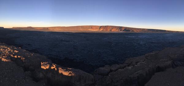
HVO geologist walks along the Mauna Loa summit trail
HVO geologist walks along the Mauna Loa summit trailAn HVO geologist walks along the Mauna Loa summit trail, with Mauna Kea visible in the distant background.
An official website of the United States government
Here's how you know
Official websites use .gov
A .gov website belongs to an official government organization in the United States.
Secure .gov websites use HTTPS
A lock () or https:// means you’ve safely connected to the .gov website. Share sensitive information only on official, secure websites.
Mauna Loa images of eruptive activity, field work, and more.
An HVO geologist walks along the Mauna Loa summit trail, with Mauna Kea visible in the distant background.
HVO staff visited the summit of Mauna Loa on foot to repair the webcam on April 24. The weather was perfectly clear and views of the caldera floor showed nothing unusual.
HVO scientists inspect a seismic station on Mauna Loa to evaluate for a possible equipment upgrade in the near future.
HVO scientists measure a GPS instrument to ensure its stability during a multi-day deployment in the Kahuku Unit of Hawai‘i Volcanoes National Park.
A high-precision Global Positioning System (GPS) survey is completed annually on Mauna Loa. This station was occupied for a period of three days to supplement the continuously operating GPS stations on the volcano. A beautiful view of Mauna Kea (in distance) could seen from this site during the GPS survey.
Clear day view of Mauna Loa during tradewind conditions from the summit of Kīlauea Volcano.
An aerial view of the prominent 1940 cinder-and-spatter cone on the floor of Mauna Loa's summit caldera. The cone, about 100 m (330 ft) high, was built during a 134-day-long eruption that began on April 7, 1940. Most of the caldera floor around the cone is covered by lava flows erupted in 1984.
These views of Mauna Loa are from near the Hawaiian Volcano Observatory looking toward the west. The view on left is typical during strong trade winds that blow the plume from Halema‘uma‘u Crater southwest of the summit area. The view on right is common during slack winds that allow vog conditions to develop in the summit area of Kīlauea.
View of cinder cones in the Northeast Rift Zone near the summit of Mauna Loa. View to the north-northeast with Mauna Kea in the background. Mauna Loa has erupted 33 times since 1843, most recently erupting in 1975 and 1984. Photo credit: Matt Patrick, USGS
This light gray block of rock (backpack for scale) is part of the approximately 830-year-old explosion deposit on the northwest rim of Moku‘āweoweo, the summit caldera of Mauna Loa. USGS photo by F.A. Trusdell.
Most of the lava flow (dark black) produced by the April 1868 Mauna Loa eruption can be seen in this aerial photo on the west (left) side of the prominent fault scarp, known informally as the Kahuku pali (formal names are Pali o Mamalu for the upper half and Pali‘okūlani for the lower half of the scarp).
Mauna Loa, Earth's largest active volcano, has erupted 33 times since 1843, producing the lava flows shown in black. All of these historic eruptions started at the summit of the volcano. From there, the eruptions either stayed in the summit area or migrated down the volcano's Northeast or Southwest Rift Zones.
Mauna Loa tends to erupt large, fast-moving lava flows. About 36 hours after the 1984 eruption began on March 25, lava flowed downstream (toward bottom-right of photo) through this ‘A‘ā channel down rift from the main vent. For scale, note the USGS scientists at work on the left side of the 70-m- (77-yard-) wide lava channel.
Mauna Loa poses most serious threat to South Kona
26 years since last Mauna Loa eruption
Aerial view of a bomb detonating on Mauna Loa near the 8500-foot elevation source of the 1935 lava flow on the morning of December 27, 1935. This was one of twenty 600-pound bombs dropped on the lava flow that morning by the Army Bombing Squadron from Luke Field, O‘ahu. Photo by Army Air Corps, 11th Photo Section.
View of Moku‘āweoweo's North Pit, looking to the west-southwest. The summit of Mauna Loa is the peak visible in the background, slightly left of center. The two linear features in the foreground are ramparts from previous fissure eruptions.
Close up of Sheet 2 of "Lava inundation zone maps for Mauna Loa, Island of Hawai‘i," recently published by the U.S. Geological Survey. Colors depict lava Inundation zones for the Kaumana, Waiākea, and Volcano-Mountain View regions on Mauna Loa. Yellow indicates the volcano's Northeast Rift Zone, one area along which lava could erupt.
Aerial view of Mauna Loa erupting on the morning of March 25, 1984, the first day of the volcano's most recent eruption. The lava flow was advancing southeast, toward Kīlauea, from fissure vents at an elevation of about 11,200 feet on Mauna Loa's Northeast Rift Zone. Moku‘āweoweo, Mauna Loa's summit caldera, is visible at top left.
A USGS Hawaiian Volcano Observatory geologist monitored the advance of an ‘A‘ā lava flow on April 6 during the 1984 Mauna Loa eruption. This flow was about 4 m (13 ft) high and advancing at a rate of 50 m (55 yards) per hour. Lava reached within 6 km (4 mi) of Hilo city limits before the 22-day-long eruption ended on April 15.
USGS Hawaiian Volcano Observatory field engineers begin the process of lowering a tiltmeter into a deep borehole on the west flank of Mauna Loa. The installation is guided by a custom-built apparatus that includes a 3-D printed jig. This tiltmeter will help monitor the currently elevated activity of Mauna Loa Volcano. USGS photo.