
Earth Observing Satellites
The images below display the countries that have owned and/or operated Earth observing satellites, and the number of satellites launched each year. The data represented in these images are gathered from various sources and are updated regularly by the USGS ECCOE team.
Quarterly Earth Observing satellite launch chart and map updates are created by best effort using new launch information from various publicly available sources, which include government websites and reports, commercial websites, and other web sources listed below:
- https://spacenews.com/
- https://space.skyrocket.de/directories/chronology.htm
- https://space.oscar.wmo.int/
- https://www.eoportal.org/
- https://database.eohandbook.com/database/missiontable.aspx
- https://www.nanosats.eu/
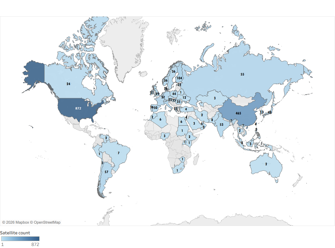
Countries with Earth Observing Satellites
The numbers on this map indicate the number of commercial and government/civil Earth observing satellites launched by the highlighted countries.
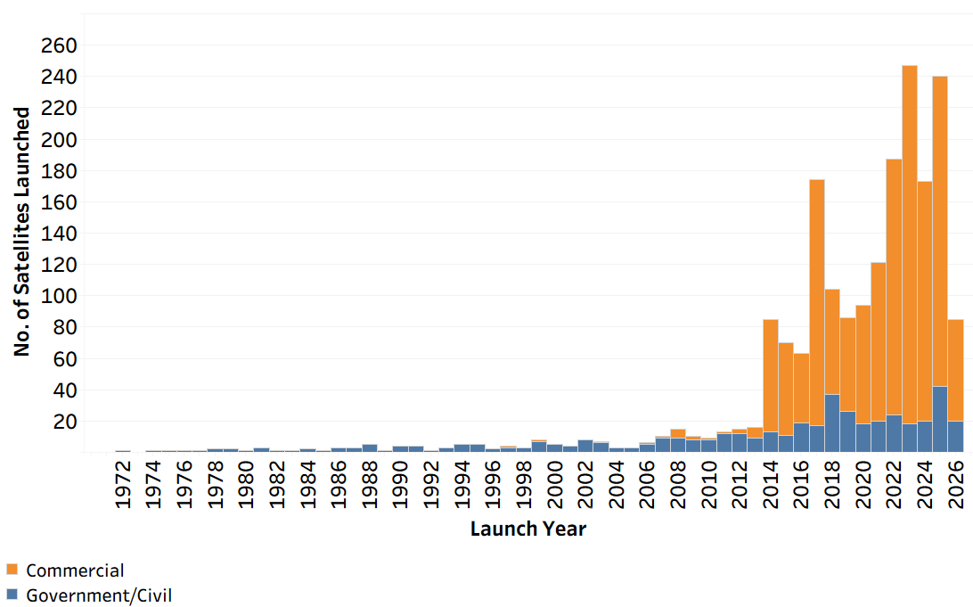
Number of Commercial, Government-Civil Earth Observing Satellites Launched
The chart below shows the number of commercial and government/civil Earth observing satellites launched each year since 1972.
To learn more about past, current, and future Earth observing satellites and sensors, visit the Earth Observing Satellites Online Compendium.