
A simplified view of the classical model for terrestrial planet formation (not to scale). From top to bottom: The central star is surrounded by nebular gas and dust where early solids form.
Images
Browse here for some of our available imagery. We may get permission to use some non-USGS images and these should be marked and are subject to copyright laws. USGS Astrogeology images can be freely downloaded.
Filter Total Items: 330

Illustration of Terrestrial Planet Formation
A simplified view of the classical model for terrestrial planet formation (not to scale). From top to bottom: The central star is surrounded by nebular gas and dust where early solids form.

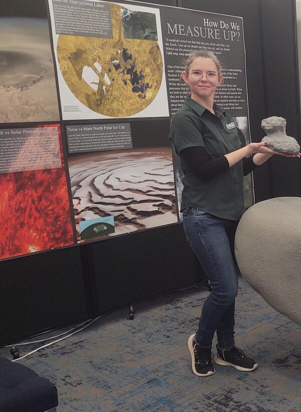
Lori Pigue with Rock.jpg
Lori Pigue is enjoying showing off a rock at Flagstaff Science Center’s Open House on September 5th.
Lori Pigue is enjoying showing off a rock at Flagstaff Science Center’s Open House on September 5th.

River2.jpg
Dr. Ryan Anderson interacts with River’s space science collection. Using LEGO bricks, River built his own version of a Mars rover, and Ingenuity, the helicopter. Also here is the space shuttle, LRV, a research base, and the lunar space station.
Dr. Ryan Anderson interacts with River’s space science collection. Using LEGO bricks, River built his own version of a Mars rover, and Ingenuity, the helicopter. Also here is the space shuttle, LRV, a research base, and the lunar space station.

fish_bugs_turtles.jpg
Left Photo: Visitors were amazed at seeing, reading, and learning about the kinds of fish that are native to Arizona.
Left Photo: Visitors were amazed at seeing, reading, and learning about the kinds of fish that are native to Arizona.
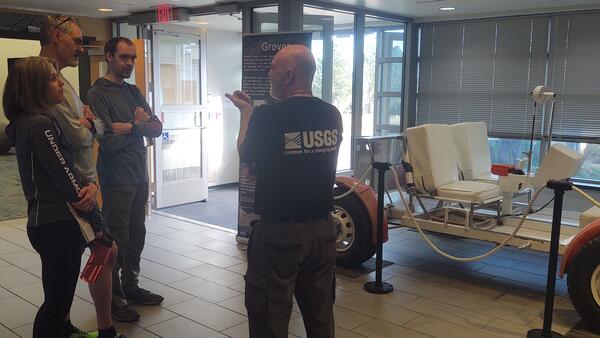
Greg Vaughn at USGS Astrogeology talks to visitors at the 2023 USGS Open House
Greg Vaughn at USGS Astrogeology talks to visitors at the 2023 USGS Open HouseGreg Vaughn at USGS Astrogeology talks to visitors at the 2023 USGS Open House. Grover is pictured to Greg's right. Photo courtesy of Lori Pigue, USGS Astrogeology.
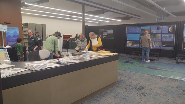
Visitors attend the USGS Open House in the Astrogeology Science Center, 2023
Visitors attend the USGS Open House in the Astrogeology Science Center, 2023Visitors attend the USGS Open House and look through outreach materials in the Astrogeology Science Center, 2023. Photo courtesy of Lori Pigue, USGS Astrogeology.

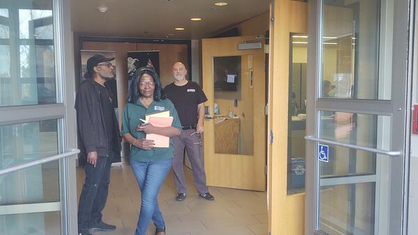
Brent Archinal giving a tour.jpg
USGS scientist, Brent Archinal, begins a tour from the lobby of Astrogeology Science Center during open house
USGS scientist, Brent Archinal, begins a tour from the lobby of Astrogeology Science Center during open house
Janet Richie, Greg Vaughn and a visitor at the Astrogeology Science Center during the USGS Open House in 2023
Janet Richie, Greg Vaughn and a visitor at the Astrogeology Science Center during the USGS Open House in 2023Janet Richie, Greg Vaughn and a visitor at the Astrogeology Science Center during the USGS Open House in 2023. Photo courtesy of Lori Pigue, USGS Astrogeology.

water river boat2.jpg
This is a photo of one of several boats GCMRC has that they take to do research on rivers. The boats are custom built to either carry research equipment, trip supplies, or navigate and assist in data collection.
This is a photo of one of several boats GCMRC has that they take to do research on rivers. The boats are custom built to either carry research equipment, trip supplies, or navigate and assist in data collection.

Rocks and more rocks2.jpg
GMEG presented a collection of Arizona rocks and minerals keyed to a geologic map of the state. Rocks ranged from pieces of recent lava flows, thousand-year-old basalts, to the oldest rocks in the southwest, the Elves Chasm gneiss (1.84 billion years old).
GMEG presented a collection of Arizona rocks and minerals keyed to a geologic map of the state. Rocks ranged from pieces of recent lava flows, thousand-year-old basalts, to the oldest rocks in the southwest, the Elves Chasm gneiss (1.84 billion years old).

Gerry.jpg
Photo of ASC Director, Dr. Justin Hagerty (nearest the table) and Research Geologist Dr. Greg Vaughan greets visitor at open house.
Photo of ASC Director, Dr. Justin Hagerty (nearest the table) and Research Geologist Dr. Greg Vaughan greets visitor at open house.

Gravity Van.jpg
If you tried to imagine what a “Gravity Van” was, what would you imagine? Visitors learned about the USGS’s Gravity Program Gravity Van, which holds special equipment for measuring ground water characteristics. The Gravity Van allows scientists to map changes in groundwater storage and to improve models that simulate groundwater flow.
If you tried to imagine what a “Gravity Van” was, what would you imagine? Visitors learned about the USGS’s Gravity Program Gravity Van, which holds special equipment for measuring ground water characteristics. The Gravity Van allows scientists to map changes in groundwater storage and to improve models that simulate groundwater flow.
Lori Pigue of USGS Astrogeology discusses planetary geology during the USGS Open House in 2023
Lori Pigue of USGS Astrogeology discusses planetary geology during the USGS Open House in 2023Lori Pigue of USGS Astrogeology discusses planetary geology during the USGS Open House in 2023
Lori Pigue of USGS Astrogeology discusses planetary geology during the USGS Open House in 2023
Lori Pigue of USGS Astrogeology discusses planetary geology during the USGS Open House in 2023Lori Pigue of USGS Astrogeology discusses planetary geology during the USGS Open House in 2023

Thumbnail for video "Two planets undergoing a hit-and-run impact"
Thumbnail for video "Two planets undergoing a hit-and-run impact"Screenshot from a computer simulation of two planets undergoing a hit-and-run giant impact. This style of collision comprises around half of the giant impacts expected to occur during the latter stages of Solar System formation. The larger (target) body is one tenth the mass of the Earth and the smaller (impactor) body is 70% the mass of the target.

Thumbnail for video "Two planets merging by giant impact"
Thumbnail for video "Two planets merging by giant impact"This is a screenshot from the video "Two planets merging by giant impact".
Thumbnail for video "Two planets merging by giant impact"
Thumbnail for video "Two planets merging by giant impact"This is a screenshot from the video "Two planets merging by giant impact".

Thumbnail for video "The disruption of two planets in a giant impact"
Thumbnail for video "The disruption of two planets in a giant impact"Screenshot of a computer simulation of two planets undergoing a disruptive giant impact. Disruptive collisions are not expected to be common in Solar System formation, and due to numerical effects, the amount of disruption shown here is likely overestimated.

NLB_743635136EDR_F1022428NCAM00353M_.jpg
This image was taken by Left Navigation Camera onboard NASA's Mars rover Curiosity on Sol 3899 (July 26, 2023).
This image was taken by Left Navigation Camera onboard NASA's Mars rover Curiosity on Sol 3899 (July 26, 2023).

Grover the Geologic Rover on Display in the Lobby of the Astrogeology Science Center
Grover the Geologic Rover on Display in the Lobby of the Astrogeology Science CenterThis photograph shows the lobby of the Astrogeology Science Center in July 2023. "Grover" the rover that USGS built to train the Apollo astronauts before their trips to the Moon is on display.

ACE_floor_map_Mars_Arizona.jpg
Photograph of the large topographic floor map of Mars at the USGS Astrogeology Science Center. A separate map of Arizona, printed to the same scale, allows visitors to compare the size of geographic features. In particular, the "grand canyon" of Mars, Valles Marineris can be compared to the Earth's Grand Canyon.
Photograph of the large topographic floor map of Mars at the USGS Astrogeology Science Center. A separate map of Arizona, printed to the same scale, allows visitors to compare the size of geographic features. In particular, the "grand canyon" of Mars, Valles Marineris can be compared to the Earth's Grand Canyon.

Astrogeology Solar System Hallway Displays
Photograph looking down the "solar system tour" hallway at the USGS Astrogeology Science Center. Images of Mercury and Venus are visible in the foreground on the left.
Photograph looking down the "solar system tour" hallway at the USGS Astrogeology Science Center. Images of Mercury and Venus are visible in the foreground on the left.

Thumbnail for video "Flying Over Valles Marineris, Mars with Analysis-Ready Data"
Thumbnail for video "Flying Over Valles Marineris, Mars with Analysis-Ready Data"This is a screenshot from the video "Flying Over Valles Marineris, Mars with Analysis-Ready Data". High resolution (~20 m per pixel) elevation data from the Mars Reconnaissance Orbiter (MRO) Context (CTX) camera are shown with a blue-to-yellow color scale indicating low-to-high elevations.