
Data Management
Center of Excellence for Geospatial Information Science (CEGIS)
The USGS operates as a dedicated team continuously amassing and disseminating large amounts of information.
The primary goal of Data Management (DM) is to optimize and maintain the order, security, and accessibility of data. Within this framework, CEGIS contributes by researching novel approaches for handling specialized information types such as geospatial and cartographic data.
Big data
Improved scientific instruments, increasing volume and lifecycle of sensors, and the passage of time all contribute to making the conveyance, cataloging, and analysis of our data more complex endeavors.
CEGIS research works to find efficient ways to access and process large and diverse datasets. We seek to optimize computation time and related storage requirements.
Catalog/convey
Effective cataloging of our data is what makes it findable for users and systematic search.
Data conveyance, or movement internally and externally, is imperative to ensuring validity and rate of access to our information, as well as optimizing resources like labor required or network access.
Integration
USGS geospatial data comes in many formats and in many scales.
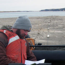
It could be the notes of a surveyor mapping the Colorado River in the nineteenth century or the measurement of the atmosphere from a contemporary weather balloon.
An important role of DM is integrating the diverse information and making it useable to various users.

2026 18th CEGIS Annual Research Meeting
2025 CEGIS Annual Research Meeting

Integration

Catalog/convey

Big data

Supply chain interdependent critical infrastructure restoration
Integration of geophysical data with The National Map data
