
USGS hydrologic technician Megan Bock surveys high water marks from Hurricane Ian in Marineland, Florida. Photograph taken October 4, 2022. Credit: Fabian Kahn, USGS.
Images
Images intro.
Filter Total Items: 185

USGS Science After Hurricane Ian
USGS hydrologic technician Megan Bock surveys high water marks from Hurricane Ian in Marineland, Florida. Photograph taken October 4, 2022. Credit: Fabian Kahn, USGS.

USGS Science After Hurricane Ian
USGS hydrologic technician Emily Robinson documents high water marks from Hurricane Ian on a house near Buckingham, Florida. Photograph taken October 2, 2022. Credit: Roberto Ravelo, USGS.
USGS hydrologic technician Emily Robinson documents high water marks from Hurricane Ian on a house near Buckingham, Florida. Photograph taken October 2, 2022. Credit: Roberto Ravelo, USGS.

Streamgage repair on Bowlegs Creek near Ft. Meade, FL (02295013)
Streamgage repair on Bowlegs Creek near Ft. Meade, FL (02295013)Streamgage repair at Bowlegs Creek near Ft. Meade, FL (02295013) after being submerged by flooding from Hurricane Ian. The site is used to monitor water levels and compute discharge in coorporation with Southwest Florida Water Management District.

Streamgage repair on Bowlegs Creek near Ft. Meade, Florida (02295013)
Streamgage repair on Bowlegs Creek near Ft. Meade, Florida (02295013)Hydrologic Technician, Erik Ohlson, repairs a streamgage at Bowlegs Creek near Ft. Meade, Florida (02295013) after it was submerged by flooding from Hurricane Ian. The site is used to monitor water levels and compute discharge in cooperation with Southwest Florida Water Management District.

Installing Storm-tide Sensors for Hurricane Ian
Lukas Medo, a USGS hydrologic technician, installs a water-level sensor in Levy County, Florida, September 26, ahead of Hurricane Ian's landfall. Photo by Patrick Marasco, USGS.
Lukas Medo, a USGS hydrologic technician, installs a water-level sensor in Levy County, Florida, September 26, ahead of Hurricane Ian's landfall. Photo by Patrick Marasco, USGS.

Before and After of the site at Rio Del La Plata blw Represa Comerio, Puerto Rico (50044210), following Hurricane Fiona
Before and After of the site at Rio Del La Plata blw Represa Comerio, Puerto Rico (50044210), following Hurricane FionaA before-and after comparison of the water level and precipitation at the site located at Rio Del La Plata blw Represa Comerio, Puerto Rico (50044210), illustrating the damage from Hurricane Fiona. The photo on the left was taken on July 11, 2022 when the site was installed. The photo on the right was taken on Sept. 20, 2022 after Hurricane Fiona.

Wet mount image of Raphidiopsis sp. collected from Lake Okeechobee
Wet mount image of Raphidiopsis sp. collected from Lake OkeechobeeWet mount image of cyanobacteria, Raphidiopsis sp., collected from Lake Okeechobee, Florida
Wet mount image of Raphidiopsis sp. collected from Lake Okeechobee
Wet mount image of Raphidiopsis sp. collected from Lake OkeechobeeWet mount image of cyanobacteria, Raphidiopsis sp., collected from Lake Okeechobee, Florida

USGS technician holding a bottle containing a sediment sample
USGS technician holding a bottle containing a sediment sampleHydrologic Technician Alan Cressler holding a bottle containing a sediment sample. Photo taken on the Caloosahatchee River below Structure 77, Moore Haven, Florida.
USGS technician holding a bottle containing a sediment sample
USGS technician holding a bottle containing a sediment sampleHydrologic Technician Alan Cressler holding a bottle containing a sediment sample. Photo taken on the Caloosahatchee River below Structure 77, Moore Haven, Florida.

Structure 77 on the Caloosahatchee River at Moore Haven, Florid
Structure 77 on the Caloosahatchee River at Moore Haven, FloridStructure 77 (S-77) on the Caloosahatchee River at Moore Haven, Florida.
Structure 77 on the Caloosahatchee River at Moore Haven, Florid
Structure 77 on the Caloosahatchee River at Moore Haven, FloridStructure 77 (S-77) on the Caloosahatchee River at Moore Haven, Florida.

USGS technician loading a bottle into a DH-95 water-quality sampler
USGS technician loading a bottle into a DH-95 water-quality samplerHydrologic Technician Alan Cressler loading a bottle into a DH-95 water-quality sampler. Photo taken on the Caloosahatchee River below Structure 77, Moore Haven, Florida

USGS technician measuring river discharge
Hydrologic Technician Adam Hines measuring river discharge using a remote controlled acoustic Dopler current profiler. Photo taken on the Caloosahatchee River below Structure 77, Moore Haven, Florida.
Hydrologic Technician Adam Hines measuring river discharge using a remote controlled acoustic Dopler current profiler. Photo taken on the Caloosahatchee River below Structure 77, Moore Haven, Florida.
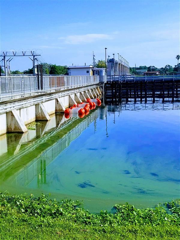
Franklin Lock and Dam, Caloosahatchee River
Photographic image taken at Franklin Lock and Dam, Caloosahatchee River, Florida
Photographic image taken at Franklin Lock and Dam, Caloosahatchee River, Florida

Water Sample Collections, Franklin Lock and Dam
Photographic image of two USGS scientists on a boat collecting water samples for HABS research at the Franklin Lock and Dam, Caloosahatchee River, Florida.
Photographic image of two USGS scientists on a boat collecting water samples for HABS research at the Franklin Lock and Dam, Caloosahatchee River, Florida.

Dianne López-Trujillo with Lynne Carrier, FEMA translator
Dianne López-Trujillo with Lynne Carrier, FEMA translatorDianne López-Trujillo with Lynne Carrier, FEMA translator.
The USGS Recognizes Dianne Lopez-Trujillo During Hispanic Heritage Month
What happens when a 6.4 magnitude earthquake strikes Puerto Rico and the public needs critical information? How does a mostly English-speaking science agency reach a mostly Spanish-speaking public?

Congressional event following the 6.4 earthquake in Puerto Rico
Congressional event following the 6.4 earthquake in Puerto RicoCongressional event following the 6.4 earthquake in Puerto Rico held on Jan. 20, 2020. Dr. Jonathan Godt (USGS) and Dr. Elizabeth A. Vanacore (Red Sismica Puerto Rico) answered questions to congressmen: Yauco's major, Bill Posey, Jenniffer González Colón, Stephanie Murphy, Donna Shalala

Congressional event following the 6.4 earthquake in Puerto Rico
Congressional event following the 6.4 earthquake in Puerto RicoOverview of the Congressional event following the 6.4 earthquake in Puerto Rico. Bottom of picture: congressmen. Center: Dianne Lopez, Lindsay Davis, Donyelle Davis
Congressional event following the 6.4 earthquake in Puerto Rico
Congressional event following the 6.4 earthquake in Puerto RicoOverview of the Congressional event following the 6.4 earthquake in Puerto Rico. Bottom of picture: congressmen. Center: Dianne Lopez, Lindsay Davis, Donyelle Davis

One of the houses destroyed during the 6.4 earthquake in Puerto Rico
One of the houses destroyed during the 6.4 earthquake in Puerto RicoOne of the houses destroyed during the 6.4 earthquake in Puerto Rico.
One of the houses destroyed during the 6.4 earthquake in Puerto Rico
One of the houses destroyed during the 6.4 earthquake in Puerto RicoOne of the houses destroyed during the 6.4 earthquake in Puerto Rico.

USGS visits areas affected by the 6.4 Puerto Rico earthquake
USGS visits areas affected by the 6.4 Puerto Rico earthquakePart of the USGS Earthquake Response Team visiting areas affected by the 6.4 earthquake. Place: Guánica Boardwalk. From left to right: Donyelle Davis, Dianne López, Jonathan Godt, Alex Grant

USGS Earthquake Response team with governor of Puerto Rico
USGS Earthquake Response team with governor of Puerto RicoUSGS team with Wanda Vazquez-Garced, governor of Puerto Rico. From left to right: Lindsay Davis, Wanda Vazquez, Dianne Lopez-Trujillo, Jonathan Godt, Donyelle Davis, Alex Grant
USGS Earthquake Response team with governor of Puerto Rico
USGS Earthquake Response team with governor of Puerto RicoUSGS team with Wanda Vazquez-Garced, governor of Puerto Rico. From left to right: Lindsay Davis, Wanda Vazquez, Dianne Lopez-Trujillo, Jonathan Godt, Donyelle Davis, Alex Grant

Stream gaging in PR after Tropical Storm Karen: staging measurement
Stream gaging in PR after Tropical Storm Karen: staging measurementStream gaging in Puerto Rico after Tropical Storm Karen: staging the measurement – Manuel Rosario, with the Caribbean-Florida Water Science Center, stages an acoustic Doppler current profiler (ADCP) to measure high flow September 25.

Stream gaging in Puerto Rico after Tropical Storm Karen: computer
Stream gaging in Puerto Rico after Tropical Storm Karen: computerStream gaging in Puerto Rico after Tropical Storm Karen: computer – Gage height and precipitation data recorded by sensors and measured manually are logged into an electronic notebook, September 25.