



No matter the season, we are out monitoring Colorado waters.
In winter...
In winter...
No matter the season, we are out monitoring Colorado waters.
In spring...
In spring...
No matter the season, we are out monitoring Colorado waters.
In summer...
In summer...
No matter the season, we are out monitoring Colorado waters.
and in the fall.
and in the fall.
Colorado Water Science Center
Welcome to the USGS Colorado Water Science Center! Please use these pages to explore the hydrologic data and scientific investigations we conduct on Colorado water resources.
NOTICE: USGS is improving the way that sample data are stored and served to the public.
Current Conditions
Current Conditions
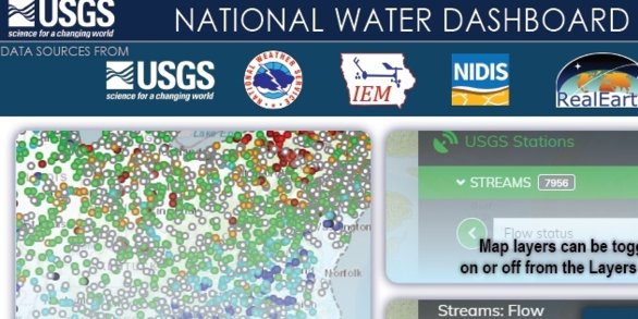
Explore real-time Colorado streamflow, groundwater, and water-quality conditions.
Science Highlight
Science Highlight

Next Generation Water Observing System: Upper Colorado River Basin
The Next Generation Water Observing System provides high-fidelity, real-time data on water quantity, quality, and use to support modern water prediction and decision-support systems that are necessary for informing water operations on a daily basis and decision-making during water emergencies.
News
Media Alert: USGS Hydrologic Study to Use Non-Toxic Dye in Lake Fork Creek
Media Alert: USGS Hydrologic Study to Use Non-Toxic Dye in Lake Fork Creek
2025 USGS 'STREAM' Workshop: Science, Technology, Research, and Evaluations for Actionable Management
2025 USGS 'STREAM' Workshop: Science, Technology, Research, and Evaluations for Actionable Management
Media Alert: USGS Dye Tracing Study in Fraser River
Media Alert: USGS Dye Tracing Study in Fraser River
Publications
Limitations and potential applicability of mixing models and transit time estimates for mine-affected watersheds based on stable isotopes Limitations and potential applicability of mixing models and transit time estimates for mine-affected watersheds based on stable isotopes
Stable isotopes are a widely used tool in defining mixing of distinct waters and identifying solute sources on mine sites. Although the utility of stable isotopes in these approaches is well-acknowledged, analytical uncertainties and lack of endmember definition may limit the application of results in providing unambiguous information to facilitate remediation. In this context, this...
Sediment transport, terrace incision, and sediment chemistry in subbasins of differing land use, Stinking Water Creek Basin near Rangely, Colorado Sediment transport, terrace incision, and sediment chemistry in subbasins of differing land use, Stinking Water Creek Basin near Rangely, Colorado
In many areas of western Colorado, Late Cretaceous Mancos Shale is a source of sediment, salinity, and selenium to surface water. Natural weathering processes and human activity can expose and move sediments from the Mancos Shale, leading to increased salinity and selenium concentrations in surface water. The U.S. Geological Survey, in cooperation with the Bureau of Land Management...
Effect of rotenone treatment on alpine stream invertebratecommunities in Colorado Effect of rotenone treatment on alpine stream invertebratecommunities in Colorado
Objective: Introduction of non-native salmonids to western United States streams has resulted in extirpation and even extinction of native cutthroat trout. Once thought to be extinct, a genetically verified population of Greenback Cutthroat Trout (GBCT) Oncorhynchus virginalis stomias was identified and used for population re-establishment efforts. To restore native trout habitat, stream...
Science
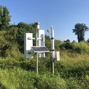
Next Generation Water Observing System (NGWOS) - Advancing Soil Moisture Monitoring
Soil moisture is an important part of the climate system, but it remains difficult to measure accurately. In 2022, the U.S. Geological Survey (USGS) began building a soil moisture monitoring network to provide high-quality continuous soil moisture data, standardize data collection methods, and test new technologies. Stations are placed in different climates and land cover types to capture a broad...
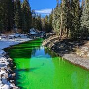
Quantifying groundwater recharge and discharge dynamics in the Upper Colorado River Basin
The Upper Colorado River Basin (UCOL) serves as an important source of water to millions of people, supports irrigation for agriculture, and provides aquatic habitat for a variety of species. Salinity concentrations endanger water supply in the Colorado River Basin, potentially causing hundreds of millions of dollars in annual economic damage because of corrosion of infrastructure, water treatment...
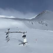
Next Generation Water Observing System (NGWOS) Snow Hydrology Monitoring Network in the Upper Colorado River Basin
Representative observations of snowpack conditions are vital for informing water availability assessments and modeling in snow dominated regions of the western United States. The U.S. Geological Survey (USGS) established a snow hydrology monitoring network in 2021 with the objective of providing high-quality, representative, and publicly available data on snowpack, soil moisture, and...