
The spectacular Mojave Desert landscapes within Red Rock Canyon National Conservation area draw millions of visitors each year.
Images
Here, you'll find images related to research going on at the Fort Collins Science Center. Our team of scientists are working on multiple areas of environmental interest, ranging from land conservation effectiveness to invasive reptiles.
Filter Total Items: 317

Red Rock Canyon National Conservation Area
The spectacular Mojave Desert landscapes within Red Rock Canyon National Conservation area draw millions of visitors each year.

Hillsides invaded by nonnative plants in Cotoni Coast Dairies
Hillsides invaded by nonnative plants in Cotoni Coast DairiesHillside of the Cotoni Coast Dairies onshore unit of the California Coastal National Monument. Prior to becoming a monument, parts of the landscape like those seen here degraded as a result of human development and invasive species. Monument managers are now looking to incorporate the best available science into their restoration plans.

View of the Pacific Ocean from Cotoni Coast Dairies
View of the Pacific Ocean from Cotoni Coast DairiesView of the Pacific Ocean from the Cotoni-Coast Dairies unit of the California Coast National Monument.
View of the Pacific Ocean from Cotoni Coast Dairies
View of the Pacific Ocean from Cotoni Coast DairiesView of the Pacific Ocean from the Cotoni-Coast Dairies unit of the California Coast National Monument.
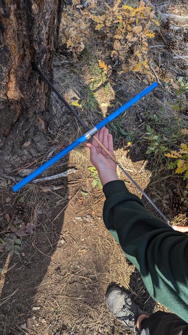
Extraction of a tree core using an increment borer
Extraction of a tree core using an increment borerA researcher demonstrates the extraction of a ponderosa pine tree core from an increment borer, the tool used to core trees. Tree coring allows scientists to learn about tree growth, age, and more without harming the tree. Photo by Carolina May (USGS)

Cotoni-Coast Dairies Retired Mine
For most of the 1900s, sections of the Cotoni-Coast Dairies unit of the California Coast National Monument were mined for limestone and shale. Minerals were transported to the cement plant from the top of quarries through conveyer belts like this one.
For most of the 1900s, sections of the Cotoni-Coast Dairies unit of the California Coast National Monument were mined for limestone and shale. Minerals were transported to the cement plant from the top of quarries through conveyer belts like this one.

Red Rock Canyon National Conservation Area
The spectacular Mojave Desert landscapes within Red Rock Canyon National Conservation area draw millions of visitors each year.
The spectacular Mojave Desert landscapes within Red Rock Canyon National Conservation area draw millions of visitors each year.
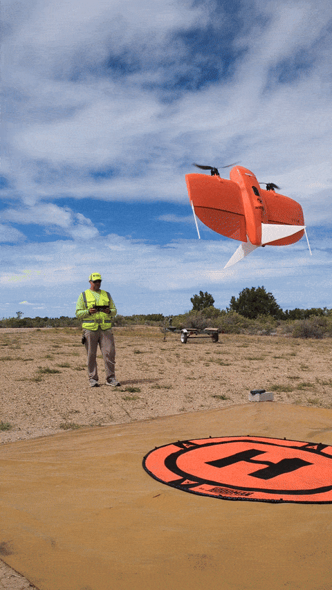
USGS scientist landing a UAS
FORT scientist Chris Holmquist-Johnson leverages uncrewed aircraft systems (UAS), such as the one shown here, to advance hydrological research through innovative aerial data collection. As a certified UAS Instructor for the Department of the Interior (DOI), he also leads training programs to expand UAS capabilities among DOI scientists.
FORT scientist Chris Holmquist-Johnson leverages uncrewed aircraft systems (UAS), such as the one shown here, to advance hydrological research through innovative aerial data collection. As a certified UAS Instructor for the Department of the Interior (DOI), he also leads training programs to expand UAS capabilities among DOI scientists.
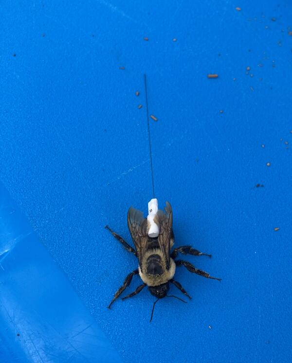
Bumble bee with radio transmitter
Researchers attach lightweight radio transmitters to bumble bees to track their movements and determine where they spend most of their time. Photo by Ian Pearse (USGS).
Researchers attach lightweight radio transmitters to bumble bees to track their movements and determine where they spend most of their time. Photo by Ian Pearse (USGS).

Shore of Lake Abert, Oregon
Lake Abert, Oregon is one of the 20 terminal lakes identified by USGS partners as priority ecosystems for study by the Saline Lakes Ecosystems IWAA.
By
Ecosystems Mission Area, Water Resources Mission Area, Forest and Rangeland Ecosystem Science Center, Fort Collins Science Center, Nevada Water Science Center, Oregon Water Science Center, Utah Water Science Center, Western Ecological Research Center (WERC), Saline Lake Ecosystems Integrated Water Availability Assessment

Site of Future I-25 Wildlife Overpass
USGS researchers and collaborators stand in front of the future site of a wildlife overpass in Colorado. Photo by Sarah Carter (USGS).
USGS researchers and collaborators stand in front of the future site of a wildlife overpass in Colorado. Photo by Sarah Carter (USGS).

USGS researchers and collaborators visit a newly completed wildlife underpass
USGS researchers and collaborators visit a newly completed wildlife underpassUSGS researchers with the Colorado Department of Transportation and Federal Highway Administration visit a newly constructed wildlife underpass on I-25, south of Castle Rock, CO. Photo by Sarah Carter (USGS).

USGS researchers visit a newly completed wildlife underpass
USGS researchers visit a newly completed wildlife underpassUSGS researchers with the Colorado Department of Transportation and Federal Highway Administration visit a newly constructed wildlife underpass on I-25, south of Castle Rock, CO. Photo by Sarah Carter (USGS)

I25 Wildlife Fence
USGS researchers and collaborators view wildlife fencing adjacent to an wildlife underpass on I-25 in Colorado. Photo by Sarah Carter (USGS).
USGS researchers and collaborators view wildlife fencing adjacent to an wildlife underpass on I-25 in Colorado. Photo by Sarah Carter (USGS).

Sage-grouse DNA
A small tube of Gunnison sage-grouse DNA, collected by the Fort Collins Molecular Ecology Lab. Photo: Shawna Zimmerman (USGS).
A small tube of Gunnison sage-grouse DNA, collected by the Fort Collins Molecular Ecology Lab. Photo: Shawna Zimmerman (USGS).

Goose Lake, Oregon-California
Goose Lake, on the Oregon-California border, is one of the 20 terminal lakes identified by USGS partners as priority ecosystems for study by the Saline Lakes Ecosystems IWAA.
By
Ecosystems Mission Area, Water Resources Mission Area, Species Management Research Program, Water Resources Research Act Program, Forest and Rangeland Ecosystem Science Center, Fort Collins Science Center, Nevada Water Science Center, Oregon Water Science Center, Utah Water Science Center, Western Ecological Research Center (WERC), Saline Lake Ecosystems Integrated Water Availability Assessment
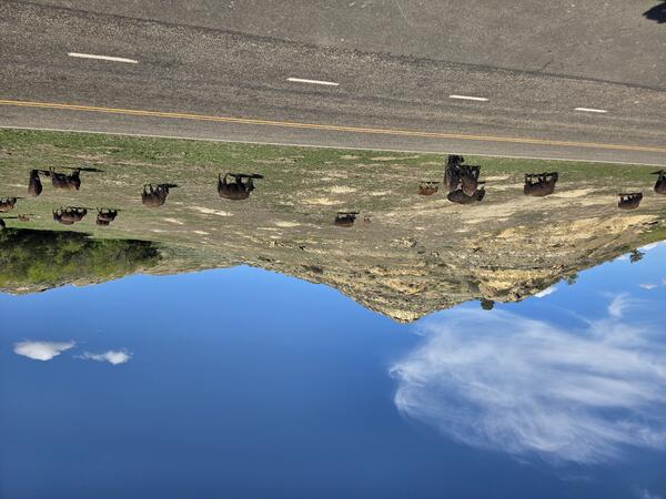
Bison grazing in Theodore Roosevelt National Park
A herd of bison graze alongside the road in Theodore Roosevelt National Park.
A herd of bison graze alongside the road in Theodore Roosevelt National Park.
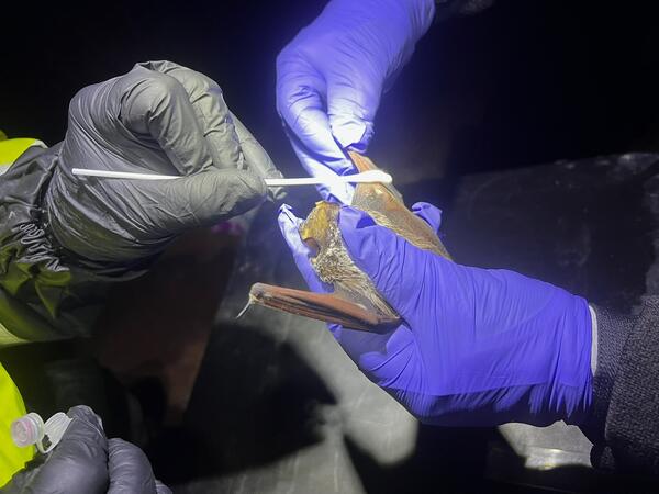
Swabbing a bat during white-nose syndrome surveillance
Swabbing a bat during white-nose syndrome surveillanceResearchers swab a bat for the presence of Pseudogymnoascus destructans (Pd), the fungus that causes deadly white-nose syndrome.
Swabbing a bat during white-nose syndrome surveillance
Swabbing a bat during white-nose syndrome surveillanceResearchers swab a bat for the presence of Pseudogymnoascus destructans (Pd), the fungus that causes deadly white-nose syndrome.

A hovercraft glides over the surface of Summer Lake, Oregon
A hovercraft glides over the surface of Summer Lake, OregonSummer Lake, Oregon is one of the 20 terminal lakes identified by USGS partners as priority ecosystems for study by the Saline Lakes Ecosystems IWAA.
By
Ecosystems Mission Area, Water Resources Mission Area, Species Management Research Program, Water Availability and Use Science Program, Forest and Rangeland Ecosystem Science Center, Fort Collins Science Center, Nevada Water Science Center, Oregon Water Science Center, Utah Water Science Center, Western Ecological Research Center (WERC), Saline Lake Ecosystems Integrated Water Availability Assessment
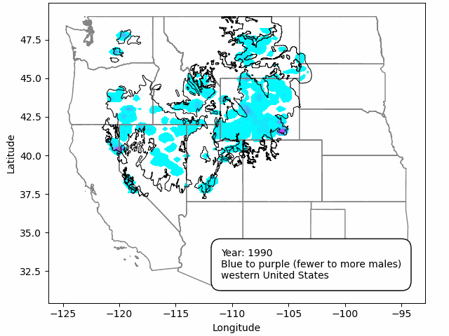
An animated heat map of greater sage-grouse (Centrocercus urophasianus) annual peak male counts from 1990 to 2025
An animated heat map of greater sage-grouse (Centrocercus urophasianus) annual peak male counts from 1990 to 2025An animated heat map of greater sage-grouse (Centrocercus urophasianus) annual peak male counts from 1990 to 2023 using the standardized sage-grouse lek database.

Paul Cryan holds 3D printed bat tools
Paul Cryan shows off some of his 3D-printed bat tools.
Paul Cryan shows off some of his 3D-printed bat tools.

Dendroparty
Field station staff use microscopes to date fire scars in wood samples from Aztec Springs, NM. Photo by Ellis Margolis (USGS).
Field station staff use microscopes to date fire scars in wood samples from Aztec Springs, NM. Photo by Ellis Margolis (USGS).