Quantitative Modeling
A requirement for managing a species, be it a common native species, a species of conservation concern, or an invasive species, is having some information on its distribution and potential drivers of distribution. Branch scientists have been tackling the question of where these types of species are and where they might be in the future. Focus species are as varied as the invasive tamarisk, Russian olive, Africanized honey bee and nutria to the federally threatened Lesser Prairie chicken and others. These and other species are modeled at a variety of spatial scales, from park or wildlife refuge to global levels. Models use various predictor layers that can include current and future climate layers (near- and long-term projections), remote-sensing derivatives (such as MODIS phenology metrics), land cover, topography, and anthropogenic features.

Using Artificial Intelligence to Estimate Traffic to Improve Planning and Access to Colorado’s Public Lands
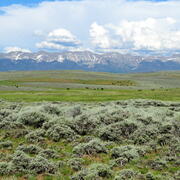
Shrubland, Alpine and Grassland Ecology (SAGE) Wildlife Research Group
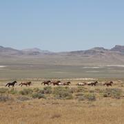
Science for management of America’s iconic wild horses and burros

Greater Sage-Grouse Population Monitoring Framework: Cheat Sheet

Data Harmonization for Greater Sage-Grouse Populations

Greater Sage-Grouse Population Monitoring Framework

Greater Sage-Grouse Population Monitoring Framework Data Inputs Information Sheet

Estimating trends for greater sage-grouse populations within highly stochastic environments

AI-driven science synthesis tools for resource managers

USGS Sagebrush Science: Supporting Public Safety and Economic Decision Making Across the West

North American Bat Monitoring Program (NABat)