



Data
The Mineral Resources Online Spatial Data web portal is our primary resource for interactive maps and downloadable data for regional and global geology, geochemistry, geophysics, and mineral resources.
Geophysical Data
Geophysical Data

Find geophysical data from airborne surveys and geophysical data compilations (magnetic, gravity, aeroradiometric).
Geochemical Data
Geochemical Data

Find data from the National Geochemical Database, focused geochemical surveys, and the NURE-HSSR collection.
Mineral Resources Data
Mineral Resources Data
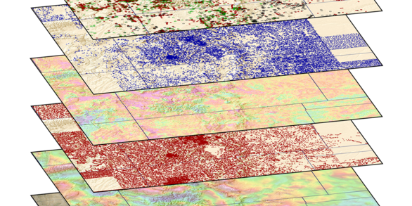
Interactive maps and downloadable data for regional and global analysis.
Filter Total Items: 415
Magnetotelluric sounding locations, stations 23 to 46, San Luis Valley, Colorado, 2007 Magnetotelluric sounding locations, stations 23 to 46, San Luis Valley, Colorado, 2007
This dataset contains *.rdata files that contain model objects returned from the glm{stats} function (v.3.3.0) in R. for 258 models derived for selected wells in the conterminous United States. The models are generalized linear models with a binomial response variable (glm family set to binomial) for forecasting the probability of groundwater levels declining or maintaining below...
Digital maps of hydrothermal alteration type, key mineral groups, and green vegetation of the western United States derived from automated analysis of ASTER satellite data Digital maps of hydrothermal alteration type, key mineral groups, and green vegetation of the western United States derived from automated analysis of ASTER satellite data
Mineral groups identified through automated analysis of remote sensing data acquired by the Advanced Spaceborne Thermal Emission and Reflection Radiometer (ASTER) were used to generate a map showing the type and spatial distribution of hydrothermal alteration, other exposed mineral groups, and green vegetation across the northwestern conterminous United States. Boolean algebra was used...
USGS Spectral Library Version 7 Data USGS Spectral Library Version 7 Data
This data release provides the U.S. Geological Survey (USGS) Spectral Library Version 7 and all related documents. The library contains spectra measured with laboratory, field, and airborne spectrometers. The instruments used cover wavelengths from the ultraviolet to the far infrared (0.2 to 200 microns). Laboratory samples of specific minerals, plants, chemical compounds, and man-made...
Physical properties by geologic unit in the southern San Luis basin, New Mexico Physical properties by geologic unit in the southern San Luis basin, New Mexico
Physical properties of geologic units are important for geophysical interpretation because they provide the tie between lithology and geophysical fields. For gravity data, the applicable physical property is bulk density, which is the overall mass per unit volume of rocks, sediments, and their pore spaces. Bulk dry density is the mass per unit volume measured when the sample is dry...
Data for a Comprehensive Survey of Fault Zones, Breccias, and Fractures in and Flanking the Eastern Espanola Basin, Rio Grande Rift, New Mexico Data for a Comprehensive Survey of Fault Zones, Breccias, and Fractures in and Flanking the Eastern Espanola Basin, Rio Grande Rift, New Mexico
This release provides the data for a comprehensive survey of geologic structures in the eastern Espaola Basin of the Rio Grande rift, New Mexico. The release includes data and analyses from 53 individual fault zones and 22 other brittle structures, such as breccia zones, joints, and veins, investigated at a total of just over 100 sites. Structures were examined and compared from poorly...
Airborne Geophysical Surveys over the Eastern Adirondacks, New York State Airborne Geophysical Surveys over the Eastern Adirondacks, New York State
Airborne geophysical surveys were conducted in the eastern Adirondacks from Dec. 7, 2015 - Dec. 21, 2015, by Goldak Airborne Surveys. The area was flown along a draped surface with a nominal survey height above ground of 125 meters. The flight line spacing was 250 meters for traverse lines and 2500 meters for control lines. Here we present downloadable magnetic and radiometric (gamma...
Airborne Magnetic Total-Field Survey, Manchester Region, Iowa, USA Airborne Magnetic Total-Field Survey, Manchester Region, Iowa, USA
This data release includes the airborne magnetic survey data collected from the Manchester region of Iowa. The Mineral Resources Program of the U.S. Geological Survey is tasked with understanding the nation's mineral resources. Precambrian rocks concealed under Paleozoic sedimentary rocks in northeast Iowa are poorly mapped and understood. Detailed high-resolution airborne magnetic...
Magnetotelluric sounding data, stations 1 to 22, Southern San Luis Valley, Colorado, 2006 Magnetotelluric sounding data, stations 1 to 22, Southern San Luis Valley, Colorado, 2006
This dataset includes the magnetotelluric (MT) sounding data collected in 2006 in the Southern San Luis Valley, Colorado. The U.S. Geological Survey conducted a series of multidisciplinary studies, including MT surveys, in the San Luis Valley to improve understanding of the hydrogeology of the Santa Fe Group and the nature of the sedimentary deposits comprising the principal groundwater...
Three GIS datasets defining areas permissive for the occurrence of uranium-bearing, solution-collapse breccia pipes in northern Arizona and southeast Utah Three GIS datasets defining areas permissive for the occurrence of uranium-bearing, solution-collapse breccia pipes in northern Arizona and southeast Utah
Some of the highest grade uranium (U) deposits in the United States are hosted by solution-collapse breccia pipes in the Grand Canyon region of northern Arizona. These structures are named for their vertical, pipe-like shape and the broken rock (breccia) that fills them. Hundreds, perhaps thousands, of these structures exist. Not all of the breccia pipes are mineralized; only a small...
USMIN Mineral Resource Data for the U.S. Geological Survey Sagebrush Mineral-Resource Assessment Project USMIN Mineral Resource Data for the U.S. Geological Survey Sagebrush Mineral-Resource Assessment Project
The point and polygon layers within this geodatabase represent locations of mineral occurrences, mines, mining and mineral districts and sites of active mineral exploration within or near the Department of the Interior (DOI) Sagebrush Focal Areas in Montana, Wyoming and Utah, central Idaho, and the Oregon-Nevada-Idaho border area. The data were compiled by the U.S. Geological Survey...
Prospect- and Mine-Related Features from U.S. Geological Survey 7.5- and 15-Minute Topographic Quadrangle Maps for the Western United States Prospect- and Mine-Related Features from U.S. Geological Survey 7.5- and 15-Minute Topographic Quadrangle Maps for the Western United States
This data release has been updated in 2017 with a newer version that includes additional states. It is recommended to use the updated data and map services of the new data release located at: https://doi.org/10.5066/F78W3CHG These data are part of a larger USGS project to develop an updated geospatial database of mines, mineral deposits and mineral regions in the United States. Mine and...
Locatable Mineral Assessment Tracts for the U.S. Geological Survey Sagebrush Mineral Resource Assessment Project Locatable Mineral Assessment Tracts for the U.S. Geological Survey Sagebrush Mineral Resource Assessment Project
The polygon (vector) feature class represents locatable mineral resource assessment tracts (tracts of land) associated with the Department of the Interior (DOI) Sagebrush Focal Areas in Montana, Wyoming and Utah, central Idaho, and the Oregon-Nevada-Idaho border area. The mineral resources tracts are geographic areas that were assessed by the U.S. Geological Survey (USGS) and were...