
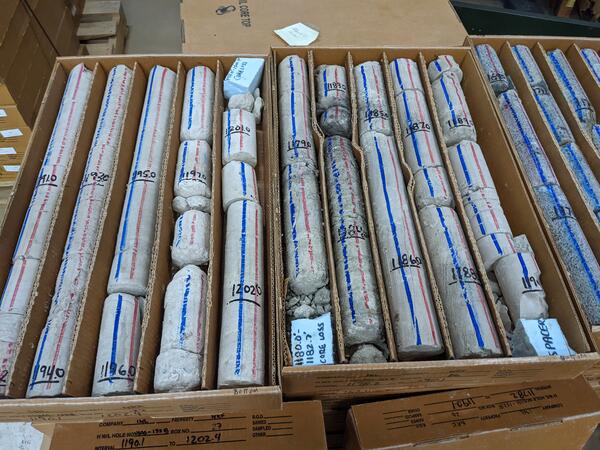
Example of drill core located in the INLPO Core Storage Library. Photograph by Allison Trcka in May 2023.
Images
Images intro.
Filter Total Items: 178
Drill core example September 2021
Example of drill core located in the INLPO Core Storage Library. Photograph by Allison Trcka in May 2023.
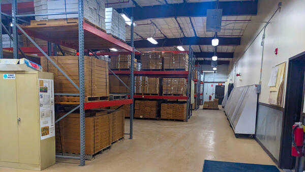
Core Library May 2023
Idaho National Laboratory Lithologic Core Storage Library. Photograph by Allison Trcka in May 2023.
Idaho National Laboratory Lithologic Core Storage Library. Photograph by Allison Trcka in May 2023.

Snake River Near Mountain Home, Idaho
Looking southeast to the Snake River across basalt rim of the Snake River Canyon from a point south of Mountain Home, Idaho, and west of Idaho State Highway 51. The Owyhee Mountains can be seen in the background. (Photograph by Lauren M. Zinsser)
Looking southeast to the Snake River across basalt rim of the Snake River Canyon from a point south of Mountain Home, Idaho, and west of Idaho State Highway 51. The Owyhee Mountains can be seen in the background. (Photograph by Lauren M. Zinsser)

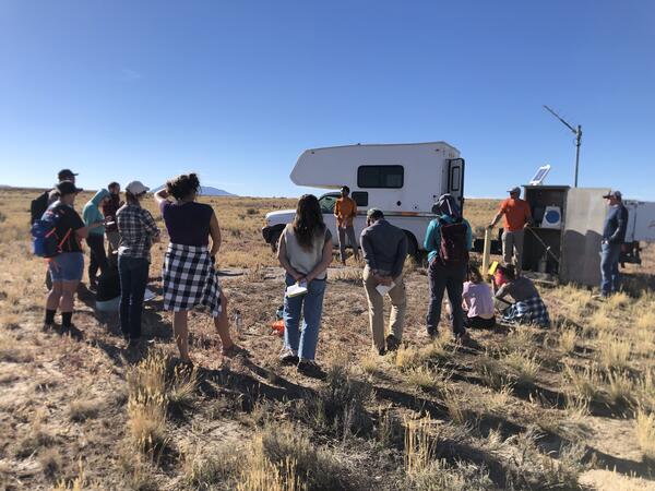
Southern Idaho Geology Field Trip
Scientists from the U.S. Geological Survey's Idaho Water Science Center, the Idaho Department of Water Resources, and the Idaho Geological Survey conducted a geology field trip of southern Idaho's Mountain Home Plateau in February 2023 to prepare for developing a hydrogeologic framework of the area. This view is from Bonneville Point looking southeast.
Scientists from the U.S. Geological Survey's Idaho Water Science Center, the Idaho Department of Water Resources, and the Idaho Geological Survey conducted a geology field trip of southern Idaho's Mountain Home Plateau in February 2023 to prepare for developing a hydrogeologic framework of the area. This view is from Bonneville Point looking southeast.
webmap Logo
Logo for the R package webmap, creates dynamic web maps. Created by Jason Fisher in January 2023.
Logo for the R package webmap, creates dynamic web maps. Created by Jason Fisher in January 2023.
inlcolor Logo
Logo for the R package inlcolor, a collection of color schemes for the Idaho National Laboratory Project Office. Created by Jason Fisher in January 2023.
Logo for the R package inlcolor, a collection of color schemes for the Idaho National Laboratory Project Office. Created by Jason Fisher in January 2023.

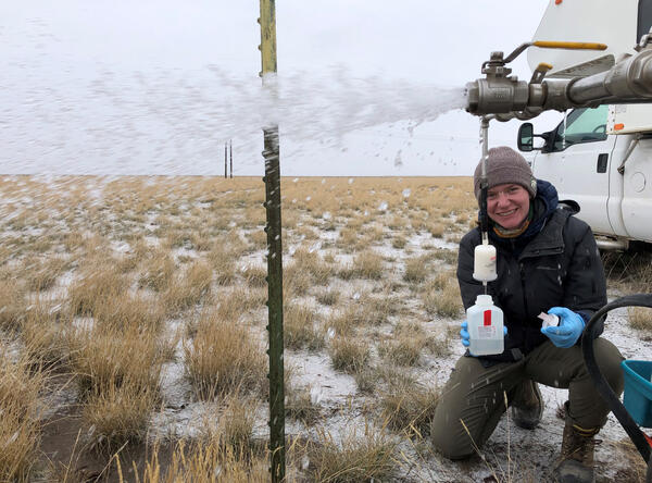
Hydrologic technician collects a water sample from Canyon Creek at Wallace, Idaho
Hydrologic technician collects a water sample from Canyon Creek at Wallace, IdahoUSGS Idaho Water Science Center hydrologic technician Niko Parrish collect a water sample at streamgage station 12413125, Canyon Creek above Mouth at Wallace, Idaho, as part of a water-quality monitoring program that the USGS conducts in the Coeur d'Alene River basin in cooperation with the U.S. Environmental Protection Agency.

Conducting geophysical logging of a monitoring well in the Raft River basin, Idaho
Conducting geophysical logging of a monitoring well in the Raft River basin, IdahoScientists from the U.S. Geological Survey's Idaho Water Science Center conducted geophysical logging of aquifer monitoring wells in the Raft River Basin on behalf of the Idaho Department of Water Resources.
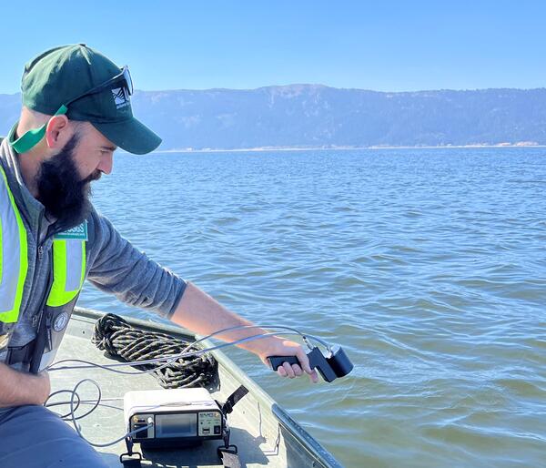
Spectral radiometer measurement in Lake Cascade, Idaho
Spectral radiometer measurement in Lake Cascade, IdahoMeasuring water leaving radiance with the spectral radiometer in Lake Cascade, Idaho as part of an effort to validate satellite data over water.
Spectral radiometer measurement in Lake Cascade, Idaho
Spectral radiometer measurement in Lake Cascade, IdahoMeasuring water leaving radiance with the spectral radiometer in Lake Cascade, Idaho as part of an effort to validate satellite data over water.
ISU Field Trip 2022
INLPO employees presenting to an Idaho State University Environmental Field Methods class about water-quality and USGS climate response wells. Photograph by Kerri Treinen in October 2022.
INLPO employees presenting to an Idaho State University Environmental Field Methods class about water-quality and USGS climate response wells. Photograph by Kerri Treinen in October 2022.
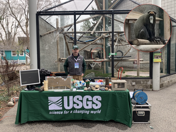
Brian on Earth Day at Zoo
Hydrologist at a booth for an outreach event at the Idaho Falls Zoo on Earth Day. Photograph by Tim Cox in April 2022.
Hydrologist at a booth for an outreach event at the Idaho Falls Zoo on Earth Day. Photograph by Tim Cox in April 2022.

U.S. Geological Survey hydrologic technician Mike Michelotti collects water samples from the South Fork Coeur d'Alene River near Pinehurst, Idaho.
U.S. Geological Survey hydrologic technician Mike Michelotti collects water samples from the South Fork Coeur d'Alene River near Pinehurst, Idaho.U.S. Geological Survey hydrologic technician Mike Michelotti collects water samples from the South Fork Coeur d'Alene River near Pinehurst, Idaho, January 17, 2022. The sample collection is part of ongoing water-quality monitoring in the Coeur d'Alene River basin conducted in cooperation with the U.S. Environmental Protection Agency.
inlpubs Logo
Logo for the R package inlpubs, used to search and analyze publications of the Idaho National Laboratory Project Office. Created by Jason Fisher in January 2022.
Logo for the R package inlpubs, used to search and analyze publications of the Idaho National Laboratory Project Office. Created by Jason Fisher in January 2022.

USGS Hydrologist Collects Groundwater Sample at Idaho National Laboratory
USGS Hydrologist Collects Groundwater Sample at Idaho National LaboratoryIn this photo USGS hydrologist Allison Trcka collects a groundwater sample at the Idaho National Laboratory in November 2021. Since 1949, the USGS has partnered with the U.S.

Buck Creek, Idaho
Buck Creek, Idaho, one year after a wildfire burned the watershed. Buck Creek was one of 36 headwater streams in watersheds burned by wildfire that USGS scientists studied to determine mercury mobilization, methylation, and bioaccumulation in aquatic insects.
Buck Creek, Idaho, one year after a wildfire burned the watershed. Buck Creek was one of 36 headwater streams in watersheds burned by wildfire that USGS scientists studied to determine mercury mobilization, methylation, and bioaccumulation in aquatic insects.
Alli Sampling
Hydrologist taking a water-quality sample. Photograph by Kerri Treinen in November 2021.
Hydrologist taking a water-quality sample. Photograph by Kerri Treinen in November 2021.

Water sample collected for mercury analysis
An example of a water sample collected to study the link between wildfire and mercury mobilization, methylation, and bioaccumulation in aquatic insects.
An example of a water sample collected to study the link between wildfire and mercury mobilization, methylation, and bioaccumulation in aquatic insects.

Soil sample collected for mercury analysis
An example of a soil sample collected to study the link between wildfire and mercury mobilization, methylation, and bioaccumulation in aquatic insects.
An example of a soil sample collected to study the link between wildfire and mercury mobilization, methylation, and bioaccumulation in aquatic insects.

USGS research hydrologist Austin Baldwin collects a soil sample from a watershed burned by wildfire
USGS research hydrologist Austin Baldwin collects a soil sample from a watershed burned by wildfireU.S. Geological Survey research hydrologist Austin Baldwin collects a soil sample near Meadow Creek, Washington, for mercury analysis. Baldwin and USGS colleagues conducted a study of mercury mobilization, methylation, and bioaccumulation in aquatic insects in headwater streams of the Pacific Northwest burned by wildfire.
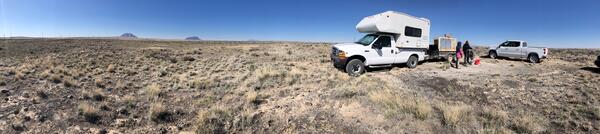
Sam Sampling April 2021
Water quality sampling set up with the Middle Butte and East Butte in the background. Photograph by Kerri Treinen in April 2021.
Water quality sampling set up with the Middle Butte and East Butte in the background. Photograph by Kerri Treinen in April 2021.

Idaho's Big Lost River Valley
Panoramic view of Idaho's Big Lost River Valley from Leslie Butte. This photo was taken during reconnaissance for a study to characterize the water resources of the Big Lost River Valley conducted in cooperation with the Idaho Department of Environmental Quality.
Panoramic view of Idaho's Big Lost River Valley from Leslie Butte. This photo was taken during reconnaissance for a study to characterize the water resources of the Big Lost River Valley conducted in cooperation with the Idaho Department of Environmental Quality.