
Brian's Staff photo taken by an unknown photographer in August 2025. Image was resaved using The Gimp in order to upload into Drupal.
Images
Images intro.
Filter Total Items: 178
Brian Twining's Staff Photo
Brian's Staff photo taken by an unknown photographer in August 2025. Image was resaved using The Gimp in order to upload into Drupal.
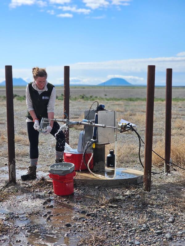
Alli Sampling at CFC on May 2025
Hydrologist taking groundwater sample for age dating with East Butte and Middle Butte in the background. Photograph by Austin Taylor in May 2025.
Hydrologist taking groundwater sample for age dating with East Butte and Middle Butte in the background. Photograph by Austin Taylor in May 2025.
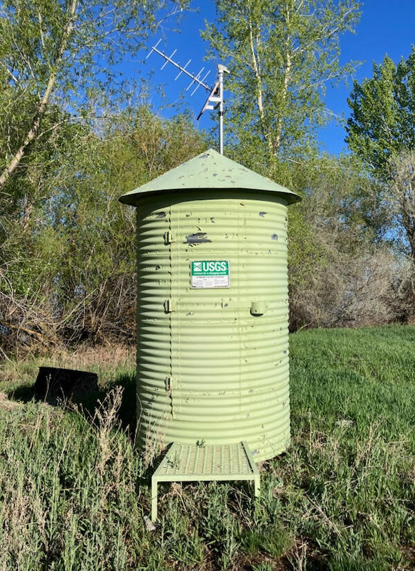
Mud lake Gauge Station
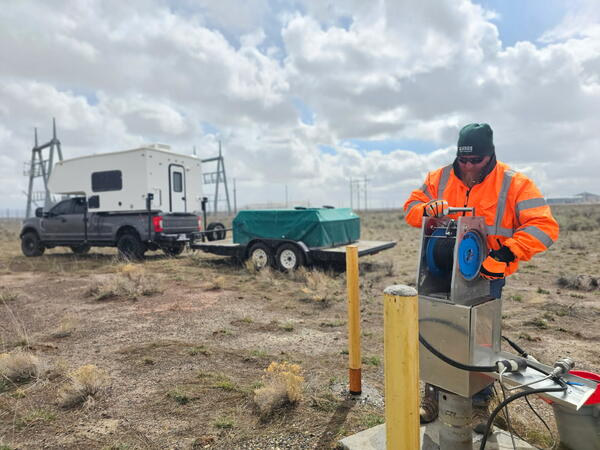
USGS gauging station located at Mud Lake, Idaho. Photograph by Tim Cox in May 2025.
USGS gauging station located at Mud Lake, Idaho. Photograph by Tim Cox in May 2025.

Groundwater-level synoptic, Camas Prairie, Idaho, April 2025
Groundwater-level synoptic, Camas Prairie, Idaho, April 2025USGS hydrologist Hannah Richardson prepares to collect a groundwater-level measurement from a well on Idaho's Camas Prairie as part of a groundwater synoptic survey, April 10, 2025. The headwaters of Lava Creek can be seen in the distance.
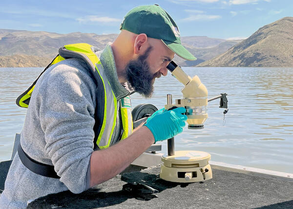
Water-quality reconnaissance of Owyhee Reservoir, eastern Oregon
Water-quality reconnaissance of Owyhee Reservoir, eastern OregonResearch hydrologist Tyler King of the U.S. Geological Survey's Hydrologic Remote Sensing Branch examines a water sample collected from Owyhee Reservoir in eastern Oregon, April 10, 2025. King and scientists from the U.S.
Groundwater monitoring at the Idaho National Laboratory
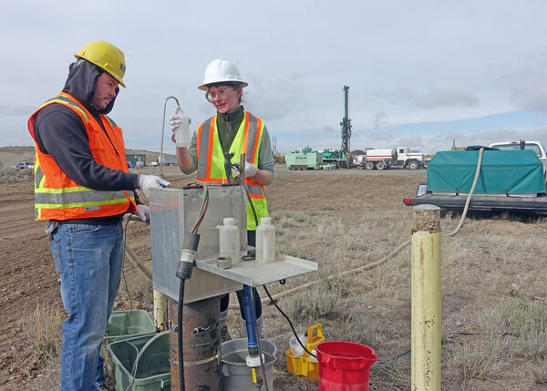
Groundwater monitoring at the Idaho National LaboratoryAustin Taylor and Allison Trcka of the USGS Idaho Water Science Center's Idaho National Laboratory Project Office collect water samples from monitoring well USGS 111 at the Idaho National Laboratory in southeastern Idaho.
Groundwater monitoring at the Idaho National Laboratory
Groundwater monitoring at the Idaho National LaboratoryAustin Taylor and Allison Trcka of the USGS Idaho Water Science Center's Idaho National Laboratory Project Office collect water samples from monitoring well USGS 111 at the Idaho National Laboratory in southeastern Idaho.
Hydrotech WL April 2025
Hydrologic technician taking a water level measurement. Photograph by Austin Taylor in April 2025.
Hydrologic technician taking a water level measurement. Photograph by Austin Taylor in April 2025.

Water-quality sampling on the Coeur d'Alene River, northern Idaho
Water-quality sampling on the Coeur d'Alene River, northern IdahoUSGS hydrologic technicians Niko Parrish and Nick Korzen collect data and water samples from the Coeur d'Alene River as part of ongoing water-quality monitoring the USGS Idaho Water Science Center conducts in cooperation with the U.S. Environmental Protection Agency.

Water-quality sampling in the Coeur d'Alene River Basin, Idaho
Water-quality sampling in the Coeur d'Alene River Basin, IdahoU.S. Geological Survey hydrologic technician Niko Parrish collects a water sample from Ninemile Creek at Wallace, Idaho, as part of ongoing water-quality monitoring conducted by the USGS Idaho Water Science Center in the Coeur d'Alene River Basin in cooperation with the U.S. Environmental Protection Agency.

Measuring Streamflow on Warm Springs Creek near Mackay, Idaho
Measuring Streamflow on Warm Springs Creek near Mackay, IdahoUSGS hydrologic technician Aliesha Bradford measures streamflow on Warm Springs Creek near Mackay, Idaho. Photo by Ryan Moore, USGS.
Measuring Streamflow on Warm Springs Creek near Mackay, Idaho
Measuring Streamflow on Warm Springs Creek near Mackay, IdahoUSGS hydrologic technician Aliesha Bradford measures streamflow on Warm Springs Creek near Mackay, Idaho. Photo by Ryan Moore, USGS.
INLPO Network Sites
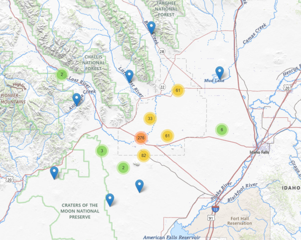
Map showing the site locations within the U.S. Geological Survey monitoring networks at the Idaho National Laboratory and surrounding areas, Idaho, from 1922 to 2024.
Map showing the site locations within the U.S. Geological Survey monitoring networks at the Idaho National Laboratory and surrounding areas, Idaho, from 1922 to 2024.
Geophysical Logger
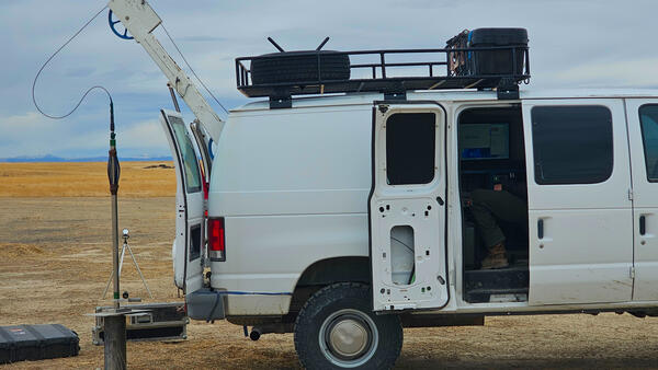
USGS geophysical logging equipment setup on a test well. This equipment looks at well deviation using a gyroscopic deviation tool. Photograph by Brian Twining in November 2024.
USGS geophysical logging equipment setup on a test well. This equipment looks at well deviation using a gyroscopic deviation tool. Photograph by Brian Twining in November 2024.
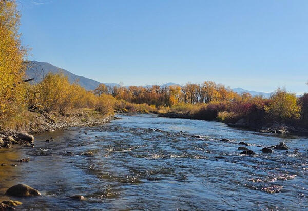
Birch Creek
Upstream view of Birch Creek, Idaho. Photograph by Austin Taylor in October 2024.
Upstream view of Birch Creek, Idaho. Photograph by Austin Taylor in October 2024.

USGS Idaho Water Science Center hydrologists brief Northwest-Pacific Islands Regional Director Jill Rolland at Crystal Springs along the Snake River
USGS Idaho Water Science Center hydrologists brief Northwest-Pacific Islands Regional Director Jill Rolland at Crystal Springs along the Snake RiverDr. Jill Rolland, Director of the USGS Northwest- Pacific Islands Region, visited Idaho during the week of September 23, 2024. During her visit, Dr.

USGS streamgage 13132513, INL Diversion at Head near Arco, Idaho
USGS streamgage 13132513, INL Diversion at Head near Arco, IdahoU.S. Geological Survey monitoring location 13132513, INL Diversion at Head near Arco, Idaho, on the U.S. Department of Energy's Idaho National Laboratory. This view looks south toward Big Southern Butte.

2024 Treasure Valley Watershed Watch
U.S. Geological Survey research hydrologist Tyler King helps students from Boise's Pierce Park Elementary School identify aquatic macroinvertebrates as part of the 2024 Watershed Watch educational outreach event along the Boise River in Boise, Idaho.
U.S. Geological Survey research hydrologist Tyler King helps students from Boise's Pierce Park Elementary School identify aquatic macroinvertebrates as part of the 2024 Watershed Watch educational outreach event along the Boise River in Boise, Idaho.

Fish dissection for histopathology analyses
Dr. Cheyenne Smith of the USGS Eastern Ecological Science Center coaches USGS Idaho Water Science Center hydrologic technician Niko Parrish in dissecting a mountain whitefish from northern Idaho's Kootenai River. The samples for histopathology analyses were collected as part of monitoring and assessment of water quality in the transboundary Kootenai River basin.
Dr. Cheyenne Smith of the USGS Eastern Ecological Science Center coaches USGS Idaho Water Science Center hydrologic technician Niko Parrish in dissecting a mountain whitefish from northern Idaho's Kootenai River. The samples for histopathology analyses were collected as part of monitoring and assessment of water quality in the transboundary Kootenai River basin.
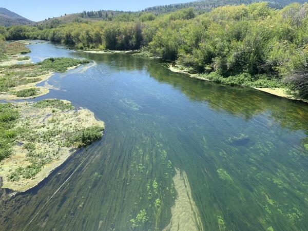
Portneuf River Algae
The Portneuf River flows calmly away from the camera. The water is clear and shows long strings of algae growing on the bottom of the channel.
The Portneuf River flows calmly away from the camera. The water is clear and shows long strings of algae growing on the bottom of the channel.
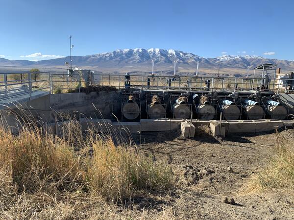
Portneuf River Headgate Structure
A concrete structure with seven large headgates that can divert water into a canal. The canal area is dry, and there are snowcapped mountains in the distance.
A concrete structure with seven large headgates that can divert water into a canal. The canal area is dry, and there are snowcapped mountains in the distance.
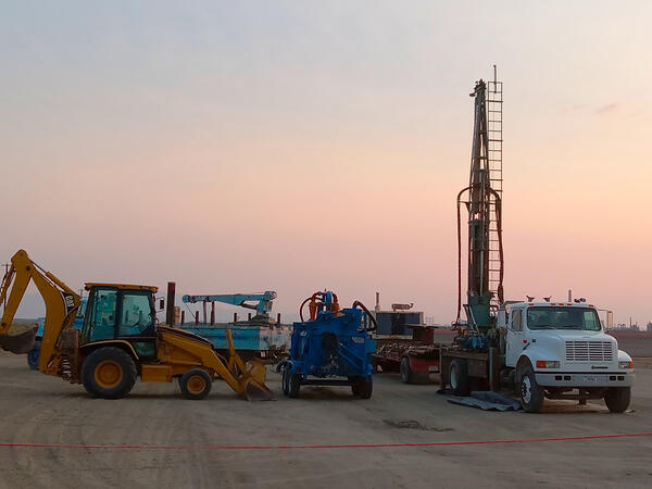
Drilling Rig July 2024
USGS core drilling rig setup at well ICPP-2352. Photo includes the core drilling rig and support equipment. Photograph by Brian Twining in July 2024.
USGS core drilling rig setup at well ICPP-2352. Photo includes the core drilling rig and support equipment. Photograph by Brian Twining in July 2024.

Lake Fork Payette River near McCall, Idaho
The Lake Fork Payette River near McCall, Idaho, reached a new peak streamflow on June 3, 2024, overflowing its banks and partially flooding a nearby road. Hydrologic technicians from the USGS Idaho Water Science Center's Boise Field Office responded to collect streamflow measurements. USGS streamgage station 13240000 can be seen at right.
The Lake Fork Payette River near McCall, Idaho, reached a new peak streamflow on June 3, 2024, overflowing its banks and partially flooding a nearby road. Hydrologic technicians from the USGS Idaho Water Science Center's Boise Field Office responded to collect streamflow measurements. USGS streamgage station 13240000 can be seen at right.