
New England WSC Products in the Third Quarter of 2026
By New England Water Science Center
October 5, 2026
List of products from the New England Water Science Center released in the third quarter of 2026.
Related
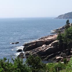
Gulf of Maine
The New England Water Science Center applies landscape science to understand water-resource challenges at the scales where decisions are made—from a local stream or aquifer to an entire watershed, river basin, or region. We combine long-term monitoring, field studies, laboratory analysis, mapping, modeling, and data delivery. By linking hydrologic, water-quality, ecological, climate, and land-use...
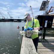
Algal Community Composition within the Lower Norwalk River
Harmful algal blooms (HABs), fish kills, and shellfish contamination are increasingly affecting coastal estuaries like the Norwalk River. Understanding the microscopic algae responsible for these events is essential for protecting public health, local economies, and marine ecosystems. As the environmental conditions of estuaries continue to change from nutrient enrichment, warming temperatures...
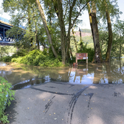
Developing Riverine and Pluvial Flood Hazard Tools for Planning and Mitigation in Massachusetts
The U.S. Geological Survey (USGS), in cooperation with the Massachusetts Executive Office of Energy and Environmental Affairs (EOEEA), is developing a web-based tool to visualize flood data in Massachusetts. Climate projections, including those derived from the Climate and Hydrologic Risk Project, are being incorporated into new and existing flood models in pilot areas distributed across the...
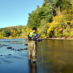
Assessing Sustainable Water Use in Connecticut
The U.S. Geological Survey (USGS) New England Water Science Center, in cooperation with the Connecticut Department of Energy and Environmental Protection (CT DEEP), is updating a planning-level support tool to help decision makers estimate daily mean streamflows and selected streamflow statistics to assess sustainable water use across the state of Connecticut.
Lidar-Derived Watershed Boundaries for Stream Gages and Selected Pour Points in Vermont, United States Lidar-Derived Watershed Boundaries for Stream Gages and Selected Pour Points in Vermont, United States
The U.S. Geological Survey (USGS), in cooperation with the Vermont Agency of Transportation (VTrans), derived watershed boundaries for the State of Vermont at the 1-meter resolution using lidar Digital Elevation Models (DEMs). Geographic Information Systems (GIS) software was used to hydrologically enforce DEMs and delineate watershed boundaries at 402 selected ungaged pour point...
Field, laboratory, and third-party quality-control data associated with sites and analytes monitored by the USGS National Water Quality Network, October 2022 through September 2024 Field, laboratory, and third-party quality-control data associated with sites and analytes monitored by the USGS National Water Quality Network, October 2022 through September 2024
From October 2022 through September 2024, the U.S. Geological Survey (USGS) National Water Quality Network (NWQN) monitored 110 surface-water river and stream sites and about 700 groundwater wells for a large number of water-quality analytes, for which associated quality-control data and corresponding statistical summaries are included in this data release. The quality-control data—for...
Land Use and Land Cover Data for the StreamStats Application in the Neponset River Watershed, Massachusetts, 2026 Land Use and Land Cover Data for the StreamStats Application in the Neponset River Watershed, Massachusetts, 2026
This data release contains the Land Use/Land Cover (LULC) data available in the Neponset River Basin StreamStats application. The U.S. Environmental Protection Agency (EPA) used the hydrologic response unit (HRU) approach outlined in EPA (2023) to derive the LULC raster from Massachusetts 2016 LULC data from MassGIS (2019), and the Natural Resources Conservation Service Soil Survey...
Hydraulic models and supplementary data for 30 stream crossing sites in Massachusetts Hydraulic models and supplementary data for 30 stream crossing sites in Massachusetts
The data in this data release are used to calibrate a Geographic Information System (GIS) based hydraulic modeling tool developed by the U.S. Geological Survey (USGS) for Massachusetts in cooperation with the Massachusetts Department of Environmental Protection (MassDEP). USGS developed one-dimensional U.S. Army Corps of Engineers (USACE) Hydrologic Engineering Center’s River Analysis...
Housatonic River watershed hydraulic models and supplementary data for stream crossings in Massachusetts Housatonic River watershed hydraulic models and supplementary data for stream crossings in Massachusetts
The U.S. Geological Survey (USGS), in cooperation with the Massachusetts Department of Environmental Protection (MassDEP), developed one-dimensional U.S. Army Corps of Engineers (USACE) Hydrologic Engineering Center’s River Analysis System (HEC-RAS) hydraulic models for stream crossing sites in the Housatonic River watershed, Massachusetts. An automated Geographic Information System (GIS...
Low-flow Statistics and Basin Characteristics Data for Stream Reaches in the Plymouth-Carver Kingston-Duxbury Aquifer Area of Southeastern Massachusetts and Cape Cod Low-flow Statistics and Basin Characteristics Data for Stream Reaches in the Plymouth-Carver Kingston-Duxbury Aquifer Area of Southeastern Massachusetts and Cape Cod
The U.S. Geological Survey (USGS), in cooperation with the Massachusetts Department of Conservation and Recreation, Office of Water Resources, developed regional regression equations for estimating selected low-flow statistics in the Plymouth-Carver Kingston-Duxbury aquifer area of southeastern Massachusetts and Cape Cod. This data release includes estimated streamflow statistics from...
Digital Elevation Model and Derivative Datasets to Support the Integration of Stormwater Drainage into the StreamStats Application for the Neponset River Watershed, Massachusetts (ver. 2.0, September 2026) Digital Elevation Model and Derivative Datasets to Support the Integration of Stormwater Drainage into the StreamStats Application for the Neponset River Watershed, Massachusetts (ver. 2.0, September 2026)
This data release contains the 1-meter resolution digital elevation model (DEM; DEM.tif) and two other derivative rasters that support the U.S. Geological Survey StreamStats application’s ability to produce on-the-fly watershed delineations (https://www.usgs.gov/streamstats). The flow direction raster (fdr.tif) indicates the directionality of flow as it exits each raster cell. If a cell...
Long Island Sound nitrogen and phosphorus SPARROW models, with model inputs and outputs, 2000-2020 Long Island Sound nitrogen and phosphorus SPARROW models, with model inputs and outputs, 2000-2020
This data release contains model files for simulating seasonal estimates of total nitrogen (N) and total phosphorus (P) loads from watersheds draining to the Long Island Sound using a dynamic SPARROW (SPAtially Referenced Regressions On Watershed attributes) model. Input data, output predictions including prediction uncertainty, model control files, and model source code are provided to...
Hydraulic models and supplementary data for 30 stream crossing sites in Massachusetts Hydraulic models and supplementary data for 30 stream crossing sites in Massachusetts
Note: this data release has been deprecated. Please see new data release here: https://doi.org/10.5066/P14HJGZI The data in this Data Release are used to calibrate a Geographic Information System (GIS) based hydraulic modeling tool developed by the U.S. Geological Survey (USGS) for Massachusetts in cooperation with the Massachusetts Department of Environmental Protection (MassDEP). USGS...
Housatonic River watershed hydraulic models and supplementary data for stream crossings in Massachusetts Housatonic River watershed hydraulic models and supplementary data for stream crossings in Massachusetts
Note: this data release has been deprecated. Please see new data release here: https://doi.org/10.5066/P1KCYM3I The U.S. Geological Survey (USGS), in cooperation with the Massachusetts Department of Environmental Protection (MassDEP), developed one-dimensional U.S. Army Corps of Engineers (USACE) Hydrologic Engineering Center’s River Analysis System (HEC-RAS) hydraulic models for stream...
Anthropogenic and geogenic factors affecting groundwater arsenic and potential drinking water exposure in the San Luis Valley, Colorado Anthropogenic and geogenic factors affecting groundwater arsenic and potential drinking water exposure in the San Luis Valley, Colorado
Groundwater arsenic is a serious health threat in many regions with limited surface water drinking supplies. In the San Luis Valley, Colorado, USA, where most residents rely on groundwater for drinking water, elevated groundwater arsenic concentrations (≥5 μg/L) were observed in 19.8% of private wells. Many recent studies have leveraged data science methods to estimate the spatial...
Authors
Ryan G. Smith, Alandra M. Lopez, Alexandder S. Honeyman, Dawson Carney, Scott Fendorf, Melissa A. Lombard, Matthew O. Gribble, Abdullah Al Fatta, Katherine A. James
Streamflow, water quality, and constituent loads and yields, Scituate Reservoir drainage area, Rhode Island, water year 2023 Streamflow, water quality, and constituent loads and yields, Scituate Reservoir drainage area, Rhode Island, water year 2023
As part of a long-term cooperative program to monitor water quality within the Scituate Reservoir drainage area, the U.S. Geological Survey, in cooperation with Providence Water (formerly the Providence Water Supply Board), collected streamflow and water-quality data in tributaries to the Scituate Reservoir, Rhode Island. Streamflow and concentrations of chloride and sodium estimated...
Authors
Kirk P. Smith
Transdisciplinary approach to private well research Transdisciplinary approach to private well research
More than 60 million people in the United States and Canada rely on private drinking water systems (mostly private wells), which fall outside of national regulations for water quality and management. This decentralized infrastructure creates unique challenges. First, fragmented policy oversight leads to inconsistent data availability. Second, population heterogeneity in well users...
Authors
Ann S. Ojeda, Jason R. Barrett, Elizabeth W. Boyer, Drew Capone, Rachel Coyte, Saugata Datta, Matthew Dietrich, Natasha Dimova, Lauren A. Eaves, Rebecca C. Fry, Anna Gitter, Xindi C. Hu, Melissa A. Lombard, Jacqueline MacDonald Gibson, Helen Moylan, Riley E. Mulhern, Heather M. Murphy, Siddhartha Roy, Bridget R. Scanlon, Leigh G. Terry, Nicole Trip, Jeffrey K. Wickliffe, Samantha C. Ying
An automatable method for developing preliminary stream crossing designs using lidar and hydraulic modeling in Massachusetts An automatable method for developing preliminary stream crossing designs using lidar and hydraulic modeling in Massachusetts
Upgrading aging and undersized stream crossings (places where culverts and bridges intersect a stream) with replacements designed for aquatic organism passage can improve infrastructure resiliency, geomorphic stability, and maintenance costs. The goal of this work is to develop preliminary culvert designs that convey hydraulic design floods and meet the Massachusetts Stream Crossings...
Authors
Meghan A. McCallister, Luke P. Sturtevant, Brendan A. McCarthy, Ian P. Armstrong
The Norwalk River Watershed The Norwalk River Watershed
The Norwalk River Watershed spans across seven communities in southwestern Connecticut and eastern New York. This geonarrative explores key water quality challenges, including nutrient pollution, pesticide runoff, and chloride contamination, while highlighting the U.S. Geological Survey's efforts to monitor and understand the collected data within the watershed.
Related
Gulf of Maine
The New England Water Science Center applies landscape science to understand water-resource challenges at the scales where decisions are made—from a local stream or aquifer to an entire watershed, river basin, or region. We combine long-term monitoring, field studies, laboratory analysis, mapping, modeling, and data delivery. By linking hydrologic, water-quality, ecological, climate, and land-use...
Algal Community Composition within the Lower Norwalk River
Harmful algal blooms (HABs), fish kills, and shellfish contamination are increasingly affecting coastal estuaries like the Norwalk River. Understanding the microscopic algae responsible for these events is essential for protecting public health, local economies, and marine ecosystems. As the environmental conditions of estuaries continue to change from nutrient enrichment, warming temperatures...
Developing Riverine and Pluvial Flood Hazard Tools for Planning and Mitigation in Massachusetts
The U.S. Geological Survey (USGS), in cooperation with the Massachusetts Executive Office of Energy and Environmental Affairs (EOEEA), is developing a web-based tool to visualize flood data in Massachusetts. Climate projections, including those derived from the Climate and Hydrologic Risk Project, are being incorporated into new and existing flood models in pilot areas distributed across the...
Assessing Sustainable Water Use in Connecticut
The U.S. Geological Survey (USGS) New England Water Science Center, in cooperation with the Connecticut Department of Energy and Environmental Protection (CT DEEP), is updating a planning-level support tool to help decision makers estimate daily mean streamflows and selected streamflow statistics to assess sustainable water use across the state of Connecticut.
Lidar-Derived Watershed Boundaries for Stream Gages and Selected Pour Points in Vermont, United States Lidar-Derived Watershed Boundaries for Stream Gages and Selected Pour Points in Vermont, United States
The U.S. Geological Survey (USGS), in cooperation with the Vermont Agency of Transportation (VTrans), derived watershed boundaries for the State of Vermont at the 1-meter resolution using lidar Digital Elevation Models (DEMs). Geographic Information Systems (GIS) software was used to hydrologically enforce DEMs and delineate watershed boundaries at 402 selected ungaged pour point...
Field, laboratory, and third-party quality-control data associated with sites and analytes monitored by the USGS National Water Quality Network, October 2022 through September 2024 Field, laboratory, and third-party quality-control data associated with sites and analytes monitored by the USGS National Water Quality Network, October 2022 through September 2024
From October 2022 through September 2024, the U.S. Geological Survey (USGS) National Water Quality Network (NWQN) monitored 110 surface-water river and stream sites and about 700 groundwater wells for a large number of water-quality analytes, for which associated quality-control data and corresponding statistical summaries are included in this data release. The quality-control data—for...
Land Use and Land Cover Data for the StreamStats Application in the Neponset River Watershed, Massachusetts, 2026 Land Use and Land Cover Data for the StreamStats Application in the Neponset River Watershed, Massachusetts, 2026
This data release contains the Land Use/Land Cover (LULC) data available in the Neponset River Basin StreamStats application. The U.S. Environmental Protection Agency (EPA) used the hydrologic response unit (HRU) approach outlined in EPA (2023) to derive the LULC raster from Massachusetts 2016 LULC data from MassGIS (2019), and the Natural Resources Conservation Service Soil Survey...
Hydraulic models and supplementary data for 30 stream crossing sites in Massachusetts Hydraulic models and supplementary data for 30 stream crossing sites in Massachusetts
The data in this data release are used to calibrate a Geographic Information System (GIS) based hydraulic modeling tool developed by the U.S. Geological Survey (USGS) for Massachusetts in cooperation with the Massachusetts Department of Environmental Protection (MassDEP). USGS developed one-dimensional U.S. Army Corps of Engineers (USACE) Hydrologic Engineering Center’s River Analysis...
Housatonic River watershed hydraulic models and supplementary data for stream crossings in Massachusetts Housatonic River watershed hydraulic models and supplementary data for stream crossings in Massachusetts
The U.S. Geological Survey (USGS), in cooperation with the Massachusetts Department of Environmental Protection (MassDEP), developed one-dimensional U.S. Army Corps of Engineers (USACE) Hydrologic Engineering Center’s River Analysis System (HEC-RAS) hydraulic models for stream crossing sites in the Housatonic River watershed, Massachusetts. An automated Geographic Information System (GIS...
Low-flow Statistics and Basin Characteristics Data for Stream Reaches in the Plymouth-Carver Kingston-Duxbury Aquifer Area of Southeastern Massachusetts and Cape Cod Low-flow Statistics and Basin Characteristics Data for Stream Reaches in the Plymouth-Carver Kingston-Duxbury Aquifer Area of Southeastern Massachusetts and Cape Cod
The U.S. Geological Survey (USGS), in cooperation with the Massachusetts Department of Conservation and Recreation, Office of Water Resources, developed regional regression equations for estimating selected low-flow statistics in the Plymouth-Carver Kingston-Duxbury aquifer area of southeastern Massachusetts and Cape Cod. This data release includes estimated streamflow statistics from...
Digital Elevation Model and Derivative Datasets to Support the Integration of Stormwater Drainage into the StreamStats Application for the Neponset River Watershed, Massachusetts (ver. 2.0, September 2026) Digital Elevation Model and Derivative Datasets to Support the Integration of Stormwater Drainage into the StreamStats Application for the Neponset River Watershed, Massachusetts (ver. 2.0, September 2026)
This data release contains the 1-meter resolution digital elevation model (DEM; DEM.tif) and two other derivative rasters that support the U.S. Geological Survey StreamStats application’s ability to produce on-the-fly watershed delineations (https://www.usgs.gov/streamstats). The flow direction raster (fdr.tif) indicates the directionality of flow as it exits each raster cell. If a cell...
Long Island Sound nitrogen and phosphorus SPARROW models, with model inputs and outputs, 2000-2020 Long Island Sound nitrogen and phosphorus SPARROW models, with model inputs and outputs, 2000-2020
This data release contains model files for simulating seasonal estimates of total nitrogen (N) and total phosphorus (P) loads from watersheds draining to the Long Island Sound using a dynamic SPARROW (SPAtially Referenced Regressions On Watershed attributes) model. Input data, output predictions including prediction uncertainty, model control files, and model source code are provided to...
Hydraulic models and supplementary data for 30 stream crossing sites in Massachusetts Hydraulic models and supplementary data for 30 stream crossing sites in Massachusetts
Note: this data release has been deprecated. Please see new data release here: https://doi.org/10.5066/P14HJGZI The data in this Data Release are used to calibrate a Geographic Information System (GIS) based hydraulic modeling tool developed by the U.S. Geological Survey (USGS) for Massachusetts in cooperation with the Massachusetts Department of Environmental Protection (MassDEP). USGS...
Housatonic River watershed hydraulic models and supplementary data for stream crossings in Massachusetts Housatonic River watershed hydraulic models and supplementary data for stream crossings in Massachusetts
Note: this data release has been deprecated. Please see new data release here: https://doi.org/10.5066/P1KCYM3I The U.S. Geological Survey (USGS), in cooperation with the Massachusetts Department of Environmental Protection (MassDEP), developed one-dimensional U.S. Army Corps of Engineers (USACE) Hydrologic Engineering Center’s River Analysis System (HEC-RAS) hydraulic models for stream...
Anthropogenic and geogenic factors affecting groundwater arsenic and potential drinking water exposure in the San Luis Valley, Colorado Anthropogenic and geogenic factors affecting groundwater arsenic and potential drinking water exposure in the San Luis Valley, Colorado
Groundwater arsenic is a serious health threat in many regions with limited surface water drinking supplies. In the San Luis Valley, Colorado, USA, where most residents rely on groundwater for drinking water, elevated groundwater arsenic concentrations (≥5 μg/L) were observed in 19.8% of private wells. Many recent studies have leveraged data science methods to estimate the spatial...
Authors
Ryan G. Smith, Alandra M. Lopez, Alexandder S. Honeyman, Dawson Carney, Scott Fendorf, Melissa A. Lombard, Matthew O. Gribble, Abdullah Al Fatta, Katherine A. James
Streamflow, water quality, and constituent loads and yields, Scituate Reservoir drainage area, Rhode Island, water year 2023 Streamflow, water quality, and constituent loads and yields, Scituate Reservoir drainage area, Rhode Island, water year 2023
As part of a long-term cooperative program to monitor water quality within the Scituate Reservoir drainage area, the U.S. Geological Survey, in cooperation with Providence Water (formerly the Providence Water Supply Board), collected streamflow and water-quality data in tributaries to the Scituate Reservoir, Rhode Island. Streamflow and concentrations of chloride and sodium estimated...
Authors
Kirk P. Smith
Transdisciplinary approach to private well research Transdisciplinary approach to private well research
More than 60 million people in the United States and Canada rely on private drinking water systems (mostly private wells), which fall outside of national regulations for water quality and management. This decentralized infrastructure creates unique challenges. First, fragmented policy oversight leads to inconsistent data availability. Second, population heterogeneity in well users...
Authors
Ann S. Ojeda, Jason R. Barrett, Elizabeth W. Boyer, Drew Capone, Rachel Coyte, Saugata Datta, Matthew Dietrich, Natasha Dimova, Lauren A. Eaves, Rebecca C. Fry, Anna Gitter, Xindi C. Hu, Melissa A. Lombard, Jacqueline MacDonald Gibson, Helen Moylan, Riley E. Mulhern, Heather M. Murphy, Siddhartha Roy, Bridget R. Scanlon, Leigh G. Terry, Nicole Trip, Jeffrey K. Wickliffe, Samantha C. Ying
An automatable method for developing preliminary stream crossing designs using lidar and hydraulic modeling in Massachusetts An automatable method for developing preliminary stream crossing designs using lidar and hydraulic modeling in Massachusetts
Upgrading aging and undersized stream crossings (places where culverts and bridges intersect a stream) with replacements designed for aquatic organism passage can improve infrastructure resiliency, geomorphic stability, and maintenance costs. The goal of this work is to develop preliminary culvert designs that convey hydraulic design floods and meet the Massachusetts Stream Crossings...
Authors
Meghan A. McCallister, Luke P. Sturtevant, Brendan A. McCarthy, Ian P. Armstrong
The Norwalk River Watershed The Norwalk River Watershed
The Norwalk River Watershed spans across seven communities in southwestern Connecticut and eastern New York. This geonarrative explores key water quality challenges, including nutrient pollution, pesticide runoff, and chloride contamination, while highlighting the U.S. Geological Survey's efforts to monitor and understand the collected data within the watershed.