
Aquatic Habitats
Aquatic Habitats
Filter Total Items: 7
Linkages among pre-contact people, lamprey, and landscapes in the Willamette Valley
The U.S. Geological Survey and Portland State University are working with the Confederated Tribes of Grand Ronde and other partners to link past lamprey harvest locations with hydrogeomorphic conditions as landscape processes and shifting rivers have changed since the pre-contact archaeological period. This research provides a deeper historical context for lamprey conservation and restoration.

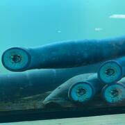
Controls on habitat for native lamprey in the Siletz River Basin
Chinook Salmon and Pacific Lamprey are culturally significant fishes to the Tribal community along the Siletz River, Oregon. The USGS studied how streamflow and bedload conditions may influence mainstem spawning habitats.
Integrating water availability in the Klamath Basin: from drought to dam removal
The USGS Water Resources Mission Area is assessing how much water is available for human and ecological needs in the United States and identifying where and when the Nation may have challenges meeting its demand for water. This information helps decision makers manage and distribute water in ways that balance competing needs. Due to its complex and competing water demands, ecological significance...
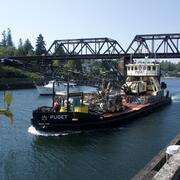
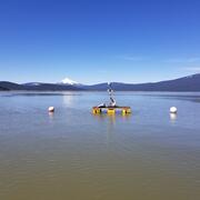
Lake Washington Ship Canal Sustainable Rivers Project
The U.S. Geological Survey (USGS) and the U.S. Army Corps of Engineers (USACE) are refining a water quality model to better understand temperature and salinity dynamics in the Lake Washington Ship Canal. This effort is supported by the Sustainable Rivers Program, a partnership between the USACE and The Nature Conservancy (TNC).

Evaluating sediment transport in Chicken Creek
The United States Geological Survey (USGS) is evaluating how the newly restored meandering channel on Chicken Creek affects sediment transport within the Tualatin River National Wildlife Refuge.

Prey Availability
Migratory wildlife need to balance the benefits of migration and reproduction with the physiological costs. This is particularly challenging in dynamic environments like wetlands, where food levels can vary greatly from year to year. For shorebirds in the Great Basin region, saline or terminal lakes provide essential habitats during their annual life cycle. To understand how changes in hydrology...
By
Ecosystems Mission Area, Water Resources Mission Area, Species Management Research Program, Forest and Rangeland Ecosystem Science Center, Fort Collins Science Center, Nevada Water Science Center, Oregon Water Science Center, Utah Water Science Center, Western Ecological Research Center (WERC), Saline Lake Ecosystems Integrated Water Availability Assessment

Fern Ridge Geomorphology
The USGS, in cooperation with the U.S. Army Corps of Engineers (USACE), is conducting targeted research to better understand geomorphic conditions and processes within the reservoir at Fern Ridge Lake, near Eugene, Oregon, so that managers have the information to support dam operations and other actions that will aid in the preservation and management of cultural sites.