
Streamflow
Streamflow
Filter Total Items: 15
The Klamath Falls Field Office
The Oregon Water Science Center’s Klamath Falls Field Office provides surface-water and water-quality data to support the basin’s most pressing water-resource and ecosystem needs.

City Beavers: Tualatin River Basin Beaver Study
Beavers and their dams are common sights along creeks in the Tualatin River basin. Beaver help create diverse habitats for many other animals, including birds, fish, and amphibians. The USGS studying the affect beaver activity has on the amount and quality of water in local streams, so that agencies in the basin can make strategic management and habitat restoration decisions based on science.
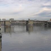
Measuring Willamette River streamflow in Portland
Learn about one of Oregon's most relied upon streamflow gages.

New gages for understanding surface water availability and spring Chinook salmon habitat in the Willamette Basin
Learn about our new streamgages in the Williamette River Basin.

Willamette Instream Flows
When streamflow fluctuates in the Willamette River so does the amount of available rearing habitat used by Threatened Upper Willamette River spring Chinook salmon and winter steelhead trout. The USGS investigates how flow conditions and dam operations affect rearing habitat availability so that flow managers can maintain suitable flows for these species.

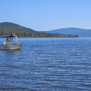
Upper Klamath River Basin Forecasts
"Determining water availability in the Upper Klamath Basin has always had a degree of uncertainty as a result of the complex hydrology and geology in the region and limited streamflow data."

Willamette River Basin Dissolved Gas Monitoring Network
USGS total dissolved gas (TDG) data help guide spill and discharge management from dams operated along tributaries of the Willamette River.

Willamette River Studies
Welcome to the Willamette River Study page. Here you will find links to USGS research for the Willamette River and the Willamette River Basin.

Water Temperature Modeling in the Middle Fork Willamette and South Santiam River Basins
Hills Creek, Lookout Point, and Dexter Dams are located on the Middle Fork Willamette River upstream of Eugene in western Oregon, and are important resources managed by the U.S. Army Corps of Engineers (USACE) for flood control, hydroelectric power, recreation, navigation, and irrigation. On the South Santiam River east of Albany in western Oregon, Green Peter and Foster Dams provide functions and...

A Thermal Mosaic for the Willamette River
The U.S. Army Corps of Engineers operates 12 dams in the Willamette River Basin. The dams alter natural temperature and hydrologic regimes. Unnatural water temperatures can negatively impact all life stages of salmonid fish species. Water temperature in the mainstem Willamette River regularly exceeds the standard of 18.0 °C (64.4 °F) designated for salmon and trout rearing and migration for mid...

Lower Columbia River Dissolved Gas Monitoring Network
USGS total dissolved gas (TDG) data help guide spill and discharge management from dams operated along the lower Columbia River.

North Santiam River Basin Study
The streamflow and water-quality conditions monitored by the USGS in the North Santiam River basin provide valuable information to water resource managers