U.S. flag

An official website of the United States government

Images

Upper Midwest Water Science Center images.

Filter Total Items: 581
Streamgage house surrounded by windswept snow with pink-hued snow-covered lake and open water in background.
Streamgage 05049700 Lake Traverse at Reservation Dam near Wheaton, Minnesota in winter

Streamgage 05049700 Lake Traverse at Reservation Dam near Wheaton, Minnesota in winter, surrounded by windswept snow, with a pink-hued snow-covered lake and open water in the background.

An orange acoustic Doppler current profiler (ADCP) floats in the middle of a river on an overcast winter da
Acoustic Doppler current profiler floating in middle of Flambeau River near Bruce, Wisconsin on a winter day
A wintery landscape
A winter landscape in Kewaunee County, Wisconsin

A wintery landscape of snow-covered grass and trees on a late morning in November in Kewaunee County in northeast Wisconsin.

Scientist in yellow jacket and green hat turning tap on side of house.
Collecting residential tap water sample in Kewaunee County, Wisconsin

Laboratory for Infectious Disease and the Environment team member Joel Stokdyk collects residential private well water sample for the well water advisory forecast study in Kewaunee County, Wisconsin.

Three scientists collecting residential water well samples on sunny snowy day
LIDE team members collecting private water well samples in Kewaunee County, Wisconsin

Team members from the USGS Laboratory for Infectious Disease and the Environment (LIDE) collecting private well water samples on a chilly November day in Kewaunee County, Wisconsin. Pictured from left to right Joel Stokdyk (USGS), Rachel Cook (USDA), Aaron Firnstahl (USGS). 

Team members from the USGS Laboratory for Infectious Disease and the Environment (LIDE) collecting private well water samples on a chilly November day in Kewaunee County, Wisconsin. Pictured from left to right Joel Stokdyk (USGS), Rachel Cook (USDA), Aaron Firnstahl (USGS). 

Two scientists standing in front of white van in front of residential garage
LIDE team members in front of field vehicle when traveling to collect private well water samples

Joel Stokdyk (USGS) and Rachel Cook (USDA) from the USGS Laboratory for Infectious Disease and the Environment (LIDE) standing in front of field vehicle en route to collecting private well water samples on a chilly November day in Kewaunee County, Wisconsin.

Snow covered brushy vegetation on the shore of stream on overcast day.
Streamgage 05429369 Swan Creek at Lalor Road near Fitchburg, Wisconsin

Streamgage 05429369 Swan Creek at Lalor Road near Fitchburg, Wisconsin with snow covered brushy vegetation on the shore of stream on overcast day.

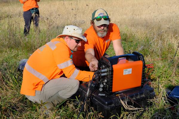
Two scientists wearing orange, look at a mobile WalkTEM unit while in the field.
Geophysicists collect electromagnetic survey data using WalkTEM in Illinois River Basin

Geophysicists collect electromagnetic survey data using a WalkTEM (transient electromagnetics (TEM)) at a site in the Illinois River Basin.

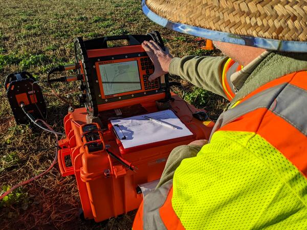
The return signal from the electromagnetic pulse administered to the ground by the WalkTEM instrument is displayed on screen
Return signal from the electromagnetic pulse administered to the ground by the WalkTEM instrument

The return signal from the electromagnetic pulse administered to the ground by the WalkTEM (transient electromagnetics (TEM)) instrument is displayed on the instrument during field data collection at a site in the Illinois River Basin.

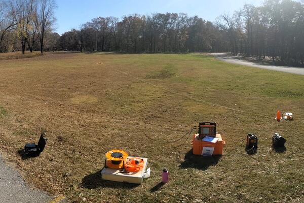
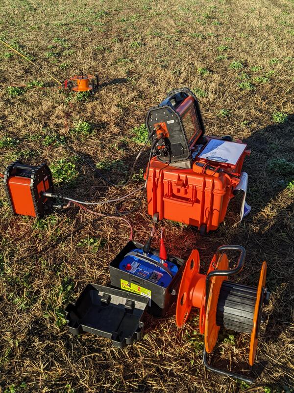
WalkTEM instrument staged for collection of ground-based electromagnetic survey data
WalkTEM instrument staged for collection of ground-based electromagnetic survey data at site in Illinois River Basin
Salmon migrating up Underwood Creek, Wisconsin, from Lake Michigan to spawn

Time lapse video (10x speed) of salmon migrating upstream from Lake Michigan to spawn, taken at Underwood Creek at Wauwatosa, Wisconsin on October 22, 2022.

Site 04087088 Underwood Creek at Wauwatosa, WI https://waterdata.usgs.gov/monitoring-location/04087088/

Time lapse video of salmon swimming up a shallow creek
Salmon migrating upstream Underwood Creek, Wisconsin, from Lake Michigan to spawn
Group of scientists standing on shore in front of research vessel in Amazon River Basin
USGS, ANA and SGB-CPRM scientists in front of research vessel in Amazon River Basin

USGS, ANA and Geological Survey of Brazil (SGB-CPRM) staff standing in front of an ANA/SBG-CPRM research vessel in the Amazon River basin in Manacapuru, Brazil to measure measure streamflow and sample suspended sediment.

SGB-CPRM (Geological Survey of Brazil)

ANA (Agencia Nacional De Aguas E Saneamento Basico)


USGS, ANA and Geological Survey of Brazil (SGB-CPRM) staff standing in front of an ANA/SBG-CPRM research vessel in the Amazon River basin in Manacapuru, Brazil to measure measure streamflow and sample suspended sediment.

SGB-CPRM (Geological Survey of Brazil)

ANA (Agencia Nacional De Aguas E Saneamento Basico)


Scientists review data on a laptop on deck of a research vessel
Reviewing streamflow measurements on board a research vessel in the Amazon River basin in Manacapuru, Brazil

USGS, ANA and SBG-CPRM staff reviewing streamflow measurements on board an ANA/SBG-CPRM research vessel in the Amazon River basin in Manacapuru, Brazil. USGS staff in middle wearing orange shirt and yellow PFD, ANA and SGB-CPRM staff in navy blue attire discuss measurements and look over data.

SGB-CPRM (Geological Survey of Brazil)

USGS, ANA and SBG-CPRM staff reviewing streamflow measurements on board an ANA/SBG-CPRM research vessel in the Amazon River basin in Manacapuru, Brazil. USGS staff in middle wearing orange shirt and yellow PFD, ANA and SGB-CPRM staff in navy blue attire discuss measurements and look over data.

SGB-CPRM (Geological Survey of Brazil)

Yellow suspended sampler suspended off side blue and white research vessel and brown water below
Yellow sediment sampler suspended off side of boat in Manacapuru, Brazil

Yellow sediment sampler suspended off side of boat in Manacapuru, Amazon River Basin, Brazil, during a field trip with USGS and National Agency for Water and Basic Sanitation (ANA) scientists (Brazil) and Geological Survey of Brazil (SGB-CPRM).

ANA (Agencia Nacional De Aguas E Saneamento Basico)

SGB-CPRM (Geological Survey of Brazil)

Yellow sediment sampler suspended off side of boat in Manacapuru, Amazon River Basin, Brazil, during a field trip with USGS and National Agency for Water and Basic Sanitation (ANA) scientists (Brazil) and Geological Survey of Brazil (SGB-CPRM).

ANA (Agencia Nacional De Aguas E Saneamento Basico)

SGB-CPRM (Geological Survey of Brazil)

Six men standing in front of three flags, American, Brazil and other
USGS meeting with National Agency for Water and Basic Sanitation (ANA) scientists in Brazil standing in front of flags

USGS meeting with National Agency for Water and Basic Sanitation (ANA) scientists in Brazil, standing in front of three flags (L-R) American flag, Brazilian Flag, ANA logo flag.

(L-R) Mauricio Abijaodi, Brian McCallum, Filipe Sampaio, Joel Groten, Travis Knight, and Vitor Saback.

ANA (Agencia Nacional De Aguas E Saneamento Basico)

Six men standing on steps in front of building with words Agencia Nacional De Aguas E Saneamento Basico
USGS meeting with National Agency for Water and Basic Sanitation (ANA) scientists in Brazil

USGS meeting with National Agency for Water and Basic Sanitation (ANA) scientists in Brazil.

Top (L – R) ANA Scientists Vitor Saback, Brian McCallum, Mauricio Abijaodi

Bottom (L-R) USGS Hydrologists Travis Knight, Joel Groten, Filipe Sampaio

ANA (Agencia Nacional De Aguas E Saneamento Basico)

USGS meeting with National Agency for Water and Basic Sanitation (ANA) scientists in Brazil.

Top (L – R) ANA Scientists Vitor Saback, Brian McCallum, Mauricio Abijaodi

Bottom (L-R) USGS Hydrologists Travis Knight, Joel Groten, Filipe Sampaio

ANA (Agencia Nacional De Aguas E Saneamento Basico)

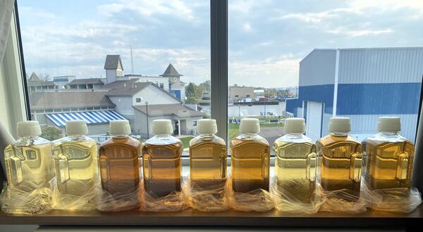
Nine clear bottles filled with colored water samples ranging from light yellow to brown sitting on a windowsill
Water samples from the St. Louis River, Minnesota

Water samples from the St. Louis River, Minnesota highlight the gradient of organic carbon concentrations. Water samples lined up on a windowsill overlooking Duluth in the background.

Water samples from the St. Louis River, Minnesota highlight the gradient of organic carbon concentrations. Water samples lined up on a windowsill overlooking Duluth in the background.

Was this page helpful?