
Restoration Science
Restoration Science
Restoration science involves enhancing aquatic environments so they contain the species of interest and permit the ecosystem to function in as normal a way as is possible. In order to achieve this water resource managers need to understand the dominant controlling components of a specific ecosystem whether they are physical or chemical factors. Therefore, the physical, chemical, and biological expertise in the WA WSC are all required in order to adequately address ecosystem restoration issues in the PNW. A particular focus has been on monitoring the redistribution of sediment within newly restored coastal wetlands to determine the effectiveness of restored processes for maintaining the desired nearshore habitats.
Filter Total Items: 26
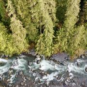
Watersheds and Fluvial Systems Team
The Watersheds and Fluvial Systems Team at the Washington Water Science Center provides reliable science to understand how watersheds, rivers, and streams function—and how they respond to a changing world. We aim to build partnerships that foster informed decision-making and effective resource management throughout the Pacific Northwest region and across the U.S.
Green River Sediment Monitoring
The Issue: Management efforts on the lower Green River to reduce flood hazards and improve habitat conditions are inherently interconnected with sediment transport and channel change dynamics. Those dynamics are, in turn, driven by a mix of interacting geologic, anthropogenic, and hydrologic factors. However, there have been no recent watershed-scale analyses of sediment dynamics in the Green...

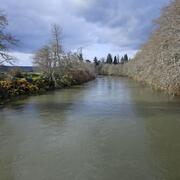
Tolt River Temperature Modeling
The Issue: The Tolt River and its tributaries, including the South Fork Tolt River, have recently experienced high water temperatures above water-quality standards. Water managers can regulate flows to influence the temperature regime of the South Fork Tolt River downstream of the dam. More information is needed to determine how far downstream water temperature strategies are effective. How USGS...

Mapping ecohydrological headwater refugia
The Issue: Forests in the Pacific Northwest have changed substantially over the past hundred years because of logging, changing forest management methods, and climate change. These forests contain a dense network of small headwater streams that supply cold, clean water and support 52 amphibian species. These amphibians live both in the cold streams and in the cool, moist areas nearby. Natural...
Chehalis Watershed Suspended Sediment Monitoring
The USGS monitored sediment loads in the Chehalis River and its major tributaries, allowing comparisons with historical monitoring. As a result, we now have a better understanding of modern sediment loads and how those loads have changed since the 1960s in response to improved land use practices. This information helps the U.S. Army Corps of Engineers maintain shipping access in Grays Harbor.

Water Temperature Dynamics in the Quillayute River Basin
The Issue: The Quillayute River Basin supports habitat for migrating, spawning, and rearing steelhead and salmon. Like many salmonid-bearing watersheds in the Pacific Northwest, water temperatures in the Quillayute River Basin are expected to warm in the coming decades. Warmer water temperatures pose a risk to salmonids and other cold-water fish, with the potential to adversely impact their health...

Coastal Habitats in Puget Sound
A Pacific Northwest icon, Puget Sound is the second-largest estuary in the United States. Its unique geology, climate, and nutrient-rich waters produce and sustain biologically productive coastal habitats. These same natural characteristics also contribute to a high quality of life that has led to growth in human population and urbanization. This growth has played a role in degrading the Sound...

Channel change monitoring following the Pilchuck Dam removal
The issue: In the summer of 2020, the Pilchuck Dam will be removed, allowing salmon access to the upper third of the Pilchuck River watershed for the first time in over a century. This removal will be associated with a short period increased sediment delivery, as the river re-works material trapped behind the dam. While the volume of impounded sediment is small and major changes in the downstream...

Water Temperature Mapping in the Snoqualmie and Skykomish River Basins
The Skykomish, Snoqualmie, and Middle Fork Snoqualmie River Basins have historically provided critical spawning, rearing, and core habitat for several salmonid species.

Quantifying Floodplain Ecological Processes and Ecosystem Services in the Delaware River Watershed
Floodplain and wetland areas provide critical ecosystem services to local and downstream communities by retaining sediments, nutrients, and floodwaters. The loss of floodplain functionality due to land use conversion and degradation reduces the provisioning of these services. Assessing, quantifying, and valuing floodplain ecosystem services provide a framework to estimate how floodplain systems...

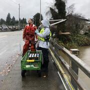
SR 530 Slide
In the immediate aftermath of the SR530 Landslide, the USGS supported first responders and decision-makers as a key member of the collaborative effort to monitor the stability of the landslide deposit and the associated impoundment of the North Fork Stillaguamish River during rescue operations. With the initial disaster response now over, longer-term questions have arisen regarding the stability...

Raging River Temperature
The Issue: Large, in-channel wood that helps to create and maintain healthy aquatic habitat in rivers throughout the Pacific Northwest was removed from many rivers in the past. In 2009, King County put wood back into the river to restore the Raging River watershed. To guide the county's restoration of the Raging River watershed, managers need to know the effect of restoration actions on in-stream...