
This is an illustration of how light behaves in the waters of Lake Washington. This is part of a study on how artificial light at night affects salmon predation.
Multimedia
Search here for some of our available field imagery and videos.
Images

Light in Water
This is an illustration of how light behaves in the waters of Lake Washington. This is part of a study on how artificial light at night affects salmon predation.

Sky Glow
This is an infographic describing sky glow. This is part of a study on how artificial light at night affects salmon predation in Seattle, Washington.
This is an infographic describing sky glow. This is part of a study on how artificial light at night affects salmon predation in Seattle, Washington.
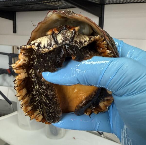
Scientists Holding Pinto Abalone
This is an image of a scientist holding a Pinto Abalone. Pinto abalone, once a familiar presence in Washington’s coastal ecosystems, have suffered a decline since.
This is an image of a scientist holding a Pinto Abalone. Pinto abalone, once a familiar presence in Washington’s coastal ecosystems, have suffered a decline since.
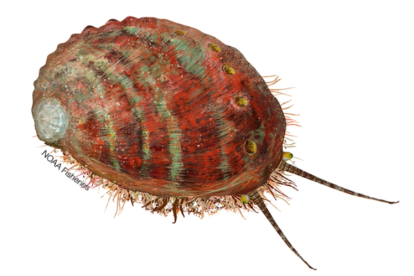
Pinto Abalone Illustration (NOAA)
This is an illustration of a Pinto abalone.
This is an illustration of a Pinto abalone.
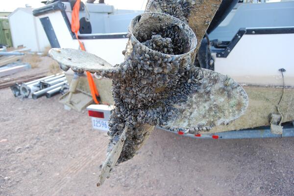
Boat with Invasive Mussel Infestation
This is an image of a boat propeller with an invasive mussel infestation.
This is an image of a boat propeller with an invasive mussel infestation.
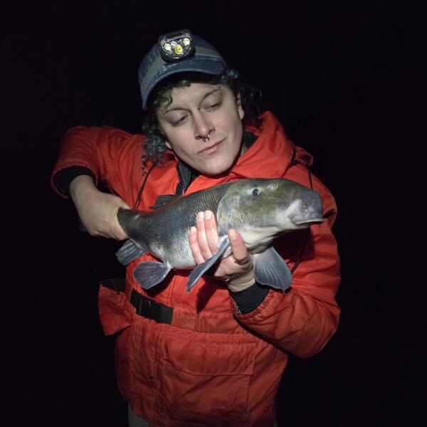
Scientist Holding a Lost River Sucker Fish
This is a photo of scientist, Ramona Rapp, holding a Lost River Sucker that was tagged in Klamath Falls, OR.
This is a photo of scientist, Ramona Rapp, holding a Lost River Sucker that was tagged in Klamath Falls, OR.
Videos

Artificial Light At Night
This is a video about the artificial light at night project, happening in Seattle, WA out of the USGS Western Fisheries Research Center.
This is a video about the artificial light at night project, happening in Seattle, WA out of the USGS Western Fisheries Research Center.
Artificial Light At Night (AD Version)
This is a video about the artificial light at night project, happening in Seattle, WA out of the USGS Western Fisheries Research Center.
This is a video about the artificial light at night project, happening in Seattle, WA out of the USGS Western Fisheries Research Center.
")
Ichthyophonus Disease in Pacific Salmon (AD)
Chinook (or King) salmon support numerous cultural and economic needs and make up more than 75% of the diet of many Indigenous communities.
Chinook (or King) salmon support numerous cultural and economic needs and make up more than 75% of the diet of many Indigenous communities.

Juvenile Sucker in Upper Klamath Lake, OR
This is a video of a juvenile sucker in Upper Klamath Lake, OR. Through decades of research, scientists at the USGS Western Fisheries Research Center have determined that over the last 30 years something has prevented young suckers from reaching adulthood. Scientists work tirelessly to find the cause of this break in recruitment into adulthood.
This is a video of a juvenile sucker in Upper Klamath Lake, OR. Through decades of research, scientists at the USGS Western Fisheries Research Center have determined that over the last 30 years something has prevented young suckers from reaching adulthood. Scientists work tirelessly to find the cause of this break in recruitment into adulthood.

Juvenile Sucker Sampling on Upper Klamath Lake, OR
Juvenile Sucker Sampling on Upper Klamath Lake, ORThis is a video of fieldwork in Upper Klamath Lake, OR. Here, biologists sample for juvenile suckers, an endangered fish species in the lake.
Juvenile Sucker Sampling on Upper Klamath Lake, OR
Juvenile Sucker Sampling on Upper Klamath Lake, ORThis is a video of fieldwork in Upper Klamath Lake, OR. Here, biologists sample for juvenile suckers, an endangered fish species in the lake.

Sea Star Wasting Disease
This is a video with Melanie Prentice and Grace Crandall on solving the mystery behind Sea Star Wasting Disease.
This is a video with Melanie Prentice and Grace Crandall on solving the mystery behind Sea Star Wasting Disease.