
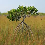
Freshwater
Freshwater
Filter Total Items: 39
Developing a Roadmap for the Future of Natural Resources in Everglades National Park
To sustain economic and ecologically viable ecosystems into the future, USGS is developing freshwater delivery targets for water flowing southward into Everglades National Park by integrating climate and sea level projections, hydrologic modeling, and ecological modeling to forecast ecosystem responses to future freshwater availability scenarios.

Integrating Remote Sensing and Numerical Modeling Technology to Detect and Manage Current and Future Harmful Algal Blooms in Louisiana’s Coastal and Tidal Waters
USGS is collaborating with partners to assess past and current CyanoHABs for the development of a predictive model and forecasting system for Lake Pontchartrain Estuary. This technology can be beneficial for informing future planning of water resource development projects, and the water management of the estuary.

Population Ecology of Florida Manatees
USGS is working with partners to understand how the federally protected Florida manatee ( Trichechus manatus latirostris) population changes over time and responds to threats.

A Fresh Set of Tools: New Information for Managing Fisheries During Changes in River Discharge
USGS scientists are conducting research to understand how estuary fisheries are affected by the the timing and/or magnitude of freshwater discharge into Lake Pontchartrain in Louisiana.

Gulf Sturgeon Ecological Investigations
The Gulf sturgeon, Acipenser oxyrinchus desotoi, has been listed as Threatened since 1991. Beginning in 1986, USGS has been investigating sturgeon population abundance and ecology throughout its range, but mostly in the Suwannee River.

Long-term Trends in Swamp Tree Growth across Drought and Salinity Gradients along the Northern Gulf Coast
This study will examine the potential effects of sea level rise, drought and water extraction by examining tree growth patterns across the Gulf Coast, specifically targeting long-term research plots available in the North American Baldcypress Swamp Network (NABCSN) and the Suwannee River.

Non-native Marine Fishes: Tracking Distributions with the USGS Nonindigenous Aquatic Species Database
WARC scientists work with local partners to verify and document sightings of non-native marine fishes.

Laboratory Investigations with Fish Species to Assist with Implementing Barataria-Terrebonne National Estuary Program’s Ecological Management Action Plans
WARC scientists will obtain live fish specimens from the field to conduct and enhance on-going laboratory research on harmful algal blooms and the use of piscicides to control invasive fish.

Monitoring and Adaptive Management Plan for Deepwater Horizon Natural Resource Damage Assessment (NRDA) Project: Large-scale Marsh Creation – Upper Barataria Component
USGS will provide support to the Large-scale Marsh Creation – Upper Barataria Component Project by monitoring change in the area of land and water, and recovery of vegetation and elevation over time.

Identifying and Projecting Water Quality Outcomes of Canal Backfilling Restoration at Jean Lafitte National Historical Park and Preserve
USGS researchers and their partners will develop a coupled hydrodynamic and water quality modeling system; calibrate and validate the models; assess and predict outcomes of a canal backfilling restoration project on key water quality attributes; and run the modeling system under a suite of scenarios reflecting changing environmental conditions.

Adding an Aquatic Prey Fish Module within the Everglades Vulnerability Analysis Modeling Framework
The USGS Joint Ecosystem Modeling team will use Bayesian networks to build a spatially explicit Everglades Vulnerability Analysis module based on current knowledge and existing data on fish density and biomass trends on the landscape.

USGS National Vision for Native Freshwater Mussel Research: Completing a Bureau-wide Ecosystems Mission Area-led Science Strategy
USGS is collaborating with partners to develop a scientific vision for freshwater Mussel research.