Western Geographic Science Center
Home
Our Western Geographic Science Center (WGSC) priority is to continue the important work of the Department of the Interior and the USGS, while also maintaining the health and safety of our employees and the community. Based on guidance from the White House, the CDC, and state and local authorities, we are shifting our operations to a virtual mode and have minimal staffing within our offices. If you need additional assistance, please contact Susan Benjamin, sbenjamin@usgs.gov.
Anne Wein Wins Bay Area Metro Award!
Congratulations to Dr. Anne Wein, Operations Research Analyst at WGSC, who received a 2019 Bay Area Metro Award for her work as lead researcher for the HayWired earthquake scenario!
Learn moreRemote Sensing and Dryland Management
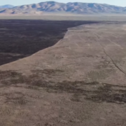
With the use of remote sensing and spatial analysis, WGSC scientists study dryland vegetation and soils to determine disturbances and help manage recovery.
Learn moreProjects and teams at WGSC
Just a few examples of WGSC projects and science teams.
Global Food Security-Support Analysis Data at 30 m (GFSAD30)
Hazards Societal Consequences and Risk Communication
Land-Use and Climate Change Team (LUCC)
Applied Landscape Ecology and Remote Sensing
Patterns in the Landscape – Analyses of Cause and Effect (PLACE)
News
Media Advisory: A Jaguar’s Field of Dreams – Live Online Public Lecture
The U.S. Geological Survey public lecture series is back and virtual. News reporters are invited to attend to learn how USGS scientists are helping protect one of the only jaguars that lives in the U.S.
New Geo-Narrative explores California’s exposure to volcanic hazards
The first step in mitigating volcanic risk and building community resilience to volcanic hazards is identifying what and who is in harm’s way.
Anne Wein Wins Prestigious 2019 Bay Area Metro Award
Congratulations to Dr. Anne Wein, Operations Research Analyst at WGSC, who received a 2019 Bay Area Metro Award from the Association of Bay Area Governments and the Metropolitan Transportation Commission for her work as lead researcher for the HayWired earthquake scenario.
Publications
Remote sensing analysis to quantify change in woodland canopy cover on the San Carlos Apache Reservation, Arizona (1935 vs. 2017)
Since the late 1800s, pinyon–juniper woodland across the western U.S. has increased in density and areal extent and encroached into former grassland areas. The San Carlos Apache Tribe wants to gain qualitative and quantitative information on the historical conditions of their tribal woodlands to use as a baseline for restoration efforts. At the...
Middleton, Barry R.; Norman, Laura M.Estimating blue carbon sequestration under coastal management scenarios
Restoring and protecting “blue carbon” ecosystems - mangrove forests, tidal marshes, and seagrass meadows - are actions considered for increasing global carbon sequestration. To improve understanding of which management actions produce the greatest gains in sequestration, we used a spatially explicit model to compare...
Moritsch, Monica Mei Jeen; Young, Mary Alida; Carnell, Paul; Macreadie, Peter I; Lovelock, Catherine E.; Nicholson, Emily; Raimondi, Peter T.; Wedding, Lisa M.; Ierodiaconou, DanielSediment mobility and river corridor assessment for a 140-kilometer segment of the main-stem Klamath River below Iron Gate Dam, California
This river corridor assessment documents sediment mobility and river response to flood disturbance along a 140-kilometer segment of the main-stem Klamath River below Iron Gate Dam, California. Field and remote sensing methods were used to assess fundamental indicators of active sediment transport and river response to a combination of natural...
Curtis, Jennifer; Poitras, Travis; Bond, Sandra; Byrd, Kristin