
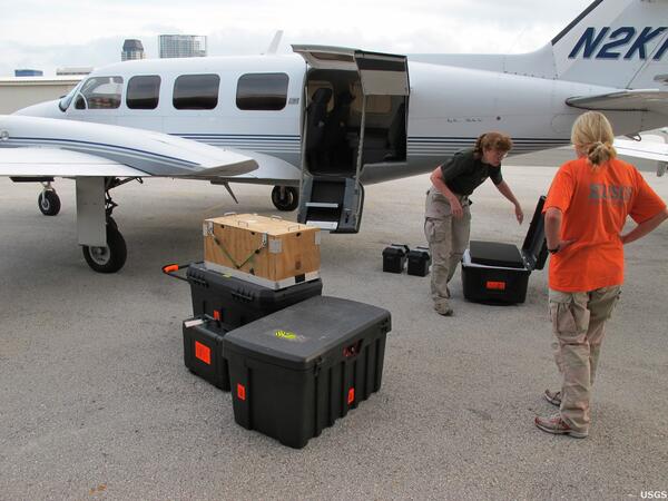
USGS geologists Karen Morgan and Ginger Tiling-Range load imaging gear for a pre-oil reconnaissance flight. USGS captured more than 350 miles of Florida's coastline, from Cedar Key to Flamingo, with over 9,800 aerial photographs. The photographs document conditions along Florida's coastline in advance of the arrival of oil from the Deepwater Horizon incident.
Images
Images
Filter Total Items: 9448
Pre-Oil Reconnaissance Flight
USGS geologists Karen Morgan and Ginger Tiling-Range load imaging gear for a pre-oil reconnaissance flight. USGS captured more than 350 miles of Florida's coastline, from Cedar Key to Flamingo, with over 9,800 aerial photographs. The photographs document conditions along Florida's coastline in advance of the arrival of oil from the Deepwater Horizon incident.

Microcystis aeruginosa Bloom
Microcystis is one of the most common bloom-forming cyanobacteria, AKA, blue-green algae. Many strains of this species produce a family of potent liver toxins, the microcystins.
Microcystis is one of the most common bloom-forming cyanobacteria, AKA, blue-green algae. Many strains of this species produce a family of potent liver toxins, the microcystins.

Pembina River
The Pembina River at Neche, ND with the streamgage house to the left top hiding in some trees.
The Pembina River at Neche, ND with the streamgage house to the left top hiding in some trees.

Pembina River
The Pembina River at Neche, North Dakota.
The Pembina River at Neche, North Dakota.

Where Two Rivers Meet
This photo of the confluence of the St. Croix River and the Mississippi River highlights the distinct contrast between water quality of the two rivers. Photo was taken during a flight searching for radio-tagged birds.
This photo of the confluence of the St. Croix River and the Mississippi River highlights the distinct contrast between water quality of the two rivers. Photo was taken during a flight searching for radio-tagged birds.

Active Lava Flow near Hawai'i Volcanoes National Park
Active Lava Flow near Hawai'i Volcanoes National ParkAreas of flowing lava show up as bright spots in this image of the active lava flow that extends south from the east rift to the ocean, near the eastern boundary of Hawai'i Volcanoes National Park. The image is a composite of a regular photo and a new ARRA-funded thermal infrared camera that will be used by USGS scientists to map lava-flow activity.

Volcano webcam
A new Webcam now sits on the north rim of Pu`u `Ō `ō. A new panorama of the crater, with a different view, will be back online soon.
A new Webcam now sits on the north rim of Pu`u `Ō `ō. A new panorama of the crater, with a different view, will be back online soon.

Yuha Fault Fractures
Fault scarp (above change in slope) with fractures (white arrows) along Yuha Fault; view to the northwest. Yellow notebook (in center) for scale.
Fault scarp (above change in slope) with fractures (white arrows) along Yuha Fault; view to the northwest. Yellow notebook (in center) for scale.

Carol Simons Collecting Water Samples at Sand Harbor, Lake Tahoe
Carol Simons Collecting Water Samples at Sand Harbor, Lake TahoeCarol Simons, from the Carnelian Bay Field Office of the California Water Science Center, collecting recreational water QW point-sampling for fecal indicator Bacteria at Sand Harbor in Lake Tahoe.

Carol Simons Collecting Water Samples at Zephyr Cove, Lake Tahoe
Carol Simons Collecting Water Samples at Zephyr Cove, Lake TahoeCarol Simons, from the Carnelian Bay Field Office of the California Water Science Center, collecting recreational water QW point-sampling for fecal indicator Bacteria at Zephyr Cove in Lake Tahoe.

Carol Simons Collecting Water Samples at Sand Harbor, Lake Tahoe
Carol Simons Collecting Water Samples at Sand Harbor, Lake TahoeCarol Simons, from the Carnelian Bay Field Office of the California Water Science Center, collecting recreational water QW point-sampling for fecal indicator Bacteria at Sand Harbor in Lake Tahoe.

View of the Sampling Site for Collecting Water Samples at Sand Harbor, Lake Tahoe
View of the Sampling Site for Collecting Water Samples at Sand Harbor, Lake TahoeView of the sampling site for collecting recreational water QW point-sampling for fecal indicator Bacteria at Zephyr Cove in Lake Tahoe.
View of the Sampling Site for Collecting Water Samples at Sand Harbor, Lake Tahoe
View of the Sampling Site for Collecting Water Samples at Sand Harbor, Lake TahoeView of the sampling site for collecting recreational water QW point-sampling for fecal indicator Bacteria at Zephyr Cove in Lake Tahoe.

Carol Simons Collecting Water Samples at Sand Harbor, Lake Tahoe
Carol Simons Collecting Water Samples at Sand Harbor, Lake TahoeCarol Simons, from the Carnelian Bay Field Office of the California Water Science Center, collecting recreational water QW point-sampling for fecal indicator Bacteria at Sand Harbor in Lake Tahoe.
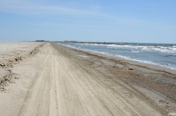
Shoreline Collection
USGS crews collected samples of the seabed in the nearshore zone of Louisiana and other Gulf Coast states to capture a pre-oil sample of organisms living in the benthic environment.
USGS crews collected samples of the seabed in the nearshore zone of Louisiana and other Gulf Coast states to capture a pre-oil sample of organisms living in the benthic environment.
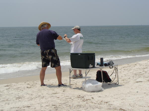
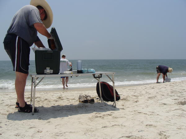
Gulf Shores Sampling
On April 20, 2010, the Deepwater Horizon Drilling Platform exploded and sank, causing an enormous oil spill in the Gulf of Mexico. U.S. Geological Survey field offices responded immediately by organizing teams to take pre-spill sediment and water samples in order to establish a baseline survey.
On April 20, 2010, the Deepwater Horizon Drilling Platform exploded and sank, causing an enormous oil spill in the Gulf of Mexico. U.S. Geological Survey field offices responded immediately by organizing teams to take pre-spill sediment and water samples in order to establish a baseline survey.
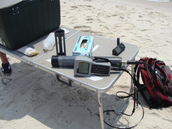
Water Sampling Equipment
On April 20, 2010, the Deepwater Horizon Drilling Platform exploded and sank, causing an enormous oil spill in the Gulf of Mexico. U.S. Geological Survey field offices responded immediately by organizing teams to take pre-spill sediment and water samples in order to establish a baseline survey.
On April 20, 2010, the Deepwater Horizon Drilling Platform exploded and sank, causing an enormous oil spill in the Gulf of Mexico. U.S. Geological Survey field offices responded immediately by organizing teams to take pre-spill sediment and water samples in order to establish a baseline survey.
Gulf Shores Sampling
On April 20, 2010, the Deepwater Horizon Drilling Platform exploded and sank, causing an enormous oil spill in the Gulf of Mexico. U.S. Geological Survey field offices responded immediately by organizing teams to take pre-spill sediment and water samples in order to establish a baseline survey.
On April 20, 2010, the Deepwater Horizon Drilling Platform exploded and sank, causing an enormous oil spill in the Gulf of Mexico. U.S. Geological Survey field offices responded immediately by organizing teams to take pre-spill sediment and water samples in order to establish a baseline survey.