
A piece of multi-year Arctic sea ice surfacing on its side. You can tell it is older ice as the color is a bright blue underneath. There is also a dusting of snow on the top.
Images
Images
Filter Total Items: 9448

Arctic Sea Ice
A piece of multi-year Arctic sea ice surfacing on its side. You can tell it is older ice as the color is a bright blue underneath. There is also a dusting of snow on the top.
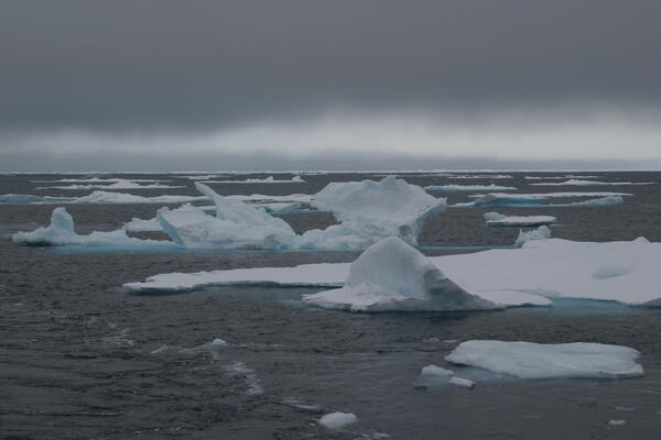
Arctic Sea Ice
Image of Arctic sea ice.
Arctic Sea Ice
Image of Arctic sea ice.
Arctic Sea Ice
Image of Arctic sea ice.
Arctic Sea Ice
Image of Arctic sea ice.

Sunset Over Arctic Ocean
Sunset over sea ice along the Arctic Ocean.
Sunset over sea ice along the Arctic Ocean.

U.S. and Canadian Ships in Arctic Ocean
Helicopter view of Canadian Coast Guard Ship Louis S. St. Laurent (top) and U.S. Coast Guard Cutter Healy (bottom) on the Arctic Ocean. The ships are coming together because the crews are planning to meet and learn the operations of the other ship. This was during a scientific expedition to map the Arctic seafloor.
Helicopter view of Canadian Coast Guard Ship Louis S. St. Laurent (top) and U.S. Coast Guard Cutter Healy (bottom) on the Arctic Ocean. The ships are coming together because the crews are planning to meet and learn the operations of the other ship. This was during a scientific expedition to map the Arctic seafloor.

Reviewing Seismic Data from Arctic Ocean
Canadian Geological Survey scientist Ruth Jackson, also chief scientist for Canadian Coast Guard Ship Louis S. St. Laurent, and USGS scientist Deborah Hutchinson review collected seismic data.
This was during a scientific expedition to map the Arctic seafloor.
Canadian Geological Survey scientist Ruth Jackson, also chief scientist for Canadian Coast Guard Ship Louis S. St. Laurent, and USGS scientist Deborah Hutchinson review collected seismic data.
This was during a scientific expedition to map the Arctic seafloor.

XBT Launch: Measuring Sound Speed
A U.S. Coast Guard member is preparing to launch an Expendable Bathythermograph (XBT) to help calculate the speed of sound in the ocean. The launcher sends a probe into the water to measure depth and temperature variation below the ship. There is a copper wire attached to both the launcher and the probe.
A U.S. Coast Guard member is preparing to launch an Expendable Bathythermograph (XBT) to help calculate the speed of sound in the ocean. The launcher sends a probe into the water to measure depth and temperature variation below the ship. There is a copper wire attached to both the launcher and the probe.

Moving from Ship to Arctic Sea Ice
Two U.S. Coast Guard members are being transported by crane from U.S. Coast Guard Cutter Healy onto a piece of multi-year Arctic sea ice. This was during a scientific expedition to map the Arctic seafloor. The expedition was a joint effort using two ships, the Healy and the Canadian Coast Guard Ship Louis S. St. Laurent.
Two U.S. Coast Guard members are being transported by crane from U.S. Coast Guard Cutter Healy onto a piece of multi-year Arctic sea ice. This was during a scientific expedition to map the Arctic seafloor. The expedition was a joint effort using two ships, the Healy and the Canadian Coast Guard Ship Louis S. St. Laurent.

Surveying Arctic Sea Ice
Two U.S. Coast Guard members are being transported by crane from U.S. Coast Guard Cutter Healy onto a piece of multi-year ice. This was during a scientific expedition to map the Arctic seafloor. The expedition was a joint effort using two ships, Healy and the Canadian Coast Guard Ship Louis S. St. Laurent.
Two U.S. Coast Guard members are being transported by crane from U.S. Coast Guard Cutter Healy onto a piece of multi-year ice. This was during a scientific expedition to map the Arctic seafloor. The expedition was a joint effort using two ships, Healy and the Canadian Coast Guard Ship Louis S. St. Laurent.

Discussing Seismic Data
USGS scientists Debbie Hutchinson and Jonathan Childs discuss collected seismic data. This image was taken on U.S. Coast Guard Cutter Healy and was during a scientific expedition to map the Arctic seafloor.
USGS scientists Debbie Hutchinson and Jonathan Childs discuss collected seismic data. This image was taken on U.S. Coast Guard Cutter Healy and was during a scientific expedition to map the Arctic seafloor.

Healy Crew Members in the Arctic
The entire science group and U.S. Coast Guard Cutter Healy crew during a 2008 scientific expedition to map the Arctic seafloor.
The entire science group and U.S. Coast Guard Cutter Healy crew during a 2008 scientific expedition to map the Arctic seafloor.

U.S. and Canadian Ships in Arctic Ocean
Helicopter view of Canadian Coast Guard Ship Louis S. St. Laurent (left) and U.S. Coast Guard Cutter Healy (right) on the Arctic Ocean. The ships are coming together because the crews are planning to meet and learn the operations of the other ship. This was during a scientific expedition to map the Arctic seafloor.
Helicopter view of Canadian Coast Guard Ship Louis S. St. Laurent (left) and U.S. Coast Guard Cutter Healy (right) on the Arctic Ocean. The ships are coming together because the crews are planning to meet and learn the operations of the other ship. This was during a scientific expedition to map the Arctic seafloor.

Canadian Helicopter on U.S. Coast Guard Cutter Healy
Canadian Helicopter on U.S. Coast Guard Cutter HealyA Canadian helicopter on U.S. Coast Guard Cutter Healy after flying from the Canadian Coast Guard ship Louis S. St. Laurent in the Arctic Ocean.
Canadian Helicopter on U.S. Coast Guard Cutter Healy
Canadian Helicopter on U.S. Coast Guard Cutter HealyA Canadian helicopter on U.S. Coast Guard Cutter Healy after flying from the Canadian Coast Guard ship Louis S. St. Laurent in the Arctic Ocean.
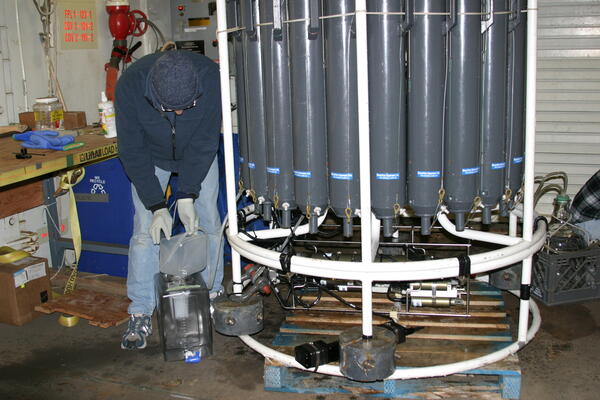
Water Samples from Conductivity Temperature Depth Profiler (CTD)
Water Samples from Conductivity Temperature Depth Profiler (CTD)Robert Sanders, with Temple University, is collecting water samples from the CTD. Both Robert and Rebecca Gast, with Woods Hole Oceanographic Institution, were using the samples to study microorganisms in the Arctic Ocean.

Polar Bears along Arctic Sea Ice
Polar bears along sea ice in the Arctic Ocean.
Polar bears along sea ice in the Arctic Ocean.

Polar Bear along Arctic Sea Ice
Polar bear along sea ice in the Arctic Ocean.
Polar bear along sea ice in the Arctic Ocean.

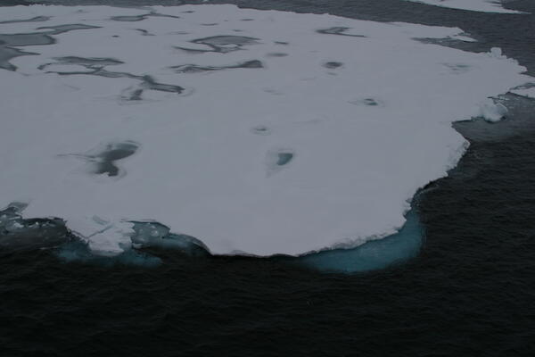
Arctic Sea Ice
Image of sea ice along the Arctic Ocean.
Image of sea ice along the Arctic Ocean.

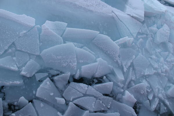
Arctic Sea Ice
Image of sea ice along the Arctic Ocean.
Image of sea ice along the Arctic Ocean.

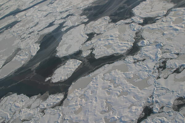
Arctic Sea Ice
Image of Arctic sea ice.