
Massachusetts inner continental shelf bottom photograph showing seafloor life.
Images
Images
Filter Total Items: 9454

Massachusetts inner continental shelf
Massachusetts inner continental shelf bottom photograph showing seafloor life.

Reflections in Rainey Lake
Baldcypress forest along the banks of Rainey Lake, remnant of a dwindling habitat that is being studied by scientists at the NWRC.
Baldcypress forest along the banks of Rainey Lake, remnant of a dwindling habitat that is being studied by scientists at the NWRC.

Alder Creek
The USGS had a antenna sight set up at Alder Creek to monitor fish movements through this dead forest killed by the eruption of Mt. Saint Helens
The USGS had a antenna sight set up at Alder Creek to monitor fish movements through this dead forest killed by the eruption of Mt. Saint Helens

Foggy Morning on the Sacramento River
This picture was taken at our juvenile Chinook tagging shed (old town Sacramento) looking upstream at our release location for our study.
This picture was taken at our juvenile Chinook tagging shed (old town Sacramento) looking upstream at our release location for our study.

American Alligator Close Up
An American Alligator in Everglades National Park. The species was once listed as Endangered, but was removed in 1987 after a successful recovery.
An American Alligator in Everglades National Park. The species was once listed as Endangered, but was removed in 1987 after a successful recovery.

American Crocodile
American crocodiles are restricted in their range within the USA to southern Florida. Decisions on restoration of the Everglades must incorporate protection for this threatened species.
American crocodiles are restricted in their range within the USA to southern Florida. Decisions on restoration of the Everglades must incorporate protection for this threatened species.

Back into the River
After tagging this fish, it was released back into the river.
After tagging this fish, it was released back into the river.

Tagging Fish on a Snowy Afternoon
Setting up a tagging location on a cold & snowy afternoon.
Setting up a tagging location on a cold & snowy afternoon.

Plankton Tow Analysis in Puget Sound
Collecting samples (sediment, aquatic vegetation, benthic invertebrates, zooplankton, forage fish, and predatory fish) to evaluate δ 15N ratios in the food web within Liberty Bay to evaluate urbanization effects on the nearshore ecosystem. (Coastal Habitats in Puget Sound program).
Collecting samples (sediment, aquatic vegetation, benthic invertebrates, zooplankton, forage fish, and predatory fish) to evaluate δ 15N ratios in the food web within Liberty Bay to evaluate urbanization effects on the nearshore ecosystem. (Coastal Habitats in Puget Sound program).

Plankton Tow Analysis in Puget Sound
Collecting sediment to look for evidence of forage fish (sand lance and/or surf smelt) spawning (eggs) in Liberty Bay - Puget Sound.
Collecting sediment to look for evidence of forage fish (sand lance and/or surf smelt) spawning (eggs) in Liberty Bay - Puget Sound.

Old Dug Well with Granite Top
Old dug well with granite top in front yard of home; currently uses drilled well.
Old dug well with granite top in front yard of home; currently uses drilled well.

Cascade Volcanoes
The volcanoes from closest to farthest are Mt. Washington, Three Fingered Jack, Mt. Jefferson. This picture is taken from Middle Sister looking north in the Cascade Range, Three Sisters Wilderness Area, Deschutes National Forest, Oregon.
The volcanoes from closest to farthest are Mt. Washington, Three Fingered Jack, Mt. Jefferson. This picture is taken from Middle Sister looking north in the Cascade Range, Three Sisters Wilderness Area, Deschutes National Forest, Oregon.

Canoe Landing
Coast Salish Canoe Journey 2009 landing in Pillar Point.
The journey pulled a water quality probe to measure salinity, temperature, pH, and dissolved oxygen.
Coast Salish Canoe Journey 2009 landing in Pillar Point.
The journey pulled a water quality probe to measure salinity, temperature, pH, and dissolved oxygen.

Florida Everglades
Alligator in Everglades Park, Florida.
Alligator in Everglades Park, Florida.

Frog in the Woods
Frog in the woods in Shenandoah National Park, Virginia.
Frog in the woods in Shenandoah National Park, Virginia.
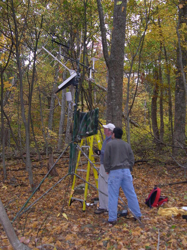
Shenandoah National Park Field Work
John Jones and Jesse Osborne working on a weather station in Shenandoah National Park, Virginia.
John Jones and Jesse Osborne working on a weather station in Shenandoah National Park, Virginia.

Prairie Wetland
A prairie wetland at Ordway Prairie near Aberdeen, South Dakota.
A prairie wetland at Ordway Prairie near Aberdeen, South Dakota.

Hatched Northern Pike Fry
USGS microbiologist Maren Tuttle counts hatched northern pike fry.
USGS microbiologist Maren Tuttle counts hatched northern pike fry.

Stream
Stream in Shenandoah National Park, Virginia.
Stream in Shenandoah National Park, Virginia.
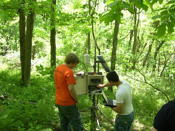
Working on Weather Station
Jesse Osborne and Christian Bongard working on a weatherstation in Shenandoah National Park, Virginia.
Jesse Osborne and Christian Bongard working on a weatherstation in Shenandoah National Park, Virginia.
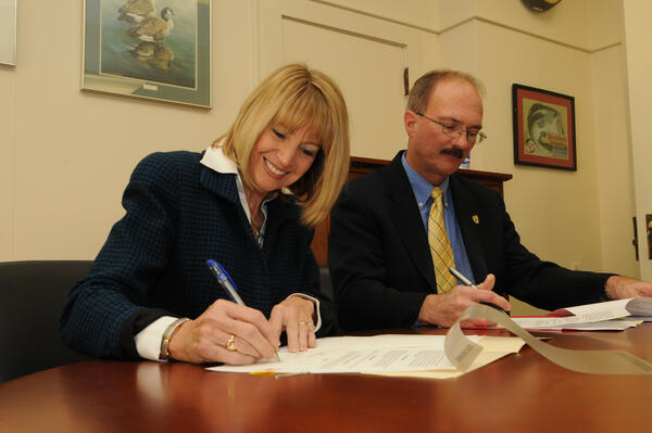
USGS Director Marcia McNutt and FWS Service Director Sam Hamilton sign a strategic habitat conservation MOU
USGS Director Marcia McNutt and FWS Service Director Sam Hamilton sign a strategic habitat conservation MOUIn the face of global climate change and other 21st-century resource threats, the U.S. Fish and Wildlife Service and the U.S. Geological Survey are taking steps to strengthen and expand their science-management relationship to conserve fish, wildlife, plants and their habitats.