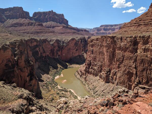
U.S. flag

An official website of the United States government

Images

Images intro.
Filter Total Items: 27
Photograph showing red-brown buttes of sedimentary rocks incised by the sediment-rich brown water of the Colorado River.
Grand_Canyon_20230908_Brennan.jpg
A combination of blues, green, and purples the Purple Gallinule displays a flamboynat array 0f feathers. This small wading bird balances itself on lilypads as it tries to navigate through the Wet Prairie ecosystem.
Purple Gallinule on Spatterdock

The long legs of a Purple Gallinule allow it to walk on top of floating lily pads as it navigates it way through a wetland. Photo courtesy of Aria Tan.

The long legs of a Purple Gallinule allow it to walk on top of floating lily pads as it navigates it way through a wetland. Photo courtesy of Aria Tan.

A flooded trail near Weston Lake. The sign that says "Weston Lake Loop, Oakridge Trail, Kingsnake Trail" can be seen.
Trail near Weston Lake, Congaree National Park

A trail near Weston Lake that was covered in water, 2021.

Credit: Carrie McIntosh

NPS map of Rocky Mountain National Park
RMNP Map.jpg
RMNP Map.jpg
RMNP Map.jpg

This is a map of Rocky Mountain National Park, produced by the Park Service and showing the boundaries and facilities, including roads, in the park.

This is a map of Rocky Mountain National Park, produced by the Park Service and showing the boundaries and facilities, including roads, in the park.

A white glacier curves through snow covered mountains towards the blue water of water below.
Margerie Glacier, Glacier National Park and Preserve

An aerial view of Margerie Glacier. Glaciers are important for many species found in Glacier Bay National Park and Preserve. NPS.

Sandstone Cliffs, Pictured Rocks National Park
From Pictured Rocks NP, Michigan

Photo of orange/red sandstone cliffs at Pictured Rocks National Park

Day 2 Rusty Sherman holding USGS flag on raft
USGS flag
USGS flag
USGS flag

Day 2 Rusty Sherman holding USGS flag on raft

Day 2 Rusty Sherman holding USGS flag on raft

Day 2 Janis LeMaster with USGS pfd
USGS PFD
USGS PFD
USGS PFD

Day 2 Janis LeMaster with USGS pfd

Day 2 Jans LeMaster sampling water quality B
Water science
Water science
Water science

Day 2 Jans LeMaster sampling water quality B

Mammoth Cave Accessible Tour. Some of the cave is accessible to wheelchairs.
Mammoth Cave Accessible Tour. Some of the cave is accessible to wheelc
Rocky Mountain National Park, early fall

Photo of Rocky Mountain National Park - fall trees in the foreground, mountains in the background.

Tufa forming at Hot Springs National Park
Spring in Hot Springs National Park

A spring in Hot Springs National Park, Arkansas. The gray rock is tufa - a sedimentary rock that precipitates out of mineral-rich springs. 

A spring in Hot Springs National Park, Arkansas. The gray rock is tufa - a sedimentary rock that precipitates out of mineral-rich springs. 

View of Crater Lake in Winter
A photo of Crater lake in winter, snow blanketing the banks.


Cliffs along north rim of the caldera rise about 1,000 feet above the lake surface (elevation 6,173 feet). Wizard Island is visible from this vantagepoint. The deep blue color of the lake is a reflection of the clear sky above and the great depth of the water (not from any mineral content in the water!).


Cliffs along north rim of the caldera rise about 1,000 feet above the lake surface (elevation 6,173 feet). Wizard Island is visible from this vantagepoint. The deep blue color of the lake is a reflection of the clear sky above and the great depth of the water (not from any mineral content in the water!).

Saguaro cacti on rocky slope in the Sonoran Desert, AZ
Saguaro cacti on a rocky slope in the Sonoran Desert, AZ

Steep, rocky slopes in Saguaro National Park near Tucson, AZ provide habitat for saguaros and may buffer populations from the negative effects of drought. Photo courtesy of Daniel Winkler, USGS SBSC.

Steep, rocky slopes in Saguaro National Park near Tucson, AZ provide habitat for saguaros and may buffer populations from the negative effects of drought. Photo courtesy of Daniel Winkler, USGS SBSC.

Map of Indiana Dunes National Park along Lake Michigan
Map of Indiana Dunes National Park

Indiana Dunes National Park is the country's 61st National Park. Based in northwestern Indiana, the National Park lines Lake Michigan and offers more than 15,000 acres for visitors to enjoy and explore.

Indiana Dunes National Park is the country's 61st National Park. Based in northwestern Indiana, the National Park lines Lake Michigan and offers more than 15,000 acres for visitors to enjoy and explore.

Map of Pictured Rocks National Lakeshore along Lake Superior
Map of Pictured Rocks National Lakeshore
Was this page helpful?