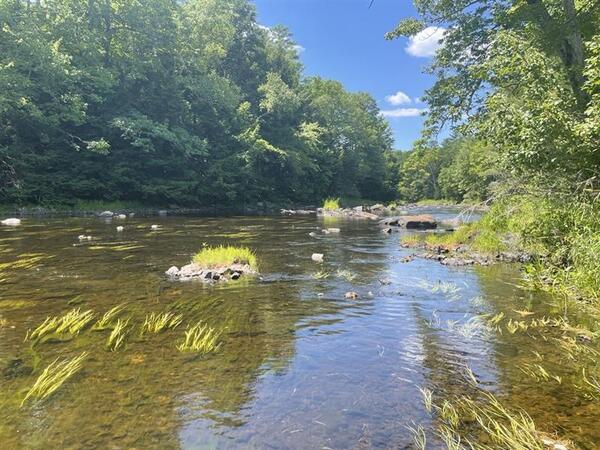
A view looking across the Connecticut River from a USGS streamgage in Suffield, Connecticut.

Official websites use .gov
A .gov website belongs to an official government organization in the United States.
Secure .gov websites use HTTPS
A lock () or https:// means you’ve safely connected to the .gov website. Share sensitive information only on official, secure websites.
Click through our gallery of photographs showcasing New England Water Science Center research projects and monitoring work throughout the region.
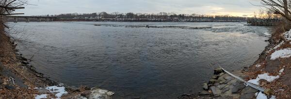
A view looking across the Connecticut River from a USGS streamgage in Suffield, Connecticut.
A view looking across the Connecticut River from a USGS streamgage in Suffield, Connecticut.
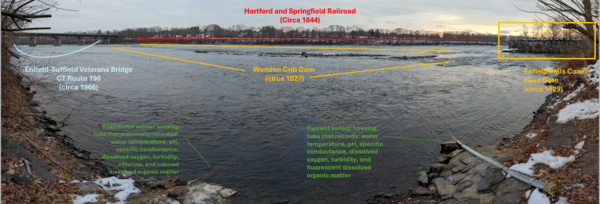
A view looking across the Connecticut River from a USGS streamgage in Suffield, Connecticut.
A view looking across the Connecticut River from a USGS streamgage in Suffield, Connecticut.
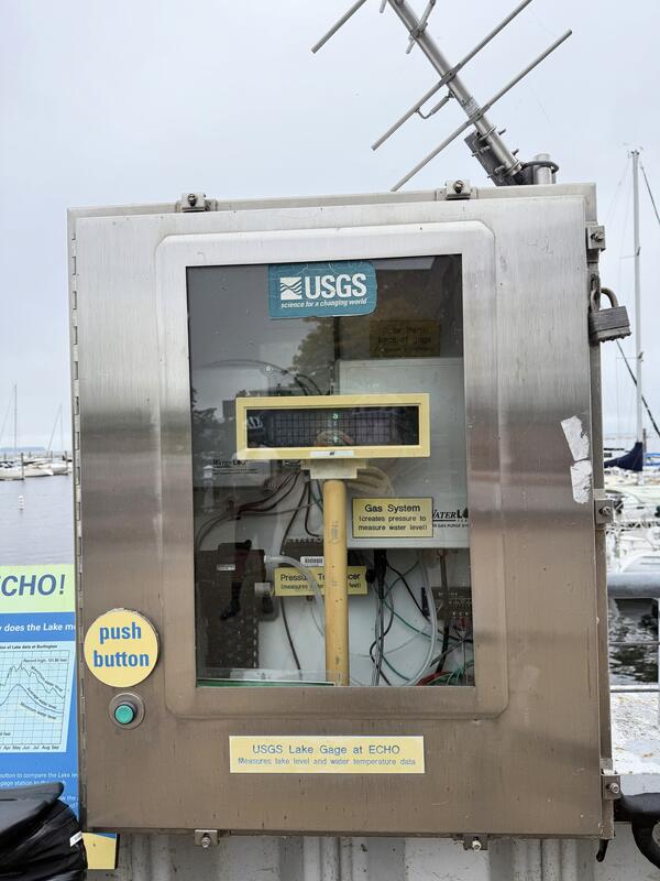
The USGS New England Water Science Center operates a streamgage on Lake Champlain in Burlington, Vermont.
The USGS New England Water Science Center operates a streamgage on Lake Champlain in Burlington, Vermont.
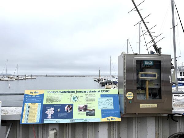
The USGS streamgage on Lake Champlain in Burlington, Vermont, is near the ECHO Leahy Center, Vermont’s Science and Nature Museum.
The USGS streamgage on Lake Champlain in Burlington, Vermont, is near the ECHO Leahy Center, Vermont’s Science and Nature Museum.
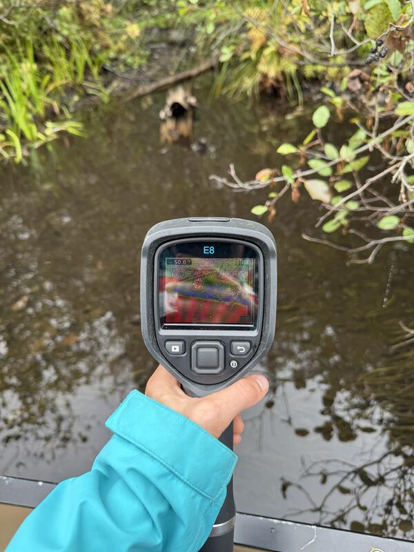
Cold groundwater seep identified using a handheld thermal infrared camera (FLIR E8) on the upper Namekagon River near Cable, Wisconsin. The groundwater discharge area was about 7-8 degrees cooler than the main channel of the Namekagon.
Cold groundwater seep identified using a handheld thermal infrared camera (FLIR E8) on the upper Namekagon River near Cable, Wisconsin. The groundwater discharge area was about 7-8 degrees cooler than the main channel of the Namekagon.
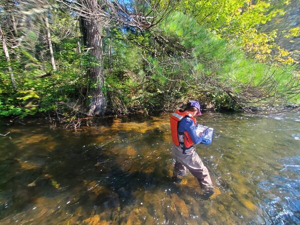
USGS New England Water Science Center physical scientist Shannon Fisher documenting the location of a groundwater seep under a pine tree on the Namekagon River near Cable, Wisconsin.
USGS New England Water Science Center physical scientist Shannon Fisher documenting the location of a groundwater seep under a pine tree on the Namekagon River near Cable, Wisconsin.
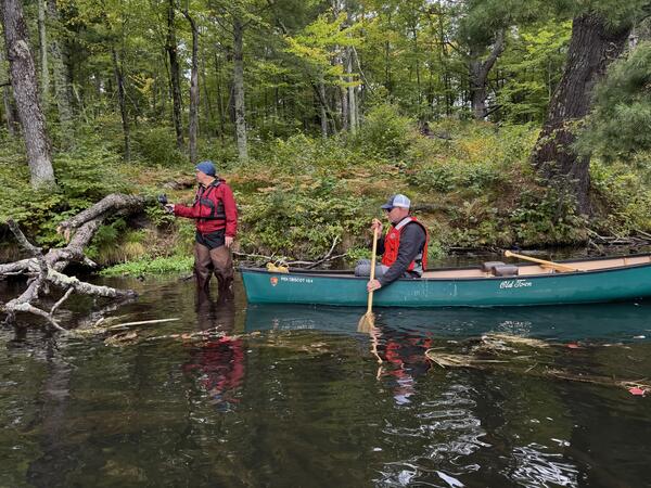
National Park Service Great Lakes Inventory and Monitoring Network (GLKM) biologist Ted Gostomski uses a handheld thermal infrared sensor to identify cold groundwater seeps in the upper Namekagon River near Cable, Wisconsin. Al Kirschbaum, a remote sensing specialist with the NPS-GLKM, documents Gostomski's findings from the canoe.
National Park Service Great Lakes Inventory and Monitoring Network (GLKM) biologist Ted Gostomski uses a handheld thermal infrared sensor to identify cold groundwater seeps in the upper Namekagon River near Cable, Wisconsin. Al Kirschbaum, a remote sensing specialist with the NPS-GLKM, documents Gostomski's findings from the canoe.
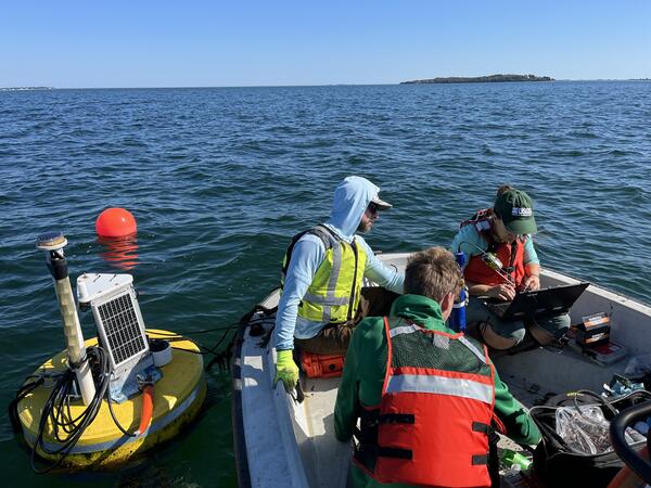
USGS hydrologic technicians Nathan Roy (front), Brandan Crowley (left), and Kaitlin Laabs (right) clean the continuous water quality equipment that was deployed on a buoy Kingston Bay. The data collection is part of a larger water quality collection project involving several Massachusetts bays.
USGS hydrologic technicians Nathan Roy (front), Brandan Crowley (left), and Kaitlin Laabs (right) clean the continuous water quality equipment that was deployed on a buoy Kingston Bay. The data collection is part of a larger water quality collection project involving several Massachusetts bays.
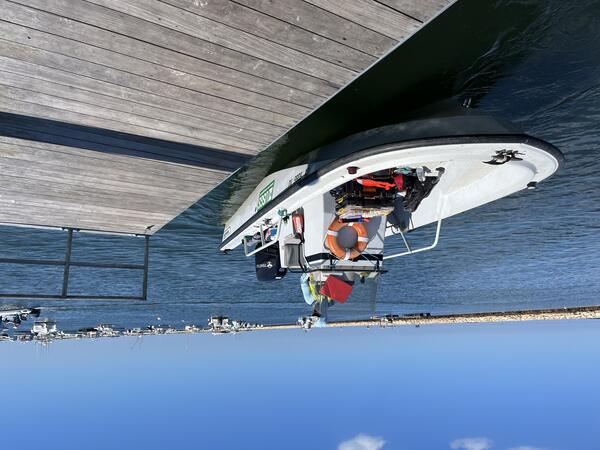
USGS hydrologic technician Brendan Crowley docks a boat in Kinston Bay after checking on continuous water quality monitoring equipment deployed in the area.
USGS hydrologic technician Brendan Crowley docks a boat in Kinston Bay after checking on continuous water quality monitoring equipment deployed in the area.
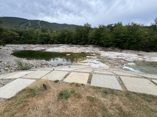
A view of the East Branch Pemigewasset River during a drought in the summer of 2025 near USGS monitoring station 01074520 near Lincoln, New Hampshire. Loon Mountain can be seen in the background.
A view of the East Branch Pemigewasset River during a drought in the summer of 2025 near USGS monitoring station 01074520 near Lincoln, New Hampshire. Loon Mountain can be seen in the background.
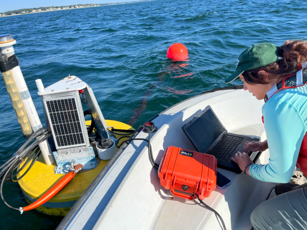
Hydrologic technician Kate Laabs downloads water quality data from a buoy in Kingston Bay near South Duxbury, Massachusetts. The water-quality monitoring is a part of a larger project.
Hydrologic technician Kate Laabs downloads water quality data from a buoy in Kingston Bay near South Duxbury, Massachusetts. The water-quality monitoring is a part of a larger project.

A view of the Lemon Fair River at USGS monitoring station 04282538 near Shoreham, Vermont, during a drought in the summer of 2025.
A view of the Lemon Fair River at USGS monitoring station 04282538 near Shoreham, Vermont, during a drought in the summer of 2025.
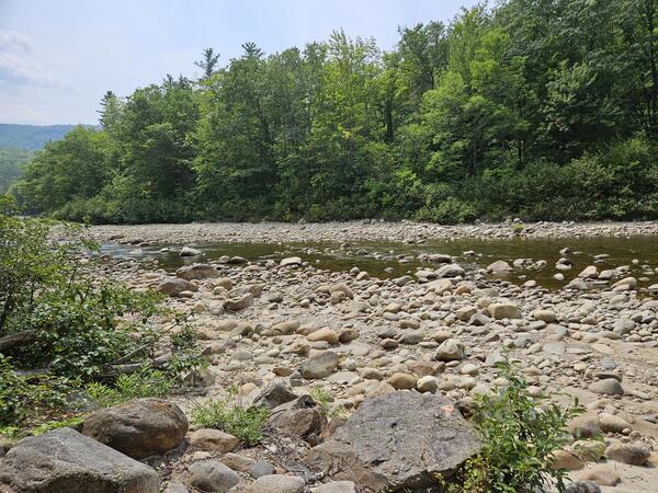
A view of low flows and exposed rocks in Otter Creek at Center Rutland, Vermont, near monitoring station 04282000. This photo was taken during a drought in the summer of 2025.
A view of low flows and exposed rocks in Otter Creek at Center Rutland, Vermont, near monitoring station 04282000. This photo was taken during a drought in the summer of 2025.
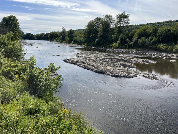
A view of the Missisquoi River from the perspective of streamgage 04293500 in East Berkshire, Vermont, in August 2025 during a period of drought.
A view of the Missisquoi River from the perspective of streamgage 04293500 in East Berkshire, Vermont, in August 2025 during a period of drought.

A view of Austin Stream in Binghamton, Maine, during a period of moderate drought in the summer of 2025.
A view of Austin Stream in Binghamton, Maine, during a period of moderate drought in the summer of 2025.

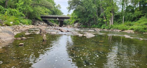
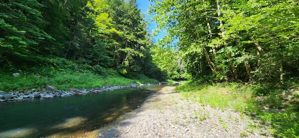
A view of the Ellis River in South Andover, Maine, near streamgage 01054300.
A view of the Ellis River in South Andover, Maine, near streamgage 01054300.
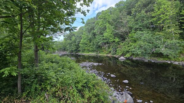
A view of the Poultney River near the USGS monitoring station 04280000 near Fair Haven, Vermont, during a drought event in summer 2025.
A view of the Poultney River near the USGS monitoring station 04280000 near Fair Haven, Vermont, during a drought event in summer 2025.
Wild River at Gilead, Maine, experienced low water levels during a drought event in the summer of 2025.
Wild River at Gilead, Maine, experienced low water levels during a drought event in the summer of 2025.
Nezinscot River at Turner Center, Maine, experienced low water levels during a drought event in the summer of 2025.
Nezinscot River at Turner Center, Maine, experienced low water levels during a drought event in the summer of 2025.
A view of the Sheepscot River in Maine taken by USGS hydrologic technicians while surveying the channel for the purpose of updating floodplain maps.
A view of the Sheepscot River in Maine taken by USGS hydrologic technicians while surveying the channel for the purpose of updating floodplain maps.

A view of the Sheepscot River in Maine taken by USGS hydrologic technicians while surveying the river. The surveyed cross-section data is used to update flood insurance rate maps for FEMA.
A view of the Sheepscot River in Maine taken by USGS hydrologic technicians while surveying the river. The surveyed cross-section data is used to update flood insurance rate maps for FEMA.