
Welcome to the Washington Water Science Center
Washington Water Science Center
The USGS Washington Water Science Center provides water resource information. You’ll find information about Washington’s rivers and streams, as well as groundwater, water quality, and cutting-edge water research. We welcome you to explore our data and scientific research.
Current Washington Water Conditions
Current Washington Water Conditions

Explore real-time Washington streamflow, groundwater, and water-quality conditions and access data with our new interactive map application.
View current water conditions
View current water conditions
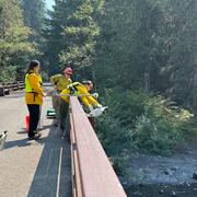
Uncrewed Aviation Systems Program
Uncrewed Aviation Systems Program

Data collection provided by uncrewed aviation systems (UAS) enhances the Washington Water Science Center’s (WAWSC) ability to monitor dynamic environmental systems, respond to natural hazards, analyze the impacts of climate change, and assess landscape change.
News
Sediment contaminants in Puget Sound: Implications for ecosystem health and remediation
Sediment contaminants in Puget Sound: Implications for ecosystem health and remediation
Washington Waters Newsletter - Spring 2025
Washington Waters Newsletter - Spring 2025
New data products now available in StreamStats
New data products now available in StreamStats
Publications
Urban heterogeneity drives dissolved organic matter sources, transport, and transformation from local to macro scales Urban heterogeneity drives dissolved organic matter sources, transport, and transformation from local to macro scales
Urbanization reshapes dissolved organic matter (DOM) sources, transport, and transformations through changes in vegetation, hydrology, and management of waste and water. Yet the impacts of urbanization on DOM are variable within and among cities. Predicting heterogeneous responses to urbanization is challenged by diverse human activities and underlying biophysical variation along stream...
Refining PAH and PCB bioavailability predictions in industrial sediments using source-fingerprinting, particle size, and bulk carbon, Puget Sound, Washington Refining PAH and PCB bioavailability predictions in industrial sediments using source-fingerprinting, particle size, and bulk carbon, Puget Sound, Washington
Nearshore marine sediments in a Puget Sound, Washington industrial embayment had elevated levels of PAHs, PCBs and DDTs. Chemical fingerprints implicated nearshore sources including creosote, industrial oil and tar waste, and a landfill. Elevated concentrations were confined to an approximate 300-m shoreline buffer in the industrial waterfront, suggesting high site fidelity and limited...
Divergent trends in fluvial suspended-sediment concentrations following improved land-use practices, southwest Washington State Divergent trends in fluvial suspended-sediment concentrations following improved land-use practices, southwest Washington State
Improvements in logging practices since the mid-20th century are widely presumed to have reduced suspended sediment loads in streams across the Pacific Northwest. However, there have been few opportunities to directly assess this, particularly in larger rivers. We compare modern (2019–22) and historical (1960s) suspended sediment monitoring in three large, actively managed watersheds in...
Science
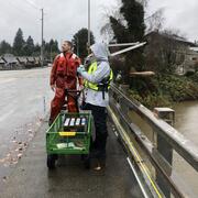
Bear Gulch Fire Water Quality Monitoring
The USGS is monitoring water quality in the North Fork Skokomish River following the Bear Gulch Fire that burned in summer 2025. USGS has over 100 years of data from this river. Streamflow data support water supply management and flood prediction. Post-fire data provides an important window into how watersheds are shaped by fire.
Green River Sediment Monitoring
The Issue: Management efforts on the lower Green River to reduce flood hazards and improve habitat conditions are inherently interconnected with sediment transport and channel change dynamics. Those dynamics are, in turn, driven by a mix of interacting geologic, anthropogenic, and hydrologic factors. However, there have been no recent watershed-scale analyses of sediment dynamics in the Green...
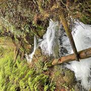
PROSPER Puget Sound - Modeling Streamflow Permanence
The Issue: Knowing when streams have water and when they run dry—called streamflow permanence—is necessary for managing water resources, protecting ecosystems, and responding to regulations and policies. In the Pacific Northwest, a major research priority is understanding how streamflow permanence might change as snowpacks shrink and summers become hotter and drier. How USGS will help: USGS is...