U.S. flag

An official website of the United States government

Coastal

Filter Total Items: 61

Restoration Impacts to Avian Populations along the Louisiana Outer Coast

USGS researchers are conducting ground surveys and collecting aerial imagery to understand avian use of restored habitats at Whiskey Island, Shell Island, Cheniere Ronquille, and Breton Island. They will also develop habitat maps to understand how coastal processes and episodic events influence barrier islands.
link

Restoration Impacts to Avian Populations along the Louisiana Outer Coast

USGS researchers are conducting ground surveys and collecting aerial imagery to understand avian use of restored habitats at Whiskey Island, Shell Island, Cheniere Ronquille, and Breton Island. They will also develop habitat maps to understand how coastal processes and episodic events influence barrier islands.
Learn More
link

Coastal Wetland Vulnerability to Climate Change and Sea-Level Rise: Understanding Ecological Thresholds and Ecosystem Transformations

Eighteen USGS coastal scientists from all four coasts of the conterminous United States are working together to advance the understanding of climate change and sea-level rise impacts to coastal wetlands.
Learn More

Predicting Sea-Level Rise Impacts to Barrier Island Habitats

Researchers at WARC are determining if temporal mismatches between digital elevation models and land cover data can impact estimates of inundation of beach habitat for barrier islands and low-lying beaches off the Gulf Coast of Florida.
link

Predicting Sea-Level Rise Impacts to Barrier Island Habitats

Researchers at WARC are determining if temporal mismatches between digital elevation models and land cover data can impact estimates of inundation of beach habitat for barrier islands and low-lying beaches off the Gulf Coast of Florida.
Learn More

Sea-Level Rise and Florida’s Island Biodiversity

While islands are some of the most biodiverse places on earth, they are also among the most threatened. Researchers from WARC and Florida Fish and Wildlife Conservation Commission are assessing the vulnerability of Florida’s coastal islands to inundation from sea-level rise and estimating potential loss of the terrestrial biodiversity on Florida’s islands.
link

Sea-Level Rise and Florida’s Island Biodiversity

While islands are some of the most biodiverse places on earth, they are also among the most threatened. Researchers from WARC and Florida Fish and Wildlife Conservation Commission are assessing the vulnerability of Florida’s coastal islands to inundation from sea-level rise and estimating potential loss of the terrestrial biodiversity on Florida’s islands.
Learn More

Decision Support for Managers Restoring Texas Coastal Marshes with Beneficial Use of Dredged Material

USGS researchers will define the range of elevation targets supporting optimal plant performance and oil strength by identifying the lower and upper thresholds of marsh conversion, and characterize ecosystem development of restored marshes over time to identify the lifetime and sustainability of restored marsh during sea-level rise. This work addresses priority science needs to improve restoration...
link

Decision Support for Managers Restoring Texas Coastal Marshes with Beneficial Use of Dredged Material

USGS researchers will define the range of elevation targets supporting optimal plant performance and oil strength by identifying the lower and upper thresholds of marsh conversion, and characterize ecosystem development of restored marshes over time to identify the lifetime and sustainability of restored marsh during sea-level rise. This work addresses priority science needs to improve restoration...
Learn More

Barrier Island Habitat Mapping for the Louisiana Outer Coast Project

The USGS is collaborating with the Louisiana Coastal Protection and Restoration Authority (CPRA) to develop post-restoration barrier island habitat maps for three of the four components associated with the Louisiana Outer Coast Restoration Project
link

Barrier Island Habitat Mapping for the Louisiana Outer Coast Project

The USGS is collaborating with the Louisiana Coastal Protection and Restoration Authority (CPRA) to develop post-restoration barrier island habitat maps for three of the four components associated with the Louisiana Outer Coast Restoration Project
Learn More

Understanding Ecosystem Response and Infrastructure Vulnerability to Sea-Level Rise for Gulf Islands National Seashore

USGS researchers will will survey elevation and vegetation in wetlands and vegetated dunes on Horn, Petite Bois, and Ship Islands; Correct the best available lidar-based digital elevation model; estimate inundation for the Gulf Islands National Seashore under various water levels and relative sea-level rise scenarios; and quantify and predict potential marsh migration for the Gulf Islands National...
link

Understanding Ecosystem Response and Infrastructure Vulnerability to Sea-Level Rise for Gulf Islands National Seashore

USGS researchers will will survey elevation and vegetation in wetlands and vegetated dunes on Horn, Petite Bois, and Ship Islands; Correct the best available lidar-based digital elevation model; estimate inundation for the Gulf Islands National Seashore under various water levels and relative sea-level rise scenarios; and quantify and predict potential marsh migration for the Gulf Islands National...
Learn More

Vertical Control of Rod Surface Elevation Table (RSET) Benchmarks to Assess Implications of Sea-Level Rise within Texas Coastal Refuges

The USGS will establish Rod Surface Elevation Tables at five National Wildlife Refuges on the Texas coast. This work will support climate adaptation and resilience planning by identifying areas susceptible to loss and degradation due to sea-level rise and extreme climatic events along the Texas Gulf Coast.
link

Vertical Control of Rod Surface Elevation Table (RSET) Benchmarks to Assess Implications of Sea-Level Rise within Texas Coastal Refuges

The USGS will establish Rod Surface Elevation Tables at five National Wildlife Refuges on the Texas coast. This work will support climate adaptation and resilience planning by identifying areas susceptible to loss and degradation due to sea-level rise and extreme climatic events along the Texas Gulf Coast.
Learn More

Sources of Recurring Outbreaks of Lythrum salicaria (Purple Loosestrife) Near the Mouth of the Mississippi River

USGS researchers are examining germination of Purple Loosestrife to determine if the seed bank can reestablish this invasive species in the Mississippi Delta.
link

Sources of Recurring Outbreaks of Lythrum salicaria (Purple Loosestrife) Near the Mouth of the Mississippi River

USGS researchers are examining germination of Purple Loosestrife to determine if the seed bank can reestablish this invasive species in the Mississippi Delta.
Learn More

Surface Elevation and Accretion Monitoring for the Maurepas Swamp Alternative-2 Mitigation Project

USGS will install and maintain up to six rod surface-elevation table (RSET) rods and paired accretion monitoring stations at the location of the Maurepas Swamp Alternative-2 Mitigation Project.
link

Surface Elevation and Accretion Monitoring for the Maurepas Swamp Alternative-2 Mitigation Project

USGS will install and maintain up to six rod surface-elevation table (RSET) rods and paired accretion monitoring stations at the location of the Maurepas Swamp Alternative-2 Mitigation Project.
Learn More

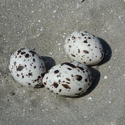
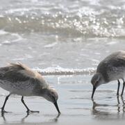
Beach Compaction and the Impacts of Tilling on Nesting Sea Turtles and Foraging Shorebirds

Researchers are investigating beach compaction, the incubation environment for turtle nests, and shorebird nest abundance at beaches throughout the southeastern United States to better understand the impacts of beach compaction to nesting turtles and foraging seabirds.
link

Beach Compaction and the Impacts of Tilling on Nesting Sea Turtles and Foraging Shorebirds

Researchers are investigating beach compaction, the incubation environment for turtle nests, and shorebird nest abundance at beaches throughout the southeastern United States to better understand the impacts of beach compaction to nesting turtles and foraging seabirds.
Learn More

Developing General Coastal Vegetation Maps for Coastal Morphodynamic Models

The USGS is collaborating with researchers from other agencies, academia, and industry to predict coastal impacts from hurricanes. The results from this study will better inform coastal morphological change models, which will lead to improved hurricane impact projections.
link

Developing General Coastal Vegetation Maps for Coastal Morphodynamic Models

The USGS is collaborating with researchers from other agencies, academia, and industry to predict coastal impacts from hurricanes. The results from this study will better inform coastal morphological change models, which will lead to improved hurricane impact projections.
Learn More
Was this page helpful?