
Jason Payne
Geophysicist with the Oklahoma-Texas Water Science Center
Science and Products
Filter Total Items: 14
Data used for the characterization of the hydrogeologic framework, groundwater-flow system, geochemistry, and aquifer hydraulic properties of the shallow groundwater system in the Wilcox and Lorraine process areas of the Wilcox Oil Company Superfund site Data used for the characterization of the hydrogeologic framework, groundwater-flow system, geochemistry, and aquifer hydraulic properties of the shallow groundwater system in the Wilcox and Lorraine process areas of the Wilcox Oil Company Superfund site
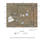
The Wilcox Oil Company Superfund site (hereinafter referred to as “the site”) was formerly an oil refinery in northeast of Bristow in Creek County, Oklahoma. Historical refinery operations contaminated the soil, surface water, streambed sediments, alluvium, and groundwater with refined and stored products at the site. The Wilcox and Lorraine process areas are where the highest...
Time-lapse self-potential, electric resistivity tomography, streamflow, groundwater-level, and weather-station datasets for the lower Rio Grande, southeast New Mexico, May–October, 2022 Time-lapse self-potential, electric resistivity tomography, streamflow, groundwater-level, and weather-station datasets for the lower Rio Grande, southeast New Mexico, May–October, 2022
This data release contains time-lapse self-potential, electric resistivity tomography, hydrographic, and weather data acquired during a geoelectric monitoring survey of the lower Rio Grande riverbed in the Mesilla Basin of southeast, New Mexico. The monitoring survey was performed by the U.S. Geological Survey (USGS) in copperation with New Mexico State University (NMSU), Elephant Butte...
Self-potential, electrical resistivity tomography, and water temperature and electrical conductivity data pertaining to the sources of groundwater at Krause Springs, Spicewood, Texas, February 4–15, 2019 Self-potential, electrical resistivity tomography, and water temperature and electrical conductivity data pertaining to the sources of groundwater at Krause Springs, Spicewood, Texas, February 4–15, 2019
This data release contains self-potential (SP), electrical resistivity tomography (ERT), and water temperature and conductivity data measured during a geophysical survey at the Krause Springs property in Spicewood, Texas. The geophysical survey was completed February 4–15, 2019, over approximately 3.1 acres on the western side of the property adjacent to the main visitor parking lot and...
Water-Quality Data and Geophysical Logs for Determination of Saline Groundwater in Selected Aquifers in Texas, 2021 Water-Quality Data and Geophysical Logs for Determination of Saline Groundwater in Selected Aquifers in Texas, 2021
The availability of groundwater-quality data along with geophysical information for relatively deep wells (wells generally more than 300 feet deep) containing saline water (dissolved-solids concentrations greater than 2,000 milligrams per liter)) is limited throughout the state of Texas. Water-quality samples are important for calibrating estimates of groundwater salinity derived from...
Waterborne Gradient Self-potential, Temperature, and Conductivity Logging of the Upper part of the Delaware River between Hancock and Port Jervis, New York, June-July 2021 Waterborne Gradient Self-potential, Temperature, and Conductivity Logging of the Upper part of the Delaware River between Hancock and Port Jervis, New York, June-July 2021
This data release contains waterborne gradient self-potential (SP), surface-water temperature, surface-water conductivity and specific conductance, and surface-water nitrate concentration data measured continuously in the upper part of the Delaware River along approximately 123 kilometers (km) between Hancock and Port Jervis, New York. All of the data were measured from a kayak between...
Fracture and Bedding Plane Analysis of Bedrock Beneath Bull Shoals Dam Using Acoustic and Optical Televiewer Geophysical Logs, Baxter County, Arkansas, 2021 Fracture and Bedding Plane Analysis of Bedrock Beneath Bull Shoals Dam Using Acoustic and Optical Televiewer Geophysical Logs, Baxter County, Arkansas, 2021
In May 2021, the U.S. Geological Survey, in cooperation with the U.S. Army Corps of Engineers, logged 9 previously drilled boreholes in the bedrock beneath Bull Shoals Dam with acoustic and optical televiewer geophysical methods. The acoustic and optical televiewer logging results were used to identify fractures and small bedding planes in the bedrock beneath the dam using the image and...
Surface Geophysical Data Used for Mapping the Top of the Dockum Group on Cannon Air Force Base in Curry County, New Mexico, 2020 Surface Geophysical Data Used for Mapping the Top of the Dockum Group on Cannon Air Force Base in Curry County, New Mexico, 2020
The hydrogeology of the Cannon Air Force Base (AFB) in Curry County, is being investigated to better understand the mechanics of groundwater flow in the area, including the identification of preferential groundwater flow paths. Mapping the top of the Dockum Group was done to help identify potential paleochannels that may have eroded the surface of the Dockum Group and subsequently filled...
Compilation of Time-Domain Electromagnetic Surface Geophysical Soundings, Historical Borehole Characteristics, Water Level, Water Quality and Hydraulic Properties Data Throughout Gaines, Yoakum, and Terry Counties in Texas, 1929-2019 Compilation of Time-Domain Electromagnetic Surface Geophysical Soundings, Historical Borehole Characteristics, Water Level, Water Quality and Hydraulic Properties Data Throughout Gaines, Yoakum, and Terry Counties in Texas, 1929-2019
In cooperation with the Llano Estacado Underground Water Conservation District (LEUWCD), the Sandy Land Underground Water Conservation District (SLUWCD), and the South Plains Underground Water Conservation District (SPUWCD), the U.S. Geological Survey (USGS) compiled historical geophysical and geochemical data in Gaines, Yoakum, and Terry Counties, Texas, and collected additional data...
Time-Domain Electromagnetic Data Used in the Assessment of the Freshwater/Saline-Water Transition Zone within the Hueco Bolson, Fort Bliss Area, El Paso, Texas 2017-2019 Time-Domain Electromagnetic Data Used in the Assessment of the Freshwater/Saline-Water Transition Zone within the Hueco Bolson, Fort Bliss Area, El Paso, Texas 2017-2019
Declining groundwater levels in the Hueco Bolson have raised concerns about the amount of available groundwater and the potential for water-quality changes. Fresh groundwater stored in the aquifer is bordered by regions of brackish-to-saline groundwater, and as the water levels in the Hueco Bolson have declined the local and regional hydraulic gradients have been altered such that the...
Digitized Historical Borehole Geophysical Logs Throughout the Mississippi Alluvial Plain Aquifer System Digitized Historical Borehole Geophysical Logs Throughout the Mississippi Alluvial Plain Aquifer System
This data release consists of historical borehole geophysical data collected by various entities and digitally recreated by the U.S. Geological Survey to characterize the physical properties of the subsurface in the Mississippi Alluvial Plain from Louisiana to Missouri. The geophysical log data were collected by different Federal, state, and local agencies throughout the area, and were...
Geophysical surveys and geospatial data for Bob Kidd Lake, Washington County, Arkansas Geophysical surveys and geospatial data for Bob Kidd Lake, Washington County, Arkansas
This data release consists of three different types of data: including direct current (DC) resistivity profiles, frequency domain electromagnetic (FDEM) survey data, and global navigation satellite system (GNSS) coordinate data of the geophysical measurement locations. A data dictionary is included along with the data and defines all of the table headings, definitions, and units. Earthen...
The use of Continuous Resistivity Profiling to Evaluate Geomorphologic Controls on Aquifer Recharge in the Mississippi Alluvial Plain from Money to Steiner, Mississippi, August 2016 to November 2016 The use of Continuous Resistivity Profiling to Evaluate Geomorphologic Controls on Aquifer Recharge in the Mississippi Alluvial Plain from Money to Steiner, Mississippi, August 2016 to November 2016
In cooperation with more than 10 local, State, and Federal stakeholders, the United States Geological Survey (USGS) is studying the aquifer systems in and near the Mississippi River alluvial plain (https://www2.usgs.gov/water/lowermississippigulf/map/index.html). This data release consists of continuous resistivity profiling (CRP) data collected by the USGS to characterize the electrical
Changes between early development (1930–60) and recent (2005–15) groundwater-level altitudes and dissolved-solids and nitrate concentrations In and near Gaines, Terry, and Yoakum Counties, Texas Changes between early development (1930–60) and recent (2005–15) groundwater-level altitudes and dissolved-solids and nitrate concentrations In and near Gaines, Terry, and Yoakum Counties, Texas
Llano Estacado Underground Water Conservation District, Sandy Land Underground Water Conservation District, and South Plains Underground Water Conservation District manage groundwater resources in a part of west Texas near the Texas-New Mexico State line. Declining groundwater levels have raised concerns about the amount of available groundwater in the study area and the potential for...
Filter Total Items: 15
Geoelectric monitoring of the electric potential field of the Lower Rio Grande before, during, and after Intermittent Streamflow, May–October, 2022 Geoelectric monitoring of the electric potential field of the Lower Rio Grande before, during, and after Intermittent Streamflow, May–October, 2022
Understanding the intermittent hydraulic connectivity between ephemeral streams and alluvial aquifers is a key challenge for managing water resources in arid environments. The lower Rio Grande flows for short, discontinuous periods during the irrigation season through the Mesilla Basin in southeastern New Mexico and southwestern Texas. Hydraulic connections between the Rio Grande and the...
Authors
Scott Ikard, Kenneth C. Carroll, Dale F. Rucker, Andrew Teeple, Jason D. Payne, Chia-Hsing Tsai, Erek H. Fuchs, Ahsan Jamil
Mapping the altitude of the top of the Dockum Group and paleochannel analysis using surface geophysical methods on and near Cannon Air Force Base in Curry County, New Mexico, 2020 Mapping the altitude of the top of the Dockum Group and paleochannel analysis using surface geophysical methods on and near Cannon Air Force Base in Curry County, New Mexico, 2020
The hydrogeology on and near Cannon Air Force Base (AFB) in eastern New Mexico was assessed to gain a better understanding of preferential groundwater flow paths through paleochannels. In and near the study area, paleochannels incised the top surface of the Dockum Group (Chinle Formation) and were subsequently filled in with electrically resistive coarse-grained sediments of the...
Authors
Jason D. Payne, Andrew P. Teeple, Jeremy McDowell, David Wallace, Walker A. Hancock
Evaluation of electrical and electromagnetic geophysical techniques to inspect earthen dam and levee structures in Arkansas Evaluation of electrical and electromagnetic geophysical techniques to inspect earthen dam and levee structures in Arkansas
Within the state of Arkansas there is an increasing number of aging dams and levees that have little to no documentation concerning their construction or composition. Surface geophysical surveys offer a non-intrusive method for investigating these structures: To describe their lithologic makeup, to evaluate the materials that they were constructed upon, and to identify potential flow...
Authors
Ryan F. Adams, Benjamin Miller, Wade Kress, Scott Ikard, Jason D. Payne, Walter Killion
Hydrogeologic framework, geochemistry, groundwater-flow system, and aquifer hydraulic properties used in the development of a conceptual model of the Ogallala, Edwards-Trinity (High Plains), and Dockum aquifers in and near Gaines, Terry, and Yoakum Counti Hydrogeologic framework, geochemistry, groundwater-flow system, and aquifer hydraulic properties used in the development of a conceptual model of the Ogallala, Edwards-Trinity (High Plains), and Dockum aquifers in and near Gaines, Terry, and Yoakum Counti
In 2014, the U.S. Geological Survey, in cooperation with Llano Estacado Underground Water Conservation District, Sandy Land Underground Water Conservation District, and South Plains Underground Water Conservation District (hereinafter referred to collectively as the “UWCDs”), began a multiphase study in and near Gaines, Terry, and Yoakum Counties, Texas, to develop a regional conceptual...
Authors
Andrew P. Teeple, Patricia B. Ging, Jonathan V. Thomas, David S. Wallace, Jason D. Payne
New insights on scale-dependent surface-groundwater exchange from a floating self-potential Dipole New insights on scale-dependent surface-groundwater exchange from a floating self-potential Dipole
In south-central Texas the lower Guadalupe River has incised into the outcrop of the Carrizo-Wilcox aquifer. The river and the aquifer are hydraulically connected across the outcrop, although the connectivity is obscured at the surface by alluvium and surface-water and groundwater exchange dynamics are currently poorly understood. To investigate surface-water and groundwater exchange...
Authors
Scott Ikard, Andrew P. Teeple, Jason Payne, Gregory P. Stanton, J. Ryan Banta
Hydrogeologic and geochemical characterization and evaluation of two arroyos for managed aquifer recharge by surface infiltration in the Pojoaque River Basin, Santa Fe County, New Mexico, 2014–15 Hydrogeologic and geochemical characterization and evaluation of two arroyos for managed aquifer recharge by surface infiltration in the Pojoaque River Basin, Santa Fe County, New Mexico, 2014–15
In order to provide long-term storage of diverted surface water from the Rio Grande as part of the Aamodt water rights settlement, managed aquifer recharge by surface infiltration in Pojoaque River Basin arroyos was proposed as an option. The initial hydrogeologic and geochemical characterization of two arroyos located within the Pojoaque River Basin was performed in 2014 and 2015 in...
Authors
Andrew J. Robertson, Jeffrey Cordova, Andrew Teeple, Jason Payne, Rob Carruth
A conceptual hydrogeologic model for the hydrogeologic framework, geochemistry, and groundwater-flow system of the Edwards-Trinity and related aquifers in the Pecos County region, Texas A conceptual hydrogeologic model for the hydrogeologic framework, geochemistry, and groundwater-flow system of the Edwards-Trinity and related aquifers in the Pecos County region, Texas
The Edwards-Trinity aquifer is a vital groundwater resource for agricultural, industrial, and municipal uses in the Trans-Pecos region of west Texas. A conceptual model of the hydrogeologic framework, geochemistry, and groundwater-flow system in the 4,700 square-mile study area was developed by the U.S. Geological Survey (USGS) in cooperation with the Middle Pecos Groundwater...
Authors
Jonathan V. Thomas, Gregory P. Stanton, Johnathan R. Bumgarner, Daniel K. Pearson, Andrew Teeple, Natalie A. Houston, Jason Payne, MaryLynn Musgrove
A conceptual model of the hydrogeologic framework, geochemistry, and groundwater-flow system of the Edwards-Trinity and related aquifers in the Pecos County region, Texas A conceptual model of the hydrogeologic framework, geochemistry, and groundwater-flow system of the Edwards-Trinity and related aquifers in the Pecos County region, Texas
A conceptual model of the hydrogeologic framework, geochemistry, and groundwater-flow system of the Edwards-Trinity and related aquifers, which include the Pecos Valley, Igneous, Dockum, Rustler, and Capitan Reef aquifers, was developed as the second phase of a groundwater availability study in the Pecos County region in west Texas. The first phase of the study was to collect and compile
Authors
Johnathan R. Bumgarner, Gregory P. Stanton, Andrew Teeple, Jonathan V. Thomas, Natalie A. Houston, Jason Payne, MaryLynn Musgrove
Geophysical characterization of the Lollie Levee near Conway, Arkansas, using capacitively coupled resistivity, coring, and direct push logging Geophysical characterization of the Lollie Levee near Conway, Arkansas, using capacitively coupled resistivity, coring, and direct push logging
A geophysical characterization of Lollie Levee near Conway, Arkansas, was conducted in February 2011. A capacitively coupled resistivity survey (using Geometric's OhmMapper) was completed along the top and toe of the 6.7-mile levee. Two-dimensional inversions were conducted on the geophysical data. As a quality-control measure, cores and direct push logs were taken at approximately 1...
Authors
Jonathan A. Gillip, Jason Payne
Enhancement of USGS scientific investigations in Texas by using geophysical techniques, 2005-10 Enhancement of USGS scientific investigations in Texas by using geophysical techniques, 2005-10
Geophysical techniques are an increasingly important tool for scientific investigations, environmental planning, and resource management. During 2005-10 the U.S. Geological Survey Texas Water Science Center greatly expanded its capabilities of using surface and borehole geophysical techniques to gain insights into how groundwater systems work and the occurrence and distribution of...
Authors
Gregory P. Stanton, Jason Payne, Andrew Teeple, Jonathan V. Thomas
Time-domain electromagnetic soundings collected in Dawson County, Nebraska, 2007-09 Time-domain electromagnetic soundings collected in Dawson County, Nebraska, 2007-09
Between April 2007 and November 2009, the U.S. Geological Survey, in cooperation with the Central Platte Natural Resources District, collected time-domain electro-magnetic (TDEM) soundings at 14 locations in Dawson County, Nebraska. The TDEM soundings provide information pertaining to the hydrogeology at each of 23 sites at the 14 locations; 30 TDEM surface geophysical soundings were...
Authors
Jason Payne, Andrew Teeple
Capacitively Coupled Resistivity Survey of Selected Irrigation Canals Within the North Platte River Valley, Western Nebraska and Eastern Wyoming, 2004 and 2007-2009 Capacitively Coupled Resistivity Survey of Selected Irrigation Canals Within the North Platte River Valley, Western Nebraska and Eastern Wyoming, 2004 and 2007-2009
Due to water resources of portions of the North Platte River basin being designated as over-appropriated by the State of Nebraska Department of Natural Resources (DNR), the North Platte Natural Resources District (NPNRD), in cooperation with the DNR, is developing an Integrated Management Plan (IMP) for groundwater and surface water in the NPNRD. As part of the IMP, a three-dimensional...
Authors
Bethany L. Burton, Michaela R. Johnson, Joseph Vrabel, Brian H. Imig, Jason Payne, Ryan E. Tompkins
Saturated thickness mapping of the Southern High Plains Aquifer in Eastern New Mexico
The overall objective of this study is to assist Cannon AFB in understanding and interpreting current and local hydrological conditions by developing an estimate of saturated thickness of the aquifer underlying Cannon AFB and surrounding areas. The Southern High Plains aquifer is the principal source of water for Cannon AFB, the nearby towns of Clovis and Portales, and the local agriculture. The...
Science and Products
Filter Total Items: 14
Data used for the characterization of the hydrogeologic framework, groundwater-flow system, geochemistry, and aquifer hydraulic properties of the shallow groundwater system in the Wilcox and Lorraine process areas of the Wilcox Oil Company Superfund site Data used for the characterization of the hydrogeologic framework, groundwater-flow system, geochemistry, and aquifer hydraulic properties of the shallow groundwater system in the Wilcox and Lorraine process areas of the Wilcox Oil Company Superfund site
The Wilcox Oil Company Superfund site (hereinafter referred to as “the site”) was formerly an oil refinery in northeast of Bristow in Creek County, Oklahoma. Historical refinery operations contaminated the soil, surface water, streambed sediments, alluvium, and groundwater with refined and stored products at the site. The Wilcox and Lorraine process areas are where the highest...
Time-lapse self-potential, electric resistivity tomography, streamflow, groundwater-level, and weather-station datasets for the lower Rio Grande, southeast New Mexico, May–October, 2022 Time-lapse self-potential, electric resistivity tomography, streamflow, groundwater-level, and weather-station datasets for the lower Rio Grande, southeast New Mexico, May–October, 2022
This data release contains time-lapse self-potential, electric resistivity tomography, hydrographic, and weather data acquired during a geoelectric monitoring survey of the lower Rio Grande riverbed in the Mesilla Basin of southeast, New Mexico. The monitoring survey was performed by the U.S. Geological Survey (USGS) in copperation with New Mexico State University (NMSU), Elephant Butte...
Self-potential, electrical resistivity tomography, and water temperature and electrical conductivity data pertaining to the sources of groundwater at Krause Springs, Spicewood, Texas, February 4–15, 2019 Self-potential, electrical resistivity tomography, and water temperature and electrical conductivity data pertaining to the sources of groundwater at Krause Springs, Spicewood, Texas, February 4–15, 2019
This data release contains self-potential (SP), electrical resistivity tomography (ERT), and water temperature and conductivity data measured during a geophysical survey at the Krause Springs property in Spicewood, Texas. The geophysical survey was completed February 4–15, 2019, over approximately 3.1 acres on the western side of the property adjacent to the main visitor parking lot and...
Water-Quality Data and Geophysical Logs for Determination of Saline Groundwater in Selected Aquifers in Texas, 2021 Water-Quality Data and Geophysical Logs for Determination of Saline Groundwater in Selected Aquifers in Texas, 2021
The availability of groundwater-quality data along with geophysical information for relatively deep wells (wells generally more than 300 feet deep) containing saline water (dissolved-solids concentrations greater than 2,000 milligrams per liter)) is limited throughout the state of Texas. Water-quality samples are important for calibrating estimates of groundwater salinity derived from...
Waterborne Gradient Self-potential, Temperature, and Conductivity Logging of the Upper part of the Delaware River between Hancock and Port Jervis, New York, June-July 2021 Waterborne Gradient Self-potential, Temperature, and Conductivity Logging of the Upper part of the Delaware River between Hancock and Port Jervis, New York, June-July 2021
This data release contains waterborne gradient self-potential (SP), surface-water temperature, surface-water conductivity and specific conductance, and surface-water nitrate concentration data measured continuously in the upper part of the Delaware River along approximately 123 kilometers (km) between Hancock and Port Jervis, New York. All of the data were measured from a kayak between...
Fracture and Bedding Plane Analysis of Bedrock Beneath Bull Shoals Dam Using Acoustic and Optical Televiewer Geophysical Logs, Baxter County, Arkansas, 2021 Fracture and Bedding Plane Analysis of Bedrock Beneath Bull Shoals Dam Using Acoustic and Optical Televiewer Geophysical Logs, Baxter County, Arkansas, 2021
In May 2021, the U.S. Geological Survey, in cooperation with the U.S. Army Corps of Engineers, logged 9 previously drilled boreholes in the bedrock beneath Bull Shoals Dam with acoustic and optical televiewer geophysical methods. The acoustic and optical televiewer logging results were used to identify fractures and small bedding planes in the bedrock beneath the dam using the image and...
Surface Geophysical Data Used for Mapping the Top of the Dockum Group on Cannon Air Force Base in Curry County, New Mexico, 2020 Surface Geophysical Data Used for Mapping the Top of the Dockum Group on Cannon Air Force Base in Curry County, New Mexico, 2020
The hydrogeology of the Cannon Air Force Base (AFB) in Curry County, is being investigated to better understand the mechanics of groundwater flow in the area, including the identification of preferential groundwater flow paths. Mapping the top of the Dockum Group was done to help identify potential paleochannels that may have eroded the surface of the Dockum Group and subsequently filled...
Compilation of Time-Domain Electromagnetic Surface Geophysical Soundings, Historical Borehole Characteristics, Water Level, Water Quality and Hydraulic Properties Data Throughout Gaines, Yoakum, and Terry Counties in Texas, 1929-2019 Compilation of Time-Domain Electromagnetic Surface Geophysical Soundings, Historical Borehole Characteristics, Water Level, Water Quality and Hydraulic Properties Data Throughout Gaines, Yoakum, and Terry Counties in Texas, 1929-2019
In cooperation with the Llano Estacado Underground Water Conservation District (LEUWCD), the Sandy Land Underground Water Conservation District (SLUWCD), and the South Plains Underground Water Conservation District (SPUWCD), the U.S. Geological Survey (USGS) compiled historical geophysical and geochemical data in Gaines, Yoakum, and Terry Counties, Texas, and collected additional data...
Time-Domain Electromagnetic Data Used in the Assessment of the Freshwater/Saline-Water Transition Zone within the Hueco Bolson, Fort Bliss Area, El Paso, Texas 2017-2019 Time-Domain Electromagnetic Data Used in the Assessment of the Freshwater/Saline-Water Transition Zone within the Hueco Bolson, Fort Bliss Area, El Paso, Texas 2017-2019
Declining groundwater levels in the Hueco Bolson have raised concerns about the amount of available groundwater and the potential for water-quality changes. Fresh groundwater stored in the aquifer is bordered by regions of brackish-to-saline groundwater, and as the water levels in the Hueco Bolson have declined the local and regional hydraulic gradients have been altered such that the...
Digitized Historical Borehole Geophysical Logs Throughout the Mississippi Alluvial Plain Aquifer System Digitized Historical Borehole Geophysical Logs Throughout the Mississippi Alluvial Plain Aquifer System
This data release consists of historical borehole geophysical data collected by various entities and digitally recreated by the U.S. Geological Survey to characterize the physical properties of the subsurface in the Mississippi Alluvial Plain from Louisiana to Missouri. The geophysical log data were collected by different Federal, state, and local agencies throughout the area, and were...
Geophysical surveys and geospatial data for Bob Kidd Lake, Washington County, Arkansas Geophysical surveys and geospatial data for Bob Kidd Lake, Washington County, Arkansas
This data release consists of three different types of data: including direct current (DC) resistivity profiles, frequency domain electromagnetic (FDEM) survey data, and global navigation satellite system (GNSS) coordinate data of the geophysical measurement locations. A data dictionary is included along with the data and defines all of the table headings, definitions, and units. Earthen...
The use of Continuous Resistivity Profiling to Evaluate Geomorphologic Controls on Aquifer Recharge in the Mississippi Alluvial Plain from Money to Steiner, Mississippi, August 2016 to November 2016 The use of Continuous Resistivity Profiling to Evaluate Geomorphologic Controls on Aquifer Recharge in the Mississippi Alluvial Plain from Money to Steiner, Mississippi, August 2016 to November 2016
In cooperation with more than 10 local, State, and Federal stakeholders, the United States Geological Survey (USGS) is studying the aquifer systems in and near the Mississippi River alluvial plain (https://www2.usgs.gov/water/lowermississippigulf/map/index.html). This data release consists of continuous resistivity profiling (CRP) data collected by the USGS to characterize the electrical
Changes between early development (1930–60) and recent (2005–15) groundwater-level altitudes and dissolved-solids and nitrate concentrations In and near Gaines, Terry, and Yoakum Counties, Texas Changes between early development (1930–60) and recent (2005–15) groundwater-level altitudes and dissolved-solids and nitrate concentrations In and near Gaines, Terry, and Yoakum Counties, Texas
Llano Estacado Underground Water Conservation District, Sandy Land Underground Water Conservation District, and South Plains Underground Water Conservation District manage groundwater resources in a part of west Texas near the Texas-New Mexico State line. Declining groundwater levels have raised concerns about the amount of available groundwater in the study area and the potential for...
Filter Total Items: 15
Geoelectric monitoring of the electric potential field of the Lower Rio Grande before, during, and after Intermittent Streamflow, May–October, 2022 Geoelectric monitoring of the electric potential field of the Lower Rio Grande before, during, and after Intermittent Streamflow, May–October, 2022
Understanding the intermittent hydraulic connectivity between ephemeral streams and alluvial aquifers is a key challenge for managing water resources in arid environments. The lower Rio Grande flows for short, discontinuous periods during the irrigation season through the Mesilla Basin in southeastern New Mexico and southwestern Texas. Hydraulic connections between the Rio Grande and the...
Authors
Scott Ikard, Kenneth C. Carroll, Dale F. Rucker, Andrew Teeple, Jason D. Payne, Chia-Hsing Tsai, Erek H. Fuchs, Ahsan Jamil
Mapping the altitude of the top of the Dockum Group and paleochannel analysis using surface geophysical methods on and near Cannon Air Force Base in Curry County, New Mexico, 2020 Mapping the altitude of the top of the Dockum Group and paleochannel analysis using surface geophysical methods on and near Cannon Air Force Base in Curry County, New Mexico, 2020
The hydrogeology on and near Cannon Air Force Base (AFB) in eastern New Mexico was assessed to gain a better understanding of preferential groundwater flow paths through paleochannels. In and near the study area, paleochannels incised the top surface of the Dockum Group (Chinle Formation) and were subsequently filled in with electrically resistive coarse-grained sediments of the...
Authors
Jason D. Payne, Andrew P. Teeple, Jeremy McDowell, David Wallace, Walker A. Hancock
Evaluation of electrical and electromagnetic geophysical techniques to inspect earthen dam and levee structures in Arkansas Evaluation of electrical and electromagnetic geophysical techniques to inspect earthen dam and levee structures in Arkansas
Within the state of Arkansas there is an increasing number of aging dams and levees that have little to no documentation concerning their construction or composition. Surface geophysical surveys offer a non-intrusive method for investigating these structures: To describe their lithologic makeup, to evaluate the materials that they were constructed upon, and to identify potential flow...
Authors
Ryan F. Adams, Benjamin Miller, Wade Kress, Scott Ikard, Jason D. Payne, Walter Killion
Hydrogeologic framework, geochemistry, groundwater-flow system, and aquifer hydraulic properties used in the development of a conceptual model of the Ogallala, Edwards-Trinity (High Plains), and Dockum aquifers in and near Gaines, Terry, and Yoakum Counti Hydrogeologic framework, geochemistry, groundwater-flow system, and aquifer hydraulic properties used in the development of a conceptual model of the Ogallala, Edwards-Trinity (High Plains), and Dockum aquifers in and near Gaines, Terry, and Yoakum Counti
In 2014, the U.S. Geological Survey, in cooperation with Llano Estacado Underground Water Conservation District, Sandy Land Underground Water Conservation District, and South Plains Underground Water Conservation District (hereinafter referred to collectively as the “UWCDs”), began a multiphase study in and near Gaines, Terry, and Yoakum Counties, Texas, to develop a regional conceptual...
Authors
Andrew P. Teeple, Patricia B. Ging, Jonathan V. Thomas, David S. Wallace, Jason D. Payne
New insights on scale-dependent surface-groundwater exchange from a floating self-potential Dipole New insights on scale-dependent surface-groundwater exchange from a floating self-potential Dipole
In south-central Texas the lower Guadalupe River has incised into the outcrop of the Carrizo-Wilcox aquifer. The river and the aquifer are hydraulically connected across the outcrop, although the connectivity is obscured at the surface by alluvium and surface-water and groundwater exchange dynamics are currently poorly understood. To investigate surface-water and groundwater exchange...
Authors
Scott Ikard, Andrew P. Teeple, Jason Payne, Gregory P. Stanton, J. Ryan Banta
Hydrogeologic and geochemical characterization and evaluation of two arroyos for managed aquifer recharge by surface infiltration in the Pojoaque River Basin, Santa Fe County, New Mexico, 2014–15 Hydrogeologic and geochemical characterization and evaluation of two arroyos for managed aquifer recharge by surface infiltration in the Pojoaque River Basin, Santa Fe County, New Mexico, 2014–15
In order to provide long-term storage of diverted surface water from the Rio Grande as part of the Aamodt water rights settlement, managed aquifer recharge by surface infiltration in Pojoaque River Basin arroyos was proposed as an option. The initial hydrogeologic and geochemical characterization of two arroyos located within the Pojoaque River Basin was performed in 2014 and 2015 in...
Authors
Andrew J. Robertson, Jeffrey Cordova, Andrew Teeple, Jason Payne, Rob Carruth
A conceptual hydrogeologic model for the hydrogeologic framework, geochemistry, and groundwater-flow system of the Edwards-Trinity and related aquifers in the Pecos County region, Texas A conceptual hydrogeologic model for the hydrogeologic framework, geochemistry, and groundwater-flow system of the Edwards-Trinity and related aquifers in the Pecos County region, Texas
The Edwards-Trinity aquifer is a vital groundwater resource for agricultural, industrial, and municipal uses in the Trans-Pecos region of west Texas. A conceptual model of the hydrogeologic framework, geochemistry, and groundwater-flow system in the 4,700 square-mile study area was developed by the U.S. Geological Survey (USGS) in cooperation with the Middle Pecos Groundwater...
Authors
Jonathan V. Thomas, Gregory P. Stanton, Johnathan R. Bumgarner, Daniel K. Pearson, Andrew Teeple, Natalie A. Houston, Jason Payne, MaryLynn Musgrove
A conceptual model of the hydrogeologic framework, geochemistry, and groundwater-flow system of the Edwards-Trinity and related aquifers in the Pecos County region, Texas A conceptual model of the hydrogeologic framework, geochemistry, and groundwater-flow system of the Edwards-Trinity and related aquifers in the Pecos County region, Texas
A conceptual model of the hydrogeologic framework, geochemistry, and groundwater-flow system of the Edwards-Trinity and related aquifers, which include the Pecos Valley, Igneous, Dockum, Rustler, and Capitan Reef aquifers, was developed as the second phase of a groundwater availability study in the Pecos County region in west Texas. The first phase of the study was to collect and compile
Authors
Johnathan R. Bumgarner, Gregory P. Stanton, Andrew Teeple, Jonathan V. Thomas, Natalie A. Houston, Jason Payne, MaryLynn Musgrove
Geophysical characterization of the Lollie Levee near Conway, Arkansas, using capacitively coupled resistivity, coring, and direct push logging Geophysical characterization of the Lollie Levee near Conway, Arkansas, using capacitively coupled resistivity, coring, and direct push logging
A geophysical characterization of Lollie Levee near Conway, Arkansas, was conducted in February 2011. A capacitively coupled resistivity survey (using Geometric's OhmMapper) was completed along the top and toe of the 6.7-mile levee. Two-dimensional inversions were conducted on the geophysical data. As a quality-control measure, cores and direct push logs were taken at approximately 1...
Authors
Jonathan A. Gillip, Jason Payne
Enhancement of USGS scientific investigations in Texas by using geophysical techniques, 2005-10 Enhancement of USGS scientific investigations in Texas by using geophysical techniques, 2005-10
Geophysical techniques are an increasingly important tool for scientific investigations, environmental planning, and resource management. During 2005-10 the U.S. Geological Survey Texas Water Science Center greatly expanded its capabilities of using surface and borehole geophysical techniques to gain insights into how groundwater systems work and the occurrence and distribution of...
Authors
Gregory P. Stanton, Jason Payne, Andrew Teeple, Jonathan V. Thomas
Time-domain electromagnetic soundings collected in Dawson County, Nebraska, 2007-09 Time-domain electromagnetic soundings collected in Dawson County, Nebraska, 2007-09
Between April 2007 and November 2009, the U.S. Geological Survey, in cooperation with the Central Platte Natural Resources District, collected time-domain electro-magnetic (TDEM) soundings at 14 locations in Dawson County, Nebraska. The TDEM soundings provide information pertaining to the hydrogeology at each of 23 sites at the 14 locations; 30 TDEM surface geophysical soundings were...
Authors
Jason Payne, Andrew Teeple
Capacitively Coupled Resistivity Survey of Selected Irrigation Canals Within the North Platte River Valley, Western Nebraska and Eastern Wyoming, 2004 and 2007-2009 Capacitively Coupled Resistivity Survey of Selected Irrigation Canals Within the North Platte River Valley, Western Nebraska and Eastern Wyoming, 2004 and 2007-2009
Due to water resources of portions of the North Platte River basin being designated as over-appropriated by the State of Nebraska Department of Natural Resources (DNR), the North Platte Natural Resources District (NPNRD), in cooperation with the DNR, is developing an Integrated Management Plan (IMP) for groundwater and surface water in the NPNRD. As part of the IMP, a three-dimensional...
Authors
Bethany L. Burton, Michaela R. Johnson, Joseph Vrabel, Brian H. Imig, Jason Payne, Ryan E. Tompkins
Saturated thickness mapping of the Southern High Plains Aquifer in Eastern New Mexico
The overall objective of this study is to assist Cannon AFB in understanding and interpreting current and local hydrological conditions by developing an estimate of saturated thickness of the aquifer underlying Cannon AFB and surrounding areas. The Southern High Plains aquifer is the principal source of water for Cannon AFB, the nearby towns of Clovis and Portales, and the local agriculture. The...