Stacey A Archfield
My current research is focused on understanding hydrologic change for water resources applications. I also maintain an interest in the use of statistical approaches to characterize hydrologic information at unmonitored locations.
EDITORIAL BOARDS
- Co-Editor, Hydrologic Sciences Journal (2018-Present)
- Associate Editor, Water Resources Research (2017-Present)
- Editor, Hydrology and Earth System Sciences (2012-Present)
EDUCATION
- Doctor of Philosophy, Civil and Environmental Engineering, Tufts University, 2009
- Master of Science, Geosystems, Massachusetts Institute of Technology, 2001
- Bachelor of Science, Geology, Northeastern University, 1999 (Minor in Mathematics)
PROFESSIONAL APPOINTMENTS
- U.S. Geological Survey, Integrated Modeling and Prediction Division. Research Hydrologist, 2017-Present
- U.S. Geological Survey, National Research Program (Dissolved in 2017). Research Hydrologist, 2013-2017
- U.S. Geological Survey, Massachusetts-Rhode Island Water Science Center
- Research Hydrologist, 2008-2013
- Hydrologist (Project Chief), 2004-2008
- Hydrologist, 1998-2004
- Tufts University, Department of Civil and Environmental Engineering. Research Assistant, 2004-2009
- Massachusetts Institute of Technology, Earth Resources Laboratory. Research Assistant, 2001
- Harvard-Smithsonian Center for Astrophysics, Space Geodesy Group. Research Associate, 1999
VISITING APPOINTMENTS
- University of Bristol, College of Engineering, United Kingdom, March-April 2013
- Vienna University of Technology, Department of Hydrology and Water Resources Management, Austria, April-May 2013
HONORS AND AWARDS
- 2014 Editors’ Citation for Excellence in Refereeing for Water Resources Research (2015)
- Archfield and Vogel [2010] paper featured in the EOS Research Spotlight. Papers featured in the Research Spotlight are selected by the editors of the 18 journals published by the American Geophysical Union. Only 3 to 4 papers are selected bi-weekly to be featured. (2011)
- Hirsch, Moyer and Archfield [2010] paper selected as one of four finalists for the William R. Boggess Award. This award is given to a paper published in the Journal of the American Water Resources Association that best describes, delineates, or analyzes a major problem or aspect of water resources from either a theoretical, applied, or philosophical standpoint. (2011)
- Selected to deliver the 2010 U.S. Geological Survey Chief Hydrologist Seminar (2010)
- Outstanding Student Paper Award, American Geophysical Union Fall Meeting (2009)
- Tufts University Civil & Environmental Engineering Department Littleton Professional Promise Award (2009)
- Northeastern University Student Commencement Speaker (1999)
- Northeastern University Student Body President (1997-1998)
Science and Products
Drought Prediction Science
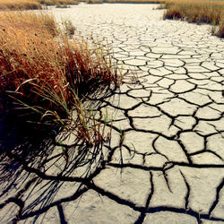
Drought is a prolonged and widespread deficit in available water supplies that creates multiple stressors across ecosystems and communities. The U.S. Geological Survey Water Mission Area conducts drought research and modeling to improve drought prediction capabilities. The research focus is on understanding the hydrological, ecological, and economic ramifications of drought. The modeling focus...
A global synthesis of land-surface fluxes under natural and human-altered watersheds using the Budyko framework
Global hydroclimatic conditions have been significantly altered, over the past century, by anthropogenic influences that arise from warming global climate and also from local/regional anthropogenic disturbances. There has been never been an effort that has systematically analyzed how the spatio-temporal variability of land-surface fluxes vary in natural and human-altered watersheds globally. This
A global synthesis of land-surface fluxes under natural and human-altered watersheds using the Budyko framework (COPY)
Global hydroclimatic conditions have been significantly altered, over the past century, by anthropogenic influences that arise from warming global climate and also from local/regional anthropogenic disturbances. There has been never been an effort that has systematically analyzed how the spatio-temporal variability of land-surface fluxes vary in natural and human-altered watersheds globally. This
Water availability for ungauged rivers: an integrative, multi-model approach to estimate water availability at ungauged rivers across the United States
There has been increasing attention placed on the need for water availability information at ungauged locations, particularly related to balancing human and ecological needs for water. Critical to assessing water availability is the necessity for daily streamflow time series; however, most of the rivers in the United States are ungauged. This proposal leverages over $1M currently allocated to the
Ten Largest Annual Instantaneous Floods and Seasonal Signal for Reference Streamgages in the United States, Water Years 1966-2015
These data describe the 10-largest annual, instantaneous flood peaks and corresponding dates of those largest floods for 473 streamgages in the Hydro-Climatic Data Network (HCDN) HCDN-2009 (Lins, 2012) network; they are also the data and results used in the companion manuscript by Collins, M.J, Hodgkins, G.A., Archfield, S.A., and Hirsch, R.M, under review, "The occurrence of large floods in the U
Statistical Methods in Water Resources - Supporting Materials
This dataset contains all of the supporting materials to accompany Helsel, D.R., Hirsch, R.M., Ryberg, K.R., Archfield, S.A., and Gilroy, E.J., 2020, Statistical methods in water resources: U.S. Geological Survey Techniques and Methods, book 4, chapter A3, 454 p., https://doi.org/10.3133/tm4a3. [Supersedes USGS Techniques of Water-Resources Investigations, book 4, chapter A3, version 1.1.]. Supple
Low-streamflow and precipitation trends for 183 U.S. Geological Survey streamgages in the Chesapeake Bay Watershed
This data release contains low-streamflow trend results from 183 U.S. Geological Survey (USGS) streamgages and precipitation trend results from gaged watersheds within the Chesapeake Bay Watershed. Data include streamgage identification number, trend slopes and significance for several low-streamflow and precipitation metrics.
Peak-streamflow trends and change-points and basin characteristics for 2,683 U.S. Geological Survey streamgages in the conterminous U.S.
This data release contains drainage basin characteristics and peak-streamflow trend and change-point results for 2,683 U.S. Geological Survey (USGS) streamgages in the conterminous U.S. Data include streamgage identification number, name, drainage area, latitude, longitude, percent urban land use, dam storage, streamgage classification, record completeness status, lag-1 autocorrelation, trend slop
Trends in 7-day-low streamflows at 174 USGS streamflow gages in the Chesapeake Bay watershed, Mid-Atlantic U.S.
This data set contains U.S. Geological Survey (USGS) streamgage identification numbers, begin and end years of the periods of streamflow record tested, Sen slope trends in the annual minimum 7-day streamflow for the period of record tested, the p-values (significance) of the trends, and the trend Sen slopes standardized by the standard deviations of the residual errors defined as the difference be
Low-streamflow trends and basin characteristics for 2,482 U.S. Geological Survey streamgages in the conterminous U.S.
This data release contains drainage basin characteristics and low-streamflow trend results for 2,482 U.S. Geological Survey (USGS) streamgages in the conterminous U.S. Data include streamgage identification number, name, drainage area, latitude, longitude, percent developed land use, percent crop land use, dam storage, streamgage classification, record completeness status, and trend slopes and sig
Filter Total Items: 43
Declining reservoir reliability and increasing reservoir vulnerability: Long-term observations reveal longer and more severe periods of low reservoir storage for major United States reservoirs
Hydrological drought is a pervasive and reoccurring challenge in managing water resources. Reservoirs are critical for lessening the impacts of drought on water available for many uses. We use a novel and generalized approach to identify periods of unusually low reservoir storage—via comparisons to operational rule curves and historical patterns—to investigate how droughts affect storage in 250 re
Authors
Caelan Simeone, John C. Hammond, Stacey A. Archfield, Dan Broman, Laura Condon, Hisham Eldardiry, Carolyn G. Olson, Jen Steyaert
Beyond simple trend tests: Detecting significant changes in design-flood quantiles
Changes in annual maximum flood (AMF), which are usually detected using simple trend tests (e.g., Mann-Kendall test (MKT)), are expected to change design-flood estimates. We propose an alternate framework to detect significant changes in design-flood between two periods and evaluate it for synthetically generated AMF from the Log-Pearson Type-3 (LP3) distribution due to changes in moments associat
Authors
Chandramauli Awasthi, Stacey A. Archfield, Brian J. Reich, Arumugam Sankarasubramanian
Projecting flood frequency curves under near-term climate change
Flood-frequency curves, critical for water infrastructure design, are typically developed based on a stationary climate assumption. However, climate changes are expected to violate this assumption. Here, we propose a new, climate-informed methodology for estimating flood-frequency curves under non-stationary future climate conditions. The methodology develops an asynchronous, semiparametric local-
Authors
Chandramauli Awasthi, Stacey A. Archfield, Karen R. Ryberg, Julie E. Kiang, A. Sankarasubramanian
The occurrence of large floods in the United States in the modern hydroclimate regime: Seasonality, trends, and large-scale climate associations
Many studies investigate river floods by analyzing annual maximum series that record the largest flow of each year, including many within-bank events inconsequential for human communities. Fewer focus on larger floods, especially at the continental scale. Using 473 streamgages across the conterminous United States with near-natural flow from 1966 to 2015, we characterized the seasonality, occurren
Authors
Mathias Collins, Glenn A. Hodgkins, Stacey A. Archfield, Robert M. Hirsch
Monthly river temperature trends across the US confound annual changes
Climate variations and human modifications of the water cycle continue to alter the Earth's surface water and energy exchanges. It is therefore critical to ascertain how these changes impact water quality and aquatic ecosystem habitat metrics such as river temperatures. Though river temperature trend analyses exist in the literature, studies on seasonal trends in river temperatures across large sp
Authors
Christa Kelleher, Heather E. Golden, Stacey A. Archfield
Global Changes in 20-year, 50-year and 100-year River Floods
Concepts like the 100-year flood event can be misleading if they are not updated to reflect significant changes over time. Here, we model observed annual maximum daily streamflow using a nonstationary approach to provide the first global picture of changes in: (a) the magnitudes of the 20-, 50-, and 100-year floods (i.e., flows of a given exceedance probability in each year); (b) the return period
Authors
Louise Slater, Gabriele Villarini, Stacey A. Archfield, Daniel R. Faulkner, R. N. Lambe, A. Khouakhi, Jiabo Yin
Statistical methods in water resources
This text began as a collection of class notes for a course on applied statistical methods for hydrologists taught at the U.S. Geological Survey (USGS) National Training Center. Course material was formalized and organized into a textbook, first published in 1992 by Elsevier as part of their Studies in Environmental Science series. In 2002, the work was made available online as a USGS report.The t
Authors
Dennis R. Helsel, Robert M. Hirsch, Karen R. Ryberg, Stacey A. Archfield, Edward J. Gilroy
Spatial and temporal patterns of low streamflow and precipitation changes in the Chesapeake Bay Watershed
Spatial and temporal patterns in low streamflows were investigated for 183 streamgages located in the Chesapeake Bay Watershed for the period 1939–2013. Metrics that represent different aspects of the frequency and magnitude of low streamflows were examined for trends: (1) the annual time series of seven‐day average minimum streamflow, (2) the scaled average deficit at or below the 2% mean daily s
Authors
Brandon J. Fleming, Stacey A. Archfield, Robert M. Hirsch, Julie E. Kiang, David M. Wolock
HESS opinions: Beyond the long-term water balance: Evolving Budyko's supply–demand framework for the Anthropocene towards a global synthesis of land-surface fluxes under natural and human-altered watersheds
Global hydroclimatic conditions have been substantially altered over the past century by anthropogenic influences that arise from the warming global climate and from local/regional anthropogenic disturbances. Traditionally, studies have used coupling of multiple models to understand how land-surface water fluxes vary due to changes in global climatic patterns and local land-use changes. We argue t
Authors
A. Sankarasubramanian, Dingbao Wang, Stacey A. Archfield, Meredith Reitz, Richard M Vogel, Amirhossein Mazrooei, Sudarshana Mukhopadhyaya
Causal effect of impervious cover on annual flood magnitude for the United States
Despite consensus that impervious surfaces increase flooding, the magnitude of the increase remains uncertain. This uncertainty largely stems from the challenge of isolating the effect of changes in impervious cover separate from other factors that also affect flooding. To control for these factors, prior study designs rely on either temporal or spatial variation in impervious cover. We leverage b
Authors
Annalise G. Blum, Paul J. Ferraro, Stacey A. Archfield, Karen R. Ryberg
Low streamflow trends at human-impacted and reference basins in the United States
We present a continent-scale exploration of trends in annual 7-day low streamflows at 2482 U.S. Geological Survey streamgages across the conterminous United States over the past 100, 75, and 50 years (1916–2015, 1941–2015 and 1966–2015). We used basin characteristics to identify subsets of study basins representative of reference basins with streamflow relatively free from human effects (n = 259),
Authors
Robert W. Dudley, Robert M. Hirsch, Stacey A. Archfield, Annalise G. Blum, Benjamin Renard
Updating estimates of low-streamflow statistics to account for possible trends
Accurate estimators of streamflow statistics are critical to the design, planning, and management of water resources. Given increasing evidence of trends in low-streamflow, new approaches to estimating low-streamflow statistics are needed. Here we investigate simple approaches to select a recent subset of the low-flow record to update the commonly used statistic of 7Q10, the annual minimum 7-day s
Authors
Annalise G. Blum, Stacey A. Archfield, Robert M. Hirsch, Richard M Vogel, Julie E. Kiang, Robert W. Dudley