Latest in Landsat September 2025 - Vol. 4 | Issue 8
First, the Latest News
-
Landsat Celebrates Major Open Data Milestone Landsat Celebrates Major Open Data Milestone
On July 14, 2025, downloads of Landsat products passed 200,000 terabytes (TB)—roughly equivalent to the storage capacity of one million smartphones. This milestone highlights the vast scale of the Landsat archive and growing demand for its data.
Landsat at Work: Preparing Residents Where Hurricanes Threaten Landsat at Work: Preparing Residents Where Hurricanes Threaten
Landsat satellites can capture the image of a hurricane if they happen to be passing over at the right time, but they also help property owners and insurance companies prepare for hurricane-strength winds.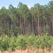
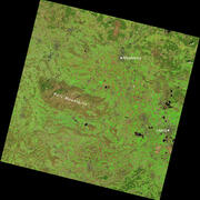
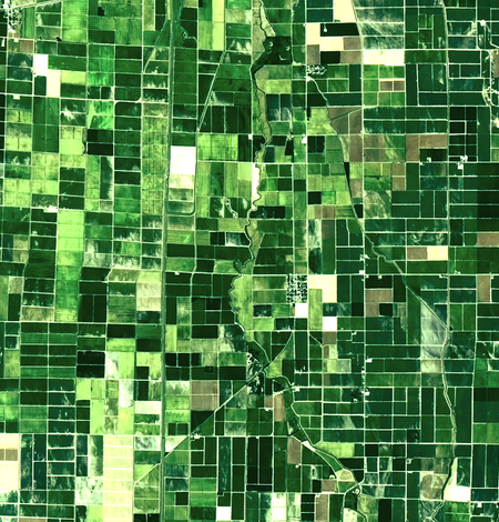
Watching the ‘Wood Basket’ of the U.S. Watching the ‘Wood Basket’ of the U.S.
The southeastern United States is an important wood-producing region of the world, sometimes referred to as the wood basket. The state of Georgia is a global forestry leader, and according to the Georgia Forestry Commission, Georgia has more acres of plantations, timberland and privately owned timberland than any other state (GFC, 2025).
Webpage Update: Landsat Data Use and the Archive Statistics
Each quarter, we update the Landsat Project Statistics webpage to provide an overview of Landsat data acquisition, distribution, and usage. The page features interactive graphics showing download trends, product availability, user demographics, and citation statistics. We also highlight scientific and practical applications of Landsat imagery across industries. Check the page out below.
-
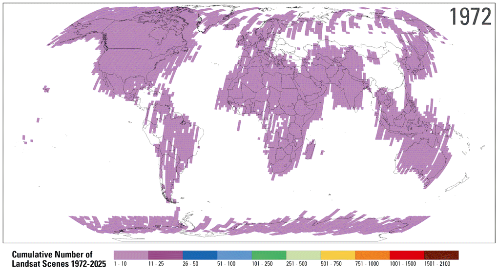
Landsat Project Statistics Landsat Project Statistics
How much Landsat data is available, and how much is downloaded? Who downloads Landsat products and what do they use it for? We answer these questions and more on this page.
Explore Top Resources for Understanding Land Change and Remote Sensing with Landsat
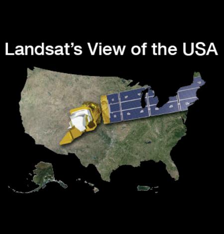
Landsat's View of the USA
How does your state use Landsat satellite data? Find out here! For each state, you can download a satellite image, put together an online puzzle, or read a USGS Fact Sheet that contains information about the benefits of Landsat.
Landsat's Everyday Benefits
Landsat data improve people's quality of life! The impacts and benefits of the Landsat Program and satellite data archive are felt worldwide. A 2023 report highlights Landsat's estimated value at $25.6 billion in economic return. Forest, fire, ag, water are just some of the topics covered by the publications listed on this page.

Landsat Interactives
These webpages use maps, images, and stories to show how Landsat satellites help people around the world. They highlight real examples—like tracking city growth, supporting farmers, managing water, and responding to natural disasters—making it easy to see how Landsat data benefits everyday life.

Remote Sensing Classroom
Check out these fun engaging lessons and activities to learn more about remote sensing and to understand land change with Landsat! Interactive applications, puzzles and games help students of all ages to learn how remote sensing scientists use 50 years of Landsat satellite data to track changes to the Earth’s surface.

Earthshots
The surface of the Earth is always changing. Some changes like earthquakes, volcanoes, floods, and landslides happen quickly, and other changes, such as most erosional processes, happen slowly over time. It’s often hard to see these changes from ground level. Earthshots shows you how satellite data are used to track these changes over time.

Eyes on Earth Episode 6 - Satellites 101
Eyes on Earth is a podcast on remote sensing, Earth observation, land change and science, brought to you by the USGS Earth Resources Observation and Science (EROS) Center. In this episode, we learn the basics of Earth observation satellites.
Educational Resources
Visit these pages to find these and so much more interesting and educational information!
-
Education Education
Landsat education resources can be used by students, teachers, and the general public to further understand the fundamentals of remote sensing, Landsat technology, and how practical applications of Landsat data are helping specialists manage Earth’s natural resources for a growing world population.
Outreach and Education Outreach and Education
At the USGS EROS Center, we study land change and produce land change data products used by researchers, resource managers, and policy makers across the nation and around the world. EROS is home to Landsat satellite operations and an authoritative source for trusted Earth observation data and science.
Got Questions? We’ve Got Answers!
-

Landsat Frequently Asked Questions Landsat Frequently Asked Questions
This page lists commonly asked questions pertaining to the Landsat satellite missions, the science behind maintaining high quality Landsat data, and what products are available - and how to download them.
Landsat Glossary and Acronyms Landsat Glossary and Acronyms
The Landsat project uses many technical terms and acronyms to describe the satellite systems, sensors, and data formats. This information is vital for interpreting satellite imagery and using Landsat data in research and environmental monitoring. Access this information to locate the terms to learn more!
Connect Connect
Access the information on this page to learn more about Landsat, access our social media platforms, or contact us with questions you have about the Landsat missions, the available science products, and how to access Landsat data!
Keep up to date with Latest in Landsat!
Direct to your inbox, Landsat's monthly newsletter features current news, uses, tools, and announcements about America's Earth-observing satellite program.
The Landsat Program is a joint effort of the U.S. Geological Survey (USGS) and the National Aeronautics and Space Administration (NASA). This partnership creates the unprecedented, continuous record of changes to the Earth's surface worldwide.