



Oregon Water Science Center
Welcome to the USGS in Oregon. Our mission is to explore the natural world around us and provide reliable scientific information to help Federal, State, and local agencies, Tribes, and the public make well-informed decisions. Our research is widely used to manage Oregon's water resources for the benefit and safety of people and the environment.
For updates please subscribe to our newsletter!
Live Stream Conditions
Live Stream Conditions

See what is happening in streams near you. View real-time stream data for streams around Oregon.
Relevant Information
Relevant Information
See what the USGS is doing locally.
News
The Oregon Water Science Center receives Portland State University’s 2026 Public Impact Partner Award
The Oregon Water Science Center receives Portland State University’s 2026 Public Impact Partner Award
Message from the Director - Oregon Water Science Center, Summer 2026
Message from the Director - Oregon Water Science Center, Summer 2026
Updates to the Upper Klamath and Harney Basin interactive data mappers
Updates to the Upper Klamath and Harney Basin interactive data mappers
Publications
Nutritional content of phytoplankton communities under ice Nutritional content of phytoplankton communities under ice
The effects of winter environmental conditions on lake ecology can be highly variable. Ice and overlying snow isolate the water below, impeding exchange of materials among water, atmosphere, and the watershed. Even with these limitations, biological communities under the ice can persist, where cold tolerant taxa can be especially abundant. Because many under-ice taxa tend to have a suite...
National-scale remotely sensed lake surface temperature in the contiguous United States National-scale remotely sensed lake surface temperature in the contiguous United States
Temperature is a master variable in aquatic ecosystems. Despite its importance for ecosystem function, our capacity to measure temperature is often limited to focal systems with intensive in situ measurements or larger systems with readily accessible data from disparate data streams. These limitations are consequential for holistically understanding aquatic ecosystem status and change...
Evaluation of submersible pressure transducers for streamflow monitoring in small streams Evaluation of submersible pressure transducers for streamflow monitoring in small streams
Compact streamgages requiring minimal infrastructure and equipped with submersible pressure transducers (PTs) are increasingly used to monitor small streams, yet disparate implementations obscure their accuracy under real-world conditions. This study isolated instrumentation-derived uncertainty in stage monitoring by co-locating various combinations of commercial vented and unvented PTs...
Science
Geospatial Data Collection in the Willamette River Basin
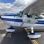
A USGS geospatial data collection initiative in Oregon’s Willamette River Basin uses advanced remote sensing and on‑the‑ground measurements to map major rivers draining the Cascade Range. This work helps track how changing water resources and river channel conditions affect a wide array of water‑management needs, river hazards, recreational users, and habitat for ESA-listed spring Chinook salmon...

Integrated Water Science Basins: Willamette River
The Willamette River Basin reflects the conflicting water demands between humans and ecosystems—particularly salmon— and the challenge resource managers face throughout the Pacific Northwest.
Linkages among pre-contact people, lamprey, and landscapes in the Willamette Valley
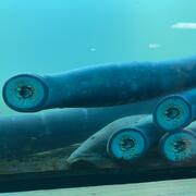
The U.S. Geological Survey and Portland State University are working with the Confederated Tribes of Grand Ronde and other partners to link past lamprey harvest locations with hydrogeomorphic conditions as landscape processes and shifting rivers have changed since the pre-contact archaeological period. This research provides a deeper historical context for lamprey conservation and restoration.