
USGS hydrographer Chris Broz gets on the cold ground to measure the high-water mark of the Pembina River at Neche, North Dakota.
Images
Explore water-related photography, imagery, and illustrations.
Filter Total Items: 2553

USGS Responds to Spring Flooding in North Dakota
USGS hydrographer Chris Broz gets on the cold ground to measure the high-water mark of the Pembina River at Neche, North Dakota.

USGS Responds to Spring Flooding in North Dakota
USGS hydrographer Spencer Wheeling gets equipment ready to collect a flood water-quality sample on the Wild Rice River near St.
USGS hydrographer Spencer Wheeling gets equipment ready to collect a flood water-quality sample on the Wild Rice River near St.

USGS Responds to Spring Flooding in North Dakota
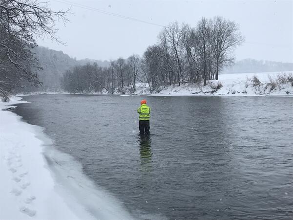
USGS hydrographer Brent Hanson wades out in freezing waters to collect flood measurements on the Sheyenne River near Cooperstown, North Dakota. Hanson reads an outside staff, which is a vertical graduated ruler used to calibrate the continuous readings of water level provided by electronic sensors.
USGS hydrographer Brent Hanson wades out in freezing waters to collect flood measurements on the Sheyenne River near Cooperstown, North Dakota. Hanson reads an outside staff, which is a vertical graduated ruler used to calibrate the continuous readings of water level provided by electronic sensors.

USGS employee collecting a measurement off bridge, Wild Rice River ND
USGS employee collecting a measurement off bridge, Wild Rice River NDUSGS employee Spencer Wheeling is forced to get creative on April 5, 2020, in the positioning of the crane used for collecting water-quality samples thanks to 6-8 inches of new snow at station 05053500 Wild Rice River near St. Benedict, ND.

USGS Responds to Spring Flooding in North Dakota
A frozen USGS rapid deployment streamgage measures the height of the Maple River near Page, North Dakota. RDGs can be installed on short notice to provide additional information at locations that are normally not gauged.
A frozen USGS rapid deployment streamgage measures the height of the Maple River near Page, North Dakota. RDGs can be installed on short notice to provide additional information at locations that are normally not gauged.

Colorado River, Marble Canyon, Arizona
Photo of the Colorado River running through Marble Canyon near Nankoweap Creek (near River Mile 51.5) in the Grand Canyon, Arizona.
Photo of the Colorado River running through Marble Canyon near Nankoweap Creek (near River Mile 51.5) in the Grand Canyon, Arizona.

Laurel Creek Cave
Laurel Creek Cave behind Laurel Falls, Laurel-Snow State Natural Area, Tennessee
Laurel Creek Cave behind Laurel Falls, Laurel-Snow State Natural Area, Tennessee

National Integrated Water Availability Assessments concept map
National Integrated Water Availability Assessments concept mapThe USGS National Integrated Water Availability Assessments (IWAAs) concept map shows daily estimates of natural water storage (water present on the landscape such as standing water, snowpack, soil water, and shallow groundwater) for approximately 110,00

Kentucky Mount
Kentucky mount constructed from Speed Rail. This mount can be used to deploy Rio Grande, RiverPro, RioPro, and RiverSurveyor ADCPs.
Kentucky mount constructed from Speed Rail. This mount can be used to deploy Rio Grande, RiverPro, RioPro, and RiverSurveyor ADCPs.

Kentucky Mount
Kentucky mount constructed from Speed Rail. This mount can be used to deploy Rio Grande, RiverPro, RioPro, and RiverSurveyor ADCPs.
Kentucky mount constructed from Speed Rail. This mount can be used to deploy Rio Grande, RiverPro, RioPro, and RiverSurveyor ADCPs.

Late fall 2019 water availability data viz (IWAAs concept map)
Late fall 2019 water availability data viz (IWAAs concept map)This animation highlights the USGS Integrated Water Availability Assessments (IWAAs) Program’s evolving capacity to estimate water availability at a national scale by visualizing daily estimates of natural water storage (water present on the landscape such as standing water, snowpack, soil water, and shallow groundwater) for approximately 110,000 regions across the

USGS gage 02171000 Lake Marion Near Pineville, SC

USGS gage 09304800 White River Below Meeker, CO
This is Hydrographer Mark Spindler performing a winter time discharge measurement at USGS stream gage 09304800 White River Below Meeker, CO. Discrete water quality samples were also collected.
This is Hydrographer Mark Spindler performing a winter time discharge measurement at USGS stream gage 09304800 White River Below Meeker, CO. Discrete water quality samples were also collected.

Two USGS employees conducting an under-ice ADCP discharge measurement.
Two USGS employees conducting an under-ice ADCP discharge measurement.Two USGS employees (Bart Dengel, and Joseph Crissup) conducting an under-ice ADCP discharge measurement near USGS stream gage station 15214000.
Two USGS employees conducting an under-ice ADCP discharge measurement.
Two USGS employees conducting an under-ice ADCP discharge measurement.Two USGS employees (Bart Dengel, and Joseph Crissup) conducting an under-ice ADCP discharge measurement near USGS stream gage station 15214000.

Hydrologic Technician Sharon Mulready checks equipment on tower (2)
Hydrologic Technician Sharon Mulready checks equipment on tower (2)Hydrologic Technician Sharon Mulready checks equipment on electrical power tower and site 372750122012701 Coyote Creek near Alviso Slough. The tidal gage is located at the confluence of Coyote Creek and Alviso Slough, and is accessible only by boat. The estuary is fed by the Sacramento and San Joaquin Rivers, and various tributaries in the Central Valley.
Routine measurement at USGS stream gage 05383950 Root River, MN
Routine measurement at USGS stream gage 05383950 Root River, MNPatrick Farrell makes a snowy, routine measurement at USGS stream gage 05383950 Root River near Pilot Mount, MN.
Routine measurement at USGS stream gage 05383950 Root River, MN
Routine measurement at USGS stream gage 05383950 Root River, MNPatrick Farrell makes a snowy, routine measurement at USGS stream gage 05383950 Root River near Pilot Mount, MN.
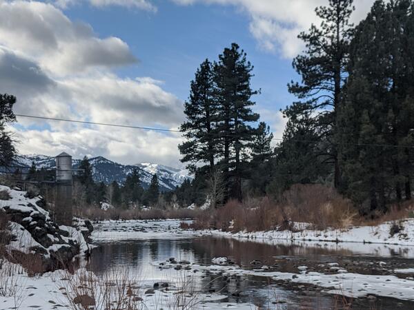
USGS gage 10308200 East fork Carson River below Markleeville, NV

USGS gage 410401112134801 Great Salt Lake Farmington Bay Outflow, UT
USGS gage 410401112134801 Great Salt Lake Farmington Bay Outflow, UTTravis Gibson services the SonTek SW prior to making a discharge measurement on a chilly morning on the Great Salt Lake at USGS gage 410401112134801 Great Salt Lake Farmington Bay Outflow, UT.

Mud tank and shakers during groundwater well drilling
Mud tank and shakers during groundwater well drillingEver wondered about how groundwater observation wells are drilled? This photo provides a behind-the-scenes look as USGS drilled a groundwater well in California last month. This photo looks down over a mud tank and shakers, which are part of drilling operations.
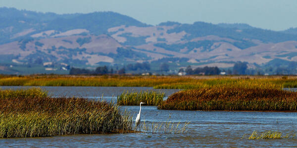
San Francisco Estuary
Photo of the San Francisco Bay Estuary. This photo show wetlands and waterfowl.
Photo of the San Francisco Bay Estuary. This photo show wetlands and waterfowl.

View of Instrument Lab at the Organic Geochemistry Research Laboratory at the KS WSC
View of Instrument Lab at the Organic Geochemistry Research Laboratory at the KS WSCLab Instrumentation used for target analyses at the OGRL at the KS WSC. Image is of part of the Instrument Laboratory.
View of Instrument Lab at the Organic Geochemistry Research Laboratory at the KS WSC
View of Instrument Lab at the Organic Geochemistry Research Laboratory at the KS WSCLab Instrumentation used for target analyses at the OGRL at the KS WSC. Image is of part of the Instrument Laboratory.