
Trinity-San Jacinto River Basin
Studies in this Texas basin will focus on the impacts of climate change and sea level variability in urban envirnoments
Willamette River Basin
Studies in this Pacific Northwest basin will advance the science used to manage water for the diverse needs of major cities, fertile agriculture, and ecologically important species
Delaware River Basin
Studies in the Northeast support innovative modern water prediction and decision support systems in a nationally important, complex interstate river system
Upper Colorado River Basin
Studies in the West examine the key potential factors affecting water supply such as snow melt
Illinois River Basin
Studies in the Midwest examine how nutrient sources, in combination with climate- and land-use change, may limit water availability in the broader Mississippi River Basin
The U.S. Geological Survey is integrating its water science programs to better address the Nation’s greatest water resource challenges. At the heart of this effort are plans to intensively study several Integrated Water Science (IWS) basins—medium-sized watersheds (10,000-20,000 square miles) and underlying aquifers—over the next decade. The IWS basins will represent a wide range of environmental, hydrologic, and landscape settings and human stressors of water resources to improve understanding of water availability across the Nation.
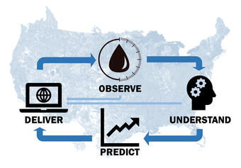
State-of-the-art water availability models, which are supported by high-density innovative monitoring and cutting-edge research, will be developed and applied in each IWS basin in ways that are scalable to larger regions represented by the basins and ultimately to the entire Nation. Water availability is defined here as the quantity and quality of both surface and groundwater across space and time, in relation to human and ecosystem needs and influenced by natural processes and human activities.
Through coordinated efforts across multiple USGS water science programs, including the Next Generation Water Observing System (NGWOS), Integrated Water Availability Assessments (IWAAs), and Integrated Water Prediction Program, the USGS is advancing observations, scientific understanding, predictive capabilities, and information delivery needed to support informed decision-making. These efforts help guide emergency response, flood forecasting, reservoir management, drinking water delivery, permit compliance, water-quality improvement, recreational safety, and more.
The USGS is using a regional framework to ensure that selected basins collectively represent the range in major drivers of the water cycle across the contiguous United States. A quantitative ranking scheme, primarily based on human stressors of water resources, is being used to ensure that the selected basins also address important water-resource challenges (Van Metre et. al., 2020).
Key questions addressed with Integrated Water Science
- What is the quality and quantity of atmospheric, surface, and subsurface water, and how do these vary through space and time?
- How do human activities affect water quantity and quality?
- How can water accounting be done more effectively and comprehensively to provide more actionable data on water availability and use?
- How does changing climate affect water quality, quantity, and reliability, as well as water-related hazards and extreme events?
- How can long-term water-related risk management be improved?
Integrated Water Science Basins
To date, IWS basin activities are underway in five river basins across the United States.

Delaware River Basin
The Delaware River Basin provides water to big cities such as New York City and Philadelphia. This basin was the first watershed selected for NGWOS and is helping scientists better understand other water basins in the Northeast region. USGS water experts started working in the Delaware River Basin in 2018 by asking stakeholders what information they need to better manage water resources. Based on their feedback, close to 100 new monitoring stations were installed over the past two years to provide additional streamflow, temperature, and salinity data.
- Learn more about NGWOS research in the Delaware River Basin
- Learn more about regional Integrated Water Availability Assessment research in the Delaware River Basin
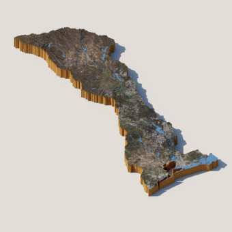
Upper Colorado River Basin
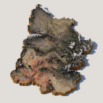
The Upper Colorado River Basin provides drinking water for 40 million people in the United States and Mexico. USGS research in the Upper Colorado River Basin examines the key potential factors affecting water supply in the upper portion of the basin, including snow processes and water storage, wildfire and basin hydrology, and salinity concentrations and water quality.
- Learn more the Upper Colorado River IWS Basin
- Learn more about NGWOS research in the Upper Colorado River Basin
- Learn more about regional Integrated Water Availability Assessment research in the Upper Colorado River Basin
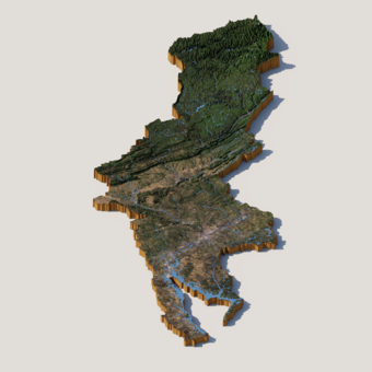
Illinois River Basin
The Illinois River Basin contains an extensive amount of urban and agricultural land uses. These areas can help improve understanding of how nutrient sources, in combination with climate- and land-use change, may limit water availability in the broader Mississippi River Basin and beyond. In addition, harmful algal bloom occurrences are commonplace in the Illinois River Basin, and having a better understanding of the factors leading to these outbreaks can help inform solutions throughout the Midwestern United States.
- Learn more about NGWOS research in the Illinois River Basin
Willamette River Basin
The Willamette River Basin flows north between Oregon’s Coast and Cascades Ranges through a fertile agricultural valley that is home to two-thirds of Oregon's population. The basin is representative of the challenges faced by conflicting water demands between humans and ecosystems—particularly salmon—throughout the entire Pacific Northwest.
- Learn more about the Willamette River IWS Basin
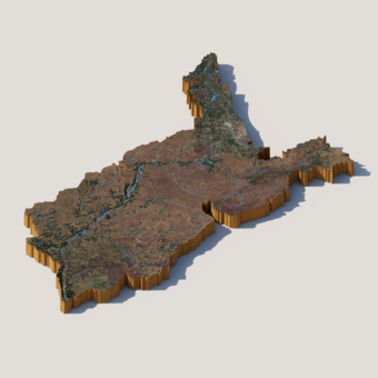
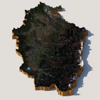
Trinity-San Jacinto River Basin
The Trinity-San Jacinto River Basin stretches from North Texas to Southeast Texas and is home to two large urban centers, Dallas-Fort Worth and Houston, which have a combined population of nearly 15 million. Areas of the basin are vulnerable to climate and sea-level variability, which will provide the USGS with the opportunity to intensively study how urban environmental and hydrological settings are impacted by climate change.
- Learn more about the Trinity-San Jacinto IWS basin
Below are other science projects associated with Integrated Water Science Basins.
Integrated Water Science Basins: Upper Colorado River

Integrated Water Availability Assessments

Integrated Water Prediction (IWP)

Integrated Water Science Basins: Willamette River

Regional Water Availability Assessment: Upper Colorado River Basin

Regional Water Availability Assessment: Delaware River Basin

Next Generation Water Observing System (NGWOS)

Next Generation Water Observing System: Illinois River Basin

Next Generation Water Observing System: Upper Colorado River Basin

Next Generation Water Observing System: Delaware River Basin
The U.S. Geological Survey is integrating its water science programs to better address the Nation’s greatest water resource challenges. At the heart of this effort are plans to intensively study several Integrated Water Science (IWS) basins—medium-sized watersheds (10,000-20,000 square miles) and underlying aquifers—over the next decade. The IWS basins will represent a wide range of environmental, hydrologic, and landscape settings and human stressors of water resources to improve understanding of water availability across the Nation.
State-of-the-art water availability models, which are supported by high-density innovative monitoring and cutting-edge research, will be developed and applied in each IWS basin in ways that are scalable to larger regions represented by the basins and ultimately to the entire Nation. Water availability is defined here as the quantity and quality of both surface and groundwater across space and time, in relation to human and ecosystem needs and influenced by natural processes and human activities.
Through coordinated efforts across multiple USGS water science programs, including the Next Generation Water Observing System (NGWOS), Integrated Water Availability Assessments (IWAAs), and Integrated Water Prediction Program, the USGS is advancing observations, scientific understanding, predictive capabilities, and information delivery needed to support informed decision-making. These efforts help guide emergency response, flood forecasting, reservoir management, drinking water delivery, permit compliance, water-quality improvement, recreational safety, and more.
The USGS is using a regional framework to ensure that selected basins collectively represent the range in major drivers of the water cycle across the contiguous United States. A quantitative ranking scheme, primarily based on human stressors of water resources, is being used to ensure that the selected basins also address important water-resource challenges (Van Metre et. al., 2020).
Key questions addressed with Integrated Water Science
- What is the quality and quantity of atmospheric, surface, and subsurface water, and how do these vary through space and time?
- How do human activities affect water quantity and quality?
- How can water accounting be done more effectively and comprehensively to provide more actionable data on water availability and use?
- How does changing climate affect water quality, quantity, and reliability, as well as water-related hazards and extreme events?
- How can long-term water-related risk management be improved?
Integrated Water Science Basins
To date, IWS basin activities are underway in five river basins across the United States.
Delaware River Basin
The Delaware River Basin provides water to big cities such as New York City and Philadelphia. This basin was the first watershed selected for NGWOS and is helping scientists better understand other water basins in the Northeast region. USGS water experts started working in the Delaware River Basin in 2018 by asking stakeholders what information they need to better manage water resources. Based on their feedback, close to 100 new monitoring stations were installed over the past two years to provide additional streamflow, temperature, and salinity data.
- Learn more about NGWOS research in the Delaware River Basin
- Learn more about regional Integrated Water Availability Assessment research in the Delaware River Basin
Upper Colorado River Basin
The Upper Colorado River Basin provides drinking water for 40 million people in the United States and Mexico. USGS research in the Upper Colorado River Basin examines the key potential factors affecting water supply in the upper portion of the basin, including snow processes and water storage, wildfire and basin hydrology, and salinity concentrations and water quality.
- Learn more the Upper Colorado River IWS Basin
- Learn more about NGWOS research in the Upper Colorado River Basin
- Learn more about regional Integrated Water Availability Assessment research in the Upper Colorado River Basin
Illinois River Basin
The Illinois River Basin contains an extensive amount of urban and agricultural land uses. These areas can help improve understanding of how nutrient sources, in combination with climate- and land-use change, may limit water availability in the broader Mississippi River Basin and beyond. In addition, harmful algal bloom occurrences are commonplace in the Illinois River Basin, and having a better understanding of the factors leading to these outbreaks can help inform solutions throughout the Midwestern United States.
- Learn more about NGWOS research in the Illinois River Basin
Willamette River Basin
The Willamette River Basin flows north between Oregon’s Coast and Cascades Ranges through a fertile agricultural valley that is home to two-thirds of Oregon's population. The basin is representative of the challenges faced by conflicting water demands between humans and ecosystems—particularly salmon—throughout the entire Pacific Northwest.
- Learn more about the Willamette River IWS Basin
Trinity-San Jacinto River Basin
The Trinity-San Jacinto River Basin stretches from North Texas to Southeast Texas and is home to two large urban centers, Dallas-Fort Worth and Houston, which have a combined population of nearly 15 million. Areas of the basin are vulnerable to climate and sea-level variability, which will provide the USGS with the opportunity to intensively study how urban environmental and hydrological settings are impacted by climate change.
- Learn more about the Trinity-San Jacinto IWS basin
Below are other science projects associated with Integrated Water Science Basins.
Integrated Water Science Basins: Upper Colorado River
Integrated Water Availability Assessments
Integrated Water Prediction (IWP)
Integrated Water Science Basins: Willamette River
Regional Water Availability Assessment: Upper Colorado River Basin
Regional Water Availability Assessment: Delaware River Basin
Next Generation Water Observing System (NGWOS)
Next Generation Water Observing System: Illinois River Basin
Next Generation Water Observing System: Upper Colorado River Basin