
Heavy rains in recent weeks resulted in water accumulating in the case of the KWcam, a webcam monitoring the summit of Kīlauea. HVO staff visited the site today to replace desiccant and dry out the enclosure. USGS photo by M. Patrick.
Multimedia
Webcams—Near-real-time images from webcams.
Videos—Collection of videos recorded during field excursions or caught on our webcams.
Image Galleries—Galleries of images and events with expanded descriptions.
The Kīlauea Photo and Video Chronology and Mauna Loa Photo and Video Chronology webpages also feature photos.
Images

April 18, 2024 — Drying out at Kīlauea summit
Heavy rains in recent weeks resulted in water accumulating in the case of the KWcam, a webcam monitoring the summit of Kīlauea. HVO staff visited the site today to replace desiccant and dry out the enclosure. USGS photo by M. Patrick.

April 18, 2024 — Drying out at Kīlauea summit
An HVO geologist services the KWcam webcam, at the summit of Kīlauea. USGS photo by K. Anderson.
An HVO geologist services the KWcam webcam, at the summit of Kīlauea. USGS photo by K. Anderson.

April 18, 2024 — Drying out at Kīlauea summit
Weak, wispy gas plumes rise vertically in the slack winds from the central portion of Halema‘uma‘u, at the summit of Kīlauea. Nothing unusual was observed today at the summit. USGS photo by M. Patrick.
Weak, wispy gas plumes rise vertically in the slack winds from the central portion of Halema‘uma‘u, at the summit of Kīlauea. Nothing unusual was observed today at the summit. USGS photo by M. Patrick.

Caldera collapse and refilling at Kīlauea—a summary of changes since 2018
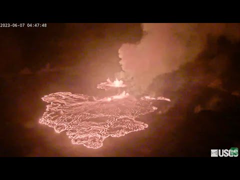
This is the thumbnail image for a two-minute video summarizing changes to the summit Kīlauea volcano since the 2018 caldera collapse. In the year after the 2018 collapse, a water lake began to rise from the bottom. It evaporated during about 90 minutes when an eruption started in Halemaʻumaʻu crater on the night of December 20, 2020.
This is the thumbnail image for a two-minute video summarizing changes to the summit Kīlauea volcano since the 2018 caldera collapse. In the year after the 2018 collapse, a water lake began to rise from the bottom. It evaporated during about 90 minutes when an eruption started in Halemaʻumaʻu crater on the night of December 20, 2020.

Distribution of HVO permanent and survey seismic stations
Distribution of permanent seismic stations and previously deployed seismic nodes in southern half of the Island of Hawai‘i. Shaded regions display the total footprint that nodal deployments this spring and summer will occupy.
Distribution of permanent seismic stations and previously deployed seismic nodes in southern half of the Island of Hawai‘i. Shaded regions display the total footprint that nodal deployments this spring and summer will occupy.

HVO’s new ArcGIS Online web map
A screenshot of HVO’s new ArcGIS Online web map for eruption map data, displaying FlowPolys features that depict lava flow boundaries from the 2022 Mauna Loa eruption.
A screenshot of HVO’s new ArcGIS Online web map for eruption map data, displaying FlowPolys features that depict lava flow boundaries from the 2022 Mauna Loa eruption.
Videos
Kīlauea Collapse and Refilling – Changes Since 2018
This video summarizes changes to the summit Kīlauea volcano since the 2018 caldera collapse. In the year after the 2018 collapse, a water lake began to rise from the bottom. It evaporated during about 90 minutes when an eruption started in Halemaʻumaʻu crater on the night of December 20, 2020.
This video summarizes changes to the summit Kīlauea volcano since the 2018 caldera collapse. In the year after the 2018 collapse, a water lake began to rise from the bottom. It evaporated during about 90 minutes when an eruption started in Halemaʻumaʻu crater on the night of December 20, 2020.
")
Kīlauea earthquake activity (January 26-February 2, 2024)
This video shows earthquake activity recorded by the Hawaiian Volcano Observatory at Kīlauea summit, extending southwest, from January 26-February 2, 2024, in 12-hour snapshots.
This video shows earthquake activity recorded by the Hawaiian Volcano Observatory at Kīlauea summit, extending southwest, from January 26-February 2, 2024, in 12-hour snapshots.

PubTalk-11/2023: Six Eruptions at Two Volcanoes Over the Past Three Years
Six Eruptions at Two Volcanoes Over the Past Three Years
How the Hawaiian Volcano Observatory monitors some of Earth’s most active volcanoes
by Katie Mulliken, Geologist, Research Corporation of the University of Hawai‘i and USGS Hawaiian Volcano Observatory
Six Eruptions at Two Volcanoes Over the Past Three Years
How the Hawaiian Volcano Observatory monitors some of Earth’s most active volcanoes
by Katie Mulliken, Geologist, Research Corporation of the University of Hawai‘i and USGS Hawaiian Volcano Observatory

Mauna Loa 2022 Eruption Anniversary
Mauna Loa 2022 eruption anniversary video. Mauna Loa is Earth's largest active volcano and covers just over half of the Island of Hawaiʻi. It erupted most recently in November-December 2022, and it will erupt again.
Mauna Loa 2022 eruption anniversary video. Mauna Loa is Earth's largest active volcano and covers just over half of the Island of Hawaiʻi. It erupted most recently in November-December 2022, and it will erupt again.
Mauna Loa 2022 Eruption Anniversary (AD)
Mauna Loa 2022 eruption anniversary video. Mauna Loa is Earth's largest active volcano and covers just over half of the Island of Hawaiʻi. It erupted most recently in November-December 2022, and it will erupt again.
Mauna Loa 2022 eruption anniversary video. Mauna Loa is Earth's largest active volcano and covers just over half of the Island of Hawaiʻi. It erupted most recently in November-December 2022, and it will erupt again.

Kīlauea volcano - views of the September 2023 summit eruption
This is a video compilation of Kīlauea volcano's summit eruption in September 2023. The video shows clips of the eruptive vents and lava fountains as the eruption progressed from September 10-16, 2023.
This is a video compilation of Kīlauea volcano's summit eruption in September 2023. The video shows clips of the eruptive vents and lava fountains as the eruption progressed from September 10-16, 2023.
Audio

Lava lake activity from inside Halema`uma`u Crater
Sounds of lava lake activity within Kilauea Volcano's summit vent inside Halema`uma`u Crater on the afternoon of February 14, 2011. The continuous "crashing wave" noise is the sound of churning lava as gases are released from the lake surface, which is in nearly constant motion.
Sounds of lava lake activity within Kilauea Volcano's summit vent inside Halema`uma`u Crater on the afternoon of February 14, 2011. The continuous "crashing wave" noise is the sound of churning lava as gases are released from the lake surface, which is in nearly constant motion.

Dramatic Developments at Kilauea Volcano
Kilauea Volcano in Hawaii has experienced its first explosive eruption in more than 80 years and is now spewing noxious gas at 10 times the normal rate. John Eichelberger, head of the USGS Volcano Hazards Program, fills us in on the situation.
Kilauea Volcano in Hawaii has experienced its first explosive eruption in more than 80 years and is now spewing noxious gas at 10 times the normal rate. John Eichelberger, head of the USGS Volcano Hazards Program, fills us in on the situation.
Webcams

[MDLcam] The Upper and Middle Parts of Mauna Loa's Southwest Rift Zone
Live image of Mauna Loa's upper and middle Southwest Rift Zone from Dandelion Cone along the middle part of the rift zone [MDLcam]. This camera is a pan-tilt-zoom model and the view may change depending on activity.
Disclaimer
Live image of Mauna Loa's upper and middle Southwest Rift Zone from Dandelion Cone along the middle part of the rift zone [MDLcam]. This camera is a pan-tilt-zoom model and the view may change depending on activity.
Disclaimer

[MSPcam] Mauna Loa's Southwest Rift Zone from the South Point area
Live image of Mauna Loa's Southwest Rift Zone from the South Point area [MSPcam]. This camera is a pan-tilt-zoom model and the view may change depending on activity.
Disclaimer
Live image of Mauna Loa's Southwest Rift Zone from the South Point area [MSPcam]. This camera is a pan-tilt-zoom model and the view may change depending on activity.
Disclaimer
[MITDcam] Kīlauea upper Southwest Rift Zone
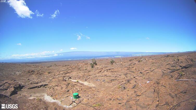
[MITDcam] Live view of Kīlauea's upper Southwest Rift Zone, looking northwest from a seismic station in the Kaʻū Desert.
[MITDcam] Live view of Kīlauea's upper Southwest Rift Zone, looking northwest from a seismic station in the Kaʻū Desert.

[B2cam] Halemaʻumaʻu crater from the east rim and down-dropped block
[B2cam] This image is from a research camera located on the down-dropped block in Kīlauea caldera and east rim of Halemaʻumaʻu crater within Hawaiʻi Volcanoes National Park. The camera is looking west towards Halemaʻumaʻu crater.
Disclaimer
[B2cam] This image is from a research camera located on the down-dropped block in Kīlauea caldera and east rim of Halemaʻumaʻu crater within Hawaiʻi Volcanoes National Park. The camera is looking west towards Halemaʻumaʻu crater.
Disclaimer
Kīlauea Volcano Live Stream - Halemaʻumaʻu crater
Live view of the eruption in Halemaʻumaʻu, from the northwest rim of the caldera, looking east [V1cam] on the USGS YouTube Channel.
- USGS Kīlauea Volcano
- USGS Hawaiian Volcano Observatory
- Kilauea webcams
Live view of the eruption in Halemaʻumaʻu, from the northwest rim of the caldera, looking east [V1cam] on the USGS YouTube Channel.
- USGS Kīlauea Volcano
- USGS Hawaiian Volcano Observatory
- Kilauea webcams

[HLcam] Live Image of Mauna Loa's northwest flank from Hualālai volcano
Live view of the northwest flank of Mauna Loa; the view is from the southeast flank of Hualālai [HLcam]. This camera is a pan-tilt-zoom model and the view may change depending on activity.
Live view of the northwest flank of Mauna Loa; the view is from the southeast flank of Hualālai [HLcam]. This camera is a pan-tilt-zoom model and the view may change depending on activity.