
Views of the water pond in Halema‘uma‘u on Friday, September 6, and Monday, September 9 are shown in this video. Ripples are evident on the pond, presumably due to wind moving over the water surface. No significant changes in the pond were observed over the weekend, and the water level continues to slowly rise. USGS video by M. Patrick.
All Multimedia
Access all multimedia to include images, video, audio, webcams, before-after imagery, and more. Filter and explore with filtering options to refine search.
Filter Total Items: 24926

Two views of the Halema‘uma‘u water pond
Views of the water pond in Halema‘uma‘u on Friday, September 6, and Monday, September 9 are shown in this video. Ripples are evident on the pond, presumably due to wind moving over the water surface. No significant changes in the pond were observed over the weekend, and the water level continues to slowly rise. USGS video by M. Patrick.

Alex stands in front of two flavors of Borah Peak
Alex Hatem stands in front of 1983 Borah Peak rupture with actual Borah Peak in the background.
Alex Hatem stands in front of 1983 Borah Peak rupture with actual Borah Peak in the background.

I-Beam and Sled ADVM Mount 3
A 4" aluminum I-beam is used allow an ADVM to be raised and lowered on a stainless steel sled. The sled is adjustable for pitch, roll, and heading.
A 4" aluminum I-beam is used allow an ADVM to be raised and lowered on a stainless steel sled. The sled is adjustable for pitch, roll, and heading.

I-Beam and Sled ADVM Mount 4
Closeup of a stainless steel sled meant to mount on a 4" aluminum I-beam. The sled is adjustable for pitch, roll, and heading.
Closeup of a stainless steel sled meant to mount on a 4" aluminum I-beam. The sled is adjustable for pitch, roll, and heading.

Uplooker Sled Mount
A 36" sled and 1.5" pipe is mounted to a 4" aluminum i-beam to allow for retrieval and servicing of an uplooking ADVM from land.
A 36" sled and 1.5" pipe is mounted to a 4" aluminum i-beam to allow for retrieval and servicing of an uplooking ADVM from land.

Uplooker Sled Mount 2
A 36" sled and 1.5" pipe is mounted to a 4" aluminum i-beam to allow for retrieval and servicing of an uplooking ADVM from land.
A 36" sled and 1.5" pipe is mounted to a 4" aluminum i-beam to allow for retrieval and servicing of an uplooking ADVM from land.

Uplooker Sled Mount 3
A 36" sled and 1.5" pipe is mounted to a 4" aluminum i-beam to allow for retrieval and servicing of an uplooking ADVM from land. The mounting plate allows for adjustment of pitch, roll, and heading.
A 36" sled and 1.5" pipe is mounted to a 4" aluminum i-beam to allow for retrieval and servicing of an uplooking ADVM from land. The mounting plate allows for adjustment of pitch, roll, and heading.

Uplooker Sled Mount 4
A 36" sled and 1.5" pipe is mounted to a 4" aluminum i-beam to allow for retrieval and servicing of an uplooking ADVM from land. The mounting plate allows for adjustment of pitch, roll, and heading.
A 36" sled and 1.5" pipe is mounted to a 4" aluminum i-beam to allow for retrieval and servicing of an uplooking ADVM from land. The mounting plate allows for adjustment of pitch, roll, and heading.

USGS employee uses the alignment of mountains.
After hiking to the location of the historic photo, USGS employee, Lisa McKeon, uses the alignment of mountains and permanent features to compose the same shot as the original. Sometimes, determining the location can take a long time, requiring moving up and down a mountainside to find the exact spot.
After hiking to the location of the historic photo, USGS employee, Lisa McKeon, uses the alignment of mountains and permanent features to compose the same shot as the original. Sometimes, determining the location can take a long time, requiring moving up and down a mountainside to find the exact spot.

Changing activity on the surface of the Halema‘uma‘u water pond
Changing activity on the surface of the Halema‘uma‘u water pondShown at 30x speed, this video highlights changing activity on the surface of the water pond. Steam wafting above the pond shifts in the wind, and circulation of the water is evident in areas of sharp color boundaries. USGS video by M. Patrick, 09-17-2019.
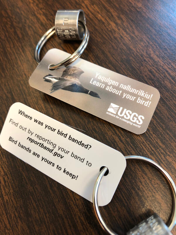
Keychain for USGS outreach activities about bird banding and reporting
Keychain for USGS outreach activities about bird banding and reportingKeychain developed for USGS outreach activities about bird banding and reporting in Yup'ik and English. Yup'ik translation provided by Jakob Sipary, Alaska Native Science and Engineering Program (ANSEP).

Little brown bat with white-nose syndrome lesions
Little brown bat (Myotis lucifugus) from an experimental infection trial with similar gross lesions as observed in this case. (A) Variably sized areas of depigmentation are widely distributed on the patagium. (B) Under UV-light, large areas of the patagium fluoresce orange.
Little brown bat (Myotis lucifugus) from an experimental infection trial with similar gross lesions as observed in this case. (A) Variably sized areas of depigmentation are widely distributed on the patagium. (B) Under UV-light, large areas of the patagium fluoresce orange.

USGS employees operating drone over river in black and white
USGS employees operating drone over river in black and whiteUSGS employees John Fulton - collecting live discharge data, Josip Adams - operating drone, and Sandy Brosnahan co-piloting and spotting, on a River in Maine.
USGS employees operating drone over river in black and white
USGS employees operating drone over river in black and whiteUSGS employees John Fulton - collecting live discharge data, Josip Adams - operating drone, and Sandy Brosnahan co-piloting and spotting, on a River in Maine.

USGS field biologist Andrea Mott displays a recently marked Tule Goose
USGS field biologist Andrea Mott displays a recently marked Tule GooseUSGS field biologist Andrea Mott displays a recently marked Tule White-fronted Goose.
USGS field biologist Andrea Mott displays a recently marked Tule Goose
USGS field biologist Andrea Mott displays a recently marked Tule GooseUSGS field biologist Andrea Mott displays a recently marked Tule White-fronted Goose.

Eyes on Earth - Episode 3 - The National Land Cover Database
Eyes on Earth - Episode 3 - The National Land Cover DatabaseSorting Landsat data into an accurate and reliable record of land cover in the United States is one of the most important jobs at EROS. This episode of Eyes on Earth explores the what, how, and why of the National Land Cover Database (NLCD).

Grinnell Glacier photographed from the summit of Mount Gould.
Grinnell Glacier photographed from the summit of Mount Gould.Since the beginning of the USGS Repeat Photography Project in 1997, Grinnell Glacier has been photographed from the summit of Mount Gould multiple times, documenting the glacier’s retreat and the enlargement of Upper Grinnell Lake. You can view previous images from this vantage point, as well as the entire collection on the

Image of the Week - Unplanted Acres in South Dakota
Image of the Week - Unplanted Acres in South DakotaAbnormally high spring rainfall and subsequent flooding in the Midwest had a season-long impact on cropland production. In these Landsat images of South Dakota growing vegetation is shown as green and unplanted areas appear pink. The difference between 2018 and 2019 is striking.

Kajsa Newton holding box turtle at Northwest Branch Anacostia River
Kajsa Newton holding box turtle at Northwest Branch Anacostia RiverNortheast Region Photo Contest Winner | Oct. 2019 | People
Kajsa Newton holding box turtle at the Northwest Branch Anacostia River near Colesville, MD
Kajsa Newton holding box turtle at Northwest Branch Anacostia River
Kajsa Newton holding box turtle at Northwest Branch Anacostia RiverNortheast Region Photo Contest Winner | Oct. 2019 | People
Kajsa Newton holding box turtle at the Northwest Branch Anacostia River near Colesville, MD

Fire Island barrier island environments
Photo of Fire Island, New York showing back barrier, dunes, beach, and nearshore environments.
Explore coastal change at Fire Island in this interactive Story Map.
Photo of Fire Island, New York showing back barrier, dunes, beach, and nearshore environments.
Explore coastal change at Fire Island in this interactive Story Map.

This video shows a close-up of the unmanned aerial system collecting a water sam
This video shows a close-up of the unmanned aerial system collecting a water samThis video shows a close-up of the unmanned aerial system collecting a water sample in Halema‘uma‘u. USGS video by M. Patrick, 26 Oct 2019.

Video of the water sampling at Kīlauea summit with unmanned aerial system
Video of the water sampling at Kīlauea summit with unmanned aerial systemThis video shows the unmanned aerial system collecting a water sample from Halema‘uma‘u. This wider view shows the scale of the UAS relative to the water pond. USGS video by M. Patrick, 26 Oct 2019.