
A telephoto view of the northwestern point of the main island within Halema‘uma‘u crater, at Kīlauea summit. A rockfall scar (center left) remains after a small collapse of the island was observed by field geologists around 12:43 p.m. HST on April 20, 2021. A sliver of the active lava lake surface is visible at the bottom of this photo.
Images
Volcano Hazard Program images.
Filter Total Items: 6274

April 20, 2021 — Kīlauea lava lake and island
A telephoto view of the northwestern point of the main island within Halema‘uma‘u crater, at Kīlauea summit. A rockfall scar (center left) remains after a small collapse of the island was observed by field geologists around 12:43 p.m. HST on April 20, 2021. A sliver of the active lava lake surface is visible at the bottom of this photo.

April 20, 2021 — Kīlauea vent
A telephoto view of the west vent and lava lake inlet within Halema‘uma‘u crater at the summit of Kīlauea. Lava erupting from the west vent (upper left) continues to feed into the active lava lake through a wide inlet near the base of the cone (center right).
A telephoto view of the west vent and lava lake inlet within Halema‘uma‘u crater at the summit of Kīlauea. Lava erupting from the west vent (upper left) continues to feed into the active lava lake through a wide inlet near the base of the cone (center right).
Kīlauea summit eruption four-month anniversary
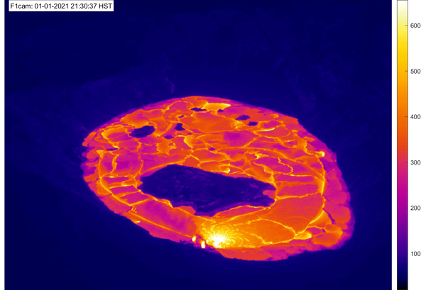
April 20 was the four-month anniversary of Kīlauea's ongoing summit eruption in Halema‘uma‘u. This animated GIF features approximately one thermal image for each day of the eruption and demonstrates eruptive activity over the past four months. At 9:30 p.m.
April 20 was the four-month anniversary of Kīlauea's ongoing summit eruption in Halema‘uma‘u. This animated GIF features approximately one thermal image for each day of the eruption and demonstrates eruptive activity over the past four months. At 9:30 p.m.

April 16, 2021: Overview of Halema‘uma‘u lava lake western portion
April 16, 2021: Overview of Halema‘uma‘u lava lake western portionDuring a Kīlauea summit helicopter overflight on Friday, April 16, an HVO scientist captured this photo of the erupting western fissure and surrounding lava lake within Halema‘uma‘u. The active western potion of the lava lake, as seen here, measured approximately 300 m (984 ft) from end-to-end at the time. USGS image.

April 19, 2021—Kīlauea summit eruption thermal map
April 19, 2021—Kīlauea summit eruption thermal mapA helicopter overflight on April 16, 2021, at approximately 12 p.m. HST allowed for aerial visual and thermal imagery to be collected of the eruption within Halema‘uma‘u crater at the summit of Kīlauea Volcano.

Halema‘uma‘u lava lake, Kīlauea summit eruption—April 16, 2021
Halema‘uma‘u lava lake, Kīlauea summit eruption—April 16, 2021A view of the lava lake from the east rim of Halema‘uma‘u Crater, at the summit of Kīlauea. The active portion of the lake is present at the far (western) end of the crater. USGS photo by M. Patrick on April 16, 2021.

Halema‘uma‘u lava lake, Kīlauea summit eruption—April 16, 2021
Halema‘uma‘u lava lake, Kīlauea summit eruption—April 16, 2021A view of the south margin of the perched lava lake in Halema‘uma‘u Crater, at the summit of Kīlauea. This photo was taken from the east rim of the crater, and shows the steep levee containing the lake. USGS photo by M. Patrick.

Halema‘uma‘u, Kīlauea summit—April 16, 2021
An HVO geologist surveys the lava lake from the eastern rim of Halema‘uma‘u Crater, at the summit of Kīlauea. The cliff that covers most of the top half of the photo formed during the collapse events of 2018, and gives a sense of the scale of that event. USGS photo by M. Patrick on April 16, 2021.
An HVO geologist surveys the lava lake from the eastern rim of Halema‘uma‘u Crater, at the summit of Kīlauea. The cliff that covers most of the top half of the photo formed during the collapse events of 2018, and gives a sense of the scale of that event. USGS photo by M. Patrick on April 16, 2021.

Halema‘uma‘u eruptive activity — April 14, 2021
A close-up view of the western fissure within Halema‘uma‘u at the summit of Kīlauea Volcano, Island of Hawai‘i. Lava continues to enter the lava lake from a wide inlet near the base of the western vent (fuming at center right). Crustal foundering is common on the active lava lake surface (center bottom), located on the western side of the crater.
A close-up view of the western fissure within Halema‘uma‘u at the summit of Kīlauea Volcano, Island of Hawai‘i. Lava continues to enter the lava lake from a wide inlet near the base of the western vent (fuming at center right). Crustal foundering is common on the active lava lake surface (center bottom), located on the western side of the crater.

Halema‘uma‘u lava lake, Kīlauea summit eruption—April 13, 2021
Halema‘uma‘u lava lake, Kīlauea summit eruption—April 13, 2021This view from the south rim of Halema‘uma‘u shows the perched lava lake, supplied by lava from the western fissure (upper right portion of photo). The levee surrounding the active lava lake is up to about 5 m (16 ft) high. USGS photo by M. Patrick on April 13, 2021.

Halema‘uma‘u lava lake, Kīlauea summit eruption—April 13, 2021
Halema‘uma‘u lava lake, Kīlauea summit eruption—April 13, 2021A close up view of the inlet at the western margin of the lava lake in Halema‘uma‘u Crater, at the summit of Kīlauea. The lava stream was covered in a thin, flexible crust and was moving at a very slow velocity. USGS photo taken by M. Patrick on April 13, 2021.

Halema‘uma‘u eruptive activity on April 9, 2021
On Friday, lava erupting from the west vent in Halema‘uma‘u crater emerged from a source closer to the vents base (center), a few feet away from the submerged effusive inlet that has been feeding the lava lake for several weeks (lower right).
On Friday, lava erupting from the west vent in Halema‘uma‘u crater emerged from a source closer to the vents base (center), a few feet away from the submerged effusive inlet that has been feeding the lava lake for several weeks (lower right).

Halema‘uma‘u eruptive activity on April 9, 2021
On Friday afternoon, April 9, lava entered the Halema‘uma‘u lava lake from two sources near the base of the west vent (degassing on left side of the image). This photo was taken around 4:00 p.m. HST from the western rim of Halema‘uma‘u crater, at Kīlauea summit. The lava source closer to the west vent emerged approximately one hour before this photo was taken.
On Friday afternoon, April 9, lava entered the Halema‘uma‘u lava lake from two sources near the base of the west vent (degassing on left side of the image). This photo was taken around 4:00 p.m. HST from the western rim of Halema‘uma‘u crater, at Kīlauea summit. The lava source closer to the west vent emerged approximately one hour before this photo was taken.

Halema‘uma‘u eruptive activity on April 9, 2021
Lava continues to erupt from the west vent in Halema‘uma‘u crater at Kīlauea Volcano's summit. This photo of the vent and active western portion of the lava lake was taken around 3:00 p.m. HST from the south rim of Halema‘uma‘u crater. USGS photo taken by K. Lynn on April 9, 2021.
Lava continues to erupt from the west vent in Halema‘uma‘u crater at Kīlauea Volcano's summit. This photo of the vent and active western portion of the lava lake was taken around 3:00 p.m. HST from the south rim of Halema‘uma‘u crater. USGS photo taken by K. Lynn on April 9, 2021.

April 8, 2021 — Kīlauea
The crusted-over southern shoreline of the lava lake in Halema‘uma‘u at Kīlauea's summit has accumulated talus (rubble) blocks on the surface since it solidified in February. On April 8, 2021, HVO field geologists noted steaming east of the talus (above the rubble in the photo) that was producing hazy viewing conditions. USGS photo by C. Parcheta.
The crusted-over southern shoreline of the lava lake in Halema‘uma‘u at Kīlauea's summit has accumulated talus (rubble) blocks on the surface since it solidified in February. On April 8, 2021, HVO field geologists noted steaming east of the talus (above the rubble in the photo) that was producing hazy viewing conditions. USGS photo by C. Parcheta.

Kīlauea summit lava lake on April 7, 2021
View of the Kīlauea summit lava lake from the west rim of Halema‘uma‘u crater on April 7, 2021. Lava continues to erupt from the west vent, where a diffuse gas plume is visible in the lower left. The active west part of the lava lake (lower center) is a lighter gray color, compared to the darker appearance of the solidified surface crust to the east.
View of the Kīlauea summit lava lake from the west rim of Halema‘uma‘u crater on April 7, 2021. Lava continues to erupt from the west vent, where a diffuse gas plume is visible in the lower left. The active west part of the lava lake (lower center) is a lighter gray color, compared to the darker appearance of the solidified surface crust to the east.

Active lava lake within Halema‘uma‘u crater on April 7, 2021
Active lava lake within Halema‘uma‘u crater on April 7, 2021A zoomed in view of the active lava lake and western vent, taken from the west rim of Halema‘uma‘u crater at Kīlauea summit. The active lava lake remains perched a few meters (yards) higher than the surrounding solidified lava crust. A few small rafted islands (darker in color) are visible within the active western lava lake.

April 5, 2021 — Kīlauea
The lava lake in Halema‘uma‘u crater, at the summit of Kīlauea, remains active, as seen in this view looking north. Active surface lava is limited to the western (left) portion of the lake between the main island and the western fissure complex. The blueish tinge to the plume from the western fissure complex (left) is due to sulfur dioxide (SO2).
The lava lake in Halema‘uma‘u crater, at the summit of Kīlauea, remains active, as seen in this view looking north. Active surface lava is limited to the western (left) portion of the lake between the main island and the western fissure complex. The blueish tinge to the plume from the western fissure complex (left) is due to sulfur dioxide (SO2).

April 5, 2021—Kīlauea summit eruption contour map
This map of Halema‘uma‘u at the summit of Kīlauea shows 20 m (66 ft) contour lines (dark gray) that mark locations of equal elevation above sea level (asl). The map shows that the lava lake has filled 225 m (738 ft) of the crater, to an elevation of 742 m (2434 ft) asl since the eruption began on December 20, 2020.
This map of Halema‘uma‘u at the summit of Kīlauea shows 20 m (66 ft) contour lines (dark gray) that mark locations of equal elevation above sea level (asl). The map shows that the lava lake has filled 225 m (738 ft) of the crater, to an elevation of 742 m (2434 ft) asl since the eruption began on December 20, 2020.

Vent in Halema‘uma‘u at Kīlauea's summit - April 2, 2021
Vent in Halema‘uma‘u at Kīlauea's summit - April 2, 2021Telephoto image of the western cone complex of the current eruption in Halema‘uma‘u at Kīlauea's summit. In the center, a horseshoe-shaped spatter rampart is partially filled in by a more recent spatter cone. The cone has an incandescent opening that spatter is occasionally erupted from.

Kīlauea summit eruption — April 2, 2021
A telephoto image from the ongoing eruption within Halema‘uma‘u crater at the summit of Kīlauea. Lava continues to enter the lava lake through an inlet near the base of the west vent cone (right). An incandescent opening near the top of the cone (upper center), ejected occasional bursts of spatter.
A telephoto image from the ongoing eruption within Halema‘uma‘u crater at the summit of Kīlauea. Lava continues to enter the lava lake through an inlet near the base of the west vent cone (right). An incandescent opening near the top of the cone (upper center), ejected occasional bursts of spatter.