Creek running through Gallatin National Forest, MT
Creek running through Gallatin National Forest, MTShallow creek with conifer trees on each side running through Gallatin National Forest, Montana.

Official websites use .gov
A .gov website belongs to an official government organization in the United States.
Secure .gov websites use HTTPS
A lock () or https:// means you’ve safely connected to the .gov website. Share sensitive information only on official, secure websites.
Explore photos, graphics, and illustrations related to projects from across the CASC Network. And be sure to check out our Climate Illustrations page, featuring free-to-download illustrations that help describe tricky climate concepts and explain how climate change affects the world around us.

Shallow creek with conifer trees on each side running through Gallatin National Forest, Montana.
Shallow creek with conifer trees on each side running through Gallatin National Forest, Montana.

Photograph of the Sanpoil River in northeast Washington State. The Sanpoil River is upstream of Grand Coulee and is a tributary of the Columbia River.
Photograph of the Sanpoil River in northeast Washington State. The Sanpoil River is upstream of Grand Coulee and is a tributary of the Columbia River.

A stream photographed during stream surveys in Washington State. Researchers monitor stream permanence using a mobile app named FLOwPER.
A stream photographed during stream surveys in Washington State. Researchers monitor stream permanence using a mobile app named FLOwPER.

Photo of water flowing into Voyageurs National Park (by Victoria G. Christensen, August 2019).
Photo of water flowing into Voyageurs National Park (by Victoria G. Christensen, August 2019).
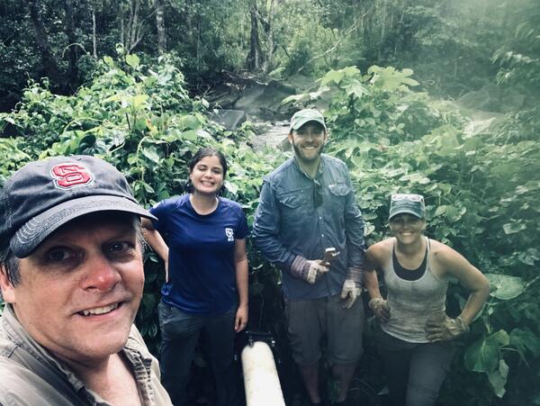
Dr. Tom Kwak, Dr. Gus Engman, Ámbar Torres Molinari, and Bonnie Myers working on rebuilding artificial streams to run experiments on native and non-native fish responses to extreme climate events.
Dr. Tom Kwak, Dr. Gus Engman, Ámbar Torres Molinari, and Bonnie Myers working on rebuilding artificial streams to run experiments on native and non-native fish responses to extreme climate events.

Pyramid Lake, Nevada, is one of the last remaining strongholds for lacustrine Lahontan cutthroat trout; almost all other large lake populations have undergone population declines or extirpation as a result of habitat degradation, overharvest, and water diversions, all compounded by the stocking of nonnative species.
Pyramid Lake, Nevada, is one of the last remaining strongholds for lacustrine Lahontan cutthroat trout; almost all other large lake populations have undergone population declines or extirpation as a result of habitat degradation, overharvest, and water diversions, all compounded by the stocking of nonnative species.

A colorful sunrise appears over the horizon of a calm ocean offshore of Melbourne, Florida. USGS Scientist RC Mickey collects data for location and elevation of sea turtle crawls and associated beach profiles this stretch of coastline.
A colorful sunrise appears over the horizon of a calm ocean offshore of Melbourne, Florida. USGS Scientist RC Mickey collects data for location and elevation of sea turtle crawls and associated beach profiles this stretch of coastline.

Scenic photo of the North River in Shattuckville, Massachusetts taken during a cloudy day.
Scenic photo of the North River in Shattuckville, Massachusetts taken during a cloudy day.

View of launch site from the Hite Overlook, UT

Miller on a recent trip to Wind Cave National Park to conduct a climate change scenario planning workshop.
Miller on a recent trip to Wind Cave National Park to conduct a climate change scenario planning workshop.
Wind Cave National Park.
Wind Cave National Park.

Razorbill with Atlantic herring in bill on Seal Island National Wildlife Refuge.
Razorbill with Atlantic herring in bill on Seal Island National Wildlife Refuge.
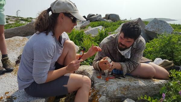
Staudinger and masters student Keenan Yakola (UMass Amherst, 2019) measuring an adult Atlantic puffin on Seal Island National Wildlife Refuge.
Staudinger and masters student Keenan Yakola (UMass Amherst, 2019) measuring an adult Atlantic puffin on Seal Island National Wildlife Refuge.

Photograph of a Hawai'ian forest near the youngest site along the Hawai'ian Long Substrate Age Gradient used in this study. This forest is on the big island of Hawai'i in Volcanoes National Park.
Photograph of a Hawai'ian forest near the youngest site along the Hawai'ian Long Substrate Age Gradient used in this study. This forest is on the big island of Hawai'i in Volcanoes National Park.
Morning on the Green River (Uinta Basin) for the celebratory and re-envisioning expedition honoring the 150 year anniversary of JW Powell’s exploration of the Colorado Plateau, summer 2019. Eaton was selected by USGS’s Youth and Education in Science (YES) to participate in this USGS and University of Wyoming
Morning on the Green River (Uinta Basin) for the celebratory and re-envisioning expedition honoring the 150 year anniversary of JW Powell’s exploration of the Colorado Plateau, summer 2019. Eaton was selected by USGS’s Youth and Education in Science (YES) to participate in this USGS and University of Wyoming

NPS image by Adams. A mule deer stands at the side of a road at Grand Teton National Park.
NPS image by Adams. A mule deer stands at the side of a road at Grand Teton National Park.
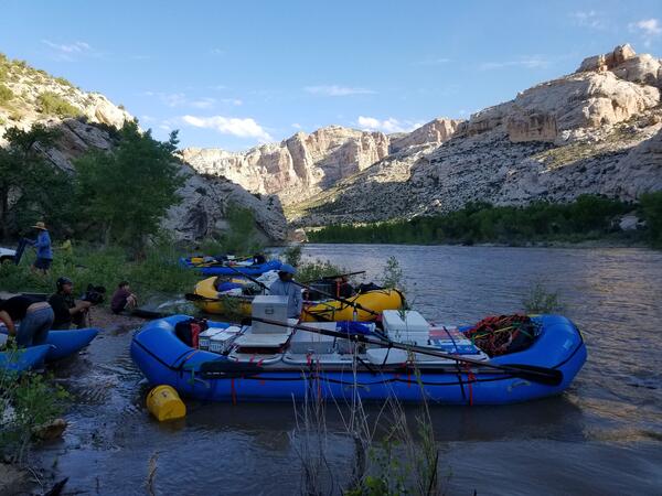
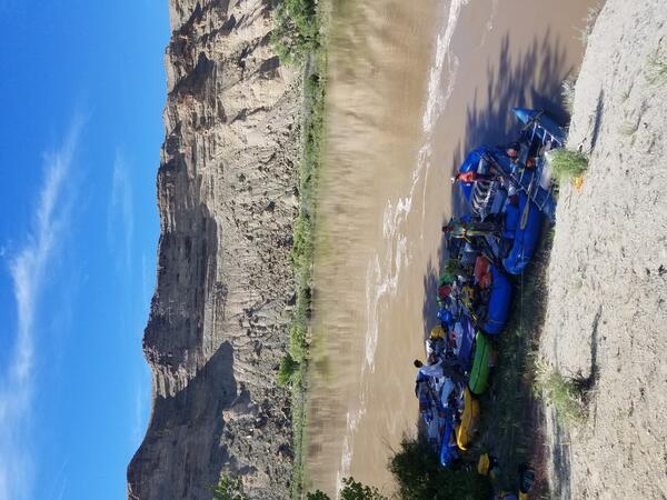
The Powell150 team’s boats stocked with gear and ready to set down the river.
The Powell150 team’s boats stocked with gear and ready to set down the river.

Mitch Eaton pictured with “Paper Powell” just before embarking on his five-day journey on the Colorado River.
Mitch Eaton pictured with “Paper Powell” just before embarking on his five-day journey on the Colorado River.

A photo of a Common tern holding an Atlantic herring in its bill. Photo credit Michelle Staudinger, PhD.
A photo of a Common tern holding an Atlantic herring in its bill. Photo credit Michelle Staudinger, PhD.

Yellow Warbler in Grass along Green River

A research and monitoring area at a sandbar/sand dune near an archaeological site along the Colorado River in Grand Canyon before encroaching vegetation removal. Photo courtesy of Joel Sankey, USGS, Southwest Biological Science Center, Grand Canyon Monitoring and Research Center.
A research and monitoring area at a sandbar/sand dune near an archaeological site along the Colorado River in Grand Canyon before encroaching vegetation removal. Photo courtesy of Joel Sankey, USGS, Southwest Biological Science Center, Grand Canyon Monitoring and Research Center.