
Habitat Management
Habitat Management
Filter Total Items: 113

Hierarchical Units of Greater Sage-Grouse Populations Informing Wildlife Management
Wildlife management boundaries often lack biological context, including information on habitat resource availability and wildlife movements. To address this, we developed multiple levels of biologically relevant and hierarchically nested greater sage-grouse ( Centrocercus urophasianus) population units to facilitate the management and conservation of populations and habitats.

Mapping Grassland Bird Community Distribution under a Changing Landscape
Researchers from the U.S. Geological Survey, the U.S. Department of Agriculture-Agricultural Research Service, and University of Arizona are studying the distribution of grassland bird communities across the western Great Plains to anticipate how species distributions may respond to a changing landscape.

Mangrove Science Network
The Mangrove Science Network is a collaboration of USGS scientists focused on working with natural resource managers to develop and conduct research whose findings will support and evaluate decisions made in mangrove management and restoration.
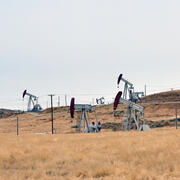
Science in Support of Energy and Minerals Development on Public Lands
America has abundant energy and natural resources, including oil, natural gas, and critical minerals. The USGS Ecosystems Mission Area supports planning, permitting, and leasing of energy and minerals by conducting research relevant to each stage of the Energy Resources Life Cycle. Bureaus and offices in the Department of the Interior responsible for managing energy and minerals resources need...

Ecosystems We Study: Grasslands
America’s grasslands are in the middle of the country where there is insufficient rain to support forests but too much to be a desert.

Ecosystems We Study: Freshwater Systems
Managing the world’s freshwater ecosystems including lakes, rivers, and springs, and the water they supply to meet environmental and societal needs in a changing climate is one of the biggest challenges for the 21st century.

Ecosystems We Study: Alaska Bioregions and Arctic
Alaska is simultaneously a landscape of extremes requiring specialized adaptations by plants and animals to survive the winters and a landscape of abundance that supports breeding birds each summer from as far away as Africa. Terrestrial Alaska also supports iconic species such as caribou and muskoxen whose population dynamics, predator/prey relationships and habitat ecology are researched by USGS...

Optimization of Management Actions for Restoration Success and Wildlife Populations
USGS researchers, in collaboration with the Wyoming Landscape Conservation Initiative and other partners, are developing a statistically based prioritization tool that will aid agencies in their management decisions.

Drought & Grazing Experiment: Understanding Impacts and Identifying Mitigation Strategies
Drylands (sometimes called ‘deserts’ or ‘arid and semi-arid' ecosystems) are defined by water scarcity. Understanding how land-use activities may effect dryland ecosystems and dryland ecological processes is a high priority for land conservation and management. Grazing by domestic livestock (typically cattle but also sheep and goats) is the most widespread land-use in drylands globally and a large...

Contributions to the development of the Western Association of Fish and Wildlife Agencies Sagebrush Conservation Strategy
USGS scientists are contributing to the development of the Western Association of Fish and Wildlife Agencies Sagebrush Conservation Strategy, a strategy intended to provide guidance so that efforts to conserve the iconic greater sage-grouse can be expanded to the entire sagebrush biome to benefit the people and wildlife that depend on it.

Informing the Habitat Assessment Framework Process—An Assessment to Understand Habitat Patch Composition and Configuration Requirements for Range-Wide Sage-Grouse Persistence
USGS scientists are developing multiple products to directly inform the Bureau of Land Management's Sage-grouse Habitat Assessment Framework process.

Weed-Suppressive Bacteria – Testing a Control Measure for Invasive Grasses in the West
Recent popular news has implied that Weed-Suppressive Bacteria (WSB) holds promise for cheatgrass control, yet a lack of peer-reviewed research exists to support this claim. USGS researchers stepped up to the challenge of objectively and rigorously evaluating the effectiveness of WSB for controlling exotic annual grasses, such as Cheatgrass and Medusahead, while also examining its impact on native...