



Landscape Processes
Landscape Processes
Text needed
Filter Total Items: 10
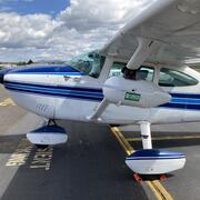
Geospatial Data Collection in the Willamette River Basin
A USGS geospatial data collection initiative in Oregon’s Willamette River Basin uses advanced remote sensing and on‑the‑ground measurements to map major rivers draining the Cascade Range. This work helps track how changing water resources and river channel conditions affect a wide array of water‑management needs, river hazards, recreational users, and habitat for ESA-listed spring Chinook salmon...
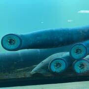
Linkages among pre-contact people, lamprey, and landscapes in the Willamette Valley
The U.S. Geological Survey and Portland State University are working with the Confederated Tribes of Grand Ronde and other partners to link past lamprey harvest locations with hydrogeomorphic conditions as landscape processes and shifting rivers have changed since the pre-contact archaeological period. This research provides a deeper historical context for lamprey conservation and restoration.

USGS Sagebrush Science: Supporting Public Safety and Economic Decision Making Across the West
The sagebrush biome is one of the largest ecosystems in North America. Encompassing nearly one-third of the continental U.S., it provides critical resources for millions of Americans and a home for hundreds of plants and animal species in the West. Natural resource management in sagebrush ecosystems can be complex, and science can support management decisions by providing knowledge and tools to...
By
Core Science Systems Mission Area, Ecosystems Mission Area, Land Management Research Program, Earth Resources Observation and Science (EROS) Center, Forest and Rangeland Ecosystem Science Center, Fort Collins Science Center, Northern Rocky Mountain Science Center, Southwest Biological Science Center, Western Ecological Research Center (WERC), Wildland Fire Science

Climate-Smart Vegetation Treatments - Using 15 Years of SageSTEP Data to Inform Management of Resilient Ecosystems
Land managers require clear, forward-looking information about where and how vegetation treatments may make the greatest difference for drought resilience in sagebrush and woodland ecosystems. We are using soil moisture and vegetation data from SageSTEP-- a long-term ecological study on fuel treatments in the Great Basin-- to analyze soil moisture dynamics and vegetation responses after common...

Understanding the Sagebrush Steppe’s Threshold for Transitions Through Resistance and Resilience Models
We are investigating ecosystem transitions and thresholds in the sagebrush steppe, studying factors influencing the shift from native to invaded plant communities after disturbances like fire. Our research tests region-wide resistance and resilience models, focusing on real-world recovery patterns, pre-fire conditions, plant succession, and land management treatments.

Pinyon-Juniper Disturbance Effects on Wildlife
Researchers from the U.S. Geological Survey are reviewing, summarizing, and analyzing what is currently known about changes happening in pinyon-juniper ecosystems in the western U.S. in response to tree removal treatments. Although tree removal can help restore sagebrush ecosystems, these treatments also impact wildlife, wildfire fuels, and invasive plants. This project will help identify key...

Vegetation and Fuel Responses to Linear Fuel-Break Treatments in and around Burned Sagebrush Steppe
After the Soda Wildfire burned nearly 280,000 acres of public and private land in southwest Idaho, the Bureau of Land Management’s (BLM) Emergency and Rehabilitation and Stabilization program (ESR) applied herbicide and seeding treatments to prevent exotic annual grass invasion and restore native vegetation. To reduce the threat of future wildfire, the BLM also constructed a network of linear...

Grazing Effects on the Annual Grass Fire-Cycle after Post Fire Management
In order to break the annual grass fire-cycle in the sagebrush steppe, land managers use pre-emergent herbicides to reduce annual grass populations and seeding to increase fire-tolerant perennials. These tools must be applied to the same soils in ways that are not counterproductive, and their application must therefore be staggered in time, which we refer to as layering. Livestock grazing can also...

Post Fire Restoration in Hawai‘i Volcanoes National Park
We are studying post-fire forest regeneration in montane habitats within Hawaiʻi Volcanoes National Park. By testing out different restoration strategies, as well as links between grass cover and fire, we hope to increase restored forest fire resistance and resilience.

Disturbance Ecology, Geomorphology, and Plant Dynamics in Grass Invaded Sites, Hawai‘i
The Keamuku Maneuver Area (KMA) is a 9,227 ha. unit of Army Pohakuloa Training Area (PTA) on Hawai‘i Island. The Army’s mission at KMA is threatened by erosional processes that could make parts of the training area too hazardous or too degraded for sustained use. These processes depend on vegetation dynamics and the nature of the soils underlying KMA. Knowledge of the training area was...