
Close-up view of visitor entrance at Building 53; the location of USGS Colorado Water Science Center.
Images
Images described and linked on this webpage come from a wide variety of USGS science activities and presentations performed by USGS Science Center staff members in the Region 7: Upper Colorado Basin. A search tool is provided to narrow the number of image files shown.
Filter Total Items: 551

CWSC Office - Visitor Entrance
Close-up view of visitor entrance at Building 53; the location of USGS Colorado Water Science Center.

Fish Creek, Wyoming
Fish Creek, Wyoming

Elk on a feedground in Wyoming.

Upper Lebo Member of the Fort Union Formation near Gillette, Wyoming
Upper Lebo Member of the Fort Union Formation near Gillette, WyomingUpper Lebo Member of the Fort Union Formation. Photo taken fro the top of Cow Creek Buttes in the Burnt Hollow BLM recreation area about 20 miles northeast of Gillette, Wyoming.

A single species stand of nonnative tamarisk
Single species stand of nonnative tamarisk on the Lower Colorado River at Cibola National Wildlife Refuge, California
Single species stand of nonnative tamarisk on the Lower Colorado River at Cibola National Wildlife Refuge, California

Fire lookout adjacent to snowpack-sampling site near Deadman Pass, Col
Fire lookout adjacent to snowpack-sampling site near Deadman Pass, ColFire lookout adjacent to snowpack-sampling site near Deadman Pass, Colorado
Fire lookout adjacent to snowpack-sampling site near Deadman Pass, Col
Fire lookout adjacent to snowpack-sampling site near Deadman Pass, ColFire lookout adjacent to snowpack-sampling site near Deadman Pass, Colorado
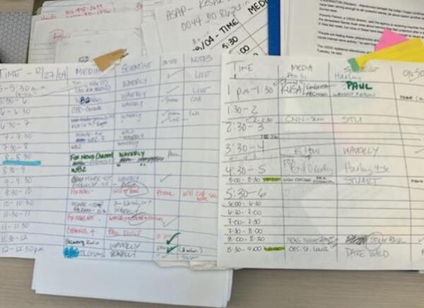
Schedule for news media interviews following Sumatra 2004 earthquake event
Schedule for news media interviews following Sumatra 2004 earthquake eventImage of schedule for news media interviews following Sumatra 2004 earthquake event.
Schedule for news media interviews following Sumatra 2004 earthquake event
Schedule for news media interviews following Sumatra 2004 earthquake eventImage of schedule for news media interviews following Sumatra 2004 earthquake event.

News media interview schedule following Sumatra 2004 earthquake event
News media interview schedule following Sumatra 2004 earthquake eventPhoto showing an intense news media interview schedule following Sumatra 2004 earthquake event.
News media interview schedule following Sumatra 2004 earthquake event
News media interview schedule following Sumatra 2004 earthquake eventPhoto showing an intense news media interview schedule following Sumatra 2004 earthquake event.

Describing work that USGS does at the Women In Science Conference
Describing work that USGS does at the Women In Science ConferenceDescribing work that USGS does to students at the Women In Science Conference
Describing work that USGS does at the Women In Science Conference
Describing work that USGS does at the Women In Science ConferenceDescribing work that USGS does to students at the Women In Science Conference

Brown's Gulch Below Brooklyn Mine near Silverton, Colorado
Brown's Gulch Below Brooklyn Mine near Silverton, ColoradoUSGS scientist measuring pH, Specific Conductance and dissolved oxygen in a remediation ditch constructed with local volcanic rock possessing some acid neutralizing capacity.
Brown's Gulch is below the Brooklyn Mine, a few miles north of Siverton, Colorado, in the Mineral Creek basin.

Eastern Utah
Scenic view of eastern Utah.

Eastern Utah Ranch
Scenic view of an eastern Utah ranch with cattle and horses.
Scenic view of an eastern Utah ranch with cattle and horses.

Eastern Utah
Scenic view of eastern Utah.

Eastern Utah
Picture of a large rock formation with a highway next to it in eastern Utah.
Picture of a large rock formation with a highway next to it in eastern Utah.

Eastern Utah
Scenic view of Eastern Utah.

Eastern Utah Ranch
Scenic view of an eastern Utah ranch with cattle and horses.
Scenic view of an eastern Utah ranch with cattle and horses.

Eastern Utah Ranch
Scenic view of an eastern Utah ranch with cattle and horses.
Scenic view of an eastern Utah ranch with cattle and horses.

Eastern Utah Ranch
Scenic view of an eastern Utah ranch with cattle and horses.
Scenic view of an eastern Utah ranch with cattle and horses.

Eastern Utah Ranch
Scenic view of an eastern Utah ranch with cattle and horses.
Scenic view of an eastern Utah ranch with cattle and horses.

Eastern Utah
Scenic view of Eastern Utah.

Eastern Utah
Scenic view of Eastern Utah.